รูปภาพหรือไฟล์เสียงนี้ ต้นฉบับอยู่ที่ คอมมอนส์ รายละเอียดด้านล่าง เป็นข้อความที่แสดงผลจาก ไฟล์ต้นฉบับในคอมมอนส์ คอมมอนส์เป็นเว็บไซต์ในโครงการสำหรับเก็บรวบรวมสื่อเสรี ที่ คุณสามารถช่วยได้
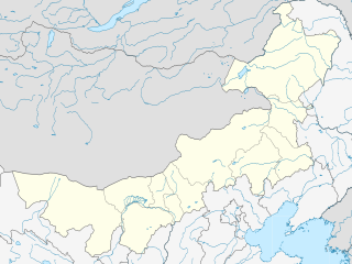
ความย่อ คำอธิบายChina Inner Mongolia location map.svg English: Location map of Inner Mongolia, People's Republic of China
Equirectangular projection, N/S stretching 141 %. True scale parallel: 45°00' N. Geographic limits of the map:
N: 53.5° N S: 37.0° N W: 96.0° E E: 127.0° E วันที่ 9 กุมภาพันธ์ พ.ศ. 2554 แหล่งที่มา งานของตัว , using
this map of China for inner China boundaries GMT data File:InnerMongoliaMap.png for inner Inner Mongolia boundaries ผู้สร้างสรรค์ Das steinerne Herz เวอร์ชันอื่น ไฟล์อื่นที่ใช้ไฟล์นี้:
China Inner Mongolia relief location map.png Location of Baynnur Prefecture within Inner Mongolia (China).svg
การอนุญาตใช้สิทธิ ข้าพเจ้า ในฐานะผู้ถือลิขสิทธิ์ของภาพหรือสื่อนี้ อนุญาตให้ใช้ภาพหรือสื่อนี้ภายใต้เงื่อนไขต่อไปนี้
ไฟล์นี้อยู่ภายใต้สัญญาอนุญาต ครีเอทีฟคอมมอนส์ แบบแสดงที่มา-อนุญาตแบบเดียวกัน 3.0 ต้นฉบับ
คุณสามารถ: ที่จะแบ่งปัน – ที่จะทำสำเนา แจกจ่าย และส่งงานดังกล่าวต่อไปที่จะเรียบเรียงใหม่ – ที่จะดัดแปลงงานดังกล่าว ภายใต้เงื่อนไขต่อไปนี้: แสดงที่มา – คุณต้องให้เกียรติเจ้าของงานอย่างเหมาะสม โดยเพิ่มลิงก์ไปยังสัญญาอนุญาต และระบุหากมีการเปลี่ยนแปลง คุณอาจทำเช่นนี้ได้ในรูปแบบใดก็ได้ตามควร แต่ต้องไม่ใช่ในลักษณะที่แนะว่าผู้ให้อนุญาตสนับสนุนคุณหรือการใช้งานของคุณอนุญาตแบบเดียวกัน – หากคุณดัดแปลง เปลี่ยนรูป หรือต่อเติมงานนี้ คุณต้องใช้สัญญาอนุญาตแบบเดียวกันหรือแบบที่เหมือนกับสัญญาอนุญาตที่ใช้กับงานนี้เท่านั้น https://creativecommons.org/licenses/by-sa/3.0 CC BY-SA 3.0 Creative Commons Attribution-Share Alike 3.0 true true อนุญาตให้คัดลอก แจกจ่ายและ/หรือดัดแปรเอกสารนี้ภายใต้เงื่อนไขของสัญญาอนุญาตเอกสารเสรีของกนู รุ่น 1.2 หรือรุ่นใด ๆ นับจากนี้ที่ออกโดยมูลนิธิซอฟต์แวร์เสรี โดยไม่มีส่วนใดห้ามแก้ไข ไม่มีข้อความปกหน้าและปกหลัง สำเนาของสัญญาอนุญาตรวมอยู่ในส่วนชื่อ สัญญาอนุญาตเอกสารเสรีของกนู http://www.gnu.org/copyleft/fdl.html GFDL GNU Free Documentation License true true
คุณสามารถเลือกสัญญาอนุญาตดังกล่าวตามต้องการ
ไทย เพิ่มคำบรรยายทรรทัดเดียวเพื่อขยายความว่าไฟล์นี้มีอะไร
ประวัติไฟล์ คลิกวันที่/เวลาเพื่อดูไฟล์ที่ปรากฏในขณะนั้น
วันที่/เวลา รูปย่อ ขนาด ผู้ใช้ ความเห็น ปัจจุบัน 04:56, 21 กุมภาพันธ์ 2554 577 × 433 (366 กิโลไบต์) Das steinerne Herz completly new version 02:55, 14 กุมภาพันธ์ 2554 663 × 500 (2.21 เมกะไบต์) Das steinerne Herz trying to correct 21:14, 10 กุมภาพันธ์ 2554 664 × 508 (2.21 เมกะไบต์) Das steinerne Herz cropping 15:02, 10 กุมภาพันธ์ 2554 748 × 605 (2.16 เมกะไบต์) Das steinerne Herz correction 01:54, 10 กุมภาพันธ์ 2554 748 × 605 (2.17 เมกะไบต์) Das steinerne Herz {{Information |Description ={{en|1=Location map of Inner Mongolia, People's Republic of China Equirectangular projection, N/S stretching 141 %. Geographic limits of the map: * N: 55.0° N * S: 3
หน้าที่มีภาพนี้ หน้าต่อไปนี้ โยงมาที่ภาพนี้:
การใช้ไฟล์ส่วนกลาง วิกิอื่นต่อไปนี้ใช้ไฟล์นี้:
Wikipedia:Kartenwerkstatt/Positionskarten/Asien Vorlage:Positionskarte China Innere Mongolei Aufwindkraftwerk Wuhai Battles of Khalkhin Gol Wuhai Chifeng Hulunbuir Hailar District Zalantun Ulanqab Fengzhen Xilinhot Hanggai (village) Manzhouli Dolon Nor Oroqen Autonomous Banner Five Pagoda Temple (Hohhot) Solun, Horqin Right Front Banner Yakeshi Dongsheng District Erenhot Baotou Donghe Airport Chifeng Yulong Airport Hulunbuir Hailar Airport Hohhot Baita International Airport Manzhouli Xijiao Airport Tongliao Airport Ulanhot Yilelite Airport Wuhai Airport Xilinhot Airport Bayannur Tsondol Ordos Ejin Horo International Airport Honggor Sum, Siziwang Banner Bayan Obo Mining District Honggor Sum, Sonid Left Banner Shangdu County Jalaid Banner Holingol Hexigten Banner Horinger County ดูการใช้ทั่วโลกเพิ่มเติม ของไฟล์นี้
ไฟล, china, inner, mongolia, location, ไฟล, ประว, ไฟล, หน, าท, ภาพน, การใช, ไฟล, วนกลางขนาดของต, วอย, าง, ของไฟล, กเซล, ความละเอ, ยดอ, กเซล, กเซล, กเซล, กเซล, กเซล, ภาพท, ความละเอ, ยดส, งกว, 8206, ไฟล, กเซล, ขนาดไฟล, โลไบต, ปภาพหร, อไฟล, เส, ยงน, นฉบ, บอย, คอม. ifl prawtiifl hnathimiphaphni karichiflswnklangkhnadkhxngtwxyang PNG nikhxngifl SVG ni 577 433 phikesl khwamlaexiydxun 320 240 phikesl 640 480 phikesl 1 024 768 phikesl 1 280 961 phikesl 2 560 1 921 phikesl duphaphthimikhwamlaexiydsungkwa 8206 ifl SVG 577 433 phikesl khnadifl 366 kiolibt rupphaphhruxiflesiyngni tnchbbxyuthi khxmmxns raylaexiyddanlang epnkhxkhwamthiaesdngphlcak ifltnchbbinkhxmmxns khxmmxnsepnewbistinokhrngkarsahrbekbrwbrwmsuxesri thi khunsamarthchwyid khwamyx khaxthibayChina Inner Mongolia location map svg English Location map of Inner Mongolia People s Republic of China Equirectangular projection N S stretching 141 True scale parallel 45 00 N Geographic limits of the map N 53 5 N S 37 0 N W 96 0 E E 127 0 Ewnthi 9 kumphaphnth ph s 2554aehlngthima ngankhxngtw using this map of China for inner China boundaries GMT data File InnerMongoliaMap png for inner Inner Mongolia boundariesphusrangsrrkh Das steinerne Herzewxrchnxun iflxunthiichiflni China Inner Mongolia relief location map png Location of Baynnur Prefecture within Inner Mongolia China svg karxnuyatichsiththi khapheca inthanaphuthuxlikhsiththikhxngphaphhruxsuxni xnuyatihichphaphhruxsuxniphayitenguxnikhtxipniiflnixyuphayitsyyaxnuyat khriexthifkhxmmxns aebbaesdngthima xnuyataebbediywkn 3 0 tnchbbkhunsamarth thicaaebngpn thicathasaena aeckcay aelasngngandngklawtxip thicaeriyberiyngihm thicaddaeplngngandngklaw phayitenguxnikhtxipni aesdngthima khuntxngihekiyrtiecakhxngnganxyangehmaasm odyephimlingkipyngsyyaxnuyat aelarabuhakmikarepliynaeplng khunxacthaechnniidinrupaebbidkidtamkhwr aettxngimichinlksnathiaenawaphuihxnuyatsnbsnunkhunhruxkarichngankhxngkhun xnuyataebbediywkn hakkhunddaeplng epliynrup hruxtxetimnganni khuntxngichsyyaxnuyataebbediywknhruxaebbthiehmuxnkbsyyaxnuyatthiichkbnganniethannhttps creativecommons org licenses by sa 3 0 CC BY SA 3 0 Creative Commons Attribution Share Alike 3 0 true true xnuyatihkhdlxk aeckcayaela hruxddaeprexksarniphayitenguxnikhkhxngsyyaxnuyatexksaresrikhxngknu run 1 2 hruxrunid nbcaknithixxkodymulnithisxftaewresri odyimmiswnidhamaekikh immikhxkhwampkhnaaelapkhlng saenakhxngsyyaxnuyatrwmxyuinswnchux syyaxnuyatexksaresrikhxngknuhttp www gnu org copyleft fdl html GFDL GNU Free Documentation License true truekhunsamartheluxksyyaxnuyatdngklawtamtxngkarkhabrryayodyyxithyephimkhabrryaythrrthdediywephuxkhyaykhwamwaiflnimixairixethmthiaesdngxyuiniflniprakxbdwyphusrangbangkhathiimmiixethmwikisnethschuxphusrangsrrkh Das steinerne Herzchuxphuichwikimiediy Das steinerne Herzyuxaraexl http commons wikimedia org wiki User Das steinerne HerzsthanalikhsiththimilikhsiththisyyaxnuyatGNU Free Documentation License version 1 2 or later xngkvsCreative Commons Attribution ShareAlike 3 0 Unported xngkvswnthisrang wnkxtng9 kumphaphnth 2011thimakhxngiflkarsrangdngedimodyphuxpohld prawtiifl khlikwnthi ewlaephuxduiflthipraktinkhnann wnthi ewlarupyxkhnadphuichkhwamehn pccubn04 56 21 kumphaphnth 2554577 433 366 kiolibt Das steinerne Herzcompletly new version 02 55 14 kumphaphnth 2554663 500 2 21 emkaibt Das steinerne Herztrying to correct 21 14 10 kumphaphnth 2554664 508 2 21 emkaibt Das steinerne Herzcropping 15 02 10 kumphaphnth 2554748 605 2 16 emkaibt Das steinerne Herzcorrection 01 54 10 kumphaphnth 2554748 605 2 17 emkaibt Das steinerne Herz Information Description en 1 Location map of Inner Mongolia People 039 s Republic of China Equirectangular projection N S stretching 141 Geographic limits of the map N 55 0 N S 3 hnathimiphaphni hnatxipni oyngmathiphaphni ohhxt mxdul Location map data China Inner Mongolia mxdul Location map data China Inner Mongolia doc karichiflswnklang wikixuntxipniichiflni karichbn ar wikipedia org قالب Location map China Inner Mongolia طبوغرافيا الصين karichbn ba wikipedia org Ҡalyp PozKarta Ҡytaj Eske Mongoliya karichbn bg wikipedia org Shablon PK Kitaj Vtreshna Mongoliya karichbn bn wikipedia org হ হ ট karichbn ceb wikipedia org Plantilya Location map China Inner Mongolia karichbn cv wikipedia org Shablon PozKartti Kitaj Halăh Respubliki Shalti Mongoli karichbn de wikipedia org Hure Grossgemeinde Wikipedia Kartenwerkstatt Positionskarten Asien Vorlage Positionskarte China Innere Mongolei Aufwindkraftwerk Wuhai karichbn en wikipedia org Hohhot Battles of Khalkhin Gol Wuhai Chifeng Hulunbuir Hailar District Zalantun Ulanqab Fengzhen Xilinhot Hanggai village Manzhouli Dolon Nor Oroqen Autonomous Banner Five Pagoda Temple Hohhot Solun Horqin Right Front Banner Yakeshi Dongsheng District Erenhot Baotou Donghe Airport Chifeng Yulong Airport Hulunbuir Hailar Airport Hohhot Baita International Airport Manzhouli Xijiao Airport Tongliao Airport Ulanhot Yilelite Airport Wuhai Airport Xilinhot Airport Bayannur Tsondol Ordos Ejin Horo International Airport Honggor Sum Siziwang Banner Bayan Obo Mining District Honggor Sum Sonid Left Banner Shangdu County Jalaid Banner Holingol Hexigten Banner Horinger County dukarichthwolkephimetimkhxngiflni ekhathungcak https th wikipedia org wiki ifl China Inner Mongolia location map svg, wikipedia, วิกิ หนังสือ, หนังสือ, ห้องสมุด,
บทความ , อ่าน, ดาวน์โหลด, ฟรี, ดาวน์โหลดฟรี, mp3, วิดีโอ, mp4, 3gp, jpg, jpeg, gif, png, รูปภาพ, เพลง, เพลง, หนัง, หนังสือ, เกม, เกม