รูปภาพหรือไฟล์เสียงนี้ ต้นฉบับอยู่ที่ คอมมอนส์ รายละเอียดด้านล่าง เป็นข้อความที่แสดงผลจาก ไฟล์ต้นฉบับในคอมมอนส์ คอมมอนส์เป็นเว็บไซต์ในโครงการสำหรับเก็บรวบรวมสื่อเสรี ที่ คุณสามารถช่วยได้
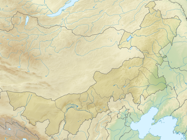
คำอธิบายChina Inner Mongolia relief location map.png English: Location map of Inner Mongolia, People's Republic of China
Equirectangular projection, N/S stretching 141 %. True scale parallel: 45°00' N.
Geographic limits of the map:
N: 53.5° N S: 37.0° N W: 96.0° E E: 127.0° E วันที่ 24 กุมภาพันธ์ พ.ศ. 2554, 08:58 (UTC) แหล่งที่มา China_Inner_Mongolia_location_map.svg ผู้สร้างสรรค์ China_Inner_Mongolia_location_map.svg: Das steinerne Herz derivative work: Das steinerne Herz (talk )
ภาพนี้ ได้รับการปรับแต่งภาพ China Inner Mongolia location map.svg . ปรับแต่งภาพโดย Das steinerne Herz.
ข้าพเจ้า ในฐานะผู้ถือลิขสิทธิ์ของภาพหรือสื่อนี้ อนุญาตให้ใช้ภาพหรือสื่อนี้ภายใต้เงื่อนไขต่อไปนี้
ไฟล์นี้อยู่ภายใต้สัญญาอนุญาต ครีเอทีฟคอมมอนส์ แบบแสดงที่มา-อนุญาตแบบเดียวกัน 3.0 ต้นฉบับ
คุณสามารถ: ที่จะแบ่งปัน – ที่จะทำสำเนา แจกจ่าย และส่งงานดังกล่าวต่อไปที่จะเรียบเรียงใหม่ – ที่จะดัดแปลงงานดังกล่าว ภายใต้เงื่อนไขต่อไปนี้: แสดงที่มา – คุณต้องให้เกียรติเจ้าของงานอย่างเหมาะสม โดยเพิ่มลิงก์ไปยังสัญญาอนุญาต และระบุหากมีการเปลี่ยนแปลง คุณอาจทำเช่นนี้ได้ในรูปแบบใดก็ได้ตามควร แต่ต้องไม่ใช่ในลักษณะที่แนะว่าผู้ให้อนุญาตสนับสนุนคุณหรือการใช้งานของคุณอนุญาตแบบเดียวกัน – หากคุณดัดแปลง เปลี่ยนรูป หรือต่อเติมงานนี้ คุณต้องใช้สัญญาอนุญาตแบบเดียวกันหรือแบบที่เหมือนกับสัญญาอนุญาตที่ใช้กับงานนี้เท่านั้น https://creativecommons.org/licenses/by-sa/3.0 CC BY-SA 3.0 Creative Commons Attribution-Share Alike 3.0 true true อนุญาตให้คัดลอก แจกจ่ายและ/หรือดัดแปรเอกสารนี้ภายใต้เงื่อนไขของสัญญาอนุญาตเอกสารเสรีของกนู รุ่น 1.2 หรือรุ่นใด ๆ นับจากนี้ที่ออกโดยมูลนิธิซอฟต์แวร์เสรี โดยไม่มีส่วนใดห้ามแก้ไข ไม่มีข้อความปกหน้าและปกหลัง สำเนาของสัญญาอนุญาตรวมอยู่ในส่วนชื่อ สัญญาอนุญาตเอกสารเสรีของกนู http://www.gnu.org/copyleft/fdl.html GFDL GNU Free Documentation License true true
คุณสามารถเลือกสัญญาอนุญาตดังกล่าวตามต้องการ
บันทึกการอัพโหลด This image is a derivative work of the following images:
File:China_Inner_Mongolia_location_map.svg licensed with Cc-by-sa-3.0, GFDL 2011-02-20T21:56:03Z Das steinerne Herz 577x433 (374280 Bytes) completly new version 2011-02-13T19:55:46Z Das steinerne Herz 663x500 (2319654 Bytes) trying to correct 2011-02-10T14:14:56Z Das steinerne Herz 664x508 (2319564 Bytes) cropping 2011-02-10T08:02:33Z Das steinerne Herz 748x605 (2264902 Bytes) correction 2011-02-09T18:54:26Z Das steinerne Herz 748x605 (2273721 Bytes) {{Information |Description ={{en|1=Location map of [[:en:Inner Mongolia|Inner Mongolia]], [[:en:People's Republic of China|People's Republic of China]] Equirectangular projection, N/S stretching 141 %. Geographic limits of Uploaded with derivativeFX
ไทย เพิ่มคำบรรยายทรรทัดเดียวเพื่อขยายความว่าไฟล์นี้มีอะไร
ประวัติไฟล์ คลิกวันที่/เวลาเพื่อดูไฟล์ที่ปรากฏในขณะนั้น
วันที่/เวลา รูปย่อ ขนาด ผู้ใช้ ความเห็น ปัจจุบัน 16:00, 24 กุมภาพันธ์ 2554 2,000 × 1,503 (5.72 เมกะไบต์) Das steinerne Herz {{Information |Description={{en|1=Location map of Inner Mongolia, People's Republic of China Equirectangular projection, N/S stretching 141 %. True scale parallel: 45°00' N. Geographic limits of t
หน้าที่มีภาพนี้ หน้าต่อไปนี้ โยงมาที่ภาพนี้:
การใช้ไฟล์ส่วนกลาง วิกิอื่นต่อไปนี้ใช้ไฟล์นี้:
Баотоу Аргун (река в Азия) Шаблон:ПК Китай Вътрешна Монголия Хълан Иншан Арбисо Дациншан Ланшан Луншоушан Жъхъ Алашан (пустиня) Генхъ Дербул Силяохъ Халхингол Чол Гашуннур Далайнор Жошуй মডিউল:অবস্থান মানচিত্র/উপাত্ত/অন্তর্দেশীয় মঙ্গোলিয়া মডিউল:অবস্থান মানচিত্র/উপাত্ত/অন্তর্দেশীয় মঙ্গোলিয়া/নথি Biluthu Großes Hinggan-Gebirge Helan-Gebirge Lang Shan Jartai Yanchi Daihai Wikipedia:Kartenwerkstatt/Positionskarten/Asien Arshan (Vulkan) Vorlage:Positionskarte China Innere Mongolei Abagaitu Zhouzhu Baotou Tongliao Hulun Lake Ulanhot Iren Dabasu Formation Ulansuhai Formation Ejinhoro Formation Haifanggou Formation Module:Location map/data/China Inner Mongolia/doc Ulansuhai Nur Jingchuan Formation ดูการใช้ทั่วโลกเพิ่มเติม ของไฟล์นี้
ไฟล, china, inner, mongolia, relief, location, ไฟล, ประว, ไฟล, หน, าท, ภาพน, การใช, ไฟล, วนกลางขนาดของต, วอย, างน, กเซล, ความละเอ, ยดอ, กเซล, กเซล, กเซล, กเซล, กเซล, ภาพท, ความละเอ, ยดส, งกว, 8206, กเซล, ขนาดไฟล, เมกะไบต, ชน, ดไมม, image, ปภาพหร, อไฟล, เส, ยงน. ifl prawtiifl hnathimiphaphni karichiflswnklangkhnadkhxngtwxyangni 798 600 phikesl khwamlaexiydxun 320 240 phikesl 639 480 phikesl 1 022 768 phikesl 1 280 962 phikesl 2 000 1 503 phikesl duphaphthimikhwamlaexiydsungkwa 8206 2 000 1 503 phikesl khnadifl 5 72 emkaibt chnidimm image png rupphaphhruxiflesiyngni tnchbbxyuthi khxmmxns raylaexiyddanlang epnkhxkhwamthiaesdngphlcak ifltnchbbinkhxmmxns khxmmxnsepnewbistinokhrngkarsahrbekbrwbrwmsuxesri thi khunsamarthchwyid khaxthibayChina Inner Mongolia relief location map png English Location map of Inner Mongolia People s Republic of China Equirectangular projection N S stretching 141 nbsp True scale parallel 45 00 N Geographic limits of the map N 53 5 N S 37 0 N W 96 0 E E 127 0 E wnthi 24 kumphaphnth ph s 2554 08 58 UTC aehlngthima China Inner Mongolia location map svg phusrangsrrkh China Inner Mongolia location map svg Das steinerne Herz derivative work Das steinerne Herz talk phaphni idrbkarprbaetngphaph sunghmaykhwamwacaidrbkarepliynaeplngphaphtangcaktnchbb tnchbbsamarthduidthini China Inner Mongolia location map svg prbaetngphaphody Das steinerne Herz nbsp khapheca inthanaphuthuxlikhsiththikhxngphaphhruxsuxni xnuyatihichphaphhruxsuxniphayitenguxnikhtxipniiflnixyuphayitsyyaxnuyat khriexthifkhxmmxns aebbaesdngthima xnuyataebbediywkn 3 0 tnchbbkhunsamarth thicaaebngpn thicathasaena aeckcay aelasngngandngklawtxip thicaeriyberiyngihm thicaddaeplngngandngklaw phayitenguxnikhtxipni aesdngthima khuntxngihekiyrtiecakhxngnganxyangehmaasm odyephimlingkipyngsyyaxnuyat aelarabuhakmikarepliynaeplng khunxacthaechnniidinrupaebbidkidtamkhwr aettxngimichinlksnathiaenawaphuihxnuyatsnbsnunkhunhruxkarichngankhxngkhun xnuyataebbediywkn hakkhunddaeplng epliynrup hruxtxetimnganni khuntxngichsyyaxnuyataebbediywknhruxaebbthiehmuxnkbsyyaxnuyatthiichkbnganniethannhttps creativecommons org licenses by sa 3 0 CC BY SA 3 0 Creative Commons Attribution Share Alike 3 0 true true xnuyatihkhdlxk aeckcayaela hruxddaeprexksarniphayitenguxnikhkhxngsyyaxnuyatexksaresrikhxngknu run 1 2 hruxrunid nbcaknithixxkodymulnithisxftaewresri odyimmiswnidhamaekikh immikhxkhwampkhnaaelapkhlng saenakhxngsyyaxnuyatrwmxyuinswnchux syyaxnuyatexksaresrikhxngknuhttp www gnu org copyleft fdl html GFDL GNU Free Documentation License true truekhunsamartheluxksyyaxnuyatdngklawtamtxngkar bnthukkarxphohld This image is a derivative work of the following images File China Inner Mongolia location map svg licensed with Cc by sa 3 0 GFDL 2011 02 20T21 56 03Z Das steinerne Herz 577x433 374280 Bytes completly new version 2011 02 13T19 55 46Z Das steinerne Herz 663x500 2319654 Bytes trying to correct 2011 02 10T14 14 56Z Das steinerne Herz 664x508 2319564 Bytes cropping 2011 02 10T08 02 33Z Das steinerne Herz 748x605 2264902 Bytes correction 2011 02 09T18 54 26Z Das steinerne Herz 748x605 2273721 Bytes Information Description en 1 Location map of en Inner Mongolia Inner Mongolia en People s Republic of China People s Republic of China Equirectangular projection N S stretching 141 nbsp Geographic limits of Uploaded with derivativeFXkhabrryayodyyxithyephimkhabrryaythrrthdediywephuxkhyaykhwamwaiflnimixairixethmthiaesdngxyuiniflniprakxbdwysthanalikhsiththimilikhsiththisyyaxnuyatGNU Free Documentation License version 1 2 or lateral nbsp xngkvsCreative Commons Attribution ShareAlike 3 0 Unported nbsp xngkvswnthisrang wnkxtng24 kumphaphnth 2011 prawtiifl khlikwnthi ewlaephuxduiflthipraktinkhnann wnthi ewlarupyxkhnadphuichkhwamehn pccubn16 00 24 kumphaphnth 25542 000 1 503 5 72 emkaibt Das steinerne Herz Information Description en 1 Location map of Inner Mongolia People 039 s Republic of China Equirectangular projection N S stretching 141 True scale parallel 45 00 039 N Geographic limits of t hnathimiphaphni hnatxipni oyngmathiphaphni epaothw mxdul Location map data China Inner Mongolia mxdul Location map data China Inner Mongolia doc karichiflswnklang wikixuntxipniichiflni karichbn ar wikipedia org قالب Location map China Inner Mongolia karichbn ba wikipedia org Ҡalyp PozKarta Ҡytaj Eske Mongoliya karichbn bg wikipedia org Hoh hot Baotou Argun reka v Aziya Shablon PK Kitaj Vtreshna Mongoliya Hlan Inshan Arbiso Dacinshan Lanshan Lunshoushan Zhh Alashan pustinya Genh Derbul Silyaoh Halhingol Chol Gashunnur Dalajnor Zhoshuj karichbn bn wikipedia org প ওথ মড উল অবস থ ন ম নচ ত র উপ ত ত অন তর দ শ য মঙ গ ল য মড উল অবস থ ন ম নচ ত র উপ ত ত অন তর দ শ য মঙ গ ল য নথ karichbn ceb wikipedia org Plantilya Location map China Inner Mongolia karichbn cv wikipedia org Shablon PozKartti Kitaj Halăh Respubliki Shalti Mongoli karichbn de wikipedia org Hulun See Biluthu Grosses Hinggan Gebirge Helan Gebirge Lang Shan Jartai Yanchi Daihai Wikipedia Kartenwerkstatt Positionskarten Asien Arshan Vulkan Vorlage Positionskarte China Innere Mongolei Abagaitu Zhouzhu karichbn en wikipedia org Shangdu Baotou Tongliao Hulun Lake Ulanhot Iren Dabasu Formation Ulansuhai Formation Ejinhoro Formation Haifanggou Formation Module Location map data China Inner Mongolia doc Ulansuhai Nur Jingchuan Formation dukarichthwolkephimetimkhxngiflni ekhathungcak https th wikipedia org wiki ifl China Inner Mongolia relief location map png, wikipedia, วิกิ หนังสือ, หนังสือ, ห้องสมุด,
บทความ , อ่าน, ดาวน์โหลด, ฟรี, ดาวน์โหลดฟรี, mp3, วิดีโอ, mp4, 3gp, jpg, jpeg, gif, png, รูปภาพ, เพลง, เพลง, หนัง, หนังสือ, เกม, เกม