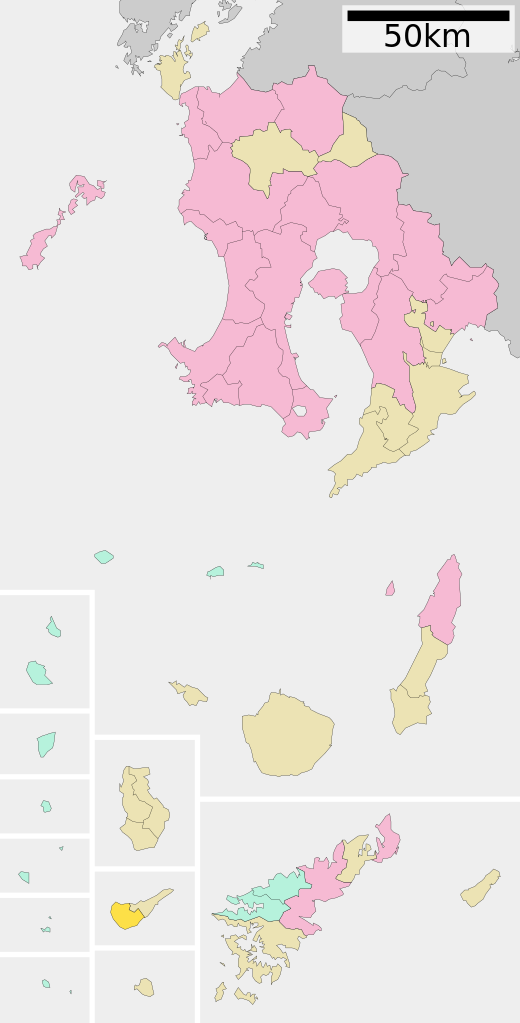
English: Location of China in Kagoshima Prefecture
日本語: ja:鹿児島県知名町位置図
วันที่
更新:2010年3月23日
แหล่งที่มา
Original file: งานของตัว
Data: 国土交通省 国土数値情報(行政区域(N03)・湖沼(W09))
ผู้สร้างสรรค์
Lincun
การอนุญาต (การใช้ไฟล์นี้ใหม่)
This file is a map of a municipality in Japan created and uploaded by Lincun on Japanese Wikipedia. It may also be a file based on one of these maps (see info in file history or author field for more info on later editors). Source:
English: Data used : Ministry of Land, Infrastructure, Transport and Tourism - National Land Numerical Information (Administrative Area (N03) / Lake (W09))
日本語: 使用データ : 国土交通省 国土数値情報(行政区域(N03)・湖沼(W09))
The original file was licensed {{GFDL}} and {{Cc-by-sa-3.0}}. See this category for more files like this. ป้ายนี้มิใช่ป้ายแสดงสถานะลิขสิทธิ์ ดังนั้นการระบุสถานะลิขสิทธิ์จึงต้องกระทำแยกต่างหาก ดูที่ Commons:Lincensing
{{Information| |Description= Location of China in Kagoshima Prefecture |Source= Japanese wiki [http://ja.wikipedia.org/wiki/%E7%94%BB%E5%83%8F:%E5%9F%BA%E7%A4%8E%E8%87%AA%E6%B2%BB%E4%BD%93%E4%BD%8D%E7%BD%AE%E5%9B%B3_46534.svg] |Date=~~~~~ |Author=[[
ไฟล, china, kagoshima, prefecture, ไฟล, ประว, ไฟล, หน, าท, ภาพน, การใช, ไฟล, วนกลาง, อม, ลเก, ยวก, บภาพขนาดของต, วอย, าง, ของไฟล, กเซล, ความละเอ, ยดอ, กเซล, กเซล, กเซล, กเซล, กเซล, กเซล, ภาพท, ความละเอ, ยดส, งกว, 8206, ไฟล, กเซล, ขนาดไฟล, โลไบต, ปภาพหร, อไฟล, . ifl prawtiifl hnathimiphaphni karichiflswnklang khxmulekiywkbphaphkhnadkhxngtwxyang PNG nikhxngifl SVG ni 305 600 phikesl khwamlaexiydxun 122 240 phikesl 244 480 phikesl 390 768 phikesl 520 1 024 phikesl 1 041 2 048 phikesl 395 777 phikesl duphaphthimikhwamlaexiydsungkwa 8206 ifl SVG 395 777 phikesl khnadifl 12 kiolibt rupphaphhruxiflesiyngni tnchbbxyuthi khxmmxns raylaexiyddanlang epnkhxkhwamthiaesdngphlcak ifltnchbbinkhxmmxns khxmmxnsepnewbistinokhrngkarsahrbekbrwbrwmsuxesri thi khunsamarthchwyid khwamyx khaxthibayChina in Kagoshima Prefecture Ja svg English Location of China in Kagoshima Prefecture 日本語 ja 鹿児島県知名町位置図wnthi 更新 2010年3月23日aehlngthima Original file ngankhxngtw Data 国土交通省 国土数値情報 行政区域 N03 湖沼 W09 phusrangsrrkh Lincunkarxnuyat karichiflniihm This file is a map of a municipality in Japan created and uploaded by Lincun on Japanese Wikipedia It may also be a file based on one of these maps see info in file history or author field for more info on later editors Source English Data used Ministry of Land Infrastructure Transport and Tourism National Land Numerical Information Administrative Area N03 Lake W09 日本語 使用データ 国土交通省 国土数値情報 行政区域 N03 湖沼 W09 The original file was licensed GFDL and Cc by sa 3 0 See this category for more files like this paynimiichpayaesdngsthanalikhsiththi dngnnkarrabusthanalikhsiththicungtxngkrathaaeyktanghak duthi Commons Lincensing karxnuyatichsiththi xnuyatihkhdlxk aeckcayaela hruxddaeprexksarniphayitenguxnikhkhxngsyyaxnuyatexksaresrikhxngknu run 1 2 hruxrunid nbcaknithixxkodymulnithisxftaewresri odyimmiswnidhamaekikh immikhxkhwampkhnaaelapkhlng saenakhxngsyyaxnuyatrwmxyuinswnchux syyaxnuyatexksaresrikhxngknuhttp www gnu org copyleft fdl html GFDL GNU Free Documentation License true trueiflnixyuphayitsyyaxnuyat khriexthifkhxmmxns aebbaesdngthima xnuyataebbediywkn 3 0 tnchbbkhunsamarth thicaaebngpn thicathasaena aeckcay aelasngngandngklawtxip thicaeriyberiyngihm thicaddaeplngngandngklaw phayitenguxnikhtxipni aesdngthima khuntxngihekiyrtiecakhxngnganxyangehmaasm odyephimlingkipyngsyyaxnuyat aelarabuhakmikarepliynaeplng khunxacthaechnniidinrupaebbidkidtamkhwr aettxngimichinlksnathiaenawaphuihxnuyatsnbsnunkhunhruxkarichngankhxngkhun xnuyataebbediywkn hakkhunddaeplng epliynrup hruxtxetimnganni khuntxngichsyyaxnuyataebbediywknhruxaebbthiehmuxnkbsyyaxnuyatthiichkbnganniethannhttps creativecommons org licenses by sa 3 0 CC BY SA 3 0 Creative Commons Attribution Share Alike 3 0 true true bnthukkarxphohld This file was moved from Japanese Wikipedia See below for original file information File name 基礎自治体位置図 46534 svgDescription 基礎自治体位置図画像情報 鹿児島県 知名町 20100323 File history wnthi ewla UTC khnad phuich khwamehn25 knyayn ph s 2550 11 07 15 600x1242 Lincun 基礎自治体位置図画像情報 鹿児島県 知名町 2 thnwakhm ph s 2550 14 05 39 600x1242 Lincun 基礎自治体位置図画像情報 鹿児島県 知名町 1 phvscikayn ph s 2551 12 17 29 480x976 Lincun 基礎自治体位置図画像情報 鹿児島県 知名町 17 emsayn ph s 2553 01 45 11 395x777 Lincun 基礎自治体位置図画像情報 鹿児島県 知名町 20100323 Page history wnthi ewla UTC Flag phuich khwamyx 25 knyayn ph s 2550 11 07 15 Lincun 基礎自治体位置図画像情報 鹿児島県 知名町 2 thnwakhm ph s 2550 14 05 39 Lincun 画像 基礎自治体位置図 46534 svg の新しい版をアップロードしました 基礎自治体位置図画像情報 鹿児島県 知名町 1 phvscikayn ph s 2551 12 17 29 Lincun 画像 基礎自治体位置図 46534 svg の新しい版をアップロードしました 基礎自治体位置図画像情報 鹿児島県 知名町 3 tulakhm ph s 2552 07 18 10 Monaneko17 emsayn ph s 2553 01 45 11 Lincun ファイル 基礎自治体位置図 46534 svg の新しい版をアップロードしました 基礎自治体位置図画像情報 鹿児島県 知名町 20100323 17 emsayn ph s 2553 01 45 34 LincunDeutsch English makedonski 한국어 日本語 فارسی khabrryayodyyxithyephimkhabrryaythrrthdediywephuxkhyaykhwamwaiflnimixairixethmthiaesdngxyuiniflniprakxbdwysthanalikhsiththimilikhsiththisyyaxnuyatCreative Commons Attribution ShareAlike 3 0 Unported xngkvsGNU Free Documentation License version 1 2 or later xngkvs prawtiifl khlikwnthi ewlaephuxduiflthipraktinkhnann wnthi ewlarupyxkhnadphuichkhwamehn pccubn19 37 18 knyayn 2559395 777 12 kiolibt KitayamaNew version due to Aira City merger 2010 08 45 17 emsayn 2553395 777 12 kiolibt Lincun 基礎自治体位置図画像情報 鹿児島県 知名町 20100323 14 58 4 phvsphakhm 2552480 976 14 kiolibt MonanekoUpdate from ja File 基礎自治体位置図 46534 svg 2008 11 01 12 17 UTC 19 17 1 phvscikayn 2551480 976 14 kiolibt Lincun 基礎自治体位置図画像情報 鹿児島県 知名町 06 52 29 emsayn 2551600 1 242 22 kiolibt Krisgrotius Information Description Location of China in Kagoshima Prefecture Source Japanese wiki http ja wikipedia org wiki E7 94 BB E5 83 8F E5 9F BA E7 A4 8E E8 87 AA E6 B2 BB E4 BD 93 E4 BD 8D E7 BD AE E5 9B B3 46534 svg Date Author 21 05 2 thnwakhm 2550600 1 242 22 kiolibt Lincun 基礎自治体位置図画像情報 鹿児島県 知名町 18 07 25 knyayn 2550600 1 242 23 kiolibt Lincun 基礎自治体位置図画像情報 鹿児島県 知名町 hnathimiphaphni hnatxipni oyngmathiphaphni china karichiflswnklang wikixuntxipniichiflni karichbn arz wikipedia org تشينا karichbn de wikipedia org China Kagoshima karichbn en wikipedia org Kagoshima Prefecture China Kagoshima karichbn fa wikipedia org چینا کاگوشیما karichbn it wikipedia org China Kagoshima karichbn ja wikipedia org 知名町 karichbn ko wikipedia org 지나정 karichbn nl wikipedia org China Kagoshima karichbn uk wikipedia org Tina Kagosima karichbn www wikidata org Q932423 karichbn zh yue wikipedia org 知名町 karichbn zh wikipedia org 知名町khxmulekiywkbphaph phaphnimikhxmulephimetim sungswnihymacakklxngdicitxlhruxsaeknenxrthisamarthekbkhxmuldngklawiwrwmkbphaphid thaphaphnithukprbprungaekikhhruxepliynaeplngcakedim khxmulbangxyangcayngkhngimepliynaeplngehmuxnphaphthithukprbprungaekikhnnchuxeruxngsn鹿児島県知名町位置図 2010年3月23日 chuxphaphAuthor Lincunkhwamkwang395khwamsung777 ekhathungcak https th wikipedia org wiki ifl China in Kagoshima Prefecture Ja svg, wikipedia, วิกิ หนังสือ, หนังสือ, ห้องสมุด,