This map was created from OpenStreetMap project data, collected by the community. This map may be incomplete, and may contain errors. Don't rely solely on it for navigation.
วันที่
(see file history)
แหล่งที่มา
openstreetmap.org
ผู้สร้าง
OpenStreetMap contributors
การอนุญาต (การใช้ไฟล์นี้ใหม่)
OpenStreetMap data and maps are licensed under the Creative Commons Attribution-ShareAlike 2.0 license (CC-BY-SA 2.0).
azərbaycanca ∙ Deutsch (Sie-Form) ∙ čeština ∙ Deutsch ∙ sicilianu ∙ italiano ∙ русский ∙ română ∙ português ∙ English ∙ magyar ∙ Nederlands ∙ slovenščina ∙ polski ∙ latviešu ∙ македонски ∙ español ∙ فارسی ∙ français ∙ suomi ∙ עברית ∙ Plattdüütsch ∙ ქართული ∙ հայերեն ∙ বাংলা ∙ ไทย ∙ 日本語 ∙ 中文 ∙ 中文(简体) ∙ 中文(繁體) ∙ العربية ∙ +/−
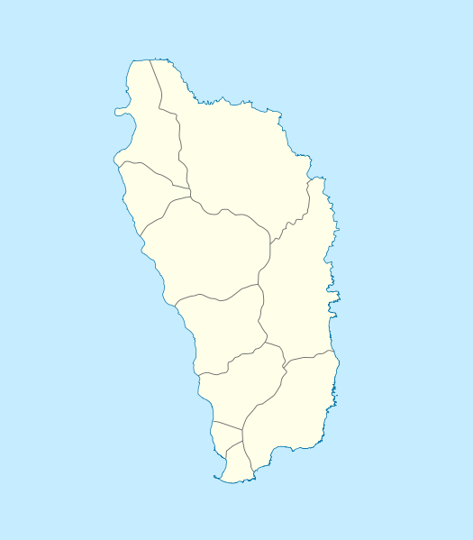
== {{int:filedesc}} == {{Information |Description= {{de|Positionskarte von Dominica}} Geographische Begrenzung der Karte: * N: 15.7° N * S: 15.15° N * W: 61.6° W * O: 61.1° W {{en|Location map of Dominica}} Geographic
ไฟล, dominica, location, ไฟล, ประว, ไฟล, หน, าท, ภาพน, การใช, ไฟล, วนกลางขนาดของต, วอย, าง, ของไฟล, กเซล, ความละเอ, ยดอ, กเซล, กเซล, กเซล, กเซล, กเซล, กเซล, ภาพท, ความละเอ, ยดส, งกว, 8206, ไฟล, กเซล, ขนาดไฟล, โลไบต, ปภาพหร, อไฟล, เส, ยงน, นฉบ, บอย, คอมมอนส, รา. ifl prawtiifl hnathimiphaphni karichiflswnklangkhnadkhxngtwxyang PNG nikhxngifl SVG ni 525 599 phikesl khwamlaexiydxun 210 240 phikesl 421 480 phikesl 673 768 phikesl 897 1 024 phikesl 1 794 2 048 phikesl 1 104 1 260 phikesl duphaphthimikhwamlaexiydsungkwa 8206 ifl SVG 1 104 1 260 phikesl khnadifl 78 kiolibt rupphaphhruxiflesiyngni tnchbbxyuthi khxmmxns raylaexiyddanlang epnkhxkhwamthiaesdngphlcak ifltnchbbinkhxmmxns khxmmxnsepnewbistinokhrngkarsahrbekbrwbrwmsuxesri thi khunsamarthchwyid khwamyx khaxthibayDominica location map svg Deutsch Positionskarte von Dominica Geographische Begrenzung der Karte N 15 7 N S 15 15 N W 61 6 W O 61 1 WEnglish Location map of Dominica Geographic limits of the map N 15 7 N S 15 15 N W 61 6 W E 61 1 Wwnthi 17 thnwakhm ph s 2552aehlngthima ngankhxngtwphusrangsrrkh NordNordWestkarxnuyat karichiflniihm khaxthibayDominica location map svg This map was created from OpenStreetMap project data collected by the community This map may be incomplete and may contain errors Don t rely solely on it for navigation wnthi see file history aehlngthima openstreetmap orgphusrang OpenStreetMap contributorskarxnuyat karichiflniihm OpenStreetMap data and maps are licensed under the Creative Commons Attribution ShareAlike 2 0 license CC BY SA 2 0 iflnixyuphayitsyyaxnuyat khriexthifkhxmmxns aebbaesdngthima xnuyataebbediywkn 2 0 thwipkhunsamarth thicaaebngpn thicathasaena aeckcay aelasngngandngklawtxip thicaeriyberiyngihm thicaddaeplngngandngklaw phayitenguxnikhtxipni aesdngthima khuntxngihekiyrtiecakhxngnganxyangehmaasm odyephimlingkipyngsyyaxnuyat aelarabuhakmikarepliynaeplng khunxacthaechnniidinrupaebbidkidtamkhwr aettxngimichinlksnathiaenawaphuihxnuyatsnbsnunkhunhruxkarichngankhxngkhun xnuyataebbediywkn hakkhunddaeplng epliynrup hruxtxetimnganni khuntxngichsyyaxnuyataebbediywknhruxaebbthiehmuxnkbsyyaxnuyatthiichkbnganniethannhttps creativecommons org licenses by sa 2 0 CC BY SA 2 0 Creative Commons Attribution Share Alike 2 0 true truephikdxangxingthangphumisastr rabuphikdbnaephnthi Wikimaps Warper thamikhwamimehmaasm krunatng warp status skip ephuxsxn aephnthinithuksranghruxphthnakhuncak Kartenwerkstatt hxngptibtikaraephnthi khxngwikiphiediyphasaeyxrmn sungkhunsamarthesnxaephnthiephuxphthnaidechnediywkn azerbaycanca Deutsch Sie Form cestina Deutsch sicilianu italiano russkij romană portugues English magyar Nederlands slovenscina polski latviesu makedonski espanol فارسی francais suomi עברית Plattduutsch ქართული հայերեն ব ল ithy 日本語 中文 中文 简体 中文 繁體 العربية khabrryayodyyxithyephimkhabrryaythrrthdediywephuxkhyaykhwamwaiflnimixairixethmthiaesdngxyuiniflniprakxbdwyphusrangbangkhathiimmiixethmwikisnethschuxphusrangsrrkh NordNordWestchuxphuichwikimiediy NordNordWestyuxaraexl http commons wikimedia org wiki User NordNordWeststhanalikhsiththimilikhsiththisyyaxnuyatCreative Commons Attribution ShareAlike 2 0 Generic xngkvswnthisrang wnkxtng17 thnwakhm 2009thimakhxngiflkarsrangdngedimodyphuxpohld prawtiifl khlikwnthi ewlaephuxduiflthipraktinkhnann wnthi ewlarupyxkhnadphuichkhwamehn pccubn17 18 17 thnwakhm 25521 104 1 260 78 kiolibt NordNordWest int filedesc Information Description de Positionskarte von Dominica Geographische Begrenzung der Karte N 15 7 N S 15 15 N W 61 6 W O 61 1 W en Location map of Dominica Geographic hnathimiphaphni hnatxipni oyngmathiphaphni oros aemaebb Location map Dominica mxdul Location map data Dominica mxdul Location map data Dominica doc karichiflswnklang wikixuntxipniichiflni karichbn af wikipedia org Sjabloon Liggingkaart Dominica karichbn an wikipedia org Plantilla Mapa de localizacion Dominica Roseau karichbn ar wikipedia org قالب خريطة مواقع دومينيكا karichbn ast wikipedia org Rousseau Modulu Minimapa data Dominica Aeropuertu Douglas Charles Aeropuertu de Canefield Modulu Minimapa data Dominica usu karichbn ba wikipedia org Ҡalyp PozKarta Dominika karichbn be tarask wikipedia org Razo Shablyon Lyakalizacyjnaya mapa Daminiki karichbn be wikipedia org Razo Spis ab ektay Susvetnaj spadchyny YuNESKA na Daminicy Shablon Na karce Daminika karichbn bg wikipedia org Shablon PK Dominika karichbn bn wikipedia org ভ গ ল ক আয তন অন য য স র বভ ম র ষ ট র ও ন র ভরশ ল অঞ চলসম হ র ত ল ক মড উল অবস থ ন ম নচ ত র উপ ত ত ড ম ন ক মড উল অবস থ ন ম নচ ত র উপ ত ত ড ম ন ক নথ karichbn bs wikipedia org Roseau Sablon Lokacijska karta Dominika karichbn ceb wikipedia org Plantilya Location map Dominica Saint Paul Saint John Saint George Jenny Point Indian River Noble Salisbury Douglas Point Saint Joseph pagklaro Sugarloaf North River Cape Melville Saint Davids Bay Tweed River Scotts Head Saint Joseph River Rosalie National Park Lagoon River Clyde River Middle Bay Douglas Bay Rough Bay Fresh Water Lake Woodford Hill Bellevue Mountain Grand Bay Hampstead dukarichthwolkephimetimkhxngiflni ekhathungcak https th wikipedia org wiki ifl Dominica location map svg, wikipedia, วิกิ หนังสือ, หนังสือ, ห้องสมุด,