ข้อมูลเพิ่มเติม This map is part of a series of location maps with unified standards: SVG as file format, standardised colours and name scheme. The boundaries on these maps always show the de facto situation and do not imply any endorsement or acceptance. In case of changes of the shown area the file is updated. The old version will be uploaded as a new file and thus is still available.
วันที่
แหล่งที่มา
Own work using:
United States National Imagery and Mapping Agency data
azərbaycanca ∙ Deutsch (Sie-Form) ∙ čeština ∙ Deutsch ∙ sicilianu ∙ italiano ∙ русский ∙ română ∙ português ∙ English ∙ magyar ∙ Nederlands ∙ slovenščina ∙ polski ∙ latviešu ∙ македонски ∙ español ∙ فارسی ∙ français ∙ suomi ∙ עברית ∙ Plattdüütsch ∙ ქართული ∙ հայերեն ∙ বাংলা ∙ ไทย ∙ 日本語 ∙ 中文 ∙ 中文(简体) ∙ 中文(繁體) ∙ العربية ∙ +/−
การอนุญาตใช้สิทธิ
Usage of this file with:
Map: NordNordWest, Licence: Creative Commons by-sa-3.0 de
explanatory notes: Legally binding is only the full legalcode. For a free usage I recommend to respect the following licence conditions: 1. Provide my name as given above: NordNordWest, 2. a copy of, or the URI for, the applicable license: https://creativecommons.org/licenses/by-sa/3.0/de/legalcode, 3. the title of the work, 4. in the case of an adaptation, a credit identifying the use of the work in the adaptation. This license and the rights granted hereunder will terminate automatically upon any breach by you of the terms of this license. Any of the above conditions can be waived if you get permission from the copyright holder. If you have questions or wish differing conditions, please contact me through nnwestt-online.de or my discussion page
This file has been released under a license which is incompatible with Facebook's licensing terms. It is not permitted to upload this file to Facebook.
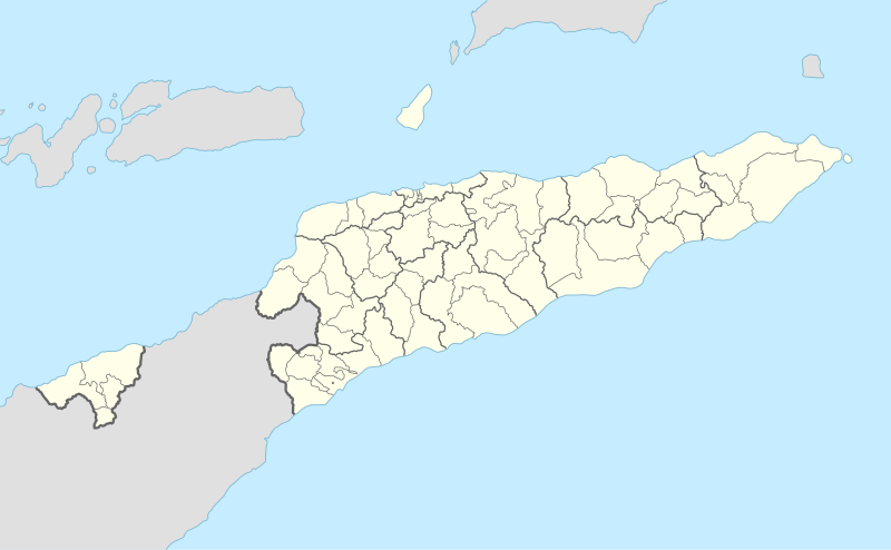
== {{int:filedesc}} == {{Information |Description= {{de|1=Positionskarte von Osttimor}} {{en|1=Location map of East Timor}} {{Location map series N |stretching=101 |top=-7.8 |bottom=-10.0 |left=123.9 |right=127.5 }} |Source={{Own using}} * United State...
ไฟล, east, timor, location, ไฟล, ประว, ไฟล, หน, าท, ภาพน, การใช, ไฟล, วนกลาง, อม, ลเก, ยวก, บภาพขนาดของต, วอย, าง, ของไฟล, กเซล, ความละเอ, ยดอ, กเซล, กเซล, กเซล, กเซล, กเซล, กเซล, ภาพท, ความละเอ, ยดส, งกว, 8206, ไฟล, กเซล, ขนาดไฟล, โลไบต, ปภาพหร, อไฟล, เส, ยงน. ifl prawtiifl hnathimiphaphni karichiflswnklang khxmulekiywkbphaphkhnadkhxngtwxyang PNG nikhxngifl SVG ni 800 494 phikesl khwamlaexiydxun 320 198 phikesl 640 395 phikesl 1 024 632 phikesl 1 280 790 phikesl 2 560 1 580 phikesl 1 701 1 050 phikesl duphaphthimikhwamlaexiydsungkwa 8206 ifl SVG 1 701 1 050 phikesl khnadifl 114 kiolibt rupphaphhruxiflesiyngni tnchbbxyuthi khxmmxns raylaexiyddanlang epnkhxkhwamthiaesdngphlcak ifltnchbbinkhxmmxns khxmmxnsepnewbistinokhrngkarsahrbekbrwbrwmsuxesri thi khunsamarthchwyid khwamyx khaxthibayEast Timor adm 2 location map svg Deutsch Positionskarte von Osttimor English Location map of East Timor Equirectangular projection vertical stretching 101 Border coordinates 7 8123 9 127 5 10 0 khxmulephimetim This map is part of a series of location maps with unified standards SVG as file format standardised colours and name scheme The boundaries on these maps always show the de facto situation and do not imply any endorsement or acceptance In case of changes of the shown area the file is updated The old version will be uploaded as a new file and thus is still available wnthi 9 singhakhm ph s 2560aehlngthima Own work using United States National Imagery and Mapping Agency data World Data Base II data http www estatal gov tl pt inicio phusrangsrrkh NordNordWestewxrchnxun aephnthinithuksranghruxphthnakhuncak Kartenwerkstatt hxngptibtikaraephnthi khxngwikiphiediyphasaeyxrmn sungkhunsamarthesnxaephnthiephuxphthnaidechnediywkn azerbaycanca Deutsch Sie Form cestina Deutsch sicilianu italiano russkij romană portugues English magyar Nederlands slovenscina polski latviesu makedonski espanol فارسی francais suomi עברית Plattduutsch ქართული հայերեն ব ল ithy 日本語 中文 中文 简体 中文 繁體 العربية karxnuyatichsiththi Usage of this file with Map NordNordWest Licence Creative Commons by sa 3 0 de explanatory notes Legally binding is only the full legalcode For a free usage I recommend to respect the following licence conditions 1 Provide my name as given above NordNordWest 2 a copy of or the URI for the applicable license https creativecommons org licenses by sa 3 0 de legalcode 3 the title of the work 4 in the case of an adaptation a credit identifying the use of the work in the adaptation This license and the rights granted hereunder will terminate automatically upon any breach by you of the terms of this license Any of the above conditions can be waived if you get permission from the copyright holder If you have questions or wish differing conditions please contact me through span class nowrap nnwestt online de span or my discussion pageiflnixyuphayitsyyaxnuyat khriexthifkhxmmxns aebbaesdngthima xnuyataebbediywkn 3 0 khxngpraethseyxrmnikaraesdngthima Karte NordNordWest Lizenz Creative Commons by sa 3 0 dekhunsamarth thicaaebngpn thicathasaena aeckcay aelasngngandngklawtxip thicaeriyberiyngihm thicaddaeplngngandngklaw phayitenguxnikhtxipni aesdngthima khuntxngihekiyrtiecakhxngnganxyangehmaasm odyephimlingkipyngsyyaxnuyat aelarabuhakmikarepliynaeplng khunxacthaechnniidinrupaebbidkidtamkhwr aettxngimichinlksnathiaenawaphuihxnuyatsnbsnunkhunhruxkarichngankhxngkhun xnuyataebbediywkn hakkhunddaeplng epliynrup hruxtxetimnganni khuntxngichsyyaxnuyataebbediywknhruxaebbthiehmuxnkbsyyaxnuyatthiichkbnganniethannhttps creativecommons org licenses by sa 3 0 de deed en CC BY SA 3 0 de Creative Commons Attribution Share Alike 3 0 de true true This file has been released under a license which is incompatible with Facebook s licensing terms It is not permitted to upload this file to Facebook khabrryayodyyxithyephimkhabrryaythrrthdediywephuxkhyaykhwamwaiflnimixairixethmthiaesdngxyuiniflniprakxbdwysthanalikhsiththimilikhsiththisyyaxnuyatCreative Commons Attribution ShareAlike 3 0 Germany xngkvswnthisrang wnkxtng9 singhakhm 2017 prawtiifl khlikwnthi ewlaephuxduiflthipraktinkhnann wnthi ewlarupyxkhnadphuichkhwamehn pccubn14 56 9 singhakhm 25601 701 1 050 114 kiolibt NordNordWest int filedesc Information Description de 1 Positionskarte von Osttimor en 1 Location map of East Timor Location map series N stretching 101 top 7 8 bottom 10 0 left 123 9 right 127 5 Source Own using United State hnathimiphaphni hnatxipni oyngmathiphaphni dili thaxakasyannanachatioxexkusi wdcinindili aemaebb Location map Timor Leste mxdul Location map data East Timor mxdul Location map data East Timor doc mxdul Location map data Timor Leste mxdul Location map data Timor Leste doc karichiflswnklang wikixuntxipniichiflni karichbn af wikipedia org Dili Sjabloon Liggingkaart Oos Timor Ermera karichbn an wikipedia org Plantilla Mapa de localizacion Timor Oriental karichbn ar wikipedia org قالب خريطة مواقع تيمور الشرقية karichbn ast wikipedia org Lospalos Modulu Minimapa data Timor Oriental Aeropuertu d Oecusse Aeropuertu de Suai Modulu Minimapa data Timor Oriental usu Dili karichbn az wikipedia org Dili Sablon Yer xeritesi Serqi Timor Manufaxi karichbn bar wikipedia org Vorlog Positionskarte Osttimor Oat im Distrikt Aileu Oat im Distrikt Ainaro Oat im Distrikt Baucau Oat im Distrikt Bobonaro Oat im Distrikt Cova Lima Oat im Distrikt Dili Oat im Distrikt Ermera Oat im Distrikt Lautem Oat im Distrikt Liquica Oat im Distrikt Manatuto Oat im Distrikt Manufahi Oat im Distrikt Oecusse Oat im Distrikt Viqueque karichbn ba wikipedia org Ҡalyp PozKarta Konsygysh Timor Dili karichbn bcl wikipedia org Dili Module Mapa nin kinamumugtakan datos East Timor Module Mapa nin kinamumugtakan datos Subangan na Timor Module Mapa nin kinamumugtakan datos Subangan na Timor doc karichbn be tarask wikipedia org Dyli Shablyon Lyakalizacyjnaya mapa Ўshodnyaga Tymoru Tymor karichbn be wikipedia org Dyli Shablon Na karce Ushodni Tymor Ajnaru karichbn bg wikipedia org Shablon PK Iztochen Timor Atauro karichbn bn wikipedia org মড উল অবস থ ন ম নচ ত র উপ ত ত প র ব ত ম র মড উল অবস থ ন ম নচ ত র উপ ত ত প র ব ত ম র নথ karichbn bs wikipedia org Dili Sablon Lokacijska karta Istocni Timor karichbn ceb wikipedia org Plantilya Location map East Timor Seli Ossu Dili dukarichthwolkephimetimkhxngiflnikhxmulekiywkbphaph phaphnimikhxmulephimetim sungswnihymacakklxngdicitxlhruxsaeknenxrthisamarthekbkhxmuldngklawiwrwmkbphaphid thaphaphnithukprbprungaekikhhruxepliynaeplngcakedim khxmulbangxyangcayngkhngimepliynaeplngehmuxnphaphthithukprbprungaekikhnnkhwamkwang1700 77pxkhwamsung1049 746px ekhathungcak https th wikipedia org wiki ifl East Timor adm 2 location map svg, wikipedia, วิกิ หนังสือ, หนังสือ, ห้องสมุด,