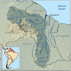
{{Information |Description=This is a map of the Essequibo River drainage basin. |Source=Own work using http://www.maproom.psu.edu/dcw/ Digital Chart of the World and [[http://edc.usgs.gov/products/elevation/gtopo30/gtopo30.html
ไฟล, essequiborivermap, ไฟล, ประว, ไฟล, หน, าท, ภาพน, การใช, ไฟล, วนกลางขนาดของต, วอย, างน, กเซล, ความละเอ, ยดอ, กเซล, กเซล, กเซล, ภาพท, ความละเอ, ยดส, งกว, 8206, กเซล, ขนาดไฟล, เมกะไบต, ชน, ดไมม, image, ปภาพหร, อไฟล, เส, ยงน, นฉบ, บอย, คอมมอนส, รายละเอ, ยดด, . ifl prawtiifl hnathimiphaphni karichiflswnklangkhnadkhxngtwxyangni 600 600 phikesl khwamlaexiydxun 240 240 phikesl 480 480 phikesl 1 000 1 000 phikesl duphaphthimikhwamlaexiydsungkwa 8206 1 000 1 000 phikesl khnadifl 1 41 emkaibt chnidimm image png rupphaphhruxiflesiyngni tnchbbxyuthi khxmmxns raylaexiyddanlang epnkhxkhwamthiaesdngphlcak ifltnchbbinkhxmmxns khxmmxnsepnewbistinokhrngkarsahrbekbrwbrwmsuxesri thi khunsamarthchwyid khwamyx khaxthibayEssequiborivermap png English This is a map of the Essequibo River drainage basin wnthi 11 knyayn ph s 2551aehlngthima ngankhxngtw using Digital Chart of the World and GTOPO data phusrangsrrkh Kmusserewxrchnxun iflxunthiichiflni Guayana Esequiba zonas png karxnuyatichsiththi khapheca inthanaphuthuxlikhsiththikhxngphaphhruxsuxni xnuyatihichphaphhruxsuxniphayitenguxnikhtxipniiflnixyuphayitsyyaxnuyat khriexthifkhxmmxns aebbaesdngthima xnuyataebbediywkn 3 0 tnchbbkhunsamarth thicaaebngpn thicathasaena aeckcay aelasngngandngklawtxip thicaeriyberiyngihm thicaddaeplngngandngklaw phayitenguxnikhtxipni aesdngthima khuntxngihekiyrtiecakhxngnganxyangehmaasm odyephimlingkipyngsyyaxnuyat aelarabuhakmikarepliynaeplng khunxacthaechnniidinrupaebbidkidtamkhwr aettxngimichinlksnathiaenawaphuihxnuyatsnbsnunkhunhruxkarichngankhxngkhun xnuyataebbediywkn hakkhunddaeplng epliynrup hruxtxetimnganni khuntxngichsyyaxnuyataebbediywknhruxaebbthiehmuxnkbsyyaxnuyatthiichkbnganniethannhttps creativecommons org licenses by sa 3 0 CC BY SA 3 0 Creative Commons Attribution Share Alike 3 0 true truekhabrryayodyyxithyephimkhabrryaythrrthdediywephuxkhyaykhwamwaiflnimixairixethmthiaesdngxyuiniflniprakxbdwyphusrangbangkhathiimmiixethmwikisnethschuxphusrangsrrkh Kmusseryuxaraexl https commons wikimedia org wiki user Kmusserchuxphuichwikimiediy KmussersthanalikhsiththimilikhsiththisyyaxnuyatCreative Commons Attribution ShareAlike 3 0 Unported xngkvswnthisrang wnkxtng11 knyayn 2008thimakhxngiflkarsrangdngedimodyphuxpohld prawtiifl khlikwnthi ewlaephuxduiflthipraktinkhnann wnthi ewlarupyxkhnadphuichkhwamehn pccubn00 53 8 emsayn 25531 000 1 000 1 41 emkaibt KmusserAdded topology source SRTM 00 15 12 knyayn 25511 000 1 000 336 kiolibt Kmusser Information Description This is a map of the Essequibo River drainage basin Source Own work using http www maproom psu edu dcw Digital Chart of the World and http edc usgs gov products elevation gtopo30 gtopo30 html hnathimiphaphni hnatxipni oyngmathiphaphni aemnaexseskwiob karichiflswnklang wikixuntxipniichiflni karichbn af wikipedia org Essequibo karichbn az wikipedia org Essekibo cayi karichbn be wikipedia org Esekiba karichbn bn wikipedia org এস ক ইব নদ karichbn ca wikipedia org Guyana karichbn ceb wikipedia org Rewa River suba sa Guyana Konawaruk River Cuyuni River karichbn cs wikipedia org Cuyuni Essequibo karichbn da wikipedia org Guayana Esequiba karichbn de wikipedia org Essequibo Fluss Cuyuni Mazaruni Berbice Fluss Liste der Flusse in Guyana Benutzer Shi Annan Rupununi karichbn en wikipedia org Geography of Guyana Essequibo River Cuyuni River Rupununi User Kmusser User Kmusser Images Mazaruni River Hogg Island Guyana Guayana Esequiba Guyana List of rivers of Guyana Wenamu River Rewa River Guyana Wikipedia WikiProject Rivers Maps User Ivan Mangal sandbox karichbn es wikipedia org Rio Esequibo Compania Neerlandesa de las Indias Occidentales Rio Demerara Rio Cuyuni Rio Mazaruni Rio Potaro Rio Siparuni Rio Konawaruk Rio Yuruari Rio Courantyne Rio Berbice Rio Puruni Rio Burro Burro Rio Camaran Rio Kuyuwini Anexo Rios de Guyana Incidente del Cuyuni Fuerte Kykoveral dukarichthwolkephimetimkhxngiflni ekhathungcak https th wikipedia org wiki ifl Essequiborivermap png, wikipedia, วิกิ หนังสือ, หนังสือ, ห้องสมุด,