This file is a map of a municipality in Japan created and uploaded by Lincun on Japanese Wikipedia. It may also be a file based on one of these maps (see info in file history or author field for more info on later editors). Source:
English: Data used : Ministry of Land, Infrastructure, Transport and Tourism - National Land Numerical Information (Administrative Area (N03) / Lake (W09))
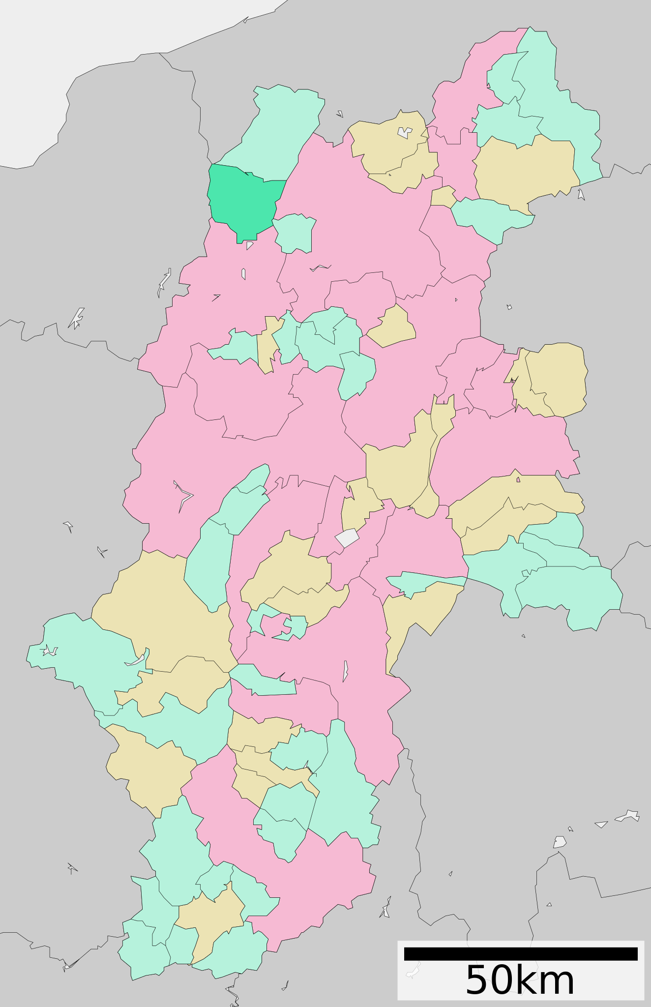
日本語: 使用データ : 国土交通省 国土数値情報(行政区域(N03)・湖沼(W09))
The original file was licensed {{GFDL}} and {{Cc-by-sa-3.0}}. See this category for more files like this. ป้ายนี้มิใช่ป้ายแสดงสถานะลิขสิทธิ์ ดังนั้นการระบุสถานะลิขสิทธิ์จึงต้องกระทำแยกต่างหาก ดูที่ Commons:Lincensing
ไฟล, hakuba, nagano, prefecture, ไฟล, ประว, ไฟล, หน, าท, ภาพน, การใช, ไฟล, วนกลาง, อม, ลเก, ยวก, บภาพขนาดของต, วอย, าง, ของไฟล, กเซล, ความละเอ, ยดอ, กเซล, กเซล, กเซล, กเซล, กเซล, กเซล, ภาพท, ความละเอ, ยดส, งกว, 8206, ไฟล, กเซล, ขนาดไฟล, โลไบต, ปภาพหร, อไฟล, เส. ifl prawtiifl hnathimiphaphni karichiflswnklang khxmulekiywkbphaphkhnadkhxngtwxyang PNG nikhxngifl SVG ni 387 599 phikesl khwamlaexiydxun 155 240 phikesl 310 480 phikesl 496 768 phikesl 662 1 024 phikesl 1 324 2 048 phikesl 393 608 phikesl duphaphthimikhwamlaexiydsungkwa 8206 ifl SVG 393 608 phikesl khnadifl 16 kiolibt rupphaphhruxiflesiyngni tnchbbxyuthi khxmmxns raylaexiyddanlang epnkhxkhwamthiaesdngphlcak ifltnchbbinkhxmmxns khxmmxnsepnewbistinokhrngkarsahrbekbrwbrwmsuxesri thi khunsamarthchwyid khwamyx khaxthibayHakuba in Nagano Prefecture Ja svg English Location of Hakuba in Nagano Prefecture 日本語 ja 長野県白馬村位置図wnthi 更新 2010年3月31日aehlngthima Original file ngankhxngtw Data 国土交通省 国土数値情報 行政区域 N03 湖沼 W09 phusrangsrrkh Lincunkarxnuyat karichiflniihm This file is a map of a municipality in Japan created and uploaded by Lincun on Japanese Wikipedia It may also be a file based on one of these maps see info in file history or author field for more info on later editors Source English Data used Ministry of Land Infrastructure Transport and Tourism National Land Numerical Information Administrative Area N03 Lake W09 日本語 使用データ 国土交通省 国土数値情報 行政区域 N03 湖沼 W09 The original file was licensed GFDL and Cc by sa 3 0 See this category for more files like this paynimiichpayaesdngsthanalikhsiththi dngnnkarrabusthanalikhsiththicungtxngkrathaaeyktanghak duthi Commons Lincensing karxnuyatichsiththi xnuyatihkhdlxk aeckcayaela hruxddaeprexksarniphayitenguxnikhkhxngsyyaxnuyatexksaresrikhxngknu run 1 2 hruxrunid nbcaknithixxkodymulnithisxftaewresri odyimmiswnidhamaekikh immikhxkhwampkhnaaelapkhlng saenakhxngsyyaxnuyatrwmxyuinswnchux syyaxnuyatexksaresrikhxngknuhttp www gnu org copyleft fdl html GFDL GNU Free Documentation License true trueiflnixyuphayitsyyaxnuyat khriexthifkhxmmxns aebbaesdngthima xnuyataebbediywkn 3 0 tnchbbkhunsamarth thicaaebngpn thicathasaena aeckcay aelasngngandngklawtxip thicaeriyberiyngihm thicaddaeplngngandngklaw phayitenguxnikhtxipni aesdngthima khuntxngihekiyrtiecakhxngnganxyangehmaasm odyephimlingkipyngsyyaxnuyat aelarabuhakmikarepliynaeplng khunxacthaechnniidinrupaebbidkidtamkhwr aettxngimichinlksnathiaenawaphuihxnuyatsnbsnunkhunhruxkarichngankhxngkhun xnuyataebbediywkn hakkhunddaeplng epliynrup hruxtxetimnganni khuntxngichsyyaxnuyataebbediywknhruxaebbthiehmuxnkbsyyaxnuyatthiichkbnganniethannhttps creativecommons org licenses by sa 3 0 CC BY SA 3 0 Creative Commons Attribution Share Alike 3 0 true true bnthukkarxphohld This file was moved from Japanese Wikipedia See below for original file information File name 基礎自治体位置図 20485 svgDescription 基礎自治体位置図画像情報 長野県 白馬村 20100331 File history wnthi ewla UTC khnad phuich khwamehn3 tulakhm ph s 2550 13 12 48 580x972 Lincun 基礎自治体位置図画像情報 長野県 白馬村 31 minakhm ph s 2552 13 30 04 464x760 Lincun 基礎自治体位置図画像情報 長野県 白馬村 20090331 10 mkrakhm ph s 2553 08 13 50 393x608 Lincun 基礎自治体位置図画像情報 長野県 白馬村 20100101 10 emsayn ph s 2553 17 07 08 393x608 Lincun 基礎自治体位置図画像情報 長野県 白馬村 20100331 Page history wnthi ewla UTC Flag phuich khwamyx 3 tulakhm ph s 2550 13 12 48 Lincun 基礎自治体位置図画像情報 長野県 白馬村 31 minakhm ph s 2552 13 30 04 Lincun ファイル 基礎自治体位置図 20485 svg の新しい版をアップロードしました 基礎自治体位置図画像情報 長野県 白馬村 20090331 31 minakhm ph s 2552 13 40 31 Lincun date14 phvscikayn ph s 2552 11 55 32 Monaneko10 mkrakhm ph s 2553 08 13 50 Lincun ファイル 基礎自治体位置図 20485 svg の新しい版をアップロードしました 基礎自治体位置図画像情報 長野県 白馬村 20100101 10 mkrakhm ph s 2553 08 14 22 Lincun10 emsayn ph s 2553 17 07 08 Lincun ファイル 基礎自治体位置図 20485 svg の新しい版をアップロードしました 基礎自治体位置図画像情報 長野県 白馬村 20100331 10 emsayn ph s 2553 17 07 31 LincunDeutsch English makedonski 한국어 日本語 فارسی khabrryayodyyxithyephimkhabrryaythrrthdediywephuxkhyaykhwamwaiflnimixairixethmthiaesdngxyuiniflniprakxbdwysthanalikhsiththimilikhsiththisyyaxnuyatGNU Free Documentation License version 1 2 or later xngkvsCreative Commons Attribution ShareAlike 3 0 Unported xngkvs prawtiifl khlikwnthi ewlaephuxduiflthipraktinkhnann wnthi ewlarupyxkhnadphuichkhwamehn pccubn18 05 4 singhakhm 2553393 608 16 kiolibt Krisgrotius update Date 31 March 2010 Author ja 利用者 Lincun 00 07 11 emsayn 2553393 608 16 kiolibt Lincun 基礎自治体位置図画像情報 長野県 白馬村 20100331 15 13 10 mkrakhm 2553393 608 15 kiolibt Lincun 基礎自治体位置図画像情報 長野県 白馬村 20100101 17 56 7 phvscikayn 2552464 760 16 kiolibt Monaneko Information Description en 1 Location of Hakuba in Nagano Prefecture ja 1 長野県北安曇郡白馬村の位置 Source ja File 基礎自治体位置図 20485 svg Author ja User Lincun Date 2009 03 31 13 30 UTC Permission oth 20 30 31 minakhm 2552464 760 16 kiolibt Lincun 基礎自治体位置図画像情報 長野県 白馬村 20090331 20 12 3 tulakhm 2550580 972 29 kiolibt Lincun 基礎自治体位置図画像情報 長野県 白馬村 hnathimiphaphni hnatxipni oyngmathiphaphni hakuba karichiflswnklang wikixuntxipniichiflni karichbn de wikipedia org Hakuba karichbn en wikipedia org Hakuba karichbn es wikipedia org Hakuba karichbn fa wikipedia org هاکوبا ناگانو karichbn fi wikipedia org Hakuba karichbn it wikipedia org Hakuba karichbn ja wikipedia org 白馬村 karichbn ko wikipedia org 하쿠바촌 karichbn nl wikipedia org Hakuba karichbn no wikipedia org Hakuba karichbn ro wikipedia org Hakuba karichbn simple wikipedia org Hakuba karichbn sv wikipedia org Hakuba karichbn uk wikipedia org Hakuba karichbn www wikidata org Q1011157khxmulekiywkbphaph phaphnimikhxmulephimetim sungswnihymacakklxngdicitxlhruxsaeknenxrthisamarthekbkhxmuldngklawiwrwmkbphaphid thaphaphnithukprbprungaekikhhruxepliynaeplngcakedim khxmulbangxyangcayngkhngimepliynaeplngehmuxnphaphthithukprbprungaekikhnnchuxeruxngsn長野県白馬村位置図 2010年3月31日 chuxphaphAuthor Lincunkhwamkwang393khwamsung608 ekhathungcak https th wikipedia org wiki ifl Hakuba in Nagano Prefecture Ja svg, wikipedia, วิกิ หนังสือ, หนังสือ, ห้องสมุด,