This image is a derivative work of the following images:
Empire of Japan (1868-1945).png licensed with PD-user-w
2010-04-13T05:49:21Z File Upload Bot (Magnus Manske) 1000x600 (183888 Bytes) {{BotMoveToCommons|en.wikipedia|year={{subst:CURRENTYEAR}}|month={{subst:CURRENTMONTHNAME}}|day={{subst:CURRENTDAY}}}} {{Information |Description={{en|The Empire of Japan at its height in 1942.}} |Source=Transferred from [ht
2007-05-27T01:31:13Z Gryffindor 707x591 (49084 Bytes) {{svg}} {{GFDL}} Modified version of [[:Image:Japanese_Empire.png]]. Fixed Ryukyu Islands, Sichuan, grammar in table. [[Category:Maps of the history of Japan]] [[Category:Maps of the history of Korea]] [[Category:Maps of th
2007-02-27T15:13:21Z Cristan 508x591 (37210 Bytes) Optimized using PNGOUT
2005-12-22T11:24:51Z Markalexander100 508x591 (47890 Bytes) {{GFDL}} Modified version of [[:Image:Japanese_Empire.png]]. Fixed Ryukyu Islands, Sichuan, grammar in table.
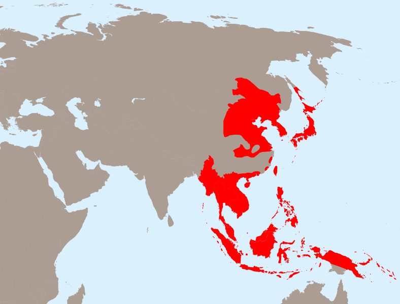
Northern part of the Sakhalin island was transferred from Japan to Soviet Russia in 1925, and the borders remained untouched until the end of WWII. Hence this territory should be omitted from the map.
Northern part of the Sakhalin island was transferred from Japan to Soviet Russia in 1925, and the borders remained untouched until the end of WWII. Hence this territory should be omitted from the map.
ไฟล, japanese, empire, 1942, ไฟล, ประว, ไฟล, หน, าท, ภาพน, การใช, ไฟล, วนกลาง, อม, ลเก, ยวก, บภาพขนาดของต, วอย, าง, ของไฟล, กเซล, ความละเอ, ยดอ, กเซล, กเซล, กเซล, กเซล, กเซล, กเซล, ภาพท, ความละเอ, ยดส, งกว, 8206, ไฟล, กเซล, ขนาดไฟล, โลไบต, ปภาพหร, อไฟล, เส, ยง. ifl prawtiifl hnathimiphaphni karichiflswnklang khxmulekiywkbphaphkhnadkhxngtwxyang PNG nikhxngifl SVG ni 788 600 phikesl khwamlaexiydxun 316 240 phikesl 631 480 phikesl 1 009 768 phikesl 1 280 974 phikesl 2 560 1 948 phikesl 1 100 837 phikesl duphaphthimikhwamlaexiydsungkwa 8206 ifl SVG 1 100 837 phikesl khnadifl 875 kiolibt rupphaphhruxiflesiyngni tnchbbxyuthi khxmmxns raylaexiyddanlang epnkhxkhwamthiaesdngphlcak ifltnchbbinkhxmmxns khxmmxnsepnewbistinokhrngkarsahrbekbrwbrwmsuxesri thi khunsamarthchwyid khwamyx khaxthibayJapanese Empire 1942 svg English The Empire of Japan at its height in 1942 Francais Japon 1942 Deutsch Japanisches Reich 1942wnthi 23 emsayn ph s 2553aehlngthima Own work based on Empire of Japan 1868 1945 png ody Mackay 86 Asie svg ody historicairaela Japanese Empire2 png ody Mackay 86phusrangsrrkh tnchbb historicair ewketxr TastyCakesSVG genesisInfoField sxrsokhdkhxng SVG nitrwcsxbthuktxngaelw iflphaphkrafiksewketxrni srangkhunodyich Inkscape karxnuyatichsiththi iflnixyuphayitsyyaxnuyat khriexthifkhxmmxns aebbaesdngthima xnuyataebbediywkn 3 0 tnchbbkhunsamarth thicaaebngpn thicathasaena aeckcay aelasngngandngklawtxip thicaeriyberiyngihm thicaddaeplngngandngklaw phayitenguxnikhtxipni aesdngthima khuntxngihekiyrtiecakhxngnganxyangehmaasm odyephimlingkipyngsyyaxnuyat aelarabuhakmikarepliynaeplng khunxacthaechnniidinrupaebbidkidtamkhwr aettxngimichinlksnathiaenawaphuihxnuyatsnbsnunkhunhruxkarichngankhxngkhun xnuyataebbediywkn hakkhunddaeplng epliynrup hruxtxetimnganni khuntxngichsyyaxnuyataebbediywknhruxaebbthiehmuxnkbsyyaxnuyatthiichkbnganniethannhttps creativecommons org licenses by sa 3 0 CC BY SA 3 0 Creative Commons Attribution Share Alike 3 0 true true bnthukkarxphohld This image is a derivative work of the following images Empire of Japan 1868 1945 png licensed with PD user w 2010 04 13T05 49 21Z File Upload Bot Magnus Manske 1000x600 183888 Bytes BotMoveToCommons en wikipedia year subst CURRENTYEAR month subst CURRENTMONTHNAME day subst CURRENTDAY Information Description en The Empire of Japan at its height in 1942 Source Transferred from htAsie svg licensed with PD self 2006 11 23T21 09 53Z Historicair 1100x837 902355 Bytes 2006 11 23T20 25 19Z Historicair 1100x837 902408 Bytes 2006 11 22T22 59 34Z Historicair 1100x837 898316 Bytes 2006 11 21T18 36 45Z Historicair 1100x837 897827 Bytes 2006 11 20T20 31 48Z Historicair 1100x837 816138 Bytes Information Description fr 1 Carte vierge de l Asie en 1 Asia Blank map Source http en wikipedia org wiki Image BlankMap World5 svg Date 20 11 2006 Author Permission PD self other versions Atelier gJapanese Empire2 png licensed with Cc by sa 3 0 migrated GFDL 2007 07 05T11 47 48Z Mahahahaneapneap 707x591 32385 Bytes pngcrushed 2007 05 27T01 31 13Z Gryffindor 707x591 49084 Bytes svg GFDL Modified version of Image Japanese Empire png Fixed Ryukyu Islands Sichuan grammar in table Category Maps of the history of Japan Category Maps of the history of Korea Category Maps of th 2007 02 27T15 13 21Z Cristan 508x591 37210 Bytes Optimized using PNGOUT 2005 12 22T11 24 51Z Markalexander100 508x591 47890 Bytes GFDL Modified version of Image Japanese Empire png Fixed Ryukyu Islands Sichuan grammar in table Uploaded with derivativeFXkhabrryayodyyxithyephimkhabrryaythrrthdediywephuxkhyaykhwamwaiflnimixairixethmthiaesdngxyuiniflniprakxbdwysthanalikhsiththimilikhsiththisyyaxnuyatCreative Commons Attribution ShareAlike 3 0 Unported xngkvswnthisrang wnkxtng23 emsayn 2010MIME type xngkvsimage svg xml prawtiifl khlikwnthi ewlaephuxduiflthipraktinkhnann wnthi ewlarupyxkhnadphuichkhwamehn pccubn03 13 1 emsayn 25631 100 837 875 kiolibt Esmu IgorsNorthern part of the Sakhalin island was transferred from Japan to Soviet Russia in 1925 and the borders remained untouched until the end of WWII Hence this territory should be omitted from the map 03 13 1 emsayn 25631 100 837 904 kiolibt Esmu IgorsReverted to version as of 01 24 25 April 2010 UTC unsuccessful edit in the Inkscape 03 11 1 emsayn 25631 100 837 882 kiolibt Esmu IgorsNorthern part of the Sakhalin island was transferred from Japan to Soviet Russia in 1925 and the borders remained untouched until the end of WWII Hence this territory should be omitted from the map 08 24 25 emsayn 25531 100 837 904 kiolibt Ras67borders removed 04 44 24 emsayn 25531 100 837 911 kiolibt TastyCakesTweaked some borders and coloured some islands that I missed 04 29 24 emsayn 25531 100 837 911 kiolibt TastyCakes Information Description en The Empire of Japan at its height in 1942 fr Carte vierge de l 039 Asie en Asia Blank map Source File Empire of Japan 1868 1945 png File Asie svg File Japanese Empire2 png Date 2010 04 23 21 26 hnathimiphaphni hnatxipni oyngmathiphaphni karyudkhrxngkmphuchakhxngyipun phuich PP2014 krabathray xinodniesiyphayitkaryudkhrxngkhxngyipun karichiflswnklang wikixuntxipniichiflni karichbn ar wikipedia org منطقة شرقى أسيا الكبرى للرفاهية المتبادلة الاحتلال الياباني للهند الشرقية الهولندية karichbn be wikipedia org Yaponskaya akupacyya Kambodzhy karichbn ca wikipedia org Ocupacio japonesa de Cambodja karichbn cs wikipedia org Japonsky fasismus karichbn de wikipedia org Grossostasiatische Wohlstandssphare karichbn en wikipedia org Greater East Asia Co Prosperity Sphere French protectorate of Cambodia Japanese nationalism User TastyCakes Stuff Wikipedia Graphics Lab Map workshop Archive Jul 2010 Imperial Japanese Army during the Pacific War karichbn es wikipedia org Ocupacion japonesa de Camboya karichbn fo wikipedia org Asarveldini karichbn fr wikipedia org Histoire du Japon Sphere de coprosperite de la Grande Asie orientale karichbn id wikipedia org Pendudukan Kamboja oleh Jepang Story Van Pembuang Asal Muasal Kabupaten Seruyan karichbn it wikipedia org Memoriale Tanaka karichbn ja wikipedia org フランス保護領カンボジア karichbn km wikipedia org ក រត រ តត រ របស ជប នន កម ព ជ karichbn ms wikipedia org Senarai empayar terbesar karichbn no wikipedia org Aksemaktene karichbn ru wikipedia org Vikipediya Kandidaty v horoshie stati 28 marta 2011 Yaponskaya okkupaciya Kambodzhi karichbn sv wikipedia org Axelmakterna karichbn tl wikipedia org Imperyo ng Hapon karichbn uk wikipedia org Yaponskij nacionalizm karichbn www wikidata org Q4919422 karichbn zh min nan wikipedia org Tai Tang a Kiōng eng khoan karichbn zh yue wikipedia org 大東亞共榮圈 karichbn zh wikipedia org 中国抗日战争 满洲国 台灣日治時期 关东州 香港日佔時期 臺灣總督府 太平洋战争 大东亚战争 汪精卫国民政府 大日本帝国 朝鲜总督府 馬來亞日佔時期 緬甸戰役 冀東防共自治政府 中華民國臨時政府 1937年 1940年 中華民國維新政府 大東亞會議 自由印度臨時政府 大東亞共榮圈 dukarichthwolkephimetimkhxngiflnikhxmulekiywkbphaph phaphnimikhxmulephimetim sungswnihymacakklxngdicitxlhruxsaeknenxrthisamarthekbkhxmuldngklawiwrwmkbphaphid thaphaphnithukprbprungaekikhhruxepliynaeplngcakedim khxmulbangxyangcayngkhngimepliynaeplngehmuxnphaphthithukprbprungaekikhnnkhwamkwang1100 1658khwamsung837 09625 ekhathungcak https th wikipedia org wiki ifl Japanese Empire 1942 svg, wikipedia, วิกิ หนังสือ, หนังสือ, ห้องสมุด,
.png.html)