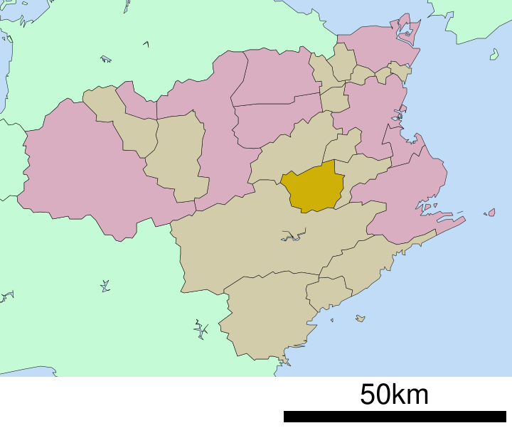
English: Location of Kamikatsu in Tokushima Prefecture
日本語: ja:徳島県上勝町位置図
วันที่
(UTC)
แหล่งที่มา
Original file: งานของตัว
Data: 国土交通省 国土数値情報(行政区域(N03)・湖沼(W09))
ผู้สร้างสรรค์
Lincun
การอนุญาต (การใช้ไฟล์นี้ใหม่)
This file is a map of a municipality in Japan created and uploaded by Lincun on Japanese Wikipedia. It may also be a file based on one of these maps (see info in file history or author field for more info on later editors). Source:
English: Data used : Ministry of Land, Infrastructure, Transport and Tourism - National Land Numerical Information (Administrative Area (N03) / Lake (W09))
日本語: 使用データ : 国土交通省 国土数値情報(行政区域(N03)・湖沼(W09))
The original file was licensed {{GFDL}} and {{Cc-by-sa-3.0}}. See this category for more files like this. ป้ายนี้มิใช่ป้ายแสดงสถานะลิขสิทธิ์ ดังนั้นการระบุสถานะลิขสิทธิ์จึงต้องกระทำแยกต่างหาก ดูที่ Commons:Lincensing
ไฟล, kamikatsu, tokushima, prefecture, ไฟล, ประว, ไฟล, หน, าท, ภาพน, การใช, ไฟล, วนกลาง, อม, ลเก, ยวก, บภาพขนาดของต, วอย, าง, ของไฟล, กเซล, ความละเอ, ยดอ, กเซล, กเซล, กเซล, กเซล, กเซล, กเซล, ภาพท, ความละเอ, ยดส, งกว, 8206, ไฟล, กเซล, ขนาดไฟล, โลไบต, ปภาพหร, อไ. ifl prawtiifl hnathimiphaphni karichiflswnklang khxmulekiywkbphaphkhnadkhxngtwxyang PNG nikhxngifl SVG ni 717 599 phikesl khwamlaexiydxun 287 240 phikesl 574 480 phikesl 919 768 phikesl 1 225 1 024 phikesl 2 450 2 048 phikesl 720 602 phikesl duphaphthimikhwamlaexiydsungkwa 8206 ifl SVG 720 602 phikesl khnadifl 12 kiolibt rupphaphhruxiflesiyngni tnchbbxyuthi khxmmxns raylaexiyddanlang epnkhxkhwamthiaesdngphlcak ifltnchbbinkhxmmxns khxmmxnsepnewbistinokhrngkarsahrbekbrwbrwmsuxesri thi khunsamarthchwyid khwamyx khaxthibayKamikatsu in Tokushima Prefecture Ja svg English Location of Kamikatsu in Tokushima Prefecture 日本語 ja 徳島県上勝町位置図wnthi 16 tulakhm ph s 2550 14 07 UTC aehlngthima Original file ngankhxngtw Data 国土交通省 国土数値情報 行政区域 N03 湖沼 W09 phusrangsrrkh Lincunkarxnuyat karichiflniihm This file is a map of a municipality in Japan created and uploaded by Lincun on Japanese Wikipedia It may also be a file based on one of these maps see info in file history or author field for more info on later editors Source English Data used Ministry of Land Infrastructure Transport and Tourism National Land Numerical Information Administrative Area N03 Lake W09 日本語 使用データ 国土交通省 国土数値情報 行政区域 N03 湖沼 W09 The original file was licensed GFDL and Cc by sa 3 0 See this category for more files like this paynimiichpayaesdngsthanalikhsiththi dngnnkarrabusthanalikhsiththicungtxngkrathaaeyktanghak duthi Commons Lincensing karxnuyatichsiththi xnuyatihkhdlxk aeckcayaela hruxddaeprexksarniphayitenguxnikhkhxngsyyaxnuyatexksaresrikhxngknu run 1 2 hruxrunid nbcaknithixxkodymulnithisxftaewresri odyimmiswnidhamaekikh immikhxkhwampkhnaaelapkhlng saenakhxngsyyaxnuyatrwmxyuinswnchux syyaxnuyatexksaresrikhxngknuhttp www gnu org copyleft fdl html GFDL GNU Free Documentation License true trueiflnixyuphayitsyyaxnuyat khriexthifkhxmmxns aebbaesdngthima xnuyataebbediywkn 3 0 tnchbbkhunsamarth thicaaebngpn thicathasaena aeckcay aelasngngandngklawtxip thicaeriyberiyngihm thicaddaeplngngandngklaw phayitenguxnikhtxipni aesdngthima khuntxngihekiyrtiecakhxngnganxyangehmaasm odyephimlingkipyngsyyaxnuyat aelarabuhakmikarepliynaeplng khunxacthaechnniidinrupaebbidkidtamkhwr aettxngimichinlksnathiaenawaphuihxnuyatsnbsnunkhunhruxkarichngankhxngkhun xnuyataebbediywkn hakkhunddaeplng epliynrup hruxtxetimnganni khuntxngichsyyaxnuyataebbediywknhruxaebbthiehmuxnkbsyyaxnuyatthiichkbnganniethannhttps creativecommons org licenses by sa 3 0 CC BY SA 3 0 Creative Commons Attribution Share Alike 3 0 true true bnthukkarxphohld This file was moved from Japanese Wikipedia See below for original file information File name 基礎自治体位置図 36302 svgDescription 基礎自治体位置図画像情報 徳島県 上勝町 File history wnthi ewla UTC khnad phuich khwamehn16 tulakhm ph s 2550 14 07 24 720x602 Lincun 基礎自治体位置図画像情報 徳島県 上勝町 Page history wnthi ewla UTC Flag phuich khwamyx 16 tulakhm ph s 2550 14 07 24 Lincun 基礎自治体位置図画像情報 徳島県 上勝町 Deutsch English makedonski 한국어 日本語 فارسی khabrryayodyyxithyephimkhabrryaythrrthdediywephuxkhyaykhwamwaiflnimixairixethmthiaesdngxyuiniflniprakxbdwysthanalikhsiththimilikhsiththisyyaxnuyatGNU Free Documentation License version 1 2 or later xngkvsCreative Commons Attribution ShareAlike 3 0 Unported xngkvsMIME type xngkvsimage svg xml prawtiifl khlikwnthi ewlaephuxduiflthipraktinkhnann wnthi ewlarupyxkhnadphuichkhwamehn pccubn20 54 22 knyayn 2552720 602 12 kiolibt Monaneko Information Description en 1 Location of Kamikatsu in Tokushima Prefecture ja 1 徳島県勝浦郡上勝町の位置 Source ja File 包括自治体区画図 36302 svg Author ja User Lincun Date 2007 10 16 14 07 UTC Permission 21 07 16 tulakhm 2550720 602 12 kiolibt Lincun 基礎自治体位置図画像情報 徳島県 上勝町 hnathimiphaphni hnatxipni oyngmathiphaphni khamiktsu karichiflswnklang wikixuntxipniichiflni karichbn cs wikipedia org Kamikacu Tokusima karichbn en wikipedia org Tokushima Prefecture Kamikatsu Tokushima karichbn fa wikipedia org کامیکاتسو توکوشیما karichbn id wikipedia org Kamikatsu Tokushima karichbn ja wikipedia org 上勝町 karichbn ko wikipedia org 가미카쓰정 karichbn ms wikipedia org Kamikatsu Tokushima karichbn uk wikipedia org Kamikacu karichbn zh wikipedia org 上勝町khxmulekiywkbphaph phaphnimikhxmulephimetim sungswnihymacakklxngdicitxlhruxsaeknenxrthisamarthekbkhxmuldngklawiwrwmkbphaphid thaphaphnithukprbprungaekikhhruxepliynaeplngcakedim khxmulbangxyangcayngkhngimepliynaeplngehmuxnphaphthithukprbprungaekikhnnchuxeruxngsn徳島県上勝町位置図chuxphaphAuthor Lincunkhwamkwang720khwamsung602 ekhathungcak https th wikipedia org wiki ifl Kamikatsu in Tokushima Prefecture Ja svg, wikipedia, วิกิ หนังสือ, หนังสือ, ห้องสมุด,