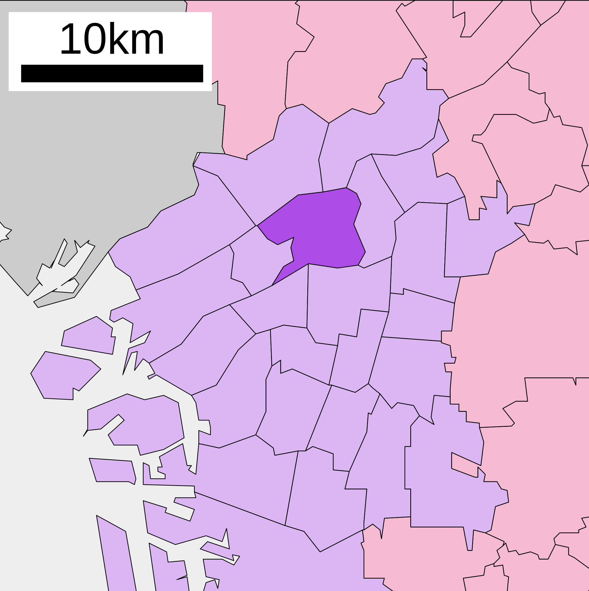
English: Location of Kita-ku of Osaka city in Osaka prefecture, Japan
日本語: ja:大阪府ja:大阪市北区位置図
วันที่
(UTC)
แหล่งที่มา
Original file: งานของตัว
Data: 国土交通省 国土数値情報(行政区域(N03)・湖沼(W09))
Data from Digital National Land Information, MLIT(行政区域(N03)・湖沼(W09))
ผู้สร้างสรรค์
Lincun
การอนุญาต (การใช้ไฟล์นี้ใหม่)
This file is a map of a municipality in Japan created and uploaded by Lincun on Japanese Wikipedia. It may also be a file based on one of these maps (see info in file history or author field for more info on later editors). Source:
English: Data used : Ministry of Land, Infrastructure, Transport and Tourism - National Land Numerical Information (Administrative Area (N03) / Lake (W09))
日本語: 使用データ : 国土交通省 国土数値情報(行政区域(N03)・湖沼(W09))
The original file was licensed {{GFDL}} and {{Cc-by-sa-3.0}}. See this category for more files like this. ป้ายนี้มิใช่ป้ายแสดงสถานะลิขสิทธิ์ ดังนั้นการระบุสถานะลิขสิทธิ์จึงต้องกระทำแยกต่างหาก ดูที่ Commons:Lincensing
ไฟล, kita, osaka, city, ไฟล, ประว, ไฟล, หน, าท, ภาพน, การใช, ไฟล, วนกลาง, อม, ลเก, ยวก, บภาพขนาดของต, วอย, าง, ของไฟล, กเซล, ความละเอ, ยดอ, กเซล, กเซล, กเซล, กเซล, กเซล, ภาพท, ความละเอ, ยดส, งกว, 8206, ไฟล, กเซล, ขนาดไฟล, โลไบต, ปภาพหร, อไฟล, เส, ยงน, นฉบ, บอย. ifl prawtiifl hnathimiphaphni karichiflswnklang khxmulekiywkbphaphkhnadkhxngtwxyang PNG nikhxngifl SVG ni 403 404 phikesl khwamlaexiydxun 239 240 phikesl 479 480 phikesl 766 768 phikesl 1 021 1 024 phikesl 2 043 2 048 phikesl duphaphthimikhwamlaexiydsungkwa 8206 ifl SVG 403 404 phikesl khnadifl 26 kiolibt rupphaphhruxiflesiyngni tnchbbxyuthi khxmmxns raylaexiyddanlang epnkhxkhwamthiaesdngphlcak ifltnchbbinkhxmmxns khxmmxnsepnewbistinokhrngkarsahrbekbrwbrwmsuxesri thi khunsamarthchwyid khwamyx khaxthibayKita ku in Osaka City svg English Location of Kita ku of Osaka city in Osaka prefecture Japan 日本語 ja 大阪府ja 大阪市北区位置図wnthi 7 thnwakhm ph s 2550 14 33 UTC aehlngthima Original file ngankhxngtw Data 国土交通省 国土数値情報 行政区域 N03 湖沼 W09 Data from Digital National Land Information MLIT 行政区域 N03 湖沼 W09 phusrangsrrkh Lincunkarxnuyat karichiflniihm This file is a map of a municipality in Japan created and uploaded by Lincun on Japanese Wikipedia It may also be a file based on one of these maps see info in file history or author field for more info on later editors Source English Data used Ministry of Land Infrastructure Transport and Tourism National Land Numerical Information Administrative Area N03 Lake W09 日本語 使用データ 国土交通省 国土数値情報 行政区域 N03 湖沼 W09 The original file was licensed GFDL and Cc by sa 3 0 See this category for more files like this paynimiichpayaesdngsthanalikhsiththi dngnnkarrabusthanalikhsiththicungtxngkrathaaeyktanghak duthi Commons Lincensing karxnuyatichsiththi khapheca inthanaphuthuxlikhsiththikhxngphaphhruxsuxni xnuyatihichphaphhruxsuxniphayitenguxnikhtxipni xnuyatihkhdlxk aeckcayaela hruxddaeprexksarniphayitenguxnikhkhxngsyyaxnuyatexksaresrikhxngknu run 1 2 hruxrunid nbcaknithixxkodymulnithisxftaewresri odyimmiswnidhamaekikh immikhxkhwampkhnaaelapkhlng saenakhxngsyyaxnuyatrwmxyuinswnchux syyaxnuyatexksaresrikhxngknuhttp www gnu org copyleft fdl html GFDL GNU Free Documentation License true trueiflnixyuphayitsyyaxnuyat khriexthifkhxmmxns aebbaesdngthima xnuyataebbediywkn 3 0 tnchbbkhunsamarth thicaaebngpn thicathasaena aeckcay aelasngngandngklawtxip thicaeriyberiyngihm thicaddaeplngngandngklaw phayitenguxnikhtxipni aesdngthima khuntxngihekiyrtiecakhxngnganxyangehmaasm odyephimlingkipyngsyyaxnuyat aelarabuhakmikarepliynaeplng khunxacthaechnniidinrupaebbidkidtamkhwr aettxngimichinlksnathiaenawaphuihxnuyatsnbsnunkhunhruxkarichngankhxngkhun xnuyataebbediywkn hakkhunddaeplng epliynrup hruxtxetimnganni khuntxngichsyyaxnuyataebbediywknhruxaebbthiehmuxnkbsyyaxnuyatthiichkbnganniethannhttps creativecommons org licenses by sa 3 0 CC BY SA 3 0 Creative Commons Attribution Share Alike 3 0 true truekhunsamartheluxksyyaxnuyatdngklawtamtxngkar bnthukkarxphohld This file was moved from Japanese Wikipedia See below for original file information File name 行政区位置図 27127 svgDescription 行政区位置図画像情報 大阪府 大阪市 北区 File history wnthi ewla UTC khnad phuich khwamehn7 thnwakhm ph s 2550 14 33 27 400x472 Lincun 行政区位置図画像情報 大阪府 大阪市 北区 Page history wnthi ewla UTC Flag phuich khwamyx 7 thnwakhm ph s 2550 14 33 27 Lincun 行政区位置図画像情報 大阪府 大阪市 北区 17 mithunayn ph s 2551 19 07 13 l BakkaiDeutsch English makedonski 한국어 日本語 فارسی khabrryayodyyxithyephimkhabrryaythrrthdediywephuxkhyaykhwamwaiflnimixairixethmthiaesdngxyuiniflniprakxbdwysthanalikhsiththimilikhsiththisyyaxnuyatGNU Free Documentation License version 1 2 or later xngkvsCreative Commons Attribution ShareAlike 3 0 Unported xngkvsthimakhxngiflkarsrangdngedimodyphuxpohld prawtiifl khlikwnthi ewlaephuxduiflthipraktinkhnann wnthi ewlarupyxkhnadphuichkhwamehn pccubn16 25 22 tulakhm 2563403 404 26 kiolibt AichiWikiFixerUpdated as File Map of Osaka Prefecture Ja svg 11 15 11 tulakhm 2552400 472 11 kiolibt Monaneko Information Description en 1 Location of Kita ku in Osaka City ja 1 大阪市北区の位置 Source ja File 行政区位置図 27127 svg Author ja User Lincun Date 2007 12 07 14 33 UTC Permission other versions Category 21 33 7 thnwakhm 2550400 472 11 kiolibt Lincun 行政区位置図画像情報 大阪府 大阪市 北区 hnathimiphaphni hnatxipni oyngmathiphaphni ekhtkhita oxsaka karichiflswnklang wikixuntxipniichiflni karichbn ca wikipedia org Kita Osaka karichbn en wikipedia org Kita ku Osaka karichbn eo wikipedia org Kvartalo Kita ku Osako karichbn es wikipedia org Kita ku Osaka karichbn eu wikipedia org Kita ku Osaka karichbn fa wikipedia org کیتا اوزاکا karichbn fi wikipedia org Kita ku Osaka karichbn fr wikipedia org Kita ku Osaka karichbn gl wikipedia org Kita ku Ōsaka karichbn it wikipedia org Kita ku Osaka karichbn ja wikipedia org 北区 大阪市 karichbn ko wikipedia org 기타구 오사카시 karichbn pl wikipedia org Kita Osaka karichbn sco wikipedia org Kita ku Osaka karichbn www wikidata org Q1207746 karichbn zh wikipedia org 北區 大阪市 khxmulekiywkbphaph phaphnimikhxmulephimetim sungswnihymacakklxngdicitxlhruxsaeknenxrthisamarthekbkhxmuldngklawiwrwmkbphaphid thaphaphnithukprbprungaekikhhruxepliynaeplngcakedim khxmulbangxyangcayngkhngimepliynaeplngehmuxnphaphthithukprbprungaekikhnnchuxeruxngsn大阪府大阪市福島区位置図chuxphaphAuthor Lincunkhwamkwang403 25khwamsung404 25 ekhathungcak https th wikipedia org wiki ifl Kita ku in Osaka City svg, wikipedia, วิกิ หนังสือ, หนังสือ, ห้องสมุด,