This file is a map of a municipality in Japan created and uploaded by Lincun on Japanese Wikipedia. It may also be a file based on one of these maps (see info in file history or author field for more info on later editors). Source:
English: Data used : Ministry of Land, Infrastructure, Transport and Tourism - National Land Numerical Information (Administrative Area (N03) / Lake (W09))
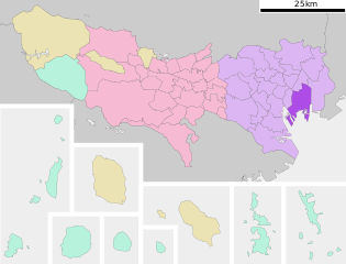
日本語: 使用データ : 国土交通省 国土数値情報(行政区域(N03)・湖沼(W09))
The original file was licensed {{GFDL}} and {{Cc-by-sa-3.0}}. See this category for more files like this. ป้ายนี้มิใช่ป้ายแสดงสถานะลิขสิทธิ์ ดังนั้นการระบุสถานะลิขสิทธิ์จึงต้องกระทำแยกต่างหาก ดูที่ Commons:Lincensing
ไฟล, koto, tokyo, prefecture, ไฟล, ประว, ไฟล, หน, าท, ภาพน, การใช, ไฟล, วนกลาง, อม, ลเก, ยวก, บภาพขนาดของต, วอย, าง, ของไฟล, กเซล, ความละเอ, ยดอ, กเซล, กเซล, กเซล, กเซล, กเซล, ภาพท, ความละเอ, ยดส, งกว, 8206, ไฟล, กเซล, ขนาดไฟล, โลไบต, ปภาพหร, อไฟล, เส, ยงน, นฉ. ifl prawtiifl hnathimiphaphni karichiflswnklang khxmulekiywkbphaphkhnadkhxngtwxyang PNG nikhxngifl SVG ni 786 599 phikesl khwamlaexiydxun 315 240 phikesl 630 480 phikesl 1 007 768 phikesl 1 280 976 phikesl 2 560 1 952 phikesl duphaphthimikhwamlaexiydsungkwa 8206 ifl SVG 800 610 phikesl khnadifl 39 kiolibt rupphaphhruxiflesiyngni tnchbbxyuthi khxmmxns raylaexiyddanlang epnkhxkhwamthiaesdngphlcak ifltnchbbinkhxmmxns khxmmxnsepnewbistinokhrngkarsahrbekbrwbrwmsuxesri thi khunsamarthchwyid khwamyx khaxthibayKoto ku in Tokyo Prefecture Ja svg English Location of Koto ku in Tokyo 日本語 ja 東京都江東区位置図wnthi 8 knyayn ph s 2550aehlngthima Original file ngankhxngtw Data 国土交通省 国土数値情報 行政区域 N03 湖沼 W09 phusrangsrrkh Lincunkarxnuyat karichiflniihm This file is a map of a municipality in Japan created and uploaded by Lincun on Japanese Wikipedia It may also be a file based on one of these maps see info in file history or author field for more info on later editors Source English Data used Ministry of Land Infrastructure Transport and Tourism National Land Numerical Information Administrative Area N03 Lake W09 日本語 使用データ 国土交通省 国土数値情報 行政区域 N03 湖沼 W09 The original file was licensed GFDL and Cc by sa 3 0 See this category for more files like this paynimiichpayaesdngsthanalikhsiththi dngnnkarrabusthanalikhsiththicungtxngkrathaaeyktanghak duthi Commons Lincensing karxnuyatichsiththi xnuyatihkhdlxk aeckcayaela hruxddaeprexksarniphayitenguxnikhkhxngsyyaxnuyatexksaresrikhxngknu run 1 2 hruxrunid nbcaknithixxkodymulnithisxftaewresri odyimmiswnidhamaekikh immikhxkhwampkhnaaelapkhlng saenakhxngsyyaxnuyatrwmxyuinswnchux syyaxnuyatexksaresrikhxngknuhttp www gnu org copyleft fdl html GFDL GNU Free Documentation License true trueiflnixyuphayitsyyaxnuyat khriexthifkhxmmxns aebbaesdngthima xnuyataebbediywkn 3 0 tnchbbkhunsamarth thicaaebngpn thicathasaena aeckcay aelasngngandngklawtxip thicaeriyberiyngihm thicaddaeplngngandngklaw phayitenguxnikhtxipni aesdngthima khuntxngihekiyrtiecakhxngnganxyangehmaasm odyephimlingkipyngsyyaxnuyat aelarabuhakmikarepliynaeplng khunxacthaechnniidinrupaebbidkidtamkhwr aettxngimichinlksnathiaenawaphuihxnuyatsnbsnunkhunhruxkarichngankhxngkhun xnuyataebbediywkn hakkhunddaeplng epliynrup hruxtxetimnganni khuntxngichsyyaxnuyataebbediywknhruxaebbthiehmuxnkbsyyaxnuyatthiichkbnganniethannhttps creativecommons org licenses by sa 3 0 CC BY SA 3 0 Creative Commons Attribution Share Alike 3 0 true true bnthukkarxphohld This file was moved from Japanese Wikipedia See below for original file information File name 基礎自治体位置図 13108 svgDescription 基礎自治体位置図画像情報 東京都 江東区 File history wnthi ewla UTC khnad phuich khwamehn8 knyayn ph s 2550 23 48 06 800x622 Lincun 基礎自治体位置図画像情報 東京都 江東区 12 knyayn ph s 2550 13 55 18 800x682 Lincun 基礎自治体位置図画像情報 東京都 江東区 Page history wnthi ewla UTC Flag phuich khwamyx 8 knyayn ph s 2550 23 48 06 Lincun 基礎自治体位置図画像情報 東京都 江東区 12 knyayn ph s 2550 13 55 18 Lincun 画像 基礎自治体位置図 13108 svg の新しい版をアップロードしました 基礎自治体位置図画像情報 東京都 江東区 Deutsch English makedonski 한국어 日本語 فارسی khabrryayodyyxithyephimkhabrryaythrrthdediywephuxkhyaykhwamwaiflnimixairixethmthiaesdngxyuiniflniprakxbdwysthanalikhsiththimilikhsiththisyyaxnuyatGNU Free Documentation License version 1 2 or later xngkvsCreative Commons Attribution ShareAlike 3 0 Unported xngkvs prawtiifl khlikwnthi ewlaephuxduiflthipraktinkhnann wnthi ewlarupyxkhnadphuichkhwamehn pccubn13 23 7 phvscikayn 2563800 610 39 kiolibt AichiWikiFixerUpdate 21 12 19 phvscikayn 2552800 682 23 kiolibt Monaneko Information Description en 1 Location of Koto ku in Tokyo ja 1 東京都江東区の位置 Source ja File 基礎自治体位置図 13108 svg Author ja User Lincun Date 2007 09 12 13 55 UTC Permission other versions Cate 20 55 12 knyayn 2550800 682 23 kiolibt Lincun 基礎自治体位置図画像情報 東京都 江東区 06 48 9 knyayn 2550800 622 23 kiolibt Lincun 基礎自治体位置図画像情報 東京都 江東区 hnathimiphaphni hnatxipni oyngmathiphaphni ekhtokhot karichiflswnklang wikixuntxipniichiflni karichbn ar wikipedia org كوتو طوكيو karichbn ca wikipedia org Kōtō karichbn ceb wikipedia org Kōtō ku karichbn ce wikipedia org Koto mahsus rajon karichbn da wikipedia org Koutou Tokyo karichbn de wikipedia org Kōtō karichbn en wikipedia org Kōtō Yumenoshima Wakasu Shin Kiba Station Toyosu Station Monzen nakacho Station Shin Kiba Kameido Station Kiyosumi shirakawa Station Sumiyoshi Station Tokyo Ariake Tokyo Aomi Toyosu Fukagawa Tokyo Morishita Station Tokyo K International School Tokyo India International School in Japan Shinonome Tokyo Tatsumi Tokyo Shiomi Tokyo Template Kōtō Ariake West Canal karichbn eo wikipedia org Kvartalo Koto karichbn es wikipedia org Kōtō Tokio karichbn eu wikipedia org Kōtō karichbn fa wikipedia org کوتو کو توکیو karichbn fi wikipedia org Kōtō karichbn gan wikipedia org 江東區 東京都 karichbn gl wikipedia org Kōtō karichbn ht wikipedia org Koto karichbn id wikipedia org Kōtō Tokyo karichbn incubator wikimedia org Wp ryu 江東区 karichbn it wikipedia org Kōtō Tokyo karichbn ja wikipedia org 江東区 karichbn jv wikipedia org Tokyo karichbn ko wikipedia org 고토구 karichbn ms wikipedia org Kōtō Tokyo karichbn nl wikipedia org Koto Tokio karichbn pl wikipedia org Tokio Okregi specjalne w Tokio Kōtō Tokio karichbn pt wikipedia org Koto Toquio karichbn ro wikipedia org Kōtō karichbn tr wikipedia org Kōtō dukarichthwolkephimetimkhxngiflnikhxmulekiywkbphaph phaphnimikhxmulephimetim sungswnihymacakklxngdicitxlhruxsaeknenxrthisamarthekbkhxmuldngklawiwrwmkbphaphid thaphaphnithukprbprungaekikhhruxepliynaeplngcakedim khxmulbangxyangcayngkhngimepliynaeplngehmuxnphaphthithukprbprungaekikhnnchuxeruxngsn東京都行政区画地図khwamkwang800pxkhwamsung610px ekhathungcak https th wikipedia org wiki ifl Koto ku in Tokyo Prefecture Ja svg, wikipedia, วิกิ หนังสือ, หนังสือ, ห้องสมุด,