This file is a map of a municipality in Japan created and uploaded by Lincun on Japanese Wikipedia. It may also be a file based on one of these maps (see info in file history or author field for more info on later editors). Source:
English: Data used : Ministry of Land, Infrastructure, Transport and Tourism - National Land Numerical Information (Administrative Area (N03) / Lake (W09))
日本語: 使用データ : 国土交通省 国土数値情報(行政区域(N03)・湖沼(W09))
The original file was licensed {{GFDL}} and {{Cc-by-sa-3.0}}. See this category for more files like this. ป้ายนี้มิใช่ป้ายแสดงสถานะลิขสิทธิ์ ดังนั้นการระบุสถานะลิขสิทธิ์จึงต้องกระทำแยกต่างหาก ดูที่ Commons:Lincensing
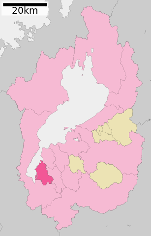
{{Information| |Description= Location of Kusatsu in Shiga Prefecture |Source= Japanese wiki [http://ja.wikipedia.org/wiki/%E3%83%95%E3%82%A1%E3%82%A4%E3%83%AB:%E5%9F%BA%E7%A4%8E%E8%87%AA%E6%B2%BB%E4%BD%93%E4%BD%8D%E7%BD%AE%E5%9B%B3_25206.svg] |Date=8
ไฟล, kusatsu, shiga, prefecture, ไฟล, ประว, ไฟล, หน, าท, ภาพน, การใช, ไฟล, วนกลาง, อม, ลเก, ยวก, บภาพขนาดของต, วอย, าง, ของไฟล, กเซล, ความละเอ, ยดอ, กเซล, กเซล, กเซล, กเซล, กเซล, กเซล, ภาพท, ความละเอ, ยดส, งกว, 8206, ไฟล, กเซล, ขนาดไฟล, โลไบต, ปภาพหร, อไฟล, เส. ifl prawtiifl hnathimiphaphni karichiflswnklang khxmulekiywkbphaphkhnadkhxngtwxyang PNG nikhxngifl SVG ni 383 599 phikesl khwamlaexiydxun 153 240 phikesl 307 480 phikesl 491 768 phikesl 655 1 024 phikesl 1 309 2 048 phikesl 390 610 phikesl duphaphthimikhwamlaexiydsungkwa 8206 ifl SVG 390 610 phikesl khnadifl 10 kiolibt rupphaphhruxiflesiyngni tnchbbxyuthi khxmmxns raylaexiyddanlang epnkhxkhwamthiaesdngphlcak ifltnchbbinkhxmmxns khxmmxnsepnewbistinokhrngkarsahrbekbrwbrwmsuxesri thi khunsamarthchwyid khwamyx khaxthibayKusatsu in Shiga prefecture Ja svg English Location of Kusatsu in Shiga Prefecture 日本語 ja 滋賀県草津市位置図wnthi 更新 2010年3月21日aehlngthima Original file ngankhxngtw Data 国土交通省 国土数値情報 行政区域 N03 湖沼 W09 phusrangsrrkh Lincunkarxnuyat karichiflniihm This file is a map of a municipality in Japan created and uploaded by Lincun on Japanese Wikipedia It may also be a file based on one of these maps see info in file history or author field for more info on later editors Source English Data used Ministry of Land Infrastructure Transport and Tourism National Land Numerical Information Administrative Area N03 Lake W09 日本語 使用データ 国土交通省 国土数値情報 行政区域 N03 湖沼 W09 The original file was licensed GFDL and Cc by sa 3 0 See this category for more files like this paynimiichpayaesdngsthanalikhsiththi dngnnkarrabusthanalikhsiththicungtxngkrathaaeyktanghak duthi Commons Lincensing karxnuyatichsiththi xnuyatihkhdlxk aeckcayaela hruxddaeprexksarniphayitenguxnikhkhxngsyyaxnuyatexksaresrikhxngknu run 1 2 hruxrunid nbcaknithixxkodymulnithisxftaewresri odyimmiswnidhamaekikh immikhxkhwampkhnaaelapkhlng saenakhxngsyyaxnuyatrwmxyuinswnchux syyaxnuyatexksaresrikhxngknuhttp www gnu org copyleft fdl html GFDL GNU Free Documentation License true trueiflnixyuphayitsyyaxnuyat khriexthifkhxmmxns aebbaesdngthima xnuyataebbediywkn 3 0 tnchbbkhunsamarth thicaaebngpn thicathasaena aeckcay aelasngngandngklawtxip thicaeriyberiyngihm thicaddaeplngngandngklaw phayitenguxnikhtxipni aesdngthima khuntxngihekiyrtiecakhxngnganxyangehmaasm odyephimlingkipyngsyyaxnuyat aelarabuhakmikarepliynaeplng khunxacthaechnniidinrupaebbidkidtamkhwr aettxngimichinlksnathiaenawaphuihxnuyatsnbsnunkhunhruxkarichngankhxngkhun xnuyataebbediywkn hakkhunddaeplng epliynrup hruxtxetimnganni khuntxngichsyyaxnuyataebbediywknhruxaebbthiehmuxnkbsyyaxnuyatthiichkbnganniethannhttps creativecommons org licenses by sa 3 0 CC BY SA 3 0 Creative Commons Attribution Share Alike 3 0 true true bnthukkarxphohld This file was moved from Japanese Wikipedia See below for original file information File name 基礎自治体位置図 25206 svgDescription 基礎自治体位置図画像情報 滋賀県 草津市 20100321 File history wnthi ewla UTC khnad phuich khwamehn8 tulakhm ph s 2550 12 49 49 450x772 Lincun 基礎自治体位置図画像情報 滋賀県 草津市 10 mkrakhm ph s 2553 10 12 10 390x610 Lincun 基礎自治体位置図画像情報 滋賀県 草津市 20100101 22 minakhm ph s 2553 13 25 46 390x610 Lincun 基礎自治体位置図画像情報 滋賀県 草津市 20100321 Page history wnthi ewla UTC Flag phuich khwamyx 8 tulakhm ph s 2550 12 49 49 Lincun 基礎自治体位置図画像情報 滋賀県 草津市 1 phvscikayn ph s 2552 13 21 59 Monaneko10 mkrakhm ph s 2553 10 12 10 Lincun ファイル 基礎自治体位置図 25206 svg の新しい版をアップロードしました 基礎自治体位置図画像情報 滋賀県 草津市 20100101 10 mkrakhm ph s 2553 10 12 42 Lincun22 minakhm ph s 2553 13 25 46 Lincun ファイル 基礎自治体位置図 25206 svg の新しい版をアップロードしました 基礎自治体位置図画像情報 滋賀県 草津市 20100321 22 minakhm ph s 2553 13 26 09 LincunDeutsch English makedonski 한국어 日本語 فارسی khabrryayodyyxithyephimkhabrryaythrrthdediywephuxkhyaykhwamwaiflnimixairixethmthiaesdngxyuiniflniprakxbdwysthanalikhsiththimilikhsiththisyyaxnuyatGNU Free Documentation License version 1 2 or later xngkvsCreative Commons Attribution ShareAlike 3 0 Unported xngkvsMIME type xngkvsimage svg xml prawtiifl khlikwnthi ewlaephuxduiflthipraktinkhnann wnthi ewlarupyxkhnadphuichkhwamehn pccubn20 49 11 krkdakhm 2553390 610 10 kiolibt Krisgrotius update Date 22 March 2010 Author ja 利用者 Lincun 20 25 22 minakhm 2553390 610 10 kiolibt Lincun 基礎自治体位置図画像情報 滋賀県 草津市 20100321 17 12 10 mkrakhm 2553390 610 9 kiolibt Lincun 基礎自治体位置図画像情報 滋賀県 草津市 20100101 16 21 15 emsayn 2552450 772 13 kiolibt Tilanus Information Description Location of Kusatsu in Shiga Prefecture Source Japanese wiki http ja wikipedia org wiki E3 83 95 E3 82 A1 E3 82 A4 E3 83 AB E5 9F BA E7 A4 8E E8 87 AA E6 B2 BB E4 BD 93 E4 BD 8D E7 BD AE E5 9B B3 25206 svg Date 8 19 49 8 tulakhm 2550450 772 13 kiolibt Lincun 基礎自治体位置図画像情報 滋賀県 草津市 hnathimiphaphni hnatxipni oyngmathiphaphni khustsu karichiflswnklang wikixuntxipniichiflni karichbn ar wikipedia org كوساتسو شيغا karichbn azb wikipedia org کوساتسو شیقا karichbn ce wikipedia org Kusacu gӀala karichbn de wikipedia org Kusatsu Shiga karichbn en wikipedia org Shiga Prefecture Kusatsu Shiga karichbn es wikipedia org Kusatsu Shiga karichbn eu wikipedia org Kusatsu Shiga karichbn fi wikipedia org Kusatsu karichbn gl wikipedia org Kusatsu Shiga karichbn id wikipedia org Kusatsu Shiga karichbn ja wikipedia org 草津市 karichbn ko wikipedia org 구사쓰시 karichbn nl wikipedia org Kusatsu karichbn ro wikipedia org Kusatsu Shiga karichbn sv wikipedia org Kusatsu karichbn tg wikipedia org Kusatsu karichbn tt wikipedia org Kusacu shәһәr karichbn uk wikipedia org Kusacu Siga karichbn www wikidata org Q386677 karichbn zh min nan wikipedia org Kusatu chhi karichbn zh wikipedia org 草津市khxmulekiywkbphaph phaphnimikhxmulephimetim sungswnihymacakklxngdicitxlhruxsaeknenxrthisamarthekbkhxmuldngklawiwrwmkbphaphid thaphaphnithukprbprungaekikhhruxepliynaeplngcakedim khxmulbangxyangcayngkhngimepliynaeplngehmuxnphaphthithukprbprungaekikhnnchuxeruxngsn滋賀県草津市位置図 2010年3月21日 chuxphaphAuthor Lincunkhwamkwang390khwamsung610 ekhathungcak https th wikipedia org wiki ifl Kusatsu in Shiga prefecture Ja svg, wikipedia, วิกิ หนังสือ, หนังสือ, ห้องสมุด,