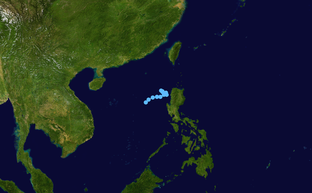
fbpx
วิกิพีเดีย

Lando 2011 track

ดูภาพที่มีความละเอียดสูงกว่า(2,700 × 1,669 พิกเซล, ขนาดไฟล์: 3.11 เมกะไบต์, ชนิดไมม์: image/png)

รูปภาพหรือไฟล์เสียงนี้ ต้นฉบับอยู่ที่ คอมมอนส์ รายละเอียดด้านล่าง เป็นข้อความที่แสดงผลจาก ไฟล์ต้นฉบับในคอมมอนส์
คอมมอนส์เป็นเว็บไซต์ในโครงการสำหรับเก็บรวบรวมสื่อเสรี ที่ คุณสามารถช่วยได้

ความย่อ

คำอธิบาย
English: Track map of Tropical Depression Lando of the 2011 Pacific typhoon season. The points show the location of the storm at 6-hour intervals. The colour represents the storm's maximum sustained wind speeds as classified in the Saffir–Simpson scale (see below), and the shape of the data points represent the nature of the storm, according to the legend below.

Saffir–Simpson scale

 
Tropical depression (≤38 mph, ≤62 km/h)
 
Tropical storm (39–73 mph, 63–118 km/h)
 
Category 1 (74–95 mph, 119–153 km/h)
 
Category 2 (96–110 mph, 154–177 km/h)
 
Category 3 (111–129 mph, 178–208 km/h)
 
Category 4 (130–156 mph, 209–251 km/h)
 
Category 5 (≥157 mph, ≥252 km/h)
 
Unknown

Storm type

Tropical cyclone
Subtropical cyclone
Extratropical cyclone / Remnant low / Tropical disturbance / Monsoon depression
วันที่ 2011-07-31–2011-08-02
แหล่งที่มา Created by Keith Edkins using WikiProject Tropical cyclones/Tracks. The background image is from NASA. Tracking data is from the Japan Meteorological Agency[1].
ผู้สร้างสรรค์ Keith Edkins
Source code
InfoField
Track map data table, if present below, is in HURDAT2 or ATCF format. See format details in [2] and [3].
Track map generator input code
WP162011, JMA16, 14, 20110731, 0000, , TD, 16.5N, 116.8E, 20, 1004, 0, 0, 0, 0, 0, 0, 0, 0, 0, 0, 0, 0, JMA, 20110731, 0600, , TD, 16.9N, 117.2E, 20, 1002, 0, 0, 0, 0, 0, 0, 0, 0, 0, 0, 0, 0, JMA, 20110731, 1200, , TD, 17.2N, 117.8E, 20, 1004, 0, 0, 0, 0, 0, 0, 0, 0, 0, 0, 0, 0, JMA, 20110731, 1800, , TD, 17.3N, 118.4E, 15, 1004, 0, 0, 0, 0, 0, 0, 0, 0, 0, 0, 0, 0, JMA, 20110801, 0000, , TD, 17.3N, 118.9E, 15, 1004, 0, 0, 0, 0, 0, 0, 0, 0, 0, 0, 0, 0, JMA, 20110801, 0600, , TD, 17.6N, 119.4E, 15, 1004, 0, 0, 0, 0, 0, 0, 0, 0, 0, 0, 0, 0, JMA, 20110801, 1200, , TD, 17.6N, 119.8E, 15, 1004, 0, 0, 0, 0, 0, 0, 0, 0, 0, 0, 0, 0, JMA, 20110801, 1800, , TD, 17.9N, 119.7E, 15, 1004, 0, 0, 0, 0, 0, 0, 0, 0, 0, 0, 0, 0, JMA, 20110802, 0000, , TD, 18.2N, 119.0E, 15, 1004, 0, 0, 0, 0, 0, 0, 0, 0, 0, 0, 0, 0, JMA, 20110802, 0600, , TD, 18.1N, 119.2E, 15, 1004, 0, 0, 0, 0, 0, 0, 0, 0, 0, 0, 0, 0, JMA, 20110802, 1200, , TD, 18.0N, 119.2E, 15, 1004, 0, 0, 0, 0, 0, 0, 0, 0, 0, 0, 0, 0, JMA, 

การอนุญาตใช้สิทธิ

คำบรรยายโดยย่อ

เพิ่มคำบรรยายทรรทัดเดียวเพื่อขยายความว่าไฟล์นี้มีอะไร

ไอเทมที่แสดงอยู่ในไฟล์นี้

ประกอบด้วย

สถานะลิขสิทธิ์

copyrighted, dedicated to the public domain by copyright holder อังกฤษ

สัญญาอนุญาต

released into the public domain by the copyright holder อังกฤษ

ประวัติไฟล์

คลิกวันที่/เวลาเพื่อดูไฟล์ที่ปรากฏในขณะนั้น

วันที่/เวลารูปย่อขนาดผู้ใช้ความเห็น
ปัจจุบัน04:52, 21 พฤษภาคม 25632,700 × 1,669 (3.11 เมกะไบต์)SupportstormFinalized JMA Wx chart data
20:17, 19 สิงหาคม 25562,700 × 1,669 (2.93 เมกะไบต์)SupportstormTweaked to match JMA advisories
14:46, 4 สิงหาคม 25541,024 × 633 (580 กิโลไบต์)Keith Edkins{{Information |Description={{en|Track map of Tropical Depression Lando (PAGASA) of the 2011 Pacific typhoon season (Designated 97W.INVEST by JTWC). The points sh

หน้าต่อไปนี้ โยงมาที่ภาพนี้:

การใช้ไฟล์ส่วนกลาง

วิกิอื่นต่อไปนี้ใช้ไฟล์นี้:

  • User:Tfmbty/2011 Pacific typhoon season
  • ไฟล, lando, 2011, track, ไฟล, ประว, ไฟล, หน, าท, ภาพน, การใช, ไฟล, วนกลางขนาดของต, วอย, างน, กเซล, ความละเอ, ยดอ, กเซล, กเซล, กเซล, กเซล, กเซล, ภาพท, ความละเอ, ยดส, งกว, 8206, กเซล, ขนาดไฟล, เมกะไบต, ชน, ดไมม, image, ปภาพหร, อไฟล, เส, ยงน, นฉบ, บอย, คอมมอนส, ร. ifl prawtiifl hnathimiphaphni karichiflswnklangkhnadkhxngtwxyangni 800 495 phikesl khwamlaexiydxun 320 198 phikesl 640 396 phikesl 1 024 633 phikesl 1 280 791 phikesl 2 700 1 669 phikesl duphaphthimikhwamlaexiydsungkwa 8206 2 700 1 669 phikesl khnadifl 3 11 emkaibt chnidimm image png rupphaphhruxiflesiyngni tnchbbxyuthi khxmmxns raylaexiyddanlang epnkhxkhwamthiaesdngphlcak ifltnchbbinkhxmmxns khxmmxnsepnewbistinokhrngkarsahrbekbrwbrwmsuxesri thi khunsamarthchwyid khwamyx khaxthibayLando 2011 track png English Track map of Tropical Depression Lando of the 2011 Pacific typhoon season The points show the location of the storm at 6 hour intervals The colour represents the storm s maximum sustained wind speeds as classified in the Saffir Simpson scale see below and the shape of the data points represent the nature of the storm according to the legend below Saffir Simpson scale Tropical depression 38 mph 62 km h Tropical storm 39 73 mph 63 118 km h Category 1 74 95 mph 119 153 km h Category 2 96 110 mph 154 177 km h Category 3 111 129 mph 178 208 km h Category 4 130 156 mph 209 251 km h Category 5 157 mph 252 km h Unknown Storm type Tropical cyclone Subtropical cyclone Extratropical cyclone Remnant low Tropical disturbance Monsoon depressionwnthi 2011 07 31 2011 08 02aehlngthima Created by Keith Edkins using WikiProject Tropical cyclones Tracks The background image is from NASA Tracking data is from the Japan Meteorological Agency 1 phusrangsrrkh Keith EdkinsSource codeInfoFieldTrack map data table if present below is in HURDAT2 or ATCF format See format details in 2 and 3 Track map generator input codeWP162011 JMA16 14 20110731 0000 TD 16 5N 116 8E 20 1004 0 0 0 0 0 0 0 0 0 0 0 0 JMA 20110731 0600 TD 16 9N 117 2E 20 1002 0 0 0 0 0 0 0 0 0 0 0 0 JMA 20110731 1200 TD 17 2N 117 8E 20 1004 0 0 0 0 0 0 0 0 0 0 0 0 JMA 20110731 1800 TD 17 3N 118 4E 15 1004 0 0 0 0 0 0 0 0 0 0 0 0 JMA 20110801 0000 TD 17 3N 118 9E 15 1004 0 0 0 0 0 0 0 0 0 0 0 0 JMA 20110801 0600 TD 17 6N 119 4E 15 1004 0 0 0 0 0 0 0 0 0 0 0 0 JMA 20110801 1200 TD 17 6N 119 8E 15 1004 0 0 0 0 0 0 0 0 0 0 0 0 JMA 20110801 1800 TD 17 9N 119 7E 15 1004 0 0 0 0 0 0 0 0 0 0 0 0 JMA 20110802 0000 TD 18 2N 119 0E 15 1004 0 0 0 0 0 0 0 0 0 0 0 0 JMA 20110802 0600 TD 18 1N 119 2E 15 1004 0 0 0 0 0 0 0 0 0 0 0 0 JMA 20110802 1200 TD 18 0N 119 2E 15 1004 0 0 0 0 0 0 0 0 0 0 0 0 JMA karxnuyatichsiththi Public domain Public domain false falsenganniidthukephyaephrsusatharnsmbtiodyecakhxng Keith Edkins sungmiphlthwolkinbangpraeths karkrathadngklawxacimsamarththaidtamkdhmayKeith Edkins xnuyatihthukkhnmisiththiinkarichiflniinthukehtuphlkarich odyimmimienguxnikh ewnaetkdhmayimxnuyatihthaechnnnkhabrryayodyyxithyephimkhabrryaythrrthdediywephuxkhyaykhwamwaiflnimixairixethmthiaesdngxyuiniflniprakxbdwysthanalikhsiththicopyrighted dedicated to the public domain by copyright holder xngkvssyyaxnuyatreleased into the public domain by the copyright holder xngkvs prawtiifl khlikwnthi ewlaephuxduiflthipraktinkhnann wnthi ewlarupyxkhnadphuichkhwamehn pccubn04 52 21 phvsphakhm 25632 700 1 669 3 11 emkaibt SupportstormFinalized JMA Wx chart data 20 17 19 singhakhm 25562 700 1 669 2 93 emkaibt SupportstormTweaked to match JMA advisories 14 46 4 singhakhm 25541 024 633 580 kiolibt Keith Edkins Information Description en Track map of Tropical Depression Lando PAGASA of the 2011 Pacific typhoon season Designated 97W INVEST by JTWC The points sh hnathimiphaphni hnatxipni oyngmathiphaphni vduphayuitfunaepsifik ph s 2554 karichiflswnklang wikixuntxipniichiflni karichbn de wikipedia org Pazifische Taifunsaison 2011 karichbn en wikipedia org 2011 Pacific typhoon season User Tfmbty 2011 Pacific typhoon season karichbn fr wikipedia org Saison cyclonique 2011 dans l ocean Pacifique nord ouest karichbn ja wikipedia org 2011年の台風 karichbn nl wikipedia org Tyfoonseizoen van de Grote Oceaan 2011 karichbn pt wikipedia org Temporada de tufoes no Pacifico de 2011 karichbn simple wikipedia org 2011 Pacific typhoon season karichbn vi wikipedia org Mua bao Tay Bắc Thai Binh Dương 2011 karichbn zh wikipedia org 2011年太平洋颱風季 ekhathungcak https th wikipedia org wiki ifl Lando 2011 track png, wikipedia, วิกิ หนังสือ, หนังสือ, ห้องสมุด,

    บทความ

    , อ่าน, ดาวน์โหลด, ฟรี, ดาวน์โหลดฟรี, mp3, วิดีโอ, mp4, 3gp, jpg, jpeg, gif, png, รูปภาพ, เพลง, เพลง, หนัง, หนังสือ, เกม, เกม