This SVG locator map contains embedded raster graphics.[1] Such images are liable to produce inferior results when scaled to different sizes (as well as possibly being very inefficient in file size). If appropriate to do so, they should be replaced with images created using vector graphics. Note: This template is only supposed to be used if the SVG file mixes vector and raster graphics. If the SVG file only contains raster graphics {{FakeSVG}} is supposed to be used. See also {{TopoSVG}}.
This file is licensed under the Creative Commons Attribution-Share Alike 4.0 International, 3.0 Unported, 2.5 Generic, 2.0 Generic and 1.0 Generic license.
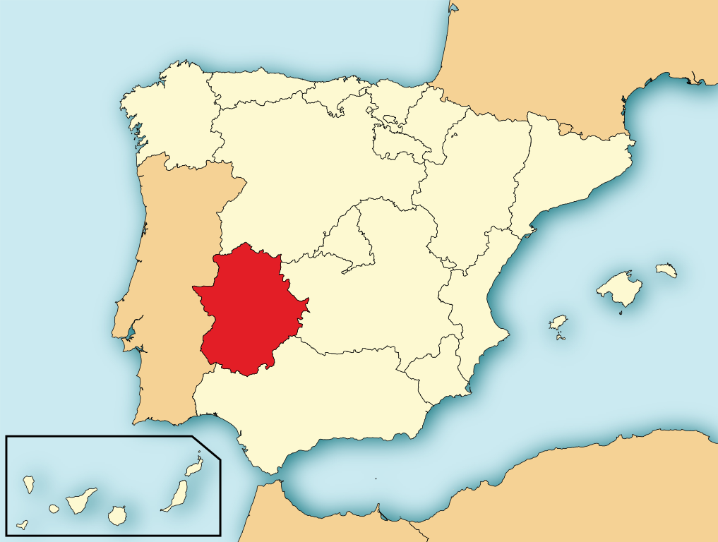
{{Information |Description= Localización de Extremadura respecto a España |Source= Image:Provincias de España centrado.svg |Date= |Author= Rastrojo |Permission= |other_versions= }} [[Category:Maps of Sp
ไฟล, localización, extremadura, ไฟล, ประว, ไฟล, หน, าท, ภาพน, การใช, ไฟล, วนกลาง, อม, ลเก, ยวก, บภาพขนาดของต, วอย, าง, ของไฟล, กเซล, ความละเอ, ยดอ, กเซล, กเซล, กเซล, กเซล, กเซล, ภาพท, ความละเอ, ยดส, งกว, 8206, ไฟล, กเซล, ขนาดไฟล, โลไบต, ปภาพหร, อไฟล, เส, ยงน, . ifl prawtiifl hnathimiphaphni karichiflswnklang khxmulekiywkbphaphkhnadkhxngtwxyang PNG nikhxngifl SVG ni 686 518 phikesl khwamlaexiydxun 318 240 phikesl 636 480 phikesl 1 017 768 phikesl 1 280 967 phikesl 2 560 1 933 phikesl duphaphthimikhwamlaexiydsungkwa 8206 ifl SVG 686 518 phikesl khnadifl 501 kiolibt rupphaphhruxiflesiyngni tnchbbxyuthi khxmmxns raylaexiyddanlang epnkhxkhwamthiaesdngphlcak ifltnchbbinkhxmmxns khxmmxnsepnewbistinokhrngkarsahrbekbrwbrwmsuxesri thi khunsamarthchwyid khwamyx khaxthibayLocalizacion de Extremadura svg English Map of Spain with Extremadura highlighted Espanol Localizacion de Extremadura respecto a Espana wnthi 6 krkdakhm ph s 2552aehlngthima File EspanaLoc svg de HansenBCN Modificada por User Mutxamel phusrangsrrkh Mutxamel subido por Rastrojo D ES SVG genesisInfoField sxrsokhdkhxng SVG nitrwcsxbthuktxngaelw iflphaphkrafiksewketxrni srangkhunodyich Adobe Illustrator This SVG locator map contains embedded raster graphics 1 Such images are liable to produce inferior results when scaled to different sizes as well as possibly being very inefficient in file size If appropriate to do so they should be replaced with images created using vector graphics Note This template is only supposed to be used if the SVG file mixes vector and raster graphics If the SVG file only contains raster graphics FakeSVG is supposed to be used See also TopoSVG karxnuyatichsiththi khapheca inthanaphuthuxlikhsiththikhxngphaphhruxsuxni xnuyatihichphaphhruxsuxniphayitenguxnikhtxipni xnuyatihkhdlxk aeckcayaela hruxddaeprexksarniphayitenguxnikhkhxngsyyaxnuyatexksaresrikhxngknu run 1 2 hruxrunid nbcaknithixxkodymulnithisxftaewresri odyimmiswnidhamaekikh immikhxkhwampkhnaaelapkhlng saenakhxngsyyaxnuyatrwmxyuinswnchux syyaxnuyatexksaresrikhxngknuhttp www gnu org copyleft fdl html GFDL GNU Free Documentation License true trueThis file is licensed under the Creative Commons Attribution Share Alike 4 0 International 3 0 Unported 2 5 Generic 2 0 Generic and 1 0 Generic license khunsamarth thicaaebngpn thicathasaena aeckcay aelasngngandngklawtxip thicaeriyberiyngihm thicaddaeplngngandngklaw phayitenguxnikhtxipni aesdngthima khuntxngihekiyrtiecakhxngnganxyangehmaasm odyephimlingkipyngsyyaxnuyat aelarabuhakmikarepliynaeplng khunxacthaechnniidinrupaebbidkidtamkhwr aettxngimichinlksnathiaenawaphuihxnuyatsnbsnunkhunhruxkarichngankhxngkhun xnuyataebbediywkn hakkhunddaeplng epliynrup hruxtxetimnganni khuntxngichsyyaxnuyataebbediywknhruxaebbthiehmuxnkbsyyaxnuyatthiichkbnganniethannhttps creativecommons org licenses by sa 4 0 CC BY SA 4 0 Creative Commons Attribution Share Alike 4 0 true truekhunsamartheluxksyyaxnuyatdngklawtamtxngkarkhabrryayodyyxithyephimkhabrryaythrrthdediywephuxkhyaykhwamwaiflnimixairixethmthiaesdngxyuiniflniprakxbdwysthanalikhsiththimilikhsiththisyyaxnuyatCreative Commons Attribution ShareAlike 1 0 Generic xngkvsCreative Commons Attribution ShareAlike 2 0 Generic xngkvsGNU Free Documentation License version 1 2 or later xngkvsCreative Commons Attribution ShareAlike 2 5 Generic xngkvsCreative Commons Attribution ShareAlike 4 0 International xngkvsCreative Commons Attribution ShareAlike 3 0 Unported xngkvswnthisrang wnkxtng6 krkdakhm 2009 prawtiifl khlikwnthi ewlaephuxduiflthipraktinkhnann wnthi ewlarupyxkhnadphuichkhwamehn pccubn02 35 5 singhakhm 2553686 518 501 kiolibt Orionistremoved border and artifacts various other fixes 17 48 6 krkdakhm 2552690 522 561 kiolibt Rastrojonueva version 01 43 3 emsayn 2551578 374 407 kiolibt PaintmanColor verde y por comunidades autonomas 02 50 8 mkrakhm 2551578 374 608 kiolibt Rastrojo Information Description Localizacion de Extremadura respecto a Espana Source Image Provincias de Espana centrado svg Date Author Rastrojo Permission other versions Category Maps of Sp hnathimiphaphni hnatxipni oyngmathiphaphni aekhwnexsetrmadura karichiflswnklang wikixuntxipniichiflni karichbn af wikipedia org Extremadura karichbn als wikipedia org Spanien karichbn an wikipedia org Extremadura karichbn ar wikipedia org إكستريمادورا قائمة للمناطق الإدارية الإسبانية على حسب الترتيب السكاني مناطق إسبانيا ذات الحكم الذاتي karichbn arz wikipedia org اقاليم اسبانيا اكستريمادورا karichbn ast wikipedia org Estremadura karichbn ast wiktionary org Estremadura karichbn ay wikipedia org Ispana karichbn az wikipedia org Estremadura karichbn be tarask wikipedia org Estremadura karichbn bg wikipedia org Estremadura karichbn br wikipedia org Kumuniezhiou emren Spagn Extremadura Estremadureg karichbn bs wikipedia org Ekstremadura karichbn ca wikipedia org Llista de comunitats autonomes espanyoles per poblacio Extremadura Usuari Arredondo ales Historia d Extremadura Usuari Axelcabrera100 karichbn crh wikipedia org Estremadura karichbn cs wikipedia org Seznam vlajek spanelskych autonomnich spolecenstvi karichbn da wikipedia org Spaniens autonome regioner Extremadura karichbn de wikipedia org Autonome Gemeinschaften Spaniens karichbn diq wikipedia org Ekstremadura karichbn el wikipedia org Estremadoyra karichbn en wikipedia org Wikipedia Graphics Lab Photography workshop Archive Aug 2010 karichbn eo wikipedia org Ekstremaduro karichbn es wikipedia org Comunidad autonoma Anexo Comunidades y ciudades autonomas de Espana Portal Extremadura Portal Extremadura Titular Red de carreteras de Espana Anexo Capitales de comunidades autonomas de Espana Historia de Extremadura karichbn es wikinews org Categoria Extremadura karichbn eu wikipedia org Autonomia erkidego karichbn ext wikipedia org Estremaura Estoria d Estremaura karichbn fr wikipedia org Wikipedia Atelier graphique Images a ameliorer Archives Fevrier 2011 Liste des commanderies templieres en Estremadure Wikipedia Atelier graphique Cartes Archives fevrier 2020 karichbn ga wikipedia org Extremadura karichbn gd wikipedia org Extremadura karichbn hi wikipedia org स प न स व यत त सम द य karichbn ht wikipedia org Estremadure dukarichthwolkephimetimkhxngiflnikhxmulekiywkbphaph phaphnimikhxmulephimetim sungswnihymacakklxngdicitxlhruxsaeknenxrthisamarthekbkhxmuldngklawiwrwmkbphaphid thaphaphnithukprbprungaekikhhruxepliynaeplngcakedim khxmulbangxyangcayngkhngimepliynaeplngehmuxnphaphthithukprbprungaekikhnnkhwamkwang686pxkhwamsung518px ekhathungcak https th wikipedia org wiki ifl Localizacion de Extremadura svg, wikipedia, วิกิ หนังสือ, หนังสือ, ห้องสมุด,