move approved by: User:LERK This image was moved from Image:Map of Japan with highlight on 30 Wakayama 和歌山県.svg {{User:Lincun/都道府県地図情報 |都道府県=和歌山県 |都道府県Latin=Wakayama-ken }} [[Category:Maps of Wa
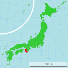
ไฟล, japan, with, highlight, wakayama, prefecture, ไฟล, ประว, ไฟล, หน, าท, ภาพน, การใช, ไฟล, วนกลาง, อม, ลเก, ยวก, บภาพขนาดของต, วอย, าง, ของไฟล, กเซล, ความละเอ, ยดอ, กเซล, กเซล, กเซล, กเซล, กเซล, ภาพท, ความละเอ, ยดส, งกว, 8206, ไฟล, กเซล, ขนาดไฟล, โลไบต, ปภาพ. ifl prawtiifl hnathimiphaphni karichiflswnklang khxmulekiywkbphaphkhnadkhxngtwxyang PNG nikhxngifl SVG ni 600 600 phikesl khwamlaexiydxun 240 240 phikesl 480 480 phikesl 768 768 phikesl 1 024 1 024 phikesl 2 048 2 048 phikesl duphaphthimikhwamlaexiydsungkwa 8206 ifl SVG 1 024 1 024 phikesl khnadifl 15 kiolibt rupphaphhruxiflesiyngni tnchbbxyuthi khxmmxns raylaexiyddanlang epnkhxkhwamthiaesdngphlcak ifltnchbbinkhxmmxns khxmmxnsepnewbistinokhrngkarsahrbekbrwbrwmsuxesri thi khunsamarthchwyid khaxthibayMap of Japan with highlight on 30 Wakayama prefecture svg 日本語 和歌山県の位置図 English Map of Japan with highlight on Wakayama kenaehlngthima 国土交通省 国土数値情報 行政区域 phusrangsrrkh Lincunkarxnuyat karichiflniihm xnuyatihkhdlxk aeckcayaela hruxddaeprexksarniphayitenguxnikhkhxngsyyaxnuyatexksaresrikhxngknu run 1 2 hruxrunid nbcaknithixxkodymulnithisxftaewresri odyimmiswnidhamaekikh immikhxkhwampkhnaaelapkhlng saenakhxngsyyaxnuyatrwmxyuinswnchux syyaxnuyatexksaresrikhxngknuhttp www gnu org copyleft fdl html GFDL GNU Free Documentation License true trueiflnixyuphayitsyyaxnuyat khriexthifkhxmmxns aebbaesdngthima xnuyataebbediywkn 3 0 tnchbbkhunsamarth thicaaebngpn thicathasaena aeckcay aelasngngandngklawtxip thicaeriyberiyngihm thicaddaeplngngandngklaw phayitenguxnikhtxipni aesdngthima khuntxngihekiyrtiecakhxngnganxyangehmaasm odyephimlingkipyngsyyaxnuyat aelarabuhakmikarepliynaeplng khunxacthaechnniidinrupaebbidkidtamkhwr aettxngimichinlksnathiaenawaphuihxnuyatsnbsnunkhunhruxkarichngankhxngkhun xnuyataebbediywkn hakkhunddaeplng epliynrup hruxtxetimnganni khuntxngichsyyaxnuyataebbediywknhruxaebbthiehmuxnkbsyyaxnuyatthiichkbnganniethannpayaesdngsthanalikhsiththinithukephimephuxihepniptamkarepliynaeplngsyyaxnuyatkhxngmulnithiwikimiediy cak GFDL ipyng GFDL khwbkhukb CC BY SA 3 0 http creativecommons org licenses by sa 3 0 CC BY SA 3 0 Creative Commons Attribution Share Alike 3 0 true true bnthukkarxphohld date time username resolution size edit summary13 50 4 March 2007 User Lincun 1 024 1 024 15 KB lt span class comment gt 都道府県地図情報 都道府県 和歌山県 都道府県Latin Wakayama ken lt span gt khabrryayodyyxithyephimkhabrryaythrrthdediywephuxkhyaykhwamwaiflnimixairixethmthiaesdngxyuiniflniprakxbdwysthanalikhsiththimilikhsiththisyyaxnuyatCreative Commons Attribution ShareAlike 3 0 Unported xngkvsGNU Free Documentation License version 1 2 or later xngkvs prawtiifl khlikwnthi ewlaephuxduiflthipraktinkhnann wnthi ewlarupyxkhnadphuichkhwamehn pccubn07 47 16 minakhm 25541 024 1 024 15 kiolibt TAKASUGI Shinjicolor changes for a better contrast lightgreen limegreen deeppink red 09 20 21 emsayn 25511 024 1 024 15 kiolibt BetacommandBotmove approved by User LERK This image was moved from Image Map of Japan with highlight on 30 Wakayama 和歌山県 svg User Lincun 都道府県地図情報 都道府県 和歌山県 都道府県Latin Wakayama ken Category Maps of Wa hnathimiphaphni hnatxipni oyngmathiphaphni cnghwdwakayama karichiflswnklang wikixuntxipniichiflni karichbn ace wikipedia org Prefektur Wakayama karichbn az wikipedia org Vakayama prefekturasi karichbn bg wikipedia org Vakayama prefektura karichbn bn wikipedia org ওয ক য ম প রশ সন ক অঞ চল karichbn br wikipedia org Listennad lec hiennou kaer e Prefedelezh Wakayama karichbn cdo wikipedia org Wakayama gaing karichbn cy wikipedia org Wakayama talaith karichbn da wikipedia org Wakayama praefekturet karichbn en wikipedia org Wakayama Prefecture Category Wikipedia requested photographs in Wakayama Prefecture karichbn eo wikipedia org Gubernio Vakajamo karichbn eu wikipedia org Wakayama prefektura karichbn fa wikipedia org استان واکایاما karichbn fr wikipedia org Prefecture de Wakayama karichbn gl wikipedia org Prefectura de Wakayama Wakayama Iwade Kinokawa Arida Kainan Gobō Shingu Tanabe Hashimoto karichbn hak wikipedia org Wakayama yen karichbn hr wikipedia org Wakayama prefektura karichbn hu wikipedia org Szerkeszto TheRower Vakajama prefektura Vakajama prefektura karichbn id wikipedia org Prefektur Wakayama karichbn ilo wikipedia org Prepektura ti Wakayama karichbn incubator wikimedia org Wp lki استان واکایاما karichbn ja wikipedia org 和歌山県 karichbn ja wikivoyage org 和歌山県 karichbn jv wikipedia org Prefektur Wakayama karichbn ka wikipedia org ვაკაიამის პრეფექტურა karichbn ko wikipedia org 분류 와카야마현 와카야마현 karichbn lt wikipedia org Vakajamos prefektura karichbn mk wikipedia org Vakaјama prefektura karichbn mn wikipedia org Vakayama karichbn mr wikipedia org व क य म प र त karichbn ms wikipedia org Wilayah Wakayama karichbn no wikipedia org Wakayama prefektur karichbn pl wikipedia org Prefektura Wakayama karichbn pnb wikipedia org ضلع واکایاما karichbn pt wikipedia org Wakayama karichbn sco wikipedia org Wakayama Prefectur karichbn sh wikipedia org Prefektura Vakajama karichbn simple wikipedia org Wakayama Prefecture karichbn si wikipedia org වකය ම ප ර න තය dukarichthwolkephimetimkhxngiflnikhxmulekiywkbphaph phaphnimikhxmulephimetim sungswnihymacakklxngdicitxlhruxsaeknenxrthisamarthekbkhxmuldngklawiwrwmkbphaphid thaphaphnithukprbprungaekikhhruxepliynaeplngcakedim khxmulbangxyangcayngkhngimepliynaeplngehmuxnphaphthithukprbprungaekikhnnchuxeruxngsn日本全図 和歌山県chuxphaphAuthor Lincun ekhathungcak https th wikipedia org wiki ifl Map of Japan with highlight on 30 Wakayama prefecture svg, wikipedia, วิกิ หนังสือ, หนังสือ, ห้องสมุด,