คำอธิบายMap of March 2012 attacks in Toulouse and Montauban, and scarlet Vigipirate area, in France.svg
Dansk: Lokalisering af Montauban og Toulouse, to byer i regionen Midi-Pyrénées, Frankrig. I pink, området hvor landets terroralarm, er blevet hævet via Vigipirate.
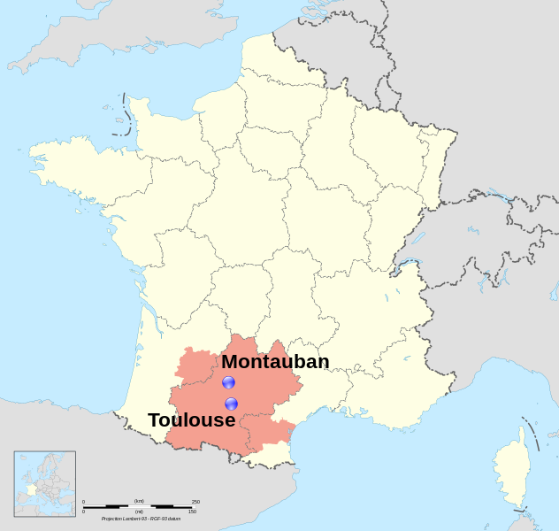
English: Location map of Montauban and Toulouse, two towns in region Midi-Pyrénées, France. In pink, the area covored by the Scarlet Vigipirate level.
Français : Carte de localisation de Montauban et Toulouse, deux villes de la région Midi-Pyrénées, France. En rose, la zone couverte par le plan Vigipirate écarlate.
วันที่
(UTC)
แหล่งที่มา
This file was derived from: France map Lambert-93 with regions and departments polygons-blank.svg:
ผู้สร้างสรรค์
France map Lambert-93 with regions and departments polygons-blank.svg: Eric Gaba (Sting - fr:Sting)
This map uses embedded text that can be easily translated using a text editor.
This W3C-invalid map was improved or created by the Wikigraphists of the Graphic Lab (fr). You can propose images to clean up, improve, create or translate as well.
This file is licensed under the Creative Commons Attribution-Share Alike 4.0 International, 3.0 Unported, 2.5 Generic, 2.0 Generic and 1.0 Generic license.
กอปปีเลฟต์: งานศิลปะนี้ไม่มีมูลค่า คุณสามารถแจกจ่ายและ/หรือแก้ไขได้ภายใต้เงื่อนไข Free Art License คุณสามารถพบตัวอย่างของสัญญาอนุญาตนี้ได้บนไซต์ Copyleft Attitude รวมทั้งบนไซต์อื่น ๆ ด้วย http://artlibre.org/licence/lal/enFALFree Art Licensefalsetrue
คุณสามารถเลือกสัญญาอนุญาตดังกล่าวตามต้องการ
บันทึกการอัพโหลด
This image is a of the following images:
File:France map Lambert-93 with regions and departments polygons-blank.svg licensed with Cc-by-sa-3.0,2.5,2.0,1.0, GFDL
2009-02-03T18:58:47Z Sting 2000x1898 (1873536 Bytes) == Summary == {{Location|46|15|00|N|02|06|00|E|scale:5000000}} {{Information |Description={{en|Blank map of {{W|France}} in the official Lambert-93 projection, with regions and departments as independent polygons. '
== {{int:filedesc}} == {{Information |Description={{Multilingual description |en= Location map of en:Montauban and en:Toulouse, two towns in region Midi-Pyrénées, France. |fr= Carte de localisation de fr:Montauban et [[:fr:Toulouse|...
Map of France showing location of Montauban and Toulouse
ความกว้าง
2000.0005
ความสูง
1898
มกราคม 16, 2023
ไฟล, march, 2012, attacks, toulouse, montauban, scarlet, vigipirate, area, france, ไฟล, ประว, ไฟล, หน, าท, ภาพน, การใช, ไฟล, วนกลาง, อม, ลเก, ยวก, บภาพขนาดของต, วอย, าง, ของไฟล, กเซล, ความละเอ, ยดอ, กเซล, กเซล, กเซล, กเซล, กเซล, กเซล, ภาพท, ความละเอ, ยดส, งกว,. ifl prawtiifl hnathimiphaphni karichiflswnklang khxmulekiywkbphaphkhnadkhxngtwxyang PNG nikhxngifl SVG ni 632 600 phikesl khwamlaexiydxun 253 240 phikesl 506 480 phikesl 809 768 phikesl 1 079 1 024 phikesl 2 158 2 048 phikesl 2 000 1 898 phikesl duphaphthimikhwamlaexiydsungkwa 8206 ifl SVG 2 000 1 898 phikesl khnadifl 946 kiolibt rupphaphhruxiflesiyngni tnchbbxyuthi khxmmxns raylaexiyddanlang epnkhxkhwamthiaesdngphlcak ifltnchbbinkhxmmxns khxmmxnsepnewbistinokhrngkarsahrbekbrwbrwmsuxesri thi khunsamarthchwyid khwamyx khaxthibayMap of March 2012 attacks in Toulouse and Montauban and scarlet Vigipirate area in France svg Dansk Lokalisering af Montauban og Toulouse to byer i regionen Midi Pyrenees Frankrig I pink omradet hvor landets terroralarm er blevet haevet via Vigipirate English Location map of Montauban and Toulouse two towns in region Midi Pyrenees France In pink the area covored by the Scarlet Vigipirate level Francais Carte de localisation de Montauban et Toulouse deux villes de la region Midi Pyrenees France En rose la zone couverte par le plan Vigipirate ecarlate wnthi 22 minakhm ph s 2555 09 49 UTC aehlngthima This file was derived from France map Lambert 93 with regions and departments polygons blank svg phusrangsrrkh France map Lambert 93 with regions and departments polygons blank svg Eric Gaba Sting fr Sting Semhurkaraesdngthima caepntxngmitamsyyaxnuyat InfoField c Semhur Wikimedia Commons CC BY SA 3 0 or Free Art License InfoField c Semhur Wikimedia CommonsSVG genesisInfoField sxrsokhdkhxngifl SVG niimthuktxng enuxngcakphbkhxphidphlad26 aehng iflphaphkrafiksewketxr W3C trwcsxbaelwmikhxphidphladiniflni srangkhunodyich Inkscape This map uses embedded text that can be easily translated using a text editor This W3C invalid map was improved or created by the Wikigraphists of the Graphic Lab fr You can propose images to clean up improve create or translate as well Toulouse region FR 31 43 36 16 N 1 26 38 E 43 604482 N 1 443962 E 43 604482 1 443962 Montauban region FR 47 44 01 05 N 1 21 21 E 44 018056 N 1 355833 E 44 018056 1 355833 karxnuyatichsiththi khapheca inthanaphuthuxlikhsiththikhxngphaphhruxsuxni xnuyatihichphaphhruxsuxniphayitenguxnikhtxipniThis file is licensed under the Creative Commons Attribution Share Alike 4 0 International 3 0 Unported 2 5 Generic 2 0 Generic and 1 0 Generic license khunsamarth thicaaebngpn thicathasaena aeckcay aelasngngandngklawtxip thicaeriyberiyngihm thicaddaeplngngandngklaw phayitenguxnikhtxipni aesdngthima khuntxngihekiyrtiecakhxngnganxyangehmaasm odyephimlingkipyngsyyaxnuyat aelarabuhakmikarepliynaeplng khunxacthaechnniidinrupaebbidkidtamkhwr aettxngimichinlksnathiaenawaphuihxnuyatsnbsnunkhunhruxkarichngankhxngkhun xnuyataebbediywkn hakkhunddaeplng epliynrup hruxtxetimnganni khuntxngichsyyaxnuyataebbediywknhruxaebbthiehmuxnkbsyyaxnuyatthiichkbnganniethannhttps creativecommons org licenses by sa 4 0 CC BY SA 4 0 Creative Commons Attribution Share Alike 4 0 true true kxppielft ngansilpaniimmimulkha khunsamarthaeckcayaela hruxaekikhidphayitenguxnikh Free Art License khunsamarthphbtwxyangkhxngsyyaxnuyatniidbnist Copyleft Attitude rwmthngbnistxun dwy http artlibre org licence lal en FAL Free Art License false truekhunsamartheluxksyyaxnuyatdngklawtamtxngkar bnthukkarxphohld This image is a of the following images File France map Lambert 93 with regions and departments polygons blank svg licensed with Cc by sa 3 0 2 5 2 0 1 0 GFDL 2009 02 03T18 58 47Z Sting 2000x1898 1873536 Bytes Summary Location 46 15 00 N 02 06 00 E scale 5000000 Information Description en Blank map of W France in the official Lambert 93 projection with regions and departments as independent polygons Uploaded with derivativeFXkhabrryayodyyxithyephimkhabrryaythrrthdediywephuxkhyaykhwamwaiflnimixairixethmthiaesdngxyuiniflniprakxbdwysthanalikhsiththimilikhsiththisyyaxnuyatCreative Commons Attribution ShareAlike 3 0 Unported xngkvsCreative Commons Attribution ShareAlike 4 0 International xngkvsCreative Commons Attribution ShareAlike 2 5 Generic xngkvsCreative Commons Attribution ShareAlike 1 0 Generic xngkvsCreative Commons Attribution ShareAlike 2 0 Generic xngkvsFree Art Licensewnthisrang wnkxtng22 minakhm 2012 prawtiifl khlikwnthi ewlaephuxduiflthipraktinkhnann wnthi ewlarupyxkhnadphuichkhwamehn pccubn03 32 26 minakhm 25552 000 1 898 946 kiolibt Pic Soudeleting boundaries 15 44 23 minakhm 25552 000 1 898 1 004 kiolibt Semhurbigger text vigipirate boundaries 17 10 22 minakhm 25552 000 1 898 999 kiolibt Semhur int filedesc Information Description Multilingual description en Location map of en Montauban and en Toulouse two towns in region Midi Pyrenees France fr Carte de localisation de fr Montauban et fr Toulouse hnathimiphaphni hnatxipni oyngmathiphaphni ehtuyingknintulusaelamngotbxng ph s 2555 karichiflswnklang wikixuntxipniichiflni karichbn ar wikipedia org هجمات ميدي بيرينيه 2012 karichbn ca wikipedia org Tirotejos del Migdia Pirineus de 2012 karichbn cs wikipedia org Utoky v Montauban a Toulouse 2012 karichbn da wikipedia org Skyderierne i Midi Pyrenees 2012 karichbn en wikipedia org Toulouse and Montauban shootings Mohammed Merah karichbn es wikipedia org Tiroteos de Mediodia Pirineos de 2012 karichbn eu wikipedia org 2012ko martxoko Frantziako tiroketak karichbn fa wikipedia org تیراندازی های تولوز و مونتوبان karichbn fi wikipedia org Midi Pyrenees n ammuskelut karichbn fr wikipedia org Montauban Mohammed Merah Wikipedia Atelier graphique Cartes Archives avril 2012 karichbn he wikipedia org פיגועי הירי בטולוז ומונטובאן 2012 karichbn it wikipedia org Attentati di Tolosa e Montauban del 2012 karichbn kk wikipedia org Tuluzadagy terakt 2012 karichbn nds wikipedia org Reeg vun Anslage in Midi Pyrenees karichbn nl wikipedia org Schietpartijen in Midi Pyrenees in maart 2012 karichbn oc wikipedia org Atemptats de Miegjorn Pireneus de marc de 2012 karichbn ro wikipedia org Atacurile armate din Toulouse și Montauban karichbn ru wikipedia org Terakt v Tuluze 2012 karichbn ta wikipedia org த ல ஸ மற ற ம ம ன ட ட ப ன த ப ப க க ச ச ட ட சம பவங கள karichbn tr wikipedia org Toulouse saldirilari karichbn uk wikipedia org Terakti na pivdni Franciyi 2012 karichbn vi wikipedia org Cac vụ nổ sung tại Midi Pyrenees 2012 karichbn www wikidata org Q501717khxmulekiywkbphaph phaphnimikhxmulephimetim sungswnihymacakklxngdicitxlhruxsaeknenxrthisamarthekbkhxmuldngklawiwrwmkbphaphid thaphaphnithukprbprungaekikhhruxepliynaeplngcakedim khxmulbangxyangcayngkhngimepliynaeplngehmuxnphaphthithukprbprungaekikhnnchuxeruxngsnMap of France showing location of Montauban and Toulousekhwamkwang2000 0005khwamsung1898 ekhathungcak https th wikipedia org wiki ifl Map of March 2012 attacks in Toulouse and Montauban and scarlet Vigipirate area in France svg, wikipedia, วิกิ หนังสือ, หนังสือ, ห้องสมุด,