This file is a map of a municipality in Japan created and uploaded by Lincun on Japanese Wikipedia. It may also be a file based on one of these maps (see info in file history or author field for more info on later editors). Source:
English: Data used : Ministry of Land, Infrastructure, Transport and Tourism - National Land Numerical Information (Administrative Area (N03) / Lake (W09))
日本語: 使用データ : 国土交通省 国土数値情報(行政区域(N03)・湖沼(W09))
The original file was licensed {{GFDL}} and {{Cc-by-sa-3.0}}. See this category for more files like this. ป้ายนี้มิใช่ป้ายแสดงสถานะลิขสิทธิ์ ดังนั้นการระบุสถานะลิขสิทธิ์จึงต้องกระทำแยกต่างหาก ดูที่ Commons:Lincensing
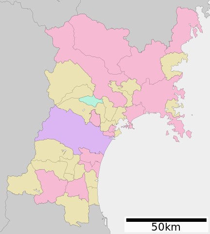
{{Information| |Description= Map of Miyagi Prefecture, Japan. |Source= Japanese wiki [http://ja.wikipedia.org/wiki/%E7%94%BB%E5%83%8F:%E5%8C%85%E6%8B%AC%E8%87%AA%E6%B2%BB%E4%BD%93%E5%8C%BA%E7%94%BB%E5%9B%B3_04000.svg] |Date=~~~~~ |Author=[[:ja: 利用
ไฟล, miyagi, prefecture, ไฟล, ประว, ไฟล, หน, าท, ภาพน, การใช, ไฟล, วนกลาง, อม, ลเก, ยวก, บภาพขนาดของต, วอย, าง, ของไฟล, กเซล, ความละเอ, ยดอ, กเซล, กเซล, กเซล, กเซล, กเซล, ภาพท, ความละเอ, ยดส, งกว, 8206, ไฟล, กเซล, ขนาดไฟล, โลไบต, ปภาพหร, อไฟล, เส, ยงน, นฉบ, บอ. ifl prawtiifl hnathimiphaphni karichiflswnklang khxmulekiywkbphaphkhnadkhxngtwxyang PNG nikhxngifl SVG ni 484 538 phikesl khwamlaexiydxun 216 240 phikesl 432 480 phikesl 691 768 phikesl 921 1 024 phikesl 1 842 2 048 phikesl duphaphthimikhwamlaexiydsungkwa 8206 ifl SVG 484 538 phikesl khnadifl 18 kiolibt rupphaphhruxiflesiyngni tnchbbxyuthi khxmmxns raylaexiyddanlang epnkhxkhwamthiaesdngphlcak ifltnchbbinkhxmmxns khxmmxnsepnewbistinokhrngkarsahrbekbrwbrwmsuxesri thi khunsamarthchwyid khwamyx khaxthibayMap of Miyagi Prefecture Ja svg English Map of Miyagi Prefecture Japan 日本語 ja 宮城県区画図wnthi 29 emsayn ph s 2551 19 22 UTC aehlngthima Original file ngankhxngtw Data 国土交通省 国土数値情報 行政区域 N03 湖沼 W09 phusrangsrrkh Lincunkarxnuyat karichiflniihm This file is a map of a municipality in Japan created and uploaded by Lincun on Japanese Wikipedia It may also be a file based on one of these maps see info in file history or author field for more info on later editors Source English Data used Ministry of Land Infrastructure Transport and Tourism National Land Numerical Information Administrative Area N03 Lake W09 日本語 使用データ 国土交通省 国土数値情報 行政区域 N03 湖沼 W09 The original file was licensed GFDL and Cc by sa 3 0 See this category for more files like this paynimiichpayaesdngsthanalikhsiththi dngnnkarrabusthanalikhsiththicungtxngkrathaaeyktanghak duthi Commons LincensingSVG genesisInfoField sxrsokhdkhxngifl SVG niimthuktxng enuxngcakphbkhxphidphlad40 aehng iflphaphkrafiksewketxr W3C trwcsxbaelwmikhxphidphladiniflni srangkhunodyich Inkscape This map uses embedded text that can be easily translated using a text editor karxnuyatichsiththi xnuyatihkhdlxk aeckcayaela hruxddaeprexksarniphayitenguxnikhkhxngsyyaxnuyatexksaresrikhxngknu run 1 2 hruxrunid nbcaknithixxkodymulnithisxftaewresri odyimmiswnidhamaekikh immikhxkhwampkhnaaelapkhlng saenakhxngsyyaxnuyatrwmxyuinswnchux syyaxnuyatexksaresrikhxngknuhttp www gnu org copyleft fdl html GFDL GNU Free Documentation License true trueiflnixyuphayitsyyaxnuyat khriexthifkhxmmxns aebbaesdngthima xnuyataebbediywkn 3 0 tnchbbkhunsamarth thicaaebngpn thicathasaena aeckcay aelasngngandngklawtxip thicaeriyberiyngihm thicaddaeplngngandngklaw phayitenguxnikhtxipni aesdngthima khuntxngihekiyrtiecakhxngnganxyangehmaasm odyephimlingkipyngsyyaxnuyat aelarabuhakmikarepliynaeplng khunxacthaechnniidinrupaebbidkidtamkhwr aettxngimichinlksnathiaenawaphuihxnuyatsnbsnunkhunhruxkarichngankhxngkhun xnuyataebbediywkn hakkhunddaeplng epliynrup hruxtxetimnganni khuntxngichsyyaxnuyataebbediywknhruxaebbthiehmuxnkbsyyaxnuyatthiichkbnganniethannhttps creativecommons org licenses by sa 3 0 CC BY SA 3 0 Creative Commons Attribution Share Alike 3 0 true true bnthukkarxphohld This file was moved from Japanese Wikipedia See below for original file information File name 包括自治体区画図 04000 svgDescription NowCommons File Map of Miyagi Prefecture Ja svg 基礎自治体位置図画像情報 宮城県 File history wnthi ewla UTC khnad phuich khwamehn22 knyayn ph s 2550 15 32 36 600x752 Lincun 基礎自治体位置図画像情報 宮城県 9 mithunayn ph s 2556 07 26 16 600x680 ニンジンシチュー デザイン変更 スケールバーの位置 配色 29 mithunayn ph s 2556 07 39 17 600x680 ニンジンシチュー デザイン変更18 mithunayn ph s 2561 12 10 08 600x680 軽快 富谷市の市政移行が反映されていなかった問題を解消 see https detail chiebukuro yahoo co jp qa question detail q10191659245 ysp 44Km44Kj44Kt44Oa44OH44Kj44KiPage history wnthi ewla UTC Flag phuich khwamyx 22 knyayn ph s 2550 15 32 36 Lincun 基礎自治体位置図画像情報 宮城県 29 mithunayn ph s 2554 08 48 15 l MGA73bot File is available on Wikimedia Commons 9 mithunayn ph s 2556 07 26 16 ニンジンシチュー ニンジンシチュー ファイル 包括自治体区画図 04000 svg の新しい版をアップロードしました29 mithunayn ph s 2556 07 39 17 ニンジンシチュー ニンジンシチュー ファイル 包括自治体区画図 04000 svg の新しい版をアップロードしました18 mithunayn ph s 2561 12 10 08 軽快 軽快 が ファイル 包括自治体区画図 04000 svg の新しいバージョンを アップロードしましたDeutsch English makedonski 한국어 日本語 فارسی khabrryayodyyxithyephimkhabrryaythrrthdediywephuxkhyaykhwamwaiflnimixairixethmthiaesdngxyuiniflniprakxbdwysthanalikhsiththimilikhsiththisyyaxnuyatCreative Commons Attribution ShareAlike 3 0 Unported xngkvsGNU Free Documentation License version 1 2 or later xngkvsMIME type xngkvsimage svg xml prawtiifl khlikwnthi ewlaephuxduiflthipraktinkhnann wnthi ewlarupyxkhnadphuichkhwamehn pccubn14 29 9 phvscikayn 2563484 538 18 kiolibt AichiWikiFixerUpdate borders and fixes 06 31 8 knyayn 2562600 680 26 kiolibt ZeroSixTwoMotoyoshi chō was merged into Kesennuma shi in 2009 15 31 10 mithunayn 2562600 680 22 kiolibt CamomillaTomiya marked as city 市 19 10 18 mithunayn 2561600 680 22 kiolibt 軽快富谷市の市政移行が反映されていなかった問題を解消 see https detail chiebukuro yahoo co jp qa question detail q10191659245 ysp 44Km44Kj44Kt44Oa44OH44Kj44Ki 14 39 29 mithunayn 2556600 680 22 kiolibt ニンジンシチューデザイン変更 14 38 29 mithunayn 2556600 680 22 kiolibt ニンジンシチューデザイン変更 14 26 9 mithunayn 2556600 680 26 kiolibt ニンジンシチューデザイン変更 スケールバーの位置 配色 14 25 9 mithunayn 2556600 680 26 kiolibt ニンジンシチューデザイン変更 スケールバーの位置 配色 02 22 30 emsayn 2551600 752 16 kiolibt Krisgrotius Information Description Map of Miyagi Prefecture Japan Source Japanese wiki http ja wikipedia org wiki E7 94 BB E5 83 8F E5 8C 85 E6 8B AC E8 87 AA E6 B2 BB E4 BD 93 E5 8C BA E7 94 BB E5 9B B3 04000 svg Date Author ja 利用 22 32 22 knyayn 2550600 752 16 kiolibt Lincun 基礎自治体位置図画像情報 宮城県 hnathimiphaphni hnatxipni oyngmathiphaphni cnghwdmiyangi karichiflswnklang wikixuntxipniichiflni karichbn bcl wikipedia org Prepekturang Miyagi karichbn de wikipedia org Prafektur Miyagi Benutzer Diefarbeblau Humanitare Folgen der Katastrophe in Japan 2011 karichbn en wikipedia org Miyagi Prefecture karichbn es wikinews org Seguidilla de fuertes sismos sacude Japon karichbn hu wikipedia org Mijagi prefektura karichbn id wikipedia org Prefektur Miyagi karichbn it wikipedia org Prefettura di Miyagi karichbn ja wikipedia org 仙台城 宮城県北部地震 宮城スタジアム 泉インターチェンジ 宮城球場 仙台スタジアム 仙台東照宮 瑞巌寺 鹿島神宮 女川原子力発電所 宮城県サッカー場 七ヶ浜サッカースタジアム 仙台市天文台 遠見塚古墳 多賀城 宮城県仙台西高等学校 香取神宮 上杉 宮城県仙台第三高等学校 大木囲貝塚 宮城県仙台二華中学校 高等学校 国分町 仙台市 黄金山神社 涌谷町 宮城県宮城野高等学校 松島基地 宮城県泉館山高等学校 仙台市立仙台商業高等学校 宮城県泉高等学校 宮城県利府高等学校 鳴瀬川橋梁 宮城学院中学校 高等学校 白石城 東北学院大学 台原森林公園 一番町 仙台市 霞目駐屯地 宮城県石巻商業高等学校 船岡城 宮城県塩釜高等学校 宮城県多賀城高等学校 宮城県名取北高等学校 仙台市陸上競技場 dukarichthwolkephimetimkhxngiflnikhxmulekiywkbphaph phaphnimikhxmulephimetim sungswnihymacakklxngdicitxlhruxsaeknenxrthisamarthekbkhxmuldngklawiwrwmkbphaphid thaphaphnithukprbprungaekikhhruxepliynaeplngcakedim khxmulbangxyangcayngkhngimepliynaeplngehmuxnphaphthithukprbprungaekikhnnchuxeruxngsn地図 ナンバープレート 宮城県chuxphaphAuthor Lincunkhwamkwang484khwamsung538 ekhathungcak https th wikipedia org wiki ifl Map of Miyagi Prefecture Ja svg, wikipedia, วิกิ หนังสือ, หนังสือ, ห้องสมุด,