คำอธิบายMarion County Oregon Incorporated and Unincorporated areas Salem Highlighted.svg
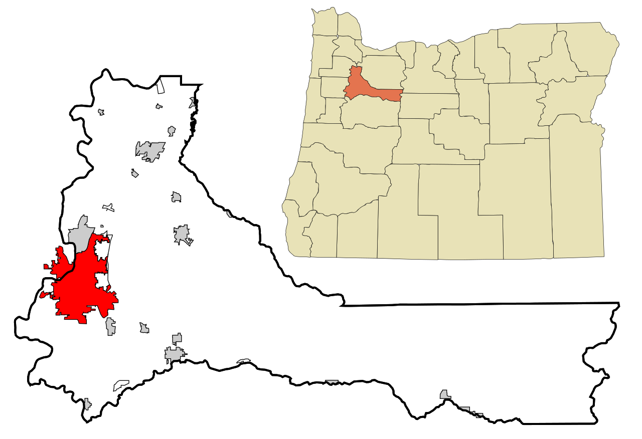
This map shows the incorporated and unincorporated areas in Marion County, Oregon, highlighting Salem in red. It was created with a custom script with US Census Bureau data and modified with Inkscape.
วันที่
แหล่งที่มา
My own work, based on public domain information. Based on similar map concepts by Ixnayonthetimmay
{{Information |Description=This map shows the incorporated and unincorporated areas in Marion County, Oregon, highlighting Salem in red. It was created with a cust
ไฟล, marion, county, oregon, incorporated, unincorporated, areas, salem, highlighted, ไฟล, ประว, ไฟล, หน, าท, ภาพน, การใช, ไฟล, วนกลางขนาดของต, วอย, าง, ของไฟล, กเซล, ความละเอ, ยดอ, กเซล, กเซล, กเซล, กเซล, กเซล, กเซล, ภาพท, ความละเอ, ยดส, งกว, 8206, ไฟล, กเซล,. ifl prawtiifl hnathimiphaphni karichiflswnklangkhnadkhxngtwxyang PNG nikhxngifl SVG ni 800 547 phikesl khwamlaexiydxun 320 219 phikesl 640 438 phikesl 1 024 701 phikesl 1 280 876 phikesl 2 560 1 752 phikesl 950 650 phikesl duphaphthimikhwamlaexiydsungkwa 8206 ifl SVG 950 650 phikesl khnadifl 159 kiolibt rupphaphhruxiflesiyngni tnchbbxyuthi khxmmxns raylaexiyddanlang epnkhxkhwamthiaesdngphlcak ifltnchbbinkhxmmxns khxmmxnsepnewbistinokhrngkarsahrbekbrwbrwmsuxesri thi khunsamarthchwyid khaxthibayMarion County Oregon Incorporated and Unincorporated areas Salem Highlighted svg This map shows the incorporated and unincorporated areas in Marion County Oregon highlighting Salem in red It was created with a custom script with US Census Bureau data and modified with Inkscape wnthi 26 tulakhm ph s 2550 aehlngthima My own work based on public domain information Based on similar map concepts by Ixnayonthetimmay phusrangsrrkh Arkyan khapheca inthanaphuthuxlikhsiththikhxngphaphhruxsuxni xnuyatihichphaphhruxsuxniphayitenguxnikhtxipni xnuyatihkhdlxk aeckcayaela hruxddaeprexksarniphayitenguxnikhkhxngsyyaxnuyatexksaresrikhxngknu run 1 2 hruxrunid nbcaknithixxkodymulnithisxftaewresri odyimmiswnidhamaekikh immikhxkhwampkhnaaelapkhlng saenakhxngsyyaxnuyatrwmxyuinswnchux syyaxnuyatexksaresrikhxngknuhttp www gnu org copyleft fdl html GFDL GNU Free Documentation License true true iflnixyuphayitsyyaxnuyat khriexthifkhxmmxns aebbaesdngthima xnuyataebbediywkn 3 0 tnchbb khunsamarth thicaaebngpn thicathasaena aeckcay aelasngngandngklawtxip thicaeriyberiyngihm thicaddaeplngngandngklaw phayitenguxnikhtxipni aesdngthima khuntxngihekiyrtiecakhxngnganxyangehmaasm odyephimlingkipyngsyyaxnuyat aelarabuhakmikarepliynaeplng khunxacthaechnniidinrupaebbidkidtamkhwr aettxngimichinlksnathiaenawaphuihxnuyatsnbsnunkhunhruxkarichngankhxngkhun xnuyataebbediywkn hakkhunddaeplng epliynrup hruxtxetimnganni khuntxngichsyyaxnuyataebbediywknhruxaebbthiehmuxnkbsyyaxnuyatthiichkbnganniethann payaesdngsthanalikhsiththinithukephimephuxihepniptamkarepliynaeplngsyyaxnuyatkhxngmulnithiwikimiediy cak GFDL ipyng GFDL khwbkhukb CC BY SA 3 0 http creativecommons org licenses by sa 3 0 CC BY SA 3 0 Creative Commons Attribution Share Alike 3 0 true trueiflnixyuphayitsyyaxnuyatkhriexthifkhxmmxns runaesdngthima xnuyataebbediywkn 2 5 thwip 2 0 thwip aela 1 0 thwipkhunsamarth thicaaebngpn thicathasaena aeckcay aelasngngandngklawtxip thicaeriyberiyngihm thicaddaeplngngandngklaw phayitenguxnikhtxipni aesdngthima khuntxngihekiyrtiecakhxngnganxyangehmaasm odyephimlingkipyngsyyaxnuyat aelarabuhakmikarepliynaeplng khunxacthaechnniidinrupaebbidkidtamkhwr aettxngimichinlksnathiaenawaphuihxnuyatsnbsnunkhunhruxkarichngankhxngkhun xnuyataebbediywkn hakkhunddaeplng epliynrup hruxtxetimnganni khuntxngichsyyaxnuyataebbediywknhruxaebbthiehmuxnkbsyyaxnuyatthiichkbnganniethannhttps creativecommons org licenses by sa 2 5 CC BY SA 2 5 Creative Commons Attribution Share Alike 2 5 true truekhunsamartheluxksyyaxnuyatdngklawtamtxngkarkhabrryayodyyxithyephimkhabrryaythrrthdediywephuxkhyaykhwamwaiflnimixairixethmthiaesdngxyuiniflniprakxbdwysthanalikhsiththimilikhsiththisyyaxnuyatCreative Commons Attribution ShareAlike 2 0 Generic nbsp xngkvsCreative Commons Attribution ShareAlike 3 0 Unported nbsp xngkvsGNU Free Documentation License version 1 2 or later nbsp xngkvsCreative Commons Attribution ShareAlike 1 0 Generic nbsp xngkvsCreative Commons Attribution ShareAlike 2 5 Generic nbsp xngkvswnthisrang wnkxtng26 tulakhm 2007 prawtiifl khlikwnthi ewlaephuxduiflthipraktinkhnann wnthi ewlarupyxkhnadphuichkhwamehn pccubn04 13 27 tulakhm 2550950 650 159 kiolibt ArkyBot commonswiki Information Description This map shows the incorporated and unincorporated areas in Marion County Oregon highlighting Salem in red It was created with a cust hnathimiphaphni hnatxipni oyngmathiphaphni eselm rthxxrikxn karichiflswnklang wikixuntxipniichiflni karichbn ar wikipedia org سايلم karichbn ast wikipedia org Salem Oregon karichbn azb wikipedia org سیلم اورقن karichbn bi wikipedia org Salem Oregon karichbn bn wikipedia org ব যবহ রক র Iiirxs স ল ম ওর গন karichbn br wikipedia org Salem Oregon karichbn ca wikipedia org Salem Oregon karichbn ceb wikipedia org Salem kapital sa estado karichbn de wikipedia org Salem Oregon Wikipedia Diskussion WikiProjekt Georeferenzierung Archiv Neue Koordinatenvorlage Arbeitsgruppe karichbn diq wikipedia org Salem Oregon karichbn el wikipedia org Salem karichbn en wikipedia org Salem Oregon karichbn et wikipedia org Salem Oregon karichbn eu wikipedia org Salem karichbn fa wikipedia org سیلم اورگن karichbn fi wikipedia org Salem Oregon karichbn fo wikipedia org Salem Oregon karichbn fr wikipedia org Salem Oregon karichbn fy wikipedia org Salem Oregon karichbn ga wikipedia org Salem Oregon karichbn gd wikipedia org Salem Oregon karichbn he wikipedia org סיילם אורגון karichbn ht wikipedia org Salem Oregon karichbn hu wikipedia org Salem Oregon karichbn ia wikipedia org Salem Oregon karichbn id wikipedia org Salem Oregon karichbn ilo wikipedia org Salem Oregon karichbn it wikipedia org Salem Oregon karichbn ja wikipedia org セイラム オレゴン州 karichbn ko wikipedia org 세일럼 오리건주 karichbn kw wikipedia org Salem Oregon karichbn mk wikipedia org Seјlem Oregon karichbn ml wikipedia org സ ല ഒറ ഗൺ karichbn nl wikipedia org Salem Oregon karichbn oc wikipedia org Salem Oregon karichbn pms wikipedia org Salem Oregon karichbn pnb wikipedia org سالم karichbn pt wikipedia org Salem Oregon karichbn qu wikipedia org Salem Oregon karichbn ro wikipedia org Salem Oregon karichbn sh wikipedia org Salem Oregon karichbn sk wikipedia org Salem Oregon karichbn sl wikipedia org Salem Oregon karichbn sr wikipedia org Seјlem karichbn ta wikipedia org ச லம ஒர கன karichbn tr wikipedia org Salem Oregon karichbn tt wikipedia org Sejlem karichbn ur wikipedia org سیلم اوریگون karichbn vo wikipedia org Salem Oregon dukarichthwolkephimetimkhxngiflni ekhathungcak https th wikipedia org wiki ifl Marion County Oregon Incorporated and Unincorporated areas Salem Highlighted svg, wikipedia, วิกิ หนังสือ, หนังสือ, ห้องสมุด,