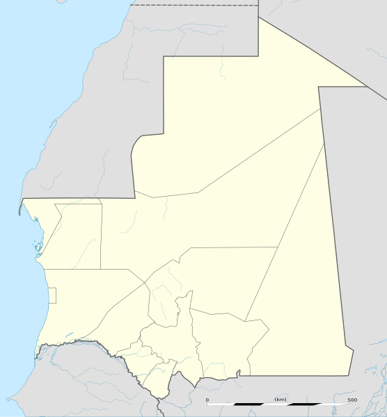
English: Blank administrative map of Mauritania, for geo-location purposes.
Français : Carte administrative vierge de la Mauritanie, destinée à la géolocalisation.
Scale: 1:4,400,000 (precision: 1,100 m) Equirectangular projection, WGS84 datum
Central meridian: 010° 57' W
Standard parallel: 21° N
Geographic limits of the map:
Top: 27° 51' N
Bottom: 14° 09' N
Left: 017° 45' W
Right: 004° 09' W
วันที่
แหล่งที่มา
งานของตัว
Sources of data:
NGDC World Data Bank II (public domain);
NGDC GSHHS (public domain);
Map Library (public domain).
ผู้สร้างสรรค์
Eric Gaba (Sting - fr:Sting)
การอนุญาต (การใช้ไฟล์นี้ใหม่)
Attribution and Share-Alike required
Any use of this map can be made as long as you credit me (Eric Gaba – Wikimedia Commons user: Sting) as the author and distribute the copies and derivative works under the same license(s) that the one(s) stated below. A message with a reply address would also be greatly appreciated.
== {{int:filedesc}} == {{Location|21|00|00|N|10|57|00|W|scale:7000000}} <br/> {{Information |Description={{en|Blank administrative map of Mauritania, for geo-location purposes.}} {{fr|Carte administrative vierge de la [[:fr:Mauritanie|M
ไฟล, mauritania, location, ไฟล, ประว, ไฟล, หน, าท, ภาพน, การใช, ไฟล, วนกลาง, อม, ลเก, ยวก, บภาพขนาดของต, วอย, าง, ของไฟล, กเซล, ความละเอ, ยดอ, กเซล, กเซล, กเซล, กเซล, กเซล, กเซล, ภาพท, ความละเอ, ยดส, งกว, 8206, ไฟล, กเซล, ขนาดไฟล, โลไบต, ปภาพหร, อไฟล, เส, ยงน,. ifl prawtiifl hnathimiphaphni karichiflswnklang khxmulekiywkbphaphkhnadkhxngtwxyang PNG nikhxngifl SVG ni 556 600 phikesl khwamlaexiydxun 222 240 phikesl 445 480 phikesl 712 768 phikesl 949 1 024 phikesl 1 899 2 048 phikesl 1 283 1 384 phikesl duphaphthimikhwamlaexiydsungkwa 8206 ifl SVG 1 283 1 384 phikesl khnadifl 184 kiolibt rupphaphhruxiflesiyngni tnchbbxyuthi khxmmxns raylaexiyddanlang epnkhxkhwamthiaesdngphlcak ifltnchbbinkhxmmxns khxmmxnsepnewbistinokhrngkarsahrbekbrwbrwmsuxesri thi khunsamarthchwyid khwamyx taaehnngthitngklxng21 00 00 ehnux 10 57 00 tawntk phaphniaelaphaphxun n sthanthiediywknthi OpenStreetMap21 000000 10 950000 khaxthibayMauritania location map svg English Blank administrative map of Mauritania for geo location purposes Francais Carte administrative vierge de la Mauritanie destinee a la geolocalisation Scale 1 4 400 000 precision 1 100 m Equirectangular projection WGS84 datum Central meridian 010 57 W Standard parallel 21 NGeographic limits of the map Top 27 51 N Bottom 14 09 N Left 017 45 W Right 004 09 Wwnthi phvscikayn ph s 2552aehlngthima ngankhxngtw Sources of data NGDC World Data Bank II public domain NGDC GSHHS public domain Map Library public domain phusrangsrrkh Eric Gaba Sting fr Sting karxnuyat karichiflniihm Attribution and Share Alike requiredAny use of this map can be made as long as you credit me Eric Gaba Wikimedia Commons user Sting as the author and distribute the copies and derivative works under the same license s that the one s stated below A message with a reply address would also be greatly appreciated ewxrchnxun Equivalent physical map karxnuyatichsiththi khapheca inthanaphuthuxlikhsiththikhxngphaphhruxsuxni xnuyatihichphaphhruxsuxniphayitenguxnikhtxipniiflnixyuphayitsyyaxnuyat khriexthifkhxmmxns aebbaesdngthima xnuyataebbediywkn 3 0 tnchbbkhunsamarth thicaaebngpn thicathasaena aeckcay aelasngngandngklawtxip thicaeriyberiyngihm thicaddaeplngngandngklaw phayitenguxnikhtxipni aesdngthima khuntxngihekiyrtiecakhxngnganxyangehmaasm odyephimlingkipyngsyyaxnuyat aelarabuhakmikarepliynaeplng khunxacthaechnniidinrupaebbidkidtamkhwr aettxngimichinlksnathiaenawaphuihxnuyatsnbsnunkhunhruxkarichngankhxngkhun xnuyataebbediywkn hakkhunddaeplng epliynrup hruxtxetimnganni khuntxngichsyyaxnuyataebbediywknhruxaebbthiehmuxnkbsyyaxnuyatthiichkbnganniethannhttps creativecommons org licenses by sa 3 0 CC BY SA 3 0 Creative Commons Attribution Share Alike 3 0 true true xnuyatihkhdlxk aeckcayaela hruxddaeprexksarniphayitenguxnikhkhxngsyyaxnuyatexksaresrikhxngknu run 1 2 hruxrunid nbcaknithixxkodymulnithisxftaewresri odyimmiswnidhamaekikh immikhxkhwampkhnaaelapkhlng saenakhxngsyyaxnuyatrwmxyuinswnchux syyaxnuyatexksaresrikhxngknuhttp www gnu org copyleft fdl html GFDL GNU Free Documentation License true truekhunsamartheluxksyyaxnuyatdngklawtamtxngkarkhabrryayodyyxithyephimkhabrryaythrrthdediywephuxkhyaykhwamwaiflnimixairixethmthiaesdngxyuiniflniprakxbdwyphusrangbangkhathiimmiixethmwikisnethschuxphusrangsrrkh Stingchuxphuichwikimiediy Stingyuxaraexl http commons wikimedia org wiki User StingsthanalikhsiththimilikhsiththisyyaxnuyatCreative Commons Attribution ShareAlike 3 0 Unported xngkvsGNU Free Documentation License version 1 2 or later xngkvsthimakhxngiflkarsrangdngedimodyphuxpohldwnthisrang wnkxtngphvscikayn 2009coordinates of the point of view xngkvs21 0 0 000 N 10 57 0 000 W prawtiifl khlikwnthi ewlaephuxduiflthipraktinkhnann wnthi ewlarupyxkhnadphuichkhwamehn pccubn20 49 23 phvscikayn 25521 283 1 384 184 kiolibt Sting int filedesc Location 21 00 00 N 10 57 00 W scale 7000000 lt br gt Information Description en Blank administrative map of Mauritania for geo location purposes fr Carte administrative vierge de la fr Mauritanie M hnathimiphaphni hnatxipni oyngmathiphaphni naxadibu aemaebb Location map Mauritania mxdul Location map data Mauritania mxdul Location map data Mauritania doc karichiflswnklang wikixuntxipniichiflni karichbn af wikipedia org Rosso Sjabloon Liggingkaart Mauritanie karichbn am wikipedia org መለጠፊያ Location map ሞሪታኒያ karichbn an wikipedia org Plantilla Mapa de localizacion Mauritania Nouakchott karichbn ar wikipedia org شنقيط تنحماد تيشيت كيفة نواذيبو قالب خريطة مواقع موريتانيا الزويرات وامبو بوتلميت بوغي تفرغ زينة القصر نواكشوط بوابة التراث العالمي خريطة مختارة قالب خريطة مواقع التراث العالمي في موريتانيا مطار تيشيت قصور وادان وشنقيطي وتشيت ووالاتا القديمة karichbn ast wikipedia org Nuakxot Modulu Minimapa data Mauritania Modulu Minimapa data Mauritania usu Mezquita de Chinguetti karichbn azb wikipedia org اقچرقویت امورج تکان موریتانی اکجوجت عین بنتیلی روسو موریتانی افدیرک ادل باقرو اکریجیت karichbn az wikipedia org Nuaksot Sablon Yer xeritesi Mavritaniya Qedim Uadan Sinqetti Tisit ve Ualata ksari Nuadibu karichbn ba wikipedia org Ҡalyp PozKarta Mavritaniya Nuakshot karichbn be tarask wikipedia org Nuakshot Shablyon Lyakalizacyjnaya mapa Mayrytanii Atar karichbn be wikipedia org Nuakshot Shablon Na karce Mayrytaniya Kifa Ayzheft Atar Shum Mayrytaniya Nuadzibu dukarichthwolkephimetimkhxngiflnikhxmulekiywkbphaph phaphnimikhxmulephimetim sungswnihymacakklxngdicitxlhruxsaeknenxrthisamarthekbkhxmuldngklawiwrwmkbphaphid thaphaphnithukprbprungaekikhhruxepliynaeplngcakedim khxmulbangxyangcayngkhngimepliynaeplngehmuxnphaphthithukprbprungaekikhnnchuxeruxngsnBlank map of Mauritania for geo location purpose ekhathungcak https th wikipedia org wiki ifl Mauritania location map svg, wikipedia, วิกิ หนังสือ, หนังสือ, ห้องสมุด,