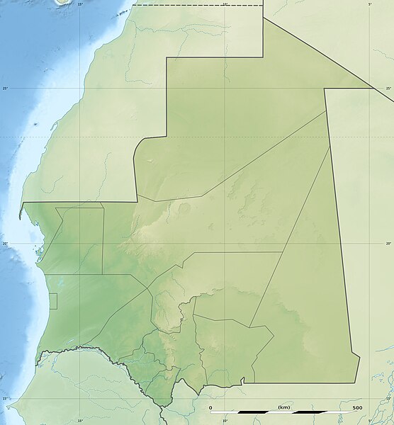
English: Blank physical map of Mauritania, for geo-location purposes.
Français : Carte physique vierge de la Mauritanie, destinée à la géolocalisation.
Scale: 1:4,400,000 (precision: 1,100 m) Equirectangular projection, WGS84 datum
Central meridian: 010° 57' W
Standard parallel: 21° N
Geographic limits of the map:
Top: 27° 51' N
Bottom: 14° 09' N
Left: 017° 45' W
Right: 004° 09' W
วันที่
แหล่งที่มา
งานของตัว
Sources of data:
SRTM30 Plus;
NGDC World Data Bank II (public domain);
NGDC GSHHS (public domain);
Map Library (public domain).
ผู้สร้างสรรค์
Eric Gaba (Sting - fr:Sting)
การอนุญาต (การใช้ไฟล์นี้ใหม่)
Attribution and Share-Alike required
Any use of this map can be made as long as you credit me (Eric Gaba – Wikimedia Commons user: Sting) as the author and distribute the copies and derivative works under the same license(s) that the one(s) stated below. A message with a reply address would also be greatly appreciated.
== {{int:filedesc}} == {{Location|21|00|00|N|10|57|00|W|scale:7000000}} <br/> {{Information |Description={{en|Blank physical map of Mauritania, for geo-location purposes.}} {{fr|Carte physique vierge de la Mauritanie,
ไฟล, mauritania, relief, location, ไฟล, ประว, ไฟล, หน, าท, ภาพน, การใช, ไฟล, วนกลาง, อม, ลเก, ยวก, บภาพขนาดของต, วอย, างน, กเซล, ความละเอ, ยดอ, กเซล, กเซล, กเซล, กเซล, กเซล, ภาพท, ความละเอ, ยดส, งกว, 8206, กเซล, ขนาดไฟล, โลไบต, ชน, ดไมม, image, jpeg, ปภาพหร, อ. ifl prawtiifl hnathimiphaphni karichiflswnklang khxmulekiywkbphaphkhnadkhxngtwxyangni 556 600 phikesl khwamlaexiydxun 222 240 phikesl 445 480 phikesl 712 768 phikesl 949 1 024 phikesl 1 283 1 384 phikesl duphaphthimikhwamlaexiydsungkwa 8206 1 283 1 384 phikesl khnadifl 257 kiolibt chnidimm image jpeg rupphaphhruxiflesiyngni tnchbbxyuthi khxmmxns raylaexiyddanlang epnkhxkhwamthiaesdngphlcak ifltnchbbinkhxmmxns khxmmxnsepnewbistinokhrngkarsahrbekbrwbrwmsuxesri thi khunsamarthchwyid khwamyx taaehnngthitngklxng21 00 00 ehnux 10 57 00 tawntk phaphniaelaphaphxun n sthanthiediywknthi OpenStreetMap21 000000 10 950000 khaxthibayMauritania relief location map jpg English Blank physical map of Mauritania for geo location purposes Francais Carte physique vierge de la Mauritanie destinee a la geolocalisation Scale 1 4 400 000 precision 1 100 m Equirectangular projection WGS84 datum Central meridian 010 57 W Standard parallel 21 NGeographic limits of the map Top 27 51 N Bottom 14 09 N Left 017 45 W Right 004 09 Wwnthi phvscikayn ph s 2552aehlngthima ngankhxngtw Sources of data SRTM30 Plus NGDC World Data Bank II public domain NGDC GSHHS public domain Map Library public domain phusrangsrrkh Eric Gaba Sting fr Sting karxnuyat karichiflniihm Attribution and Share Alike requiredAny use of this map can be made as long as you credit me Eric Gaba Wikimedia Commons user Sting as the author and distribute the copies and derivative works under the same license s that the one s stated below A message with a reply address would also be greatly appreciated ewxrchnxun Equivalent administrative map karxnuyatichsiththi khapheca inthanaphuthuxlikhsiththikhxngphaphhruxsuxni xnuyatihichphaphhruxsuxniphayitenguxnikhtxipniiflnixyuphayitsyyaxnuyat khriexthifkhxmmxns aebbaesdngthima xnuyataebbediywkn 3 0 tnchbbkhunsamarth thicaaebngpn thicathasaena aeckcay aelasngngandngklawtxip thicaeriyberiyngihm thicaddaeplngngandngklaw phayitenguxnikhtxipni aesdngthima khuntxngihekiyrtiecakhxngnganxyangehmaasm odyephimlingkipyngsyyaxnuyat aelarabuhakmikarepliynaeplng khunxacthaechnniidinrupaebbidkidtamkhwr aettxngimichinlksnathiaenawaphuihxnuyatsnbsnunkhunhruxkarichngankhxngkhun xnuyataebbediywkn hakkhunddaeplng epliynrup hruxtxetimnganni khuntxngichsyyaxnuyataebbediywknhruxaebbthiehmuxnkbsyyaxnuyatthiichkbnganniethannhttps creativecommons org licenses by sa 3 0 CC BY SA 3 0 Creative Commons Attribution Share Alike 3 0 true true xnuyatihkhdlxk aeckcayaela hruxddaeprexksarniphayitenguxnikhkhxngsyyaxnuyatexksaresrikhxngknu run 1 2 hruxrunid nbcaknithixxkodymulnithisxftaewresri odyimmiswnidhamaekikh immikhxkhwampkhnaaelapkhlng saenakhxngsyyaxnuyatrwmxyuinswnchux syyaxnuyatexksaresrikhxngknuhttp www gnu org copyleft fdl html GFDL GNU Free Documentation License true truekhunsamartheluxksyyaxnuyatdngklawtamtxngkarkhabrryayodyyxithyephimkhabrryaythrrthdediywephuxkhyaykhwamwaiflnimixairixethmthiaesdngxyuiniflniprakxbdwyphusrangbangkhathiimmiixethmwikisnethshnathikhxngwtthuphayitpraphcnni changphaphchuxphusrangsrrkh Stingchuxphuichwikimiediy Stingyuxaraexl http commons wikimedia org wiki User StingsthanalikhsiththimilikhsiththisyyaxnuyatGNU Free Documentation License version 1 2 or later xngkvsCreative Commons Attribution ShareAlike 3 0 Unported xngkvswnthisrang wnkxtngphvscikayn 2009thimakhxngiflkarsrangdngedimodyphuxpohldcoordinates of the point of view xngkvs21 0 0 000 N 10 57 0 000 W prawtiifl khlikwnthi ewlaephuxduiflthipraktinkhnann wnthi ewlarupyxkhnadphuichkhwamehn pccubn20 14 19 krkdakhm 25531 283 1 384 257 kiolibt StingColor profile 20 47 23 phvscikayn 25521 283 1 384 256 kiolibt Sting int filedesc Location 21 00 00 N 10 57 00 W scale 7000000 lt br gt Information Description en Blank physical map of Mauritania for geo location purposes fr Carte physique vierge de la Mauritanie hnathimiphaphni hnatxipni oyngmathiphaphni nuxakchxt aemaebb Location map Mauritania mxdul Location map data Mauritania mxdul Location map data Mauritania doc karichiflswnklang wikixuntxipniichiflni karichbn af wikipedia org Kaap Blanco karichbn ar wikipedia org نواكشوط أطار قالب خريطة مواقع موريتانيا المذرذرة روصو ألاك كرمسين امبلل انجاكو واد الناقة تامشكط بافريشية حفرة أهل الشيخ karichbn ast wikipedia org Modulu Minimapa data Mauritania Modulu Minimapa data Mauritania usu karichbn az wikipedia org Ras Naudibu Sablon Yer xeritesi Mavritaniya Bank d Arqen Milli Parki Qedim Uadan Sinqetti Tisit ve Ualata ksari karichbn bar wikipedia org Mauretanien karichbn ba wikipedia org Ҡalyp PozKarta Mavritaniya karichbn be wikipedia org Senegal raka Shablon Na karce Mayrytaniya karichbn bg wikipedia org Nuakshot Shablon PK Mavritaniya Fderik Zuerat Bank d Argen nacionalen park Kifa karichbn bn wikipedia org ন ওয কশ ত মড উল অবস থ ন ম নচ ত র উপ ত ত ম র ত ন য মড উল অবস থ ন ম নচ ত র উপ ত ত ম র ত ন য নথ karichbn bs wikipedia org Sablon Lokacijska karta Mauritanija karichbn ceb wikipedia org Plantilya Location map Mauritania karichbn ce wikipedia org Kep Mettigan karta Mavritani karichbn ckb wikipedia org داڕێژە Location map Mauritania karichbn cs wikipedia org Sablona LocMap Mauritanie Kediet Ijill Narodni park Banc d Arguin karichbn da wikipedia org Skabelon Kortpositioner Mauretanien karichbn de wikipedia org Arguin Mauretanien Ras Nouadhibou Vorlage Positionskarte Mauretanien Aouelloul Wikipedia Kartenwerkstatt Positionskarten Afrika Tenoumer Arguin Sandbank Kijji dukarichthwolkephimetimkhxngiflnikhxmulekiywkbphaph phaphnimikhxmulephimetim sungswnihymacakklxngdicitxlhruxsaeknenxrthisamarthekbkhxmuldngklawiwrwmkbphaphid thaphaphnithukprbprungaekikhhruxepliynaeplngcakedim khxmulbangxyangcayngkhngimepliynaeplngehmuxnphaphthithukprbprungaekikhnnkarcdwangphaphpktikhwamlaexiydaenwnxn72 dpikhwamlaexiydaenwtng72 dpisxftaewrthiichAdobe Photoshop 7 0aekikhphaphlasud10 13 19 krkdakhm 2553sepssiimidprbethiyb ekhathungcak https th wikipedia org wiki ifl Mauritania relief location map jpg, wikipedia, วิกิ หนังสือ, หนังสือ, ห้องสมุด,