| | รูปภาพหรือไฟล์เสียงนี้ ต้นฉบับอยู่ที่ คอมมอนส์ รายละเอียดด้านล่าง เป็นข้อความที่แสดงผลจาก ไฟล์ต้นฉบับในคอมมอนส์ คอมมอนส์เป็นเว็บไซต์ในโครงการสำหรับเก็บรวบรวมสื่อเสรี ที่ คุณสามารถช่วยได้ |
ความย่อ
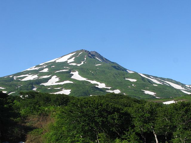
| คำอธิบายMount Chōkai.JPG | English: Mount Chōkai, Yuri-honjo city, Akita pref., Japan 日本語: 鳥海山 秋田県由利本荘市から |
| วันที่ | |
| แหล่งที่มา | Qwert1234's file |
| ผู้สร้างสรรค์ | Qwert1234 |
| ตำแหน่งที่ตั้งกล้อง | 39° 08′ 38.08″ เหนือ, 140° 04′ 22.4″ ตะวันออก | ภาพนี้และภาพอื่น ๆ ณ สถานที่เดียวกันที่ OpenStreetMap | 39.143912; 140.072889 |
|---|
การอนุญาตใช้สิทธิ
ข้าพเจ้า ในฐานะผู้ถือลิขสิทธิ์ของภาพหรือสื่อนี้ อนุญาตให้ใช้ภาพหรือสื่อนี้ภายใต้เงื่อนไขต่อไปนี้
ไฟล์นี้อยู่ภายใต้สัญญาอนุญาต ครีเอทีฟคอมมอนส์ แบบแสดงที่มา-อนุญาตแบบเดียวกัน 3.0 ต้นฉบับ
- คุณสามารถ:
- ที่จะแบ่งปัน – ที่จะทำสำเนา แจกจ่าย และส่งงานดังกล่าวต่อไป
- ที่จะเรียบเรียงใหม่ – ที่จะดัดแปลงงานดังกล่าว
- ภายใต้เงื่อนไขต่อไปนี้:
- แสดงที่มา – คุณต้องให้เกียรติเจ้าของงานอย่างเหมาะสม โดยเพิ่มลิงก์ไปยังสัญญาอนุญาต และระบุหากมีการเปลี่ยนแปลง คุณอาจทำเช่นนี้ได้ในรูปแบบใดก็ได้ตามควร แต่ต้องไม่ใช่ในลักษณะที่แนะว่าผู้ให้อนุญาตสนับสนุนคุณหรือการใช้งานของคุณ
- อนุญาตแบบเดียวกัน – หากคุณดัดแปลง เปลี่ยนรูป หรือต่อเติมงานนี้ คุณต้องใช้สัญญาอนุญาตแบบเดียวกันหรือแบบที่เหมือนกับสัญญาอนุญาตที่ใช้กับงานนี้เท่านั้น
https://creativecommons.org/licenses/by-sa/3.0CC BY-SA 3.0 Creative Commons Attribution-Share Alike 3.0 truetrue เพิ่มคำบรรยายทรรทัดเดียวเพื่อขยายความว่าไฟล์นี้มีอะไร
ประวัติไฟล์
คลิกวันที่/เวลาเพื่อดูไฟล์ที่ปรากฏในขณะนั้น
| วันที่/เวลา | รูปย่อ | ขนาด | ผู้ใช้ | ความเห็น |
|---|
| ปัจจุบัน | 20:06, 9 มกราคม 2559 | | 2,977 × 2,235 (1.15 เมกะไบต์) | Qwert1234 | {{Information |Description={{en|1=Mount Chōkai, Yuri-honjo city, Akita pref., Japan}} {{ja|1=鳥海山 秋田県由利本荘市から}} |Source=Qwert1234's file |Author=Qwert1234 |Date=2014-07-05 |Permission= |other_versions= }} {{location dec|39.1439... |
หน้าที่มีภาพนี้
หน้าต่อไปนี้ โยงมาที่ภาพนี้:
การใช้ไฟล์ส่วนกลาง
วิกิอื่นต่อไปนี้ใช้ไฟล์นี้:
การใช้บน en.wikivoyage.org การใช้บน fr.wikivoyage.org 各都道府県の最高峰 出羽山地 ภาพนี้มีข้อมูลเพิ่มเติม ซึ่งส่วนใหญ่มาจากกล้องดิจิตอลหรือสแกนเนอร์ที่สามารถเก็บข้อมูลดังกล่าวไว้รวมกับภาพได้ ถ้าภาพนี้ถูกปรับปรุงแก้ไขหรือเปลี่ยนแปลงจากเดิม ข้อมูลบางอย่างจะยังคงไม่เปลี่ยนแปลงเหมือนภาพที่ถูกปรับปรุงแก้ไขนั้น
ไฟล, mount, chōkai, ไฟล, ประว, ไฟล, หน, าท, ภาพน, การใช, ไฟล, วนกลาง, อม, ลเก, ยวก, บภาพขนาดของต, วอย, างน, กเซล, ความละเอ, ยดอ, กเซล, กเซล, กเซล, กเซล, กเซล, กเซล, ภาพท, ความละเอ, ยดส, งกว, 8206, กเซล, ขนาดไฟล, เมกะไบต, ชน, ดไมม, image, jpeg, ปภาพหร, อไฟล, เส. ifl prawtiifl hnathimiphaphni karichiflswnklang khxmulekiywkbphaphkhnadkhxngtwxyangni 799 600 phikesl khwamlaexiydxun 320 240 phikesl 640 480 phikesl 1 023 768 phikesl 1 280 961 phikesl 2 560 1 922 phikesl 2 977 2 235 phikesl duphaphthimikhwamlaexiydsungkwa 8206 2 977 2 235 phikesl khnadifl 1 15 emkaibt chnidimm image jpeg rupphaphhruxiflesiyngni tnchbbxyuthi khxmmxns raylaexiyddanlang epnkhxkhwamthiaesdngphlcak ifltnchbbinkhxmmxns khxmmxnsepnewbistinokhrngkarsahrbekbrwbrwmsuxesri thi khunsamarthchwyid khwamyx khaxthibayMount Chōkai JPG English Mount Chōkai Yuri honjo city Akita pref Japan 日本語 鳥海山 秋田県由利本荘市からwnthi 5 krkdakhm ph s 2557aehlngthima Qwert1234 s filephusrangsrrkh Qwert1234 taaehnngthitngklxng39 08 38 08 ehnux 140 04 22 4 tawnxxk phaphniaelaphaphxun n sthanthiediywknthi OpenStreetMap39 143912 140 072889karxnuyatichsiththi khapheca inthanaphuthuxlikhsiththikhxngphaphhruxsuxni xnuyatihichphaphhruxsuxniphayitenguxnikhtxipniiflnixyuphayitsyyaxnuyat khriexthifkhxmmxns aebbaesdngthima xnuyataebbediywkn 3 0 tnchbbkhunsamarth thicaaebngpn thicathasaena aeckcay aelasngngandngklawtxip thicaeriyberiyngihm thicaddaeplngngandngklaw phayitenguxnikhtxipni aesdngthima khuntxngihekiyrtiecakhxngnganxyangehmaasm odyephimlingkipyngsyyaxnuyat aelarabuhakmikarepliynaeplng khunxacthaechnniidinrupaebbidkidtamkhwr aettxngimichinlksnathiaenawaphuihxnuyatsnbsnunkhunhruxkarichngankhxngkhun xnuyataebbediywkn hakkhunddaeplng epliynrup hruxtxetimnganni khuntxngichsyyaxnuyataebbediywknhruxaebbthiehmuxnkbsyyaxnuyatthiichkbnganniethannhttps creativecommons org licenses by sa 3 0 CC BY SA 3 0 Creative Commons Attribution Share Alike 3 0 true truekhabrryayodyyxithyephimkhabrryaythrrthdediywephuxkhyaykhwamwaiflnimixairixethmthiaesdngxyuiniflniprakxbdwysthanalikhsiththimilikhsiththisyyaxnuyatCreative Commons Attribution ShareAlike 3 0 Unported xngkvswnthisrang wnkxtng5 krkdakhm 2014coordinates of the point of view xngkvs39 8 38 083 N 140 4 22 400 Eheading xngkvs 180 xngsabnthukphaphdwyCanon PowerShot G9 xngkvsMIME type xngkvsimage jpeg prawtiifl khlikwnthi ewlaephuxduiflthipraktinkhnann wnthi ewlarupyxkhnadphuichkhwamehn pccubn20 06 9 mkrakhm 25592 977 2 235 1 15 emkaibt Qwert1234 Information Description en 1 Mount Chōkai Yuri honjo city Akita pref Japan ja 1 鳥海山 秋田県由利本荘市から Source Qwert1234 039 s file Author Qwert1234 Date 2014 07 05 Permission other versions location dec 39 1439 hnathimiphaphni hnatxipni oyngmathiphaphni ethuxkekhaedwa karichiflswnklang wikixuntxipniichiflni karichbn en wikipedia org List of Japanese prefectures by highest mountain Dewa Mountains karichbn en wikivoyage org Yurihonjo karichbn es wikipedia org Anexo Montanas y colinas de Japon karichbn fr wikivoyage org Yurihonjō karichbn ja wikipedia org 鳥海山 各都道府県の最高峰 出羽山地 karichbn zh wikipedia org 日本各都道府縣最高峰khxmulekiywkbphaph phaphnimikhxmulephimetim sungswnihymacakklxngdicitxlhruxsaeknenxrthisamarthekbkhxmuldngklawiwrwmkbphaphid thaphaphnithukprbprungaekikhhruxepliynaeplngcakedim khxmulbangxyangcayngkhngimepliynaeplngehmuxnphaphthithukprbprungaekikhnnphuphlitklxngCanonrunkhxngklxngCanon PowerShot G9ewlaepidhnaklxng1 160 winathi 0 00625 khaexff 8xtrakhwamerw ISO80ewlathibnthukphaph06 23 5 krkdakhm 2557khwamyawofkselns14 783 mm karcdwangphaphpktikhwamlaexiydaenwnxn180 dpikhwamlaexiydaenwtng180 dpisxftaewrthiichWindows Photo Editor 6 3 9600 17418aekikhphaphlasud21 15 9 mkrakhm 2559taaehnng Y aela Ckungklangrunexksif Exif 2 2ewlathiaeplngepndicithl06 23 5 krkdakhm 2557khwamhmaykhxngaetlakhxmophenntY Cb Cr immikhaohmdkarbibxdphaph5khwamerwchtetxr7 3125kharurbaesng A 6karchdechyaesng0rurbaesngkwangsud3 34375 APEX f 3 19 ohmdkarwdaesngaephtethirnaeflchimichaeflch rangbichaeflchrunaeflchphiksthirxngrb1sepssisRGBkhwamlaexiydranabofks X11 216 494845361khwamlaexiydranabofks Y11 178 082191781hnwykhwamlaexiydranabofksniwwithikarwdesnesxrcudediywtnchbbiflklxngthayphaphningdicithlkarpramwlphaphophlessspktiohmdexksophechxrexksophechxrxtonmtiiwtbalansiwtbalansxtonmtidicithlsum1chnidsinaekhpecxrpkti ekhathungcak https th wikipedia org wiki ifl Mount Chōkai JPG, wikipedia, วิกิ หนังสือ, หนังสือ, ห้องสมุด,
บทความ
, อ่าน, ดาวน์โหลด, ฟรี, ดาวน์โหลดฟรี, mp3, วิดีโอ, mp4, 3gp, jpg, jpeg, gif, png, รูปภาพ, เพลง, เพลง, หนัง, หนังสือ, เกม, เกม