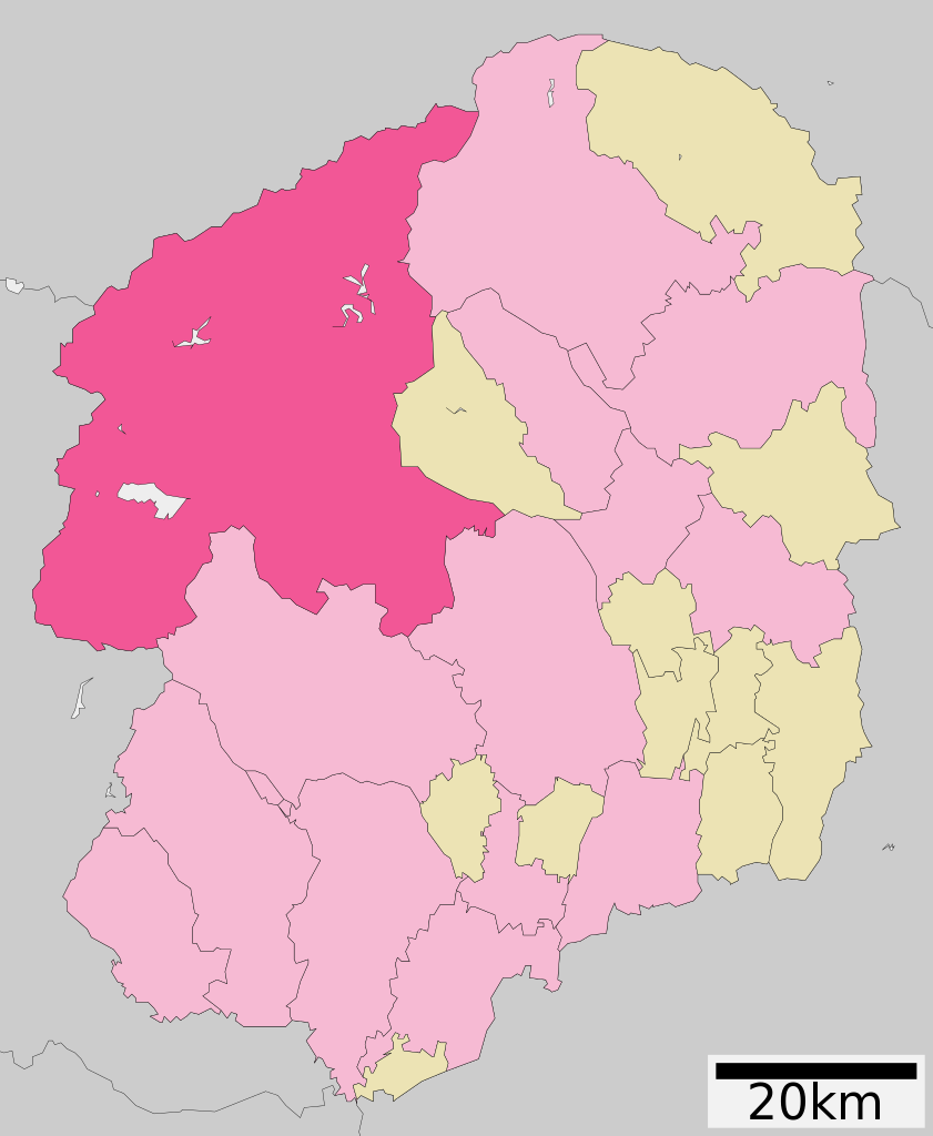
English: Location of Nikkō city in Tochigi Prefecture, Japan
한국어: 일본 도치기 현 닛코 시를 나타낸 그림
วันที่
5:02 March 28th 2009 (UTC, Latest version)
แหล่งที่มา
ja:ファイル:基礎自治体位置図 09206.svg on Japanese Wikipedia
ผู้สร้างสรรค์
Lincun from Japanese Wikipedia
การอนุญาต (การใช้ไฟล์นี้ใหม่)
This file is a map of a municipality in Japan created and uploaded by Lincun on Japanese Wikipedia. It may also be a file based on one of these maps (see info in file history or author field for more info on later editors). Source:
English: Data used : Ministry of Land, Infrastructure, Transport and Tourism - National Land Numerical Information (Administrative Area (N03) / Lake (W09))
日本語: 使用データ : 国土交通省 国土数値情報(行政区域(N03)・湖沼(W09))
The original file was licensed {{GFDL}} and {{Cc-by-sa-3.0}}. See this category for more files like this. ป้ายนี้มิใช่ป้ายแสดงสถานะลิขสิทธิ์ ดังนั้นการระบุสถานะลิขสิทธิ์จึงต้องกระทำแยกต่างหาก ดูที่ Commons:Lincensing
{{Information| |Description= Location of Nikko in Tochigi Prefecture |Source= Japanese wiki [http://ja.wikipedia.org/wiki/%E7%94%BB%E5%83%8F:%E5%9F%BA%E7%A4%8E%E8%87%AA%E6%B2%BB%E4%BD%93%E4%BD%8D%E7%BD%AE%E5%9B%B3_09206.svg] |Date=~~~~~ |Author=[[:j
ไฟล, nikko, tochigi, prefecture, ไฟล, ประว, ไฟล, หน, าท, ภาพน, การใช, ไฟล, วนกลาง, อม, ลเก, ยวก, บภาพขนาดของต, วอย, าง, ของไฟล, กเซล, ความละเอ, ยดอ, กเซล, กเซล, กเซล, กเซล, กเซล, ภาพท, ความละเอ, ยดส, งกว, 8206, ไฟล, กเซล, ขนาดไฟล, โลไบต, ปภาพหร, อไฟล, เส, ยงน,. ifl prawtiifl hnathimiphaphni karichiflswnklang khxmulekiywkbphaphkhnadkhxngtwxyang PNG nikhxngifl SVG ni 460 560 phikesl khwamlaexiydxun 197 240 phikesl 394 480 phikesl 631 768 phikesl 841 1 024 phikesl 1 682 2 048 phikesl duphaphthimikhwamlaexiydsungkwa 8206 ifl SVG 460 560 phikesl khnadifl 22 kiolibt rupphaphhruxiflesiyngni tnchbbxyuthi khxmmxns raylaexiyddanlang epnkhxkhwamthiaesdngphlcak ifltnchbbinkhxmmxns khxmmxnsepnewbistinokhrngkarsahrbekbrwbrwmsuxesri thi khunsamarthchwyid khwamyx khaxthibayNikko in Tochigi Prefecture Ja svg 日本語 日本国 栃木県日光市の位置English Location of Nikkō city in Tochigi Prefecture Japan한국어 일본 도치기 현 닛코 시를 나타낸 그림wnthi 5 02 March 28th 2009 UTC Latest version aehlngthima ja ファイル 基礎自治体位置図 09206 svg on Japanese Wikipediaphusrangsrrkh Lincun from Japanese Wikipediakarxnuyat karichiflniihm This file is a map of a municipality in Japan created and uploaded by Lincun on Japanese Wikipedia It may also be a file based on one of these maps see info in file history or author field for more info on later editors Source English Data used Ministry of Land Infrastructure Transport and Tourism National Land Numerical Information Administrative Area N03 Lake W09 日本語 使用データ 国土交通省 国土数値情報 行政区域 N03 湖沼 W09 The original file was licensed GFDL and Cc by sa 3 0 See this category for more files like this paynimiichpayaesdngsthanalikhsiththi dngnnkarrabusthanalikhsiththicungtxngkrathaaeyktanghak duthi Commons Lincensingxnuyatihkhdlxk aeckcayaela hruxddaeprexksarniphayitenguxnikhkhxngsyyaxnuyatexksaresrikhxngknu run 1 2 hruxrunid nbcaknithixxkodymulnithisxftaewresri odyimmiswnidhamaekikh immikhxkhwampkhnaaelapkhlng saenakhxngsyyaxnuyatrwmxyuinswnchux syyaxnuyatexksaresrikhxngknuhttp www gnu org copyleft fdl html GFDL GNU Free Documentation License true trueiflnixyuphayitsyyaxnuyat khriexthifkhxmmxns aebbaesdngthima xnuyataebbediywkn 3 0 tnchbbkhunsamarth thicaaebngpn thicathasaena aeckcay aelasngngandngklawtxip thicaeriyberiyngihm thicaddaeplngngandngklaw phayitenguxnikhtxipni aesdngthima khuntxngihekiyrtiecakhxngnganxyangehmaasm odyephimlingkipyngsyyaxnuyat aelarabuhakmikarepliynaeplng khunxacthaechnniidinrupaebbidkidtamkhwr aettxngimichinlksnathiaenawaphuihxnuyatsnbsnunkhunhruxkarichngankhxngkhun xnuyataebbediywkn hakkhunddaeplng epliynrup hruxtxetimnganni khuntxngichsyyaxnuyataebbediywknhruxaebbthiehmuxnkbsyyaxnuyatthiichkbnganniethannhttps creativecommons org licenses by sa 3 0 CC BY SA 3 0 Creative Commons Attribution Share Alike 3 0 true true bnthukkarxphohld This file was moved from Japanese Wikipedia See below for original file information File name 基礎自治体位置図 09206 svgDescription 基礎自治体位置図画像情報 栃木県 日光市 20100329 File history wnthi ewla UTC khnad phuich khwamehn26 knyayn ph s 2550 11 50 20 530x712 Lincun 基礎自治体位置図画像情報 栃木県 日光市 28 minakhm ph s 2552 05 02 50 424x552 Lincun 基礎自治体位置図画像情報 栃木県 日光市 20090323 10 emsayn ph s 2553 14 21 47 460x560 Lincun 基礎自治体位置図画像情報 栃木県 日光市 20100329 Page history wnthi ewla UTC Flag phuich khwamyx 26 knyayn ph s 2550 11 50 20 Lincun 基礎自治体位置図画像情報 栃木県 日光市 28 minakhm ph s 2552 05 02 50 Lincun ファイル 基礎自治体位置図 09206 svg の新しい版をアップロードしました 基礎自治体位置図画像情報 栃木県 日光市 20090323 28 minakhm ph s 2552 05 13 34 Lincun date12 krkdakhm ph s 2552 04 43 06 l LERK NowCommons 10 emsayn ph s 2553 14 21 47 Lincun ファイル 基礎自治体位置図 09206 svg の新しい版をアップロードしました 基礎自治体位置図画像情報 栃木県 日光市 20100329 10 emsayn ph s 2553 14 22 10 LincunDeutsch English makedonski 한국어 日本語 فارسی khabrryayodyyxithyephimkhabrryaythrrthdediywephuxkhyaykhwamwaiflnimixairixethmthiaesdngxyuiniflniprakxbdwysthanalikhsiththimilikhsiththisyyaxnuyatGNU Free Documentation License version 1 2 or later xngkvsCreative Commons Attribution ShareAlike 3 0 Unported xngkvs prawtiifl khlikwnthi ewlaephuxduiflthipraktinkhnann wnthi ewlarupyxkhnadphuichkhwamehn pccubn01 18 18 singhakhm 2564460 560 22 kiolibt Ketchup901Update borders 16 44 11 phvscikayn 2561460 560 11 kiolibt Fgg11update 11 39 12 krkdakhm 2552424 552 9 kiolibt LERKnew version available from ja ファイル 基礎自治体位置図 09206 svg 23 58 24 singhakhm 2551530 712 14 kiolibt Krisgrotius Information Description Location of Nikko in Tochigi Prefecture Source Japanese wiki http ja wikipedia org wiki E7 94 BB E5 83 8F E5 9F BA E7 A4 8E E8 87 AA E6 B2 BB E4 BD 93 E4 BD 8D E7 BD AE E5 9B B3 09206 svg Date Author j hnathimiphaphni hnatxipni oyngmathiphaphni nikok karichiflswnklang wikixuntxipniichiflni karichbn ar wikipedia org نيكو اليابان karichbn arz wikipedia org مدينه نيكو karichbn azb wikipedia org نیکو توچیقی karichbn ca wikipedia org Nikkō karichbn ce wikipedia org Nikko karichbn de wikipedia org Nikkō karichbn en wikipedia org Nikkō karichbn es wikipedia org Nikkō Tochigi karichbn eu wikipedia org Nikkō karichbn fa wikipedia org نیکو توچیگی karichbn fi wikipedia org Nikkō karichbn gl wikipedia org Nikkō karichbn id wikipedia org Nikkō Tochigi karichbn ja wikipedia org 日光市 karichbn ko wikipedia org 닛코시 karichbn mt wikipedia org Nikkō karichbn nl wikipedia org Nikko karichbn pl wikipedia org Prefektura Tochigi karichbn ro wikipedia org Nikkō karichbn simple wikipedia org Nikkō karichbn sv wikipedia org Nikkō karichbn tg wikipedia org Nikko karichbn tl wikipedia org Nikkō Tochigi karichbn tt wikipedia org Nikko karichbn uk wikipedia org Nikko Totigi karichbn vi wikipedia org Nikkō Tochigi karichbn www wikidata org Q235753 karichbn zh min nan wikipedia org Nikko chhi karichbn zh wikipedia org 日光市khxmulekiywkbphaph phaphnimikhxmulephimetim sungswnihymacakklxngdicitxlhruxsaeknenxrthisamarthekbkhxmuldngklawiwrwmkbphaphid thaphaphnithukprbprungaekikhhruxepliynaeplngcakedim khxmulbangxyangcayngkhngimepliynaeplngehmuxnphaphthithukprbprungaekikhnnchuxeruxngsn栃木県行政区画地図 2014年4月5日 khwamkwang460khwamsung560 ekhathungcak https th wikipedia org wiki ifl Nikko in Tochigi Prefecture Ja svg, wikipedia, วิกิ หนังสือ, หนังสือ, ห้องสมุด,