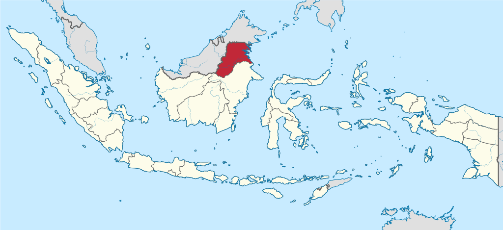
Deutsch: Lage der Provinz XY (siehe Dateiname) in Indonesien.
English: Location of province XY (see filename) in Indonesia
วันที่
แหล่งที่มา
งานของตัว
This vector image includes elements that have been taken or adapted from this file:
West Kalimantan in Indonesia.svg (โดย TUBS).
ผู้สร้างสรรค์
NordNordWest
เวอร์ชันอื่น
This SVG map is part of a locator map series applying the widespread location map scheme. Please see root category to browse for more.
More ▼
ทวีปแอฟริกา
Algeria • Angola • Benin • Botswana • Burkina Faso • Burundi • Cameroon • Cape Verde • Central African Republic • Chad • Comoros • Côte d'Ivoire • Democratic Republic of the Congo • Republic of the Congo • Djibouti • Egypt • Equatorial Guinea • Eritrea • Eswatini • Ethiopia • Gabon • Gambia • Ghana • Guinea-Bissau • Guinea • Kenya • Lesotho • Liberia • Libya • Madagascar • Malawi • Mali • Mauritania • Mauritius • Morocco • Mozambique • Namibia • Niger • Nigeria • Rwanda • (Sahrawi Arab Democratic Republic) • Senegal • Seychelles • Sierre Leone • Somalia • Somaliland • South Africa • South Sudan • Sudan • São Tomé and Príncipe • Tanzania • Togo • Tunisia • Uganda • Yemen • Zambia • Zimbabwe
ทวีปเอเชีย
(Abkhazia) • Afghanistan • Armenia • Azerbaijan • Bahrain • Bangladesh • Bhutan • Brunei • Cambodia • China • Republic of China • Cyprus • East Timor • Egypt • Georgia • India • Indonesia • Iran • Iraq • Israel • Japan • Jordan • Kazakhstan • Kuwait • Kyrgyzstan • Laos • Lebanon • Malaysia • Maldives • Mongolia • Myanmar • Nepal • North Korea • (Northern Cyprus) • Oman • Pakistan • (Palestine) • Papua New Guinea • Philippines • Qatar • Russia • Saudi Arabia • Singapore • South Korea • (South Ossetia) • Sri Lanka • Syria • Tajikistan • Thailand • Turkey • Turkmenistan • United Arab Emirates • Uzbekistan • Vietnam • Yemen
ทวีปยุโรป
(European Union) • (Abkhazia) • Albania • Andorra • Armenia • Austria • Azerbaijan • Belarus • Belgium • Bosnia and Herzegovina • Bulgaria • Czech Republic • Croatia • Cyprus • Denmark • Estonia • Finland • France • Georgia • Germany • Greece • (Guernsey) • Hungary • Iceland • Ireland • Italy • (Jersey) • Kazakhstan • (Kosovo) • Latvia • Liechtenstein • Lithuania • Luxembourg • Malta • (Isle of Man) • Moldova • Monaco • Montenegro • Netherlands • North Macedonia • (Northern Cyprus) • Norway • Poland • Portugal • Romania • Russia • San Marino • Serbia • Slovakia • Slovenia • (South Ossetia) • Spain • Sweden • Switzerland • Turkey • Ukraine • United Kingdom • Vatican City
ทวีปอเมริกาเหนือ
Antigua and Barbuda • Bahamas • Barbados • Belize • Canada • Costa Rica • Cuba • Dominica • Dominican Republic • El Salvador • Grenada • Guatemala • Haiti • Honduras • Iceland • Jamaica • Mexico • Nicaragua • Panama • Saint Kitts and Nevis • Saint Lucia • Saint Vincent and the Grenadines • Trinidad and Tobago • United States
โอเชียเนีย
Australia • (Cook Islands) • Fiji • Indonesia • Kiribati • Marshall Islands • Micronesia • Nauru • New Zealand • (Niue) • Palau • Papua New Guinea • Samoa • Solomon Islands • Tonga • Tuvalu • Vanuatu
ทวีปอเมริกาใต้
Argentina • Bolivia • Brazil • Chile • Colombia • Ecuador • Guyana • Panama • Paraguay • Peru • Suriname • Trinidad and Tobago • Uruguay • Venezuela
ทวีปแอนตาร์กติกา
-
Locator maps design recommendations ▼
Principles
Design Guidelines are based on ▸location map design of the German map shop (in German). It's preferable to derive new locator maps from existing location maps. Please keep both size and ratio in this case. Thus the new locator maps may still be applied as location map (▸Guide). Marker color is supposed to be darkred. Waterbodies may be transparent, to show other objects better. Please be aware that this guide is only a recommendation. It’s not an inevitable law!
Color template
Template toolbox
Other optional map elements
Subdivision of a country
Country within an international organization
Country without context projected on the globe
Country without context
Highlight small areas
Marker
Merged markers
“Glowing” edges
Zoom
Zoom
Zoom
“Remote” areas and mini maps
Mini maps show where the depicted area actually is situated. Check out ▸Vorlage:Positionskarte+ (in German) and ▸Modèle:Carte en coin (in French) of how to insert a mini map in virtually every map.
Small maps apply different scales
Small map applies same scale as main map
Mini map with box
Depicted continent dark grey
Zoomed box on a world map also showing the remote part of country
Disputed areas
rest of Serbia: foreign or the same country?
Kosovo: part of Serbia?
Whether South Ossetia or Abkhazia form a part of Georgia is disputed. The marked Georgian administrative region however is partly under Georgian control (solid red) while other parts are part break-away "country" South Ossetia (hatched).
India claims some northern areas (hatched) while other areas are controlled by India but challenged by other countries. India claims all of Kashmir (red areas), while it controls only the southern part of it (cf. broad red stripes vs. narrow red stripes).
Western Sahara: part of Morocco?
Like above. However, the map differentiates whether the disputed area is controlled by Morocco or not.
Locator map of Taiwan in China. Map hatches all areas that are claimed but not controlled by China. Hence, highlighted Taiwan is also hatched grey/red.
Greyed special objects
Glaciers
Urbanized areas
Backgrounds
Relief
Relief (like before, but outlines highlighted)
Satellite view
Land cover
Relief
Corresponding imagemaps ▼
ทวีปแอฟริกา
Algeria • Angola • Benin • Botswana • Burkina Faso • Burundi • Cameroon • Cape Verde • Central African Republic • Chad • Comoros • Côte d'Ivoire • Democratic Republic of the Congo • Repbulic of the Congo • Djibouti • Egypt • Equatorial Guinea • Eritrea • Ethiopia • Gabon • Gambia • Ghana • Guinea-Bissau • Guinea • Kenya • Lesotho • Liberia • Libya • Madagascar • Malawi • Mali • Mauritania • Mauritius • Morocco • Mozambique • Namibia • Niger • Nigeria • Rwanda • (Sahrawi Arab Democratic Republic) • Senegal • Seychelles • Sierre Leone • Somalia • South Africa • South Sudan • Sudan • Swaziland • São Tomé and Príncipe • Tanzania • Togo • Tunisia • Uganda • Yemen • Zambia • Zimbabwe
ทวีปเอเชีย
(Abkhazia) • Afghanistan • Armenia • Azerbaijan • Bahrain • Bangladesh • Bhutan • Brunei • Cambodia • China• Republic of China • Cyprus • East Timor • Egypt • Georgia • India • Indonesia • Iran • Iraq • Israel • Japan • Jordan • Kazakhstan • Kuwait • Kyrgyzstan • Laos • Lebanon • Malaysia • Maldives • Mongolia • Myanmar • Nepal • North Korea • (Northern Cyprus) • Oman • Pakistan • (Palestine) • Papua New Guinea• Philippines • Qatar • Russia • Saudi Arabia • Singapore • South Korea • (South Ossetia) • Sri Lanka • Syria • Tajikistan • Thailand • Turkey • Turkmenistan• United Arab Emirates • Uzbekistan • Vietnam • Yemen
ทวีปยุโรป
(Abkhazia) • Albania • Andorra • Armenia • Austria • Azerbaijan • Belarus • Belgium • Bosnia and Herzegovina • Bulgaria • Czech Republic • Croatia • Cyprus • Denmark • Estonia • Finland • France • Georgia • Germany • Greece • (Guernsey) • Hungary • Iceland • Ireland • Italy • (Jersey) • Kazakhstan • (Kosovo) • Latvia • Liechtenstein • Lithuania • Luxembourg • Macedonia • Malta • (Isle of Man) • Moldova • Monaco • Montenegro • Netherlands • (Northern Cyprus) • Norway • Poland • Portugal • Romania • Russia • San Marino • Serbia • Slovakia • Slovenia • (South Ossetia) • Spain • Sweden • Switzerland • Turkey • Ukraine • United Kingdom • Vatican City
ทวีปอเมริกาเหนือ
Antigua and Barbuda • Bahamas • Barbados • Belize • Canada • Costa Rica • Cuba • Dominica • Dominican Republic • El Salvador • Grenada • Guatemala • Haiti • Honduras • Iceland • Jamaica • Mexico • Nicaragua • Panama • Saint Kitts and Nevis • Saint Lucia • Saint Vincent and the Grenadines • Trinidad and Tobago • United States
โอเชียเนีย
Australia • Brunei • (Cook Islands) • East Timor • Fiji • Indonesia • Kiribati • Marshall Islands • Micronesia • Nauru • New Zealand • (Niue) • Palau • Papua New Guinea • Samoa • Solomon Islands • Tonga • Tuvalu • Vanuatu
ทวีปอเมริกาใต้
Argentina • Bolivia • Brazil • Chile • Colombia • Ecuador • Guyana • Panama • Paraguay • Peru • Suriname • Trinidad and Tobago • Uruguay • Venezuela
== {{int:filedesc}} == {{Information |Description={{de|Lage der Provinz XY (siehe Dateiname) in Indonesien.}} {{en|Location of province XY (see filename) in Indonesia}} |Source={{own}}{{AttribSVG|West Kalimantan in ...
ไฟล, north, kalimantan, indonesia, ไฟล, ประว, ไฟล, หน, าท, ภาพน, การใช, ไฟล, วนกลาง, อม, ลเก, ยวก, บภาพขนาดของต, วอย, าง, ของไฟล, กเซล, ความละเอ, ยดอ, กเซล, กเซล, กเซล, กเซล, กเซล, กเซล, ภาพท, ความละเอ, ยดส, งกว, 8206, ไฟล, กเซล, ขนาดไฟล, โลไบต, ปภาพหร, อไฟล, . ifl prawtiifl hnathimiphaphni karichiflswnklang khxmulekiywkbphaphkhnadkhxngtwxyang PNG nikhxngifl SVG ni 800 367 phikesl khwamlaexiydxun 320 147 phikesl 640 293 phikesl 1 024 469 phikesl 1 280 587 phikesl 2 560 1 173 phikesl 982 450 phikesl duphaphthimikhwamlaexiydsungkwa 8206 ifl SVG 982 450 phikesl khnadifl 792 kiolibt rupphaphhruxiflesiyngni tnchbbxyuthi khxmmxns raylaexiyddanlang epnkhxkhwamthiaesdngphlcak ifltnchbbinkhxmmxns khxmmxnsepnewbistinokhrngkarsahrbekbrwbrwmsuxesri thi khunsamarthchwyid khwamyx khaxthibayNorth Kalimantan in Indonesia svg Deutsch Lage der Provinz XY siehe Dateiname in Indonesien English Location of province XY see filename in Indonesiawnthi 30 mithunayn ph s 2556aehlngthima ngankhxngtw This vector image includes elements that have been taken or adapted from this file West Kalimantan in Indonesia svg ody TUBS phusrangsrrkh NordNordWestewxrchnxun This SVG map is part of a locator map series applying the widespread location map scheme Please see root category to browse for more More thwipaexfrikaAlgeria Angola Benin Botswana Burkina Faso Burundi Cameroon Cape Verde Central African Republic Chad Comoros Cote d Ivoire Democratic Republic of the Congo Republic of the Congo Djibouti Egypt Equatorial Guinea Eritrea Eswatini Ethiopia Gabon Gambia Ghana Guinea Bissau Guinea Kenya Lesotho Liberia Libya Madagascar Malawi Mali Mauritania Mauritius Morocco Mozambique Namibia Niger Nigeria Rwanda Sahrawi Arab Democratic Republic Senegal Seychelles Sierre Leone Somalia Somaliland South Africa South Sudan Sudan Sao Tome and Principe Tanzania Togo Tunisia Uganda Yemen Zambia Zimbabwethwipexechiy Abkhazia Afghanistan Armenia Azerbaijan Bahrain Bangladesh Bhutan Brunei Cambodia China Republic of China Cyprus East Timor Egypt Georgia India Indonesia Iran Iraq Israel Japan Jordan Kazakhstan Kuwait Kyrgyzstan Laos Lebanon Malaysia Maldives Mongolia Myanmar Nepal North Korea Northern Cyprus Oman Pakistan Palestine Papua New Guinea Philippines Qatar Russia Saudi Arabia Singapore South Korea South Ossetia Sri Lanka Syria Tajikistan Thailand Turkey Turkmenistan United Arab Emirates Uzbekistan Vietnam Yementhwipyuorp European Union Abkhazia Albania Andorra Armenia Austria Azerbaijan Belarus Belgium Bosnia and Herzegovina Bulgaria Czech Republic Croatia Cyprus Denmark Estonia Finland France Georgia Germany Greece Guernsey Hungary Iceland Ireland Italy Jersey Kazakhstan Kosovo Latvia Liechtenstein Lithuania Luxembourg Malta Isle of Man Moldova Monaco Montenegro Netherlands North Macedonia Northern Cyprus Norway Poland Portugal Romania Russia San Marino Serbia Slovakia Slovenia South Ossetia Spain Sweden Switzerland Turkey Ukraine United Kingdom Vatican CitythwipxemrikaehnuxAntigua and Barbuda Bahamas Barbados Belize Canada Costa Rica Cuba Dominica Dominican Republic El Salvador Grenada Guatemala Haiti Honduras Iceland Jamaica Mexico Nicaragua Panama Saint Kitts and Nevis Saint Lucia Saint Vincent and the Grenadines Trinidad and Tobago United StatesoxechiyeniyAustralia Cook Islands Fiji Indonesia Kiribati Marshall Islands Micronesia Nauru New Zealand Niue Palau Papua New Guinea Samoa Solomon Islands Tonga Tuvalu VanuatuthwipxemrikaitArgentina Bolivia Brazil Chile Colombia Ecuador Guyana Panama Paraguay Peru Suriname Trinidad and Tobago Uruguay Venezuelathwipaexntarktika Locator maps design recommendations Principles Design Guidelines are based on location map design of the German map shop in German It s preferable to derive new locator maps from existing location maps Please keep both size and ratio in this case Thus the new locator maps may still be applied as location map Guide Marker color is supposed to be darkred Waterbodies may be transparent to show other objects better Please be aware that this guide is only a recommendation It s not an inevitable law Color template Template toolbox Other optional map elements Subdivision of a country Country within an international organization Country without context projected on the globe Country without contextHighlight small areas Marker Merged markers Glowing edges Zoom Zoom Zoom Remote areas and mini maps Mini maps show where the depicted area actually is situated Check out Vorlage Positionskarte in German and Modele Carte en coin in French of how to insert a mini map in virtually every map Small maps apply different scales Small map applies same scale as main map Mini map with box Depicted continent dark grey Zoomed box on a world map also showing the remote part of countryDisputed areas rest of Serbia foreign or the same country Kosovo part of Serbia Whether South Ossetia or Abkhazia form a part of Georgia is disputed The marked Georgian administrative region however is partly under Georgian control solid red while other parts are part break away country South Ossetia hatched India claims some northern areas hatched while other areas are controlled by India but challenged by other countries India claims all of Kashmir red areas while it controls only the southern part of it cf broad red stripes vs narrow red stripes Western Sahara part of Morocco Like above However the map differentiates whether the disputed area is controlled by Morocco or not Locator map of Taiwan in China Map hatches all areas that are claimed but not controlled by China Hence highlighted Taiwan is also hatched grey red Greyed special objects Glaciers Urbanized areasBackgrounds Relief Relief like before but outlines highlighted Satellite view Land cover ReliefCorresponding imagemaps thwipaexfrikaAlgeria Angola Benin Botswana Burkina Faso Burundi Cameroon Cape Verde Central African Republic Chad Comoros Cote d Ivoire Democratic Republic of the Congo Repbulic of the Congo Djibouti Egypt Equatorial Guinea Eritrea Ethiopia Gabon Gambia Ghana Guinea Bissau Guinea Kenya Lesotho Liberia Libya Madagascar Malawi Mali Mauritania Mauritius Morocco Mozambique Namibia Niger Nigeria Rwanda Sahrawi Arab Democratic Republic Senegal Seychelles Sierre Leone Somalia South Africa South Sudan Sudan Swaziland Sao Tome and Principe Tanzania Togo Tunisia Uganda Yemen Zambia Zimbabwethwipexechiy Abkhazia Afghanistan Armenia Azerbaijan Bahrain Bangladesh Bhutan Brunei Cambodia China Republic of China Cyprus East Timor Egypt Georgia India Indonesia Iran Iraq Israel Japan Jordan Kazakhstan Kuwait Kyrgyzstan Laos Lebanon Malaysia Maldives Mongolia Myanmar Nepal North Korea Northern Cyprus Oman Pakistan Palestine Papua New Guinea Philippines Qatar Russia Saudi Arabia Singapore South Korea South Ossetia Sri Lanka Syria Tajikistan Thailand Turkey Turkmenistan United Arab Emirates Uzbekistan Vietnam Yementhwipyuorp Abkhazia Albania Andorra Armenia Austria Azerbaijan Belarus Belgium Bosnia and Herzegovina Bulgaria Czech Republic Croatia Cyprus Denmark Estonia Finland France Georgia Germany Greece Guernsey Hungary Iceland Ireland Italy Jersey Kazakhstan Kosovo Latvia Liechtenstein Lithuania Luxembourg Macedonia Malta Isle of Man Moldova Monaco Montenegro Netherlands Northern Cyprus Norway Poland Portugal Romania Russia San Marino Serbia Slovakia Slovenia South Ossetia Spain Sweden Switzerland Turkey Ukraine United Kingdom Vatican CitythwipxemrikaehnuxAntigua and Barbuda Bahamas Barbados Belize Canada Costa Rica Cuba Dominica Dominican Republic El Salvador Grenada Guatemala Haiti Honduras Iceland Jamaica Mexico Nicaragua Panama Saint Kitts and Nevis Saint Lucia Saint Vincent and the Grenadines Trinidad and Tobago United StatesoxechiyeniyAustralia Brunei Cook Islands East Timor Fiji Indonesia Kiribati Marshall Islands Micronesia Nauru New Zealand Niue Palau Papua New Guinea Samoa Solomon Islands Tonga Tuvalu VanuatuthwipxemrikaitArgentina Bolivia Brazil Chile Colombia Ecuador Guyana Panama Paraguay Peru Suriname Trinidad and Tobago Uruguay VenezuelaOtherthwipaexntarktika aephnthiolk lukolk karxnuyatichsiththi khapheca inthanaphuthuxlikhsiththikhxngphaphhruxsuxni xnuyatihichphaphhruxsuxniphayitenguxnikhtxipniiflnixyuphayitsyyaxnuyat khriexthifkhxmmxns aebbaesdngthima xnuyataebbediywkn 3 0 tnchbbkhunsamarth thicaaebngpn thicathasaena aeckcay aelasngngandngklawtxip thicaeriyberiyngihm thicaddaeplngngandngklaw phayitenguxnikhtxipni aesdngthima khuntxngihekiyrtiecakhxngnganxyangehmaasm odyephimlingkipyngsyyaxnuyat aelarabuhakmikarepliynaeplng khunxacthaechnniidinrupaebbidkidtamkhwr aettxngimichinlksnathiaenawaphuihxnuyatsnbsnunkhunhruxkarichngankhxngkhun xnuyataebbediywkn hakkhunddaeplng epliynrup hruxtxetimnganni khuntxngichsyyaxnuyataebbediywknhruxaebbthiehmuxnkbsyyaxnuyatthiichkbnganniethannhttps creativecommons org licenses by sa 3 0 CC BY SA 3 0 Creative Commons Attribution Share Alike 3 0 true truekhabrryayodyyxithyephimkhabrryaythrrthdediywephuxkhyaykhwamwaiflnimixairixethmthiaesdngxyuiniflniprakxbdwyphusrangbangkhathiimmiixethmwikisnethschuxphusrangsrrkh NordNordWestchuxphuichwikimiediy NordNordWestyuxaraexl http commons wikimedia org wiki User NordNordWeststhanalikhsiththimilikhsiththisyyaxnuyatCreative Commons Attribution ShareAlike 3 0 Unported xngkvsthimakhxngiflkarsrangdngedimodyphuxpohldwnthisrang wnkxtng30 mithunayn 2013MIME type xngkvsimage svg xml prawtiifl khlikwnthi ewlaephuxduiflthipraktinkhnann wnthi ewlarupyxkhnadphuichkhwamehn pccubn19 22 4 thnwakhm 2565982 450 792 kiolibt NordNordWestupd 2022 05 44 9 singhakhm 2564982 450 912 kiolibt AfrogindahoodFix on Papua West Papua border 20 13 30 mithunayn 25561 200 460 838 kiolibt NordNordWest int filedesc Information Description de Lage der Provinz XY siehe Dateiname in Indonesien en Location of province XY see filename in Indonesia Source own AttribSVG West Kalimantan in hnathimiphaphni hnatxipni oyngmathiphaphni cnghwdkalimntnehnux karichiflswnklang wikixuntxipniichiflni karichbn ace wikipedia org Kalimantan Utara karichbn ar wikipedia org كالمنتان الشمالية قالب Location map Indonesia provinces سلطنة بولونغان karichbn azb wikipedia org قوزئی کالیمانتان karichbn az wikipedia org Simali Kalimantan karichbn ban wikipedia org Kalimantan Utara Propinsi ring Indonesia Kecamatan miwah kelurahan ring Kalimantan Utara karichbn bar wikipedia org Kalimantan Utara karichbn bcl wikipedia org Plantilya Location map Indonesya Mga probinsiya karichbn be wikipedia org Paynochny Kalimantan karichbn bn wikipedia org উত তর ক ল ম ন ত ন karichbn bs wikipedia org Sablon Lokacijska karta Indonezija provincije karichbn cdo wikipedia org Bae k Kalimantan karichbn ceb wikipedia org Plantilya Location map Indonesia provinces karichbn cs wikipedia org Severni Kalimantan karichbn de wikipedia org Kalimantan Utara Liste der Verwaltungseinheiten Indonesiens Diskussion Kalimantan Utara Provinzen Indonesiens karichbn en wikipedia org Bulungan Regency Wikipedia WikiProject Indonesia Cartography User Bwmodular Sandbox4 Module Location map data Indonesia provinces doc Nunukan Island North Kalimantan Robert Atty Bessing Airport Template NKalimantan geo stub Long Apung Krayan Tideng Pale Module Location map data Indonesia provinces Long Berayang Draft List of Southeast Asian first level country subdivisions karichbn eo wikipedia org Administra divido de Indonezio karichbn es wikipedia org Provincia de Borneo Septentrional karichbn eu wikipedia org Ipar Kalimantan karichbn fa wikipedia org الگو Location map Indonesia provinces karichbn fi wikipedia org Pohjois Kalimantan karichbn frr wikipedia org Nuurd Kalimantan karichbn fr wikipedia org Kalimantan du Nord karichbn gor wikipedia org Provinsi to Indonesia karichbn he wikipedia org צפון קאלימנטן karichbn hi wikipedia org उत तर क ल म त न karichbn ia wikipedia org Appendice Lista de provincias de Indonesia karichbn id wikipedia org Taman Nasional Kayan Mentarang Daftar kecamatan dan kelurahan di Kalimantan Utara Pengguna Fuyufahri Juluran Wilayah Kalimantan Utara daerah pemilihan dukarichthwolkephimetimkhxngiflnikhxmulekiywkbphaph phaphnimikhxmulephimetim sungswnihymacakklxngdicitxlhruxsaeknenxrthisamarthekbkhxmuldngklawiwrwmkbphaphid thaphaphnithukprbprungaekikhhruxepliynaeplngcakedim khxmulbangxyangcayngkhngimepliynaeplngehmuxnphaphthithukprbprungaekikhnnkhwamkwang982 172pxkhwamsung450 195px ekhathungcak https th wikipedia org wiki ifl North Kalimantan in Indonesia svg, wikipedia, วิกิ หนังสือ, หนังสือ, ห้องสมุด,