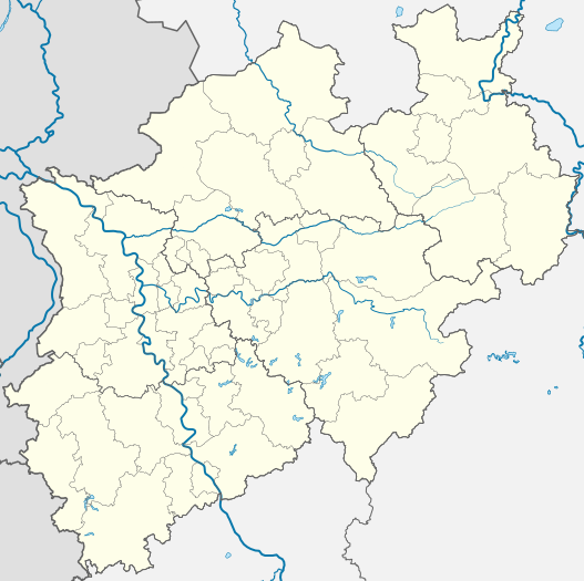
Deutsch: Positionskarte Nordrhein-Westfalen, Germany. Geographische Begrenzung der Karte:
English: Location map North Rhine-Westphalia, Germany. Geographic limits of the map:
Français : Carte du land Rhénanie-du-Nord-Westphalie (Allemagne) destinée à géolocalisation. Les limites géographiques sont:
Coords
↑
52.552° N
↓
50.315° N
←
5.834° E
→
9.481° E
Open this image as an overlay in Google Earth (Google Maps, Bing)
(Help|Source)
วันที่
แหล่งที่มา
งานของตัว, based on (not all layers may be visible or included):
File:North rhine w template 2.svg by TUBS (for borders)
Bezirksregierung Köln: Nordrhein-Westfalen in Zahlen und Karten (for rivers)
Ministerium für Umwelt und Naturschutz, Landwirtschaft und Verbraucherschutz des Landes Nordrhein-Westfalen: Bäche/Flüsse/Seen (for rivers)
Landesumweltamt Nordrhein-Westfalen: Gewässergüte in Nordrhein-Westfalen (for rivers)
File:Netherlands Limburg location map.svg, by Erik Frohne (for rivers and borders)
File:Netherlands Overijssel location map.svg, by Erik Frohne (for rivers and borders)
File:Netherlands Gelderland location map.svg, by Erik Frohne (for rivers and borders)
Hessisches Landesamt für Umwelt und Geologie: Wasserrahmenrichtlinie in Hessen (for rivers and borders)
File:Municipalities in Rhineland-Palatinate.svg by TUBS (for rivers and borders)
For populated areas, either:
Bezirksregierung Köln Übersichtskarte NRW 1:500.000 für Nordrhein-Westfalen (may be substituted by www.maps-for-free data in later versions) or
www.maps-for-free.com
Wasser- und Schifffahrtsverwaltung des Bundes: Bundeswasserstraßenkarte DBWK1000 (for channels)
For topography and hill shades, either:
www.maps-for-free.com (like in File:North Rhine-Westphalia Topography 02.png by TUBS) (may be substituted by SRTM data in later versions) or
NGA's and NASA's SRTM3 data provided to me by user Alexrk2, much like applied in File:North Rhine-Westphalia relief location map.jpg
Alexrk2 also helped me with corrections of the projection of my maps thus becoming a equirectangular projection maps. Alexrk2 provided me this help via email but the application of his/her corrections werde first made public by uploading the file File:North Rhine-Westphalia relief location map.jpg
Only to compare some issues:
Ministerium für Umwelt und Naturschutz, Landwirtschaft und Verbraucherschutz des Landes Nordrhein-Westfalen: Fließgewässer, Kanäle und Seen in NRW
ไฟล์นี้มีให้ใช้ภายใต้ CC0 1.0 Universal Public Domain Dedication ของครีเอทีฟคอมมอนส์
The person who associated a work with this deed has dedicated the work to the public domain by waiving all of their rights to the work worldwide under copyright law, including all related and neighboring rights, to the extent allowed by law. You can copy, modify, distribute and perform the work, even for commercial purposes, all without asking permission.
http://creativecommons.org/publicdomain/zero/1.0/deed.enCC0Creative Commons Zero, Public Domain Dedicationfalsefalse
Public domainPublic domainfalsefalse
กอปปีเลฟต์: งานศิลปะนี้ไม่มีมูลค่า คุณสามารถแจกจ่ายและ/หรือแก้ไขได้ภายใต้เงื่อนไข Free Art License คุณสามารถพบตัวอย่างของสัญญาอนุญาตนี้ได้บนไซต์ Copyleft Attitude รวมทั้งบนไซต์อื่น ๆ ด้วย http://artlibre.org/licence/lal/enFALFree Art Licensefalsetrue
คุณสามารถเลือกสัญญาอนุญาตดังกล่าวตามต้องการ
I'd greatly appreciate, that you attribute this media file to Wikimedia Commons, if used outside Wikipedia or Commons. For use in publications such as books, newspapers, blogs, websites, please insert here the following line:
{{published|author= |date= |url= |title= |org= }}
and fill the applicable fields. (Example). License terms given above still apply.
বাংলা ∙ Deutsch ∙ Deutsch (Sie-Form) ∙ Ελληνικά ∙ English ∙ español ∙ français ∙ Ἀρχαία ἑλληνικὴ ∙ Bahasa Indonesia ∙ 日本語 ∙ македонски ∙ Nederlands ∙ português ∙ русский ∙ Türkçe ∙ 简体中文 ∙ 繁體中文 ∙ +/−
ไฟล, north, rhine, westphalia, location, ไฟล, ประว, ไฟล, หน, าท, ภาพน, การใช, ไฟล, วนกลางขนาดของต, วอย, าง, ของไฟล, กเซล, ความละเอ, ยดอ, กเซล, กเซล, กเซล, กเซล, กเซล, ภาพท, ความละเอ, ยดส, งกว, 8206, ไฟล, กเซล, ขนาดไฟล, เมกะไบต, ปภาพหร, อไฟล, เส, ยงน, นฉบ, บอย,. ifl prawtiifl hnathimiphaphni karichiflswnklangkhnadkhxngtwxyang PNG nikhxngifl SVG ni 527 524 phikesl khwamlaexiydxun 241 240 phikesl 483 480 phikesl 772 768 phikesl 1 030 1 024 phikesl 2 060 2 048 phikesl duphaphthimikhwamlaexiydsungkwa 8206 ifl SVG 527 524 phikesl khnadifl 1 22 emkaibt rupphaphhruxiflesiyngni tnchbbxyuthi khxmmxns raylaexiyddanlang epnkhxkhwamthiaesdngphlcak ifltnchbbinkhxmmxns khxmmxnsepnewbistinokhrngkarsahrbekbrwbrwmsuxesri thi khunsamarthchwyid khwamyx khaxthibayNorth Rhine Westphalia location map 01 svg Deutsch Positionskarte Nordrhein Westfalen Germany Geographische Begrenzung der Karte English Location map North Rhine Westphalia Germany Geographic limits of the map Francais Carte du land Rhenanie du Nord Westphalie Allemagne destinee a geolocalisation Les limites geographiques sont Coords 52 552 N 50 315 N 5 834 E 9 481 EOpen this image as an overlay in Google Earth Google Maps Bing Help Source wnthi ph s 2551aehlngthima ngankhxngtw based on not all layers may be visible or included File North rhine w template 2 svg by TUBS for borders Bezirksregierung Koln Nordrhein Westfalen in Zahlen und Karten for rivers Ministerium fur Umwelt und Naturschutz Landwirtschaft und Verbraucherschutz des Landes Nordrhein Westfalen Bache Flusse Seen for rivers Landesumweltamt Nordrhein Westfalen Gewassergute in Nordrhein Westfalen for rivers File Netherlands Limburg location map svg by Erik Frohne for rivers and borders File Netherlands Overijssel location map svg by Erik Frohne for rivers and borders File Netherlands Gelderland location map svg by Erik Frohne for rivers and borders Hessisches Landesamt fur Umwelt und Geologie Wasserrahmenrichtlinie in Hessen for rivers and borders File Municipalities in Rhineland Palatinate svg by TUBS for rivers and borders For populated areas either Bezirksregierung Koln Ubersichtskarte NRW 1 500 000 fur Nordrhein Westfalen may be substituted by www maps for free data in later versions or www maps for free com Wasser und Schifffahrtsverwaltung des Bundes Bundeswasserstrassenkarte DBWK1000 for channels For topography and hill shades either www maps for free com like in File North Rhine Westphalia Topography 02 png by TUBS may be substituted by SRTM data in later versions or NGA s and NASA s SRTM3 data provided to me by user Alexrk2 much like applied in File North Rhine Westphalia relief location map jpg Alexrk2 also helped me with corrections of the projection of my maps thus becoming a equirectangular projection maps Alexrk2 provided me this help via email but the application of his her corrections werde first made public by uploading the file File North Rhine Westphalia relief location map jpgOnly to compare some issues Ministerium fur Umwelt und Naturschutz Landwirtschaft und Verbraucherschutz des Landes Nordrhein Westfalen Fliessgewasser Kanale und Seen in NRWphusrangsrrkh TUBSewxrchnxun aekikh Location maps of North Rhine Westphalia Main rivers and borders Only borders All vector objects visible All vector objects w o populated areas Physical with hill shades Physical w o hill shades Hill shades only Physical with hill shades JPG derived labeled labeled mapsSVG genesisInfoField sxrsokhdkhxngifl SVG niimthuktxng enuxngcakphbkhxphidphlad5 aehng iflphaphkrafiksewketxr W3C trwcsxbaelwmikhxphidphladiniflni srangkhunodyich Adobe Illustrator This Adobe SVG map is very large because its creator TUBS kept the superfluous Adobe PGF or other CDATA garbage karxnuyatichsiththi TUBS inthanaphuthuxlikhsiththikhxngphaphhruxsuxni xnuyatihichphaphhruxsuxniphayitenguxnikhtxipni xnuyatihkhdlxk aeckcayaela hruxddaeprexksarniphayitenguxnikhkhxngsyyaxnuyatexksaresrikhxngknu run 1 2 hruxrunid nbcaknithixxkodymulnithisxftaewresri odyimmiswnidhamaekikh immikhxkhwampkhnaaelapkhlng saenakhxngsyyaxnuyatrwmxyuinswnchux syyaxnuyatexksaresrikhxngknuhttp www gnu org copyleft fdl html GFDL GNU Free Documentation License true trueiflnixyuphayitsyyaxnuyatkhriexthifkhxmmxns runaesdngthima 3 0 tnchbb 2 5 thwip 2 0 thwip aela 1 0 thwipkaraesdngthima TUBSkhunsamarth thicaaebngpn thicathasaena aeckcay aelasngngandngklawtxip thicaeriyberiyngihm thicaddaeplngngandngklaw phayitenguxnikhtxipni aesdngthima khuntxngihekiyrtiecakhxngnganxyangehmaasm odyephimlingkipyngsyyaxnuyat aelarabuhakmikarepliynaeplng khunxacthaechnniidinrupaebbidkidtamkhwr aettxngimichinlksnathiaenawaphuihxnuyatsnbsnunkhunhruxkarichngankhxngkhunhttps creativecommons org licenses by 3 0 CC BY 3 0 Creative Commons Attribution 3 0 true trueiflnixyuphayitsyyaxnuyatkhriexthifkhxmmxns runaesdngthima xnuyataebbediywkn 3 0 tnchbb 2 5 thwip 2 0 thwip aela 1 0 thwipkaraesdngthima TUBSkhunsamarth thicaaebngpn thicathasaena aeckcay aelasngngandngklawtxip thicaeriyberiyngihm thicaddaeplngngandngklaw phayitenguxnikhtxipni aesdngthima khuntxngihekiyrtiecakhxngnganxyangehmaasm odyephimlingkipyngsyyaxnuyat aelarabuhakmikarepliynaeplng khunxacthaechnniidinrupaebbidkidtamkhwr aettxngimichinlksnathiaenawaphuihxnuyatsnbsnunkhunhruxkarichngankhxngkhun xnuyataebbediywkn hakkhunddaeplng epliynrup hruxtxetimnganni khuntxngichsyyaxnuyataebbediywknhruxaebbthiehmuxnkbsyyaxnuyatthiichkbnganniethannhttps creativecommons org licenses by sa 3 0 CC BY SA 3 0 Creative Commons Attribution Share Alike 3 0 true true iflnimiihichphayit CC0 1 0 Universal Public Domain Dedication khxngkhriexthifkhxmmxnsThe person who associated a work with this deed has dedicated the work to the public domain by waiving all of their rights to the work worldwide under copyright law including all related and neighboring rights to the extent allowed by law You can copy modify distribute and perform the work even for commercial purposes all without asking permission http creativecommons org publicdomain zero 1 0 deed en CC0 Creative Commons Zero Public Domain Dedication false falsePublic domain Public domain false falsekhapheca phuthuxlikhsiththiinnganni khxmxbnganihepnsatharnsmbti prakasnimiphlthwolkinbangpraeths karkrathadngklawxacimsamarththaidtamkdhmaykhaphecaxnuyatihthukkhnmisiththiinkarichiflniinthukehtuphlkarich odyimmimienguxnikh ewnaetkdhmayimxnuyatihthaechnnnkxppielft ngansilpaniimmimulkha khunsamarthaeckcayaela hruxaekikhidphayitenguxnikh Free Art License khunsamarthphbtwxyangkhxngsyyaxnuyatniidbnist Copyleft Attitude rwmthngbnistxun dwy http artlibre org licence lal en FAL Free Art License false truekhunsamartheluxksyyaxnuyatdngklawtamtxngkar I d greatly appreciate that you attribute this media file to Wikimedia Commons if used outside Wikipedia or Commons For use in publications such as books newspapers blogs websites please insert here the following line published author date url title org and fill the applicable fields Example License terms given above still apply ব ল Deutsch Deutsch Sie Form Ellhnika English espanol francais Ἀrxaia ἑllhnikὴ Bahasa Indonesia 日本語 makedonski Nederlands portugues russkij Turkce 简体中文 繁體中文 khabrryayodyyxithyephimkhabrryaythrrthdediywephuxkhyaykhwamwaiflnimixairixethmthiaesdngxyuiniflniprakxbdwyphusrangbangkhathiimmiixethmwikisnethschuxphusrangsrrkh TUBSchuxphuichwikimiediy TUBSyuxaraexl http commons wikimedia org wiki User TUBSsthanalikhsiththicopyrighted dedicated to the public domain by copyright holder xngkvssyyaxnuyatCreative Commons Attribution 2 5 Generic xngkvsCreative Commons Attribution ShareAlike 2 0 Generic xngkvsattribution only license xngkvsreleased into the public domain by the copyright holder xngkvsCC0 xngkvsCreative Commons Attribution ShareAlike 3 0 Unported xngkvsCreative Commons Attribution ShareAlike 1 0 Generic xngkvsGNU Free Documentation License version 1 2 or later xngkvsCreative Commons Attribution ShareAlike 2 5 Generic xngkvsCreative Commons Attribution 1 0 Generic xngkvsCreative Commons Attribution 3 0 Unported xngkvsFree Art LicenseCreative Commons Attribution 2 0 Generic xngkvsthimakhxngiflkarsrangdngedimodyphuxpohldwnthisrang wnkxtng2008 prawtiifl khlikwnthi ewlaephuxduiflthipraktinkhnann lasud ekasud du ihmkwa 10 ekakwa 10 10 20 50 100 250 500 wnthi ewlarupyxkhnadphuichkhwamehn pccubn02 35 17 thnwakhm 2552527 524 1 22 emkaibt TUBSkorr crop area 16 05 20 tulakhm 2552657 656 476 kiolibt TUBS ac 03 33 27 mkrakhm 2552657 656 479 kiolibt TUBS Information Description Source Date Author Permission other versions 03 26 27 mkrakhm 2552657 656 479 kiolibt TUBS Information Description Source Date Author Permission other versions 15 23 4 phvscikayn 2551657 656 429 kiolibt TUBS Information Description Source Date Author Permission other versions 15 40 9 tulakhm 2551657 656 424 kiolibt TUBS Information Description Source Date Author Permission other versions 15 38 9 tulakhm 2551688 688 424 kiolibt TUBS Information Description Source Date Author Permission other versions 15 44 8 tulakhm 2551654 656 424 kiolibt TUBS reduced stroke thickness again rivers and districts 15 27 8 tulakhm 2551654 656 424 kiolibt TUBS lightened district borders 15 09 8 tulakhm 2551654 656 424 kiolibt TUBS added transpareny to all those above rivers lines moved the rivers aside the borders lasud ekasud du ihmkwa 10 ekakwa 10 10 20 50 100 250 500 hnathimiphaphni hnatxipni oyngmathiphaphni siekin dxrthmunth dusesildxrf dusbwrkh thaxakasyanokholybxn nxys bielxeflth bxn luxedinichth xaekhin eklesinekhiyrechin edthmxlth eminechinklthbkh erkhlingehaesin ermichth exsesin ehemxr aekhrephin aebrkichklthbkh okholy oslingengin obkhum oxebxrehaesin mxdul Location map data Germany North Rhine Westphalia mxdul Location map data Germany North Rhine Westphalia doc karichiflswnklang wikixuntxipniichiflni karichbn als wikipedia org Vorlage Infobox Laufwasserkraftwerk Vorlage Infobox Laufwasserkraftwerk Doku Vorlage Positionskarte Deutschland Nordrhein Westfalen karichbn ar wikipedia org قالب Location map Germany North Rhine Westphalia سلاح الجو الملكي ألمانيا karichbn az wikipedia org Vuppertal Sablon Yer xeritesi Almaniya Simali Reyn Vestfaliya Kosfeld Hagen Hamm Monxenqladbax Mulhaym Munster Remsayd Herne Simali Reyn Vestfaliya Drenstaynfurt Isselburq Staynfurt Varendorf Zassenberq Zendenhorst Hayligenhaus Ratingen Verl Datteln Emsdetten Or Erkensvik Rede Telqte Teklenburq Velen Villix Ziqen UEFA Avropa Liqasi 2019 2020 karichbn bar wikipedia org Boddinghausen Vorlog Positionskarte Deutschland Nordrhein Westfalen karichbn ba wikipedia org Ҡalyp PozKarta Germaniya Tonyaҡ Rejn Vestfaliya Myunster karichbn bg wikipedia org Shablon PK Germaniya Severen Rejn Vestfaliya karichbn bn wikipedia org ক লন বন ব ম নবন দর স ট শন মড উল অবস থ ন ম নচ ত র উপ ত ত জ র ম ন নর ডর ইন ভ স টফ ল ন মড উল অবস থ ন ম নচ ত র উপ ত ত জ র ম ন নর ডর ইন ভ স টফ ল ন নথ karichbn ceb wikipedia org Plantilya Location map Germany North Rhine Westphalia karichbn cs wikipedia org Sablona LocMap Nemecko Severni Poryni Vestfalsko karichbn cv wikipedia org Dyussel Rur Rejn yuppi A Nete yuppi Ajkkumer Myulenbah Ajpbah Ajstringhauzer Bah dukarichthwolkephimetimkhxngiflni ekhathungcak https th wikipedia org wiki ifl North Rhine Westphalia location map 01 svg, wikipedia, วิกิ หนังสือ, หนังสือ, ห้องสมุด,