Land and shoreline: 1:110m Natural Earth Datasets, borders 1:50m
วันที่
แหล่งที่มา
งานของตัว
ผู้สร้างสรรค์
Tentotwo
Shell script for generating the map using GMT
#!/bin/sh# Set common optionsPROJECTION=A-165.0/-10.0/180/19.998266666666666c REGION=-320.2519138145009/-12.459450078533589/-5.473602099069988/26.40516525873812r FILENAME=Pacific_Ocean_laea_location_map.ps # Get Natural Earth datafilesecho"Downloading datafiles from naturalearthdata.com" wget-nv-nc\http://www.naturalearthdata.com/http//www.naturalearthdata.com/download/110m/physical/110m-coastline.zip\http://www.naturalearthdata.com/http//www.naturalearthdata.com/download/110m/physical/110m-land.zip\http://www.naturalearthdata.com/http//www.naturalearthdata.com/download/110m/cultural/110m-admin-0-boundary-lines.zip echo"...done\n"echo"Inflating archives" unzip110m\*.zip echo"...done\n"echo"Converting shapefiles to GMT" ogr2ogr-FGMT110m_land.gmt110m_land.shp ogr2ogr-FGMT110m_coastline.gmt110m_coastline.shp ogr2ogr-FGMT50m_borders.gmtne_50m_admin_0_boundary_lines_land.shp echo"...done\n"echo"Creating maps" GMTpsxy-m-J$PROJECTION-R$REGION--PAGE_COLOR=198/236/255--POLAR_CAP=none--PAPER_MEDIA=A3--BASEMAP_TYPE=plain--BASEMAP_AXES=NESW--FRAME_PEN=0.15p,black110m_land.gmt-K-G254/254/233>$FILENAME GMTpsxy-m-J$PROJECTION-R$REGION110m_coastline.gmt-O-K-W0.535p,9/120/171>>$FILENAME GMTpsxy-m-J$PROJECTION-R$REGION50m_borders.gmt-O-W100/100/100>>$FILENAMEecho"...done\n"echo"You can now open $FILENAME in Inkscape to clean up the file and save it as SVG. You should add an ocean coloured background and simplify the graticules using CTRL+L." gv$FILENAME
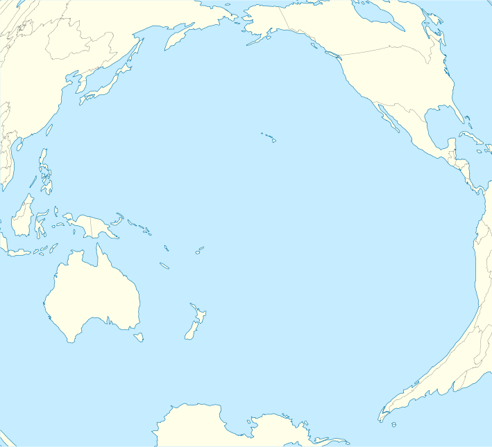
ไฟล, pacific, ocean, laea, location, ไฟล, ประว, ไฟล, หน, าท, ภาพน, การใช, ไฟล, วนกลางขนาดของต, วอย, าง, ของไฟล, กเซล, ความละเอ, ยดอ, กเซล, กเซล, กเซล, กเซล, กเซล, กเซล, ภาพท, ความละเอ, ยดส, งกว, 8206, ไฟล, กเซล, ขนาดไฟล, โลไบต, ปภาพหร, อไฟล, เส, ยงน, นฉบ, บอย,. ifl prawtiifl hnathimiphaphni karichiflswnklangkhnadkhxngtwxyang PNG nikhxngifl SVG ni 659 600 phikesl khwamlaexiydxun 264 240 phikesl 528 480 phikesl 844 768 phikesl 1 126 1 024 phikesl 2 251 2 048 phikesl 709 645 phikesl duphaphthimikhwamlaexiydsungkwa 8206 ifl SVG 709 645 phikesl khnadifl 217 kiolibt rupphaphhruxiflesiyngni tnchbbxyuthi khxmmxns raylaexiyddanlang epnkhxkhwamthiaesdngphlcak ifltnchbbinkhxmmxns khxmmxnsepnewbistinokhrngkarsahrbekbrwbrwmsuxesri thi khunsamarthchwyid Agemaps com khwamyx khaxthibayPacific Ocean laea location map svg English Location map of Pacific Ocean Projection Lambert azimuthal equal area projection Area of interest N 60 0 N S 80 0 N W 260 0 E E 70 0 E Projection center NS 10 0 N WE 165 0 E GMT projection JA 165 0 10 0 180 19 998266666666666c GMT region R 320 2519138145009 12 459450078533589 5 473602099069988 26 40516525873812r Land and shoreline 1 110m Natural Earth Datasets borders 1 50m wnthi 1 kumphaphnth ph s 2555 aehlngthima ngankhxngtw phusrangsrrkh Tentotwo Shell script for generating the map using GMT archive copy bin sh Set common options PROJECTION A 165 0 10 0 180 19 998266666666666c REGION 320 2519138145009 12 459450078533589 5 473602099069988 26 40516525873812r FILENAME Pacific Ocean laea location map ps Get Natural Earth datafiles echo Downloading datafiles from naturalearthdata com wget nv nc http www naturalearthdata com http www naturalearthdata com download 110m physical 110m coastline zip http www naturalearthdata com http www naturalearthdata com download 110m physical 110m land zip http www naturalearthdata com http www naturalearthdata com download 110m cultural 110m admin 0 boundary lines zip echo done n echo Inflating archives unzip 110m zip echo done n echo Converting shapefiles to GMT ogr2ogr F GMT 110m land gmt 110m land shp ogr2ogr F GMT 110m coastline gmt 110m coastline shp ogr2ogr F GMT 50m borders gmt ne 50m admin 0 boundary lines land shp echo done n echo Creating maps GMT psxy m J PROJECTION R REGION PAGE COLOR 198 236 255 POLAR CAP none PAPER MEDIA A3 BASEMAP TYPE plain BASEMAP AXES NESW FRAME PEN 0 15p black 110m land gmt K G254 254 233 gt FILENAME GMT psxy m J PROJECTION R REGION 110m coastline gmt O K W0 535p 9 120 171 gt gt FILENAME GMT psxy m J PROJECTION R REGION 50m borders gmt O W100 100 100 gt gt FILENAME echo done n echo You can now open FILENAME in Inkscape to clean up the file and save it as SVG You should add an ocean coloured background and simplify the graticules using CTRL L gv FILENAME karxnuyatichsiththi khapheca inthanaphuthuxlikhsiththikhxngphaphhruxsuxni xnuyatihichphaphhruxsuxniphayitenguxnikhtxipniiflnixyuphayitsyyaxnuyat khriexthifkhxmmxns aebbaesdngthima xnuyataebbediywkn 3 0 tnchbbkhunsamarth thicaaebngpn thicathasaena aeckcay aelasngngandngklawtxip thicaeriyberiyngihm thicaddaeplngngandngklaw phayitenguxnikhtxipni aesdngthima khuntxngihekiyrtiecakhxngnganxyangehmaasm odyephimlingkipyngsyyaxnuyat aelarabuhakmikarepliynaeplng khunxacthaechnniidinrupaebbidkidtamkhwr aettxngimichinlksnathiaenawaphuihxnuyatsnbsnunkhunhruxkarichngankhxngkhun xnuyataebbediywkn hakkhunddaeplng epliynrup hruxtxetimnganni khuntxngichsyyaxnuyataebbediywknhruxaebbthiehmuxnkbsyyaxnuyatthiichkbnganniethannhttps creativecommons org licenses by sa 3 0 CC BY SA 3 0 Creative Commons Attribution Share Alike 3 0 true truekhabrryayodyyxithyephimkhabrryaythrrthdediywephuxkhyaykhwamwaiflnimixairbatkothbataurus the bullphasamuxxemriknlibra moonixethmthiaesdngxyuiniflniprakxbdwyphusrangbangkhathiimmiixethmwikisnethschuxphusrangsrrkh Tentotwochuxphuichwikimiediy Tentotwoyuxaraexl http commons wikimedia org wiki User TentotwosthanalikhsiththimilikhsiththisyyaxnuyatCreative Commons Attribution ShareAlike 3 0 Unported nbsp xngkvswnthisrang wnkxtng1 kumphaphnth 2012thimakhxngiflkarsrangdngedimodyphuxpohld prawtiifl khlikwnthi ewlaephuxduiflthipraktinkhnann wnthi ewlarupyxkhnadphuichkhwamehn pccubn17 51 1 kumphaphnth 2555709 645 217 kiolibt TentotwoFixed missing colour in Asia 17 00 1 kumphaphnth 2555709 645 235 kiolibt Tentotwo hnathimiphaphni hnatxipni oyngmathiphaphni kapingamarangi khirismas chals khingsfxrd smith tarawa nixuxaotputapu nukuhiwa nukuoxor midewyxathxll hmuekaaosisexti ekaaraorotnga ekaaaekhoriln esathtarawa ithep aemaebb Location map Pacific Ocean mxdul Location map data Pacific Ocean mxdul Location map data Pacific Ocean doc karichiflswnklang wikixuntxipniichiflni karichbn af wikipedia org Tahiti Tuamotu argipel Gambiereilande Acteongroep Sjabloon Liggingkaart Stille Oseaan karichbn an wikipedia org Plantilla Mapa de localizacion Oceano Pacifico karichbn ar wikipedia org ياب خط التاريخ الدولي قالب خريطة مواقع المحيط الهادئ نوكوورو ثوران بركاني غامض سنة 1808 karichbn ast wikipedia org Micronesia Archipielagu de Ḥawai Islla Clipperton Puntu caliente de Galapagos Islles Marqueses Oahu Fatu Hiva Islla Campbell Atafu Islles Carolines Islla de Pascua Fuexa de les Marianes Islles Marianes Reserva marina de Galapagos Observatorios de Mauna Kea Islles Spratly Islles Auckland Islles Campbell Islles Antipodes Pearl Harbor Raiatea Islles Chatham Kilauea Tinian Aeropuertu Seymour Aeropuertu de Palmyra Aeropuertu de San Cristobal Aeropuertu del Atolon Johnston Totegegie Wheeler Army Airfield Hanga Roa Waitangi Islles Maug Agrihan Islla Rota Islla de Pagan Guguan Alamagan Modulu Minimapa data Oceanu Pacificu usu dukarichthwolkephimetimkhxngiflni ekhathungcak https th wikipedia org wiki ifl Pacific Ocean laea location map svg, wikipedia, วิกิ หนังสือ, หนังสือ, ห้องสมุด,