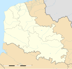
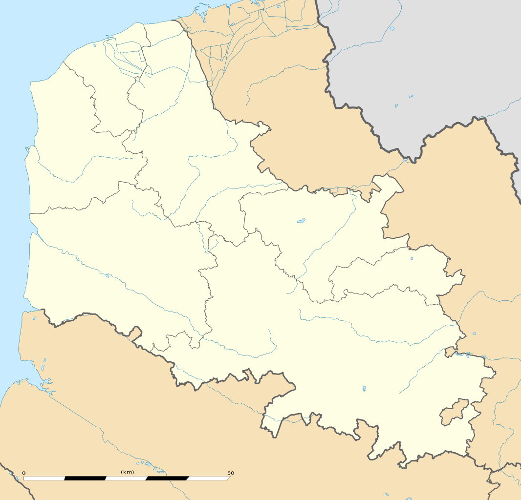
English: Blank administrative map of the department of Pas-de-Calais, France, as in January 2007, for geo-location purpose, with distinct boundaries for regions, departments and arrondissements.
Français : Carte administrative vierge du département du Pas-de-Calais, France, tel qu'en janvier 2007, destinée à la géolocalisation, avec limite distincte des régions, départements et arrondissements.
Estimated scale: 1:440,000 (precision: 110 m) Equirectangular projection, WGS84 datum
Standard meridian: 002° 22' 30" E
Central parallel: 50° 30' N
Geographic limits of the map:
Top: 51° 03' N
Bottom: 49° 57' N
Left: 001° 28' 30" E
Right: 003° 16' 30" E
วันที่
แหล่งที่มา
งานของตัว
Sources of data:
NASA Shuttle Radar Topography Mission (SWBD) (public domain);
NGDC World Data Bank II (public domain);
Vmap-0
References for the boundaries:
INSEE
ผู้สร้างสรรค์
Eric Gaba (Sting - fr:Sting)
การอนุญาต (การใช้ไฟล์นี้ใหม่)
Attribution and Share-Alike required
Any use of this map can be made as long as you credit me (Eric Gaba – Wikimedia Commons user: Sting) as the author and distribute the copies and derivative works under the same license(s) that the one(s) stated below. A message with a reply address would also be greatly appreciated.
เวอร์ชันอื่น
Equivalent physical map
This map was improved or created by the Wikigraphists of the Graphic Lab (fr). You can propose images to clean up, improve, create or translate as well.
การอนุญาตใช้สิทธิ
Eric Gaba, Wikimedia Commons user Sting ในฐานะผู้ถือลิขสิทธิ์ของภาพหรือสื่อนี้ อนุญาตให้ใช้ภาพหรือสื่อนี้ภายใต้เงื่อนไขต่อไปนี้
== {{int:filedesc}} == {{Location|50|30|00|N|02|22|30|E|scale:500000}} {{Information |Description={{en|Blank administrative map of the department of Pas-de-Calais, France, as in January 2007, for geo-location purpose, with distinct b
ไฟล, calais, department, location, ไฟล, ประว, ไฟล, หน, าท, ภาพน, การใช, ไฟล, วนกลาง, อม, ลเก, ยวก, บภาพขนาดของต, วอย, าง, ของไฟล, กเซล, ความละเอ, ยดอ, กเซล, กเซล, กเซล, กเซล, กเซล, กเซล, ภาพท, ความละเอ, ยดส, งกว, 8206, ไฟล, กเซล, ขนาดไฟล, โลไบต, ปภาพหร, อไฟล, . ifl prawtiifl hnathimiphaphni karichiflswnklang khxmulekiywkbphaphkhnadkhxngtwxyang PNG nikhxngifl SVG ni 624 599 phikesl khwamlaexiydxun 250 240 phikesl 500 480 phikesl 800 768 phikesl 1 066 1 024 phikesl 2 133 2 048 phikesl 1 157 1 111 phikesl duphaphthimikhwamlaexiydsungkwa 8206 ifl SVG 1 157 1 111 phikesl khnadifl 311 kiolibt rupphaphhruxiflesiyngni tnchbbxyuthi khxmmxns raylaexiyddanlang epnkhxkhwamthiaesdngphlcak ifltnchbbinkhxmmxns khxmmxnsepnewbistinokhrngkarsahrbekbrwbrwmsuxesri thi khunsamarthchwyid khwamyx taaehnngthitngklxng50 30 00 ehnux 2 22 30 tawnxxk phaphniaelaphaphxun n sthanthiediywknthi OpenStreetMap50 500000 2 375000khaxthibayPas de Calais department location map svg English Blank administrative map of the department of Pas de Calais France as in January 2007 for geo location purpose with distinct boundaries for regions departments and arrondissements Francais Carte administrative vierge du departement du Pas de Calais France tel qu en janvier 2007 destinee a la geolocalisation avec limite distincte des regions departements et arrondissements Estimated scale 1 440 000 precision 110 m Equirectangular projection WGS84 datum Standard meridian 002 22 30 E Central parallel 50 30 NGeographic limits of the map Top 51 03 N Bottom 49 57 N Left 001 28 30 E Right 003 16 30 Ewnthi singhakhm ph s 2554aehlngthima ngankhxngtw Sources of data NASA Shuttle Radar Topography Mission SWBD public domain NGDC World Data Bank II public domain Vmap 0 References for the boundaries INSEEphusrangsrrkh Eric Gaba Sting fr Sting karxnuyat karichiflniihm Attribution and Share Alike requiredAny use of this map can be made as long as you credit me Eric Gaba Wikimedia Commons user Sting as the author and distribute the copies and derivative works under the same license s that the one s stated below A message with a reply address would also be greatly appreciated ewxrchnxun Equivalent physical map This map was improved or created by the Wikigraphists of the Graphic Lab fr You can propose images to clean up improve create or translate as well karxnuyatichsiththi Eric Gaba Wikimedia Commons user Sting inthanaphuthuxlikhsiththikhxngphaphhruxsuxni xnuyatihichphaphhruxsuxniphayitenguxnikhtxipniiflnixyuphayitsyyaxnuyat khriexthifkhxmmxns aebbaesdngthima xnuyataebbediywkn 3 0 tnchbbkaraesdngthima Eric Gaba Wikimedia Commons user Stingkhunsamarth thicaaebngpn thicathasaena aeckcay aelasngngandngklawtxip thicaeriyberiyngihm thicaddaeplngngandngklaw phayitenguxnikhtxipni aesdngthima khuntxngihekiyrtiecakhxngnganxyangehmaasm odyephimlingkipyngsyyaxnuyat aelarabuhakmikarepliynaeplng khunxacthaechnniidinrupaebbidkidtamkhwr aettxngimichinlksnathiaenawaphuihxnuyatsnbsnunkhunhruxkarichngankhxngkhun xnuyataebbediywkn hakkhunddaeplng epliynrup hruxtxetimnganni khuntxngichsyyaxnuyataebbediywknhruxaebbthiehmuxnkbsyyaxnuyatthiichkbnganniethannhttps creativecommons org licenses by sa 3 0 CC BY SA 3 0 Creative Commons Attribution Share Alike 3 0 true truekhabrryayodyyxithyephimkhabrryaythrrthdediywephuxkhyaykhwamwaiflnimixairixethmthiaesdngxyuiniflniprakxbdwyphusrangbangkhathiimmiixethmwikisnethschuxphusrangsrrkh Stingchuxphuichwikimiediy Stingyuxaraexl http commons wikimedia org wiki User StingsthanalikhsiththimilikhsiththisyyaxnuyatCreative Commons Attribution ShareAlike 3 0 Unported xngkvsthimakhxngiflkarsrangdngedimodyphuxpohldwnthisrang wnkxtngsinghakhm 2011coordinates of the point of view xngkvs50 30 0 000 N 2 22 30 000 E prawtiifl khlikwnthi ewlaephuxduiflthipraktinkhnann wnthi ewlarupyxkhnadphuichkhwamehn pccubn22 37 3 singhakhm 25541 157 1 111 311 kiolibt Sting int filedesc Location 50 30 00 N 02 22 30 E scale 500000 Information Description en Blank administrative map of the department of Pas de Calais France as in January 2007 for geo location purpose with distinct b hnathimiphaphni hnatxipni oyngmathiphaphni kaael emuxng mxdul Location map data France Pas de Calais mxdul Location map data France Pas de Calais doc karichiflswnklang wikixuntxipniichiflni karichbn als wikipedia org Vorlage Positionskarte Frankreich Pas de Calais karichbn ar wikipedia org قالب Location map France Pas de Calais karichbn ceb wikipedia org Plantilya Location map France Pas de Calais karichbn de wikipedia org Stade Bollaert Delelis Wikipedia Kartenwerkstatt Positionskarten Europa Stade de la Liberation Stade de l Epopee Vorlage Positionskarte Frankreich Pas de Calais Flugplatz Audembert Flugplatz Bapaume Grevillers Flugplatz Saint Omer Wizernes Flughafen Calais Dunkerque Flughafen Merville Calonne Flugplatz Vitry en Artois Einband Weltmeisterschaft 1995 Phare de Calais karichbn en wikipedia org Module Location map data France Pas de Calais doc Eglise Notre Dame de Calais Module Location map data France Pas de Calais karichbn eo wikipedia org Boulogne sur Mer Calais Saint Omer Pas de Calais Bethune Ŝablono Situo sur mapo Francio Pas de Calais Henin Beaumont Le Touquet Paris Plage Lievin Montreuil Pas de Calais Stadiono Bollaert Delelis Sangatte Mazingarbe Vitry en Artois Wizernes Arras stacidomo Calais Frethun stacidomo Frethun Boulogne Ville stacidomo Boulogne Tintelleries stacidomo Boulogne Maritime stacidomo Lens stacidomo Bethune stacidomo Calais Ville stacidomo Calais Maritime stacidomo Etaples Le Touquet stacidomo Etaples Saint Omer stacidomo Rang du Fliers Verton Berck stacidomo Verton Berck Rang du Fliers dukarichthwolkephimetimkhxngiflnikhxmulekiywkbphaph phaphnimikhxmulephimetim sungswnihymacakklxngdicitxlhruxsaeknenxrthisamarthekbkhxmuldngklawiwrwmkbphaphid thaphaphnithukprbprungaekikhhruxepliynaeplngcakedim khxmulbangxyangcayngkhngimepliynaeplngehmuxnphaphthithukprbprungaekikhnnchuxeruxngsnLocation map of the department of Pas de Calaiskhwamkwang1157khwamsung1111 ekhathungcak https th wikipedia org wiki ifl Pas de Calais department location map svg, wikipedia, วิกิ หนังสือ, หนังสือ, ห้องสมุด,