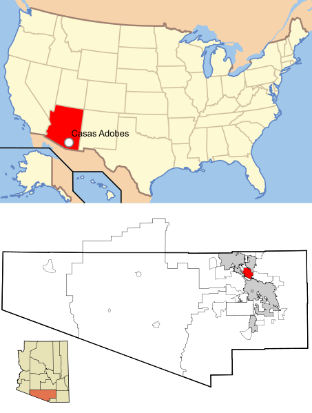
คำอธิบายPima County Arizona USA Casas Adobes highlighted.svg
This map shows the incorporated areas and unincorporated areas in Pima County, Arizona. Incorporated cities are shown in gray and data for their borders and locations are based on the 2000/2030 PAG Transportation Analysis Zone Map. Casas Adobes is highlighted in red. Information for unincorporated locations and borders are based on the Census 2000 Pima County Tract Outline Index Map (PDF). I created this map in en:Inkscape.
ภาพนี้ ได้รับการปรับแต่งภาพ ซึ่งหมายความว่าจะได้รับการเปลี่ยนแปลงภาพต่างจากต้นฉบับ การปรับปรุง: Added location of Casas Adobes in United States. ต้นฉบับสามารถดูได้ที่นี่: Pima County Incorporated and Unincorporated areas Casas Adobes highlighted.svg. ปรับแต่งภาพโดย Sswonk.
This image is a derivative work of the following images:
File:Map_of_USA_AZ.svg licensed with Cc-by-2.0, Cc-by-sa-1.0, Cc-by-sa-2.0, Cc-by-sa-3.0-migrated-with-disclaimers, GFDL-en
2006-05-26T18:34:12Z Huebi 286x186 (171269 Bytes)
2006-05-26T08:48:00Z Huebi 959x593 (317355 Bytes) {{Information| |Description=Map of USA with Arizona highlighted |other_versions=[[:image:Map of USA with state names.svg]] }} [[Category:Maps of the United States]] [[Category:SVG maps]] {{GFDL-en}}{{cc-by-2.0}}{{cc-by-sa-1
File:Pima_County_Incorporated_and_Unincorporated_areas_Casas_Adobes_highlighted.svg licensed with Cc-by-sa-2.5,2.0,1.0, Cc-by-sa-3.0-migrated, GFDL
2007-02-19T17:06:09Z Ixnayonthetimmay 1100x700 (61287 Bytes) {{Information |Description=This map shows the [[:w:Municipality|incorporated areas]] and [[:w:Unincorporated area|unincorporated areas]] in [[:w:Pima County, Arizona|Pima County]], [[:w:Arizona|Arizona]]. Incorporated cities
{{Information |Description=This map shows the incorporated areas and unincorporated areas in Pima County, Arizona. Incorporated cities are shown in gray and data for
ไฟล, pima, county, arizona, casas, adobes, highlighted, ไฟล, ประว, ไฟล, หน, าท, ภาพน, การใช, ไฟล, วนกลางขนาดของต, วอย, าง, ของไฟล, กเซล, ความละเอ, ยดอ, กเซล, กเซล, กเซล, กเซล, กเซล, กเซล, ภาพท, ความละเอ, ยดส, งกว, 8206, ไฟล, กเซล, ขนาดไฟล, โลไบต, ปภาพหร, อไฟล,. ifl prawtiifl hnathimiphaphni karichiflswnklangkhnadkhxngtwxyang PNG nikhxngifl SVG ni 453 599 phikesl khwamlaexiydxun 181 240 phikesl 363 480 phikesl 580 768 phikesl 774 1 024 phikesl 1 548 2 048 phikesl 1 100 1 455 phikesl duphaphthimikhwamlaexiydsungkwa 8206 ifl SVG 1 100 1 455 phikesl khnadifl 160 kiolibt rupphaphhruxiflesiyngni tnchbbxyuthi khxmmxns raylaexiyddanlang epnkhxkhwamthiaesdngphlcak ifltnchbbinkhxmmxns khxmmxnsepnewbistinokhrngkarsahrbekbrwbrwmsuxesri thi khunsamarthchwyid khaxthibayPima County Arizona USA Casas Adobes highlighted svg This map shows the incorporated areas and unincorporated areas in Pima County Arizona Incorporated cities are shown in gray and data for their borders and locations are based on the 2000 2030 PAG Transportation Analysis Zone Map Casas Adobes is highlighted in red Information for unincorporated locations and borders are based on the Census 2000 Pima County Tract Outline Index Map PDF I created this map in en Inkscape wnthi 10 mkrakhm ph s 2554 05 28 UTC aehlngthima Map of USA AZ svg Pima County Incorporated and Unincorporated areas Casas Adobes highlighted svgphusrangsrrkh Map of USA AZ svg Huebi Pima County Incorporated and Unincorporated areas Casas Adobes highlighted svg Ixnayonthetimmay derivative work Sswonk talk phaphni idrbkarprbaetngphaph sunghmaykhwamwacaidrbkarepliynaeplngphaphtangcaktnchbb karprbprung Added location of Casas Adobes in United States tnchbbsamarthduidthini Pima County Incorporated and Unincorporated areas Casas Adobes highlighted svg prbaetngphaphody Sswonk iflnixyuphayitsyyaxnuyat khriexthifkhxmmxns aebbaesdngthima xnuyataebbediywkn 3 0 tnchbbkhunsamarth thicaaebngpn thicathasaena aeckcay aelasngngandngklawtxip thicaeriyberiyngihm thicaddaeplngngandngklaw phayitenguxnikhtxipni aesdngthima khuntxngihekiyrtiecakhxngnganxyangehmaasm odyephimlingkipyngsyyaxnuyat aelarabuhakmikarepliynaeplng khunxacthaechnniidinrupaebbidkidtamkhwr aettxngimichinlksnathiaenawaphuihxnuyatsnbsnunkhunhruxkarichngankhxngkhun xnuyataebbediywkn hakkhunddaeplng epliynrup hruxtxetimnganni khuntxngichsyyaxnuyataebbediywknhruxaebbthiehmuxnkbsyyaxnuyatthiichkbnganniethannhttps creativecommons org licenses by sa 3 0 CC BY SA 3 0 Creative Commons Attribution Share Alike 3 0 true true bnthukkarxphohld This image is a derivative work of the following images File Map of USA AZ svg licensed with Cc by 2 0 Cc by sa 1 0 Cc by sa 2 0 Cc by sa 3 0 migrated with disclaimers GFDL en 2006 05 26T18 34 12Z Huebi 286x186 171269 Bytes 2006 05 26T08 48 00Z Huebi 959x593 317355 Bytes Information Description Map of USA with Arizona highlighted other versions image Map of USA with state names svg Category Maps of the United States Category SVG maps GFDL en cc by 2 0 cc by sa 1File Pima County Incorporated and Unincorporated areas Casas Adobes highlighted svg licensed with Cc by sa 2 5 2 0 1 0 Cc by sa 3 0 migrated GFDL 2007 02 19T17 06 09Z Ixnayonthetimmay 1100x700 61287 Bytes Information Description This map shows the w Municipality incorporated areas and w Unincorporated area unincorporated areas in w Pima County Arizona Pima County w Arizona Arizona Incorporated citiesUploaded with derivativeFXkhabrryayodyyxithyephimkhabrryaythrrthdediywephuxkhyaykhwamwaiflnimixairixethmthiaesdngxyuiniflniprakxbdwysthanalikhsiththimilikhsiththisyyaxnuyatCreative Commons Attribution ShareAlike 3 0 Unported xngkvs prawtiifl khlikwnthi ewlaephuxduiflthipraktinkhnann wnthi ewlarupyxkhnadphuichkhwamehn pccubn02 09 16 mkrakhm 25541 100 1 455 160 kiolibt Ras67cropped 12 43 10 mkrakhm 25541 100 1 500 176 kiolibt SswonkCasas Adobes highlighted with white locator on US map 12 32 10 mkrakhm 25541 100 1 500 176 kiolibt Sswonk Information Description This map shows the incorporated areas and unincorporated areas in Pima County Arizona Incorporated cities are shown in gray and data for hnathimiphaphni hnatxipni oyngmathiphaphni ehtuyingkninthusxn ph s 2554 karichiflswnklang wikixuntxipniichiflni karichbn fi wikipedia org Tucsonin joukkoampuminen karichbn ja wikipedia org 2011年ツーソン銃撃事件 karichbn mk wikipedia org Obid za atentat na Gabriela Gifords karichbn ms wikipedia org Penembakan Tucson 2011 karichbn simple wikipedia org 2011 Tucson shooting karichbn vi wikipedia org Nổ sung Tucson 2011 karichbn zh wikipedia org 2011年圖森槍擊事件 ekhathungcak https th wikipedia org wiki ifl Pima County Arizona USA Casas Adobes highlighted svg, wikipedia, วิกิ หนังสือ, หนังสือ, ห้องสมุด,