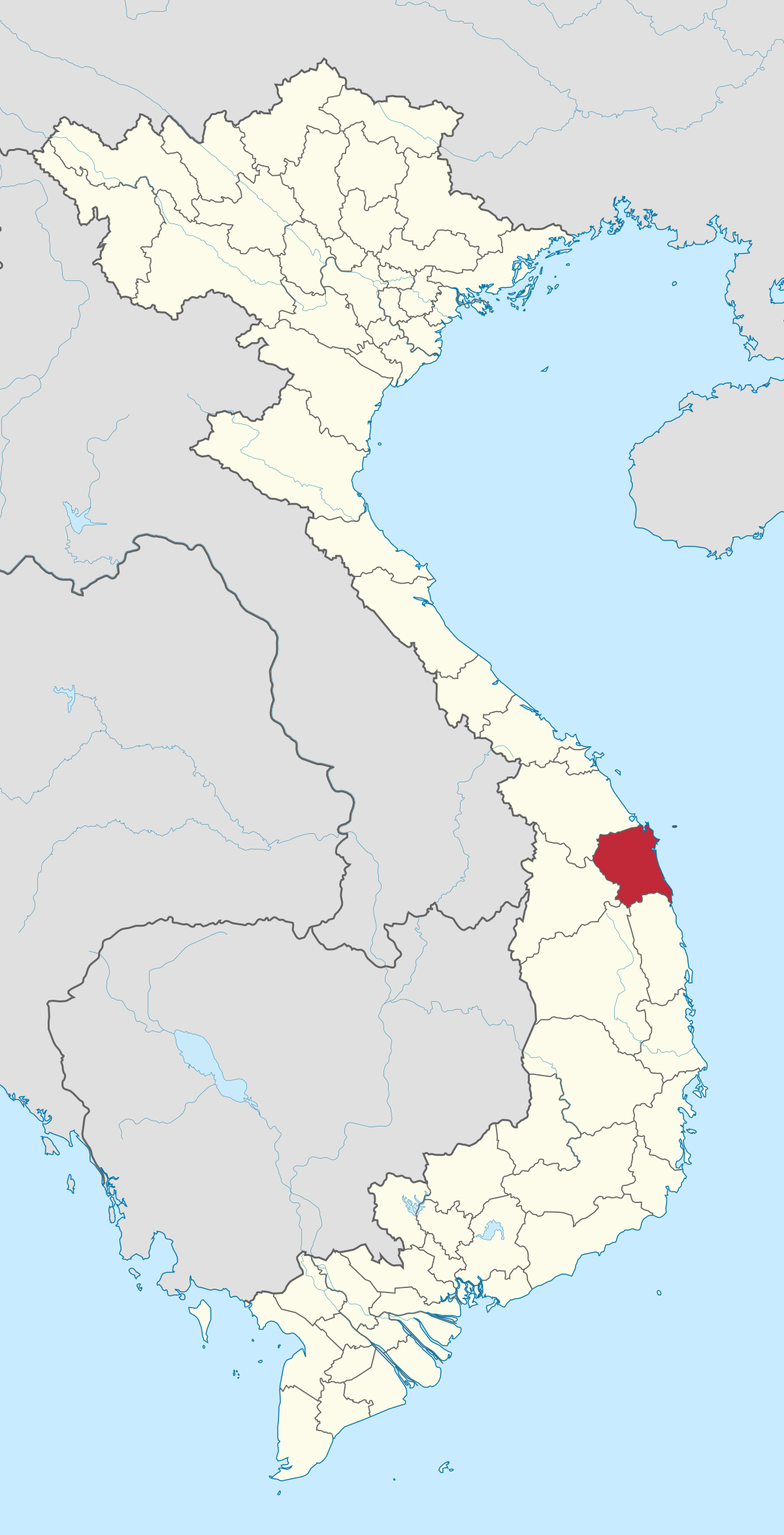
Deutsch: Lage der Provinz XY (siehe Dateiname) in Vietnam.
English: Location of province XY (see filename) in Vietnam.
วันที่
แหล่งที่มา
งานของตัว
This SVG _?_ includes elements that have been taken or adapted from this _?_:
Vietnam location map.svg (โดย Uwe Dedering).
ผู้สร้างสรรค์
TUBS
เวอร์ชันอื่น
This SVG map is part of a locator map series applying the widespread location map scheme. Please see root category to browse for more.
More ▼
ทวีปแอฟริกา
Algeria • Angola • Benin • Botswana • Burkina Faso • Burundi • Cameroon • Cape Verde • Central African Republic • Chad • Comoros • Côte d'Ivoire • Democratic Republic of the Congo • Republic of the Congo • Djibouti • Egypt • Equatorial Guinea • Eritrea • Eswatini • Ethiopia • Gabon • Gambia • Ghana • Guinea-Bissau • Guinea • Kenya • Lesotho • Liberia • Libya • Madagascar • Malawi • Mali • Mauritania • Mauritius • Morocco • Mozambique • Namibia • Niger • Nigeria • Rwanda • (Sahrawi Arab Democratic Republic) • Senegal • Seychelles • Sierre Leone • Somalia • Somaliland • South Africa • South Sudan • Sudan • São Tomé and Príncipe • Tanzania • Togo • Tunisia • Uganda • Yemen • Zambia • Zimbabwe
ทวีปเอเชีย
(Abkhazia) • Afghanistan • Armenia • Azerbaijan • Bahrain • Bangladesh • Bhutan • Brunei • Cambodia • China • Republic of China • Cyprus • East Timor • Egypt • Georgia • India • Indonesia • Iran • Iraq • Israel • Japan • Jordan • Kazakhstan • Kuwait • Kyrgyzstan • Laos • Lebanon • Malaysia • Maldives • Mongolia • Myanmar • Nepal • North Korea • (Northern Cyprus) • Oman • Pakistan • (Palestine) • Papua New Guinea • Philippines • Qatar • Russia • Saudi Arabia • Singapore • South Korea • (South Ossetia) • Sri Lanka • Syria • Tajikistan • Thailand • Turkey • Turkmenistan • United Arab Emirates • Uzbekistan • Vietnam • Yemen
ทวีปยุโรป
(European Union) • (Abkhazia) • Albania • Andorra • Armenia • Austria • Azerbaijan • Belarus • Belgium • Bosnia and Herzegovina • Bulgaria • Czech Republic • Croatia • Cyprus • Denmark • Estonia • Finland • France • Georgia • Germany • Greece • (Guernsey) • Hungary • Iceland • Ireland • Italy • (Jersey) • Kazakhstan • (Kosovo) • Latvia • Liechtenstein • Lithuania • Luxembourg • Malta • (Isle of Man) • Moldova • Monaco • Montenegro • Netherlands • North Macedonia • (Northern Cyprus) • Norway • Poland • Portugal • Romania • Russia • San Marino • Serbia • Slovakia • Slovenia • (South Ossetia) • Spain • Sweden • Switzerland • Turkey • Ukraine • United Kingdom • Vatican City
ทวีปอเมริกาเหนือ
Antigua and Barbuda • Bahamas • Barbados • Belize • Canada • Costa Rica • Cuba • Dominica • Dominican Republic • El Salvador • Grenada • Guatemala • Haiti • Honduras • Iceland • Jamaica • Mexico • Nicaragua • Panama • Saint Kitts and Nevis • Saint Lucia • Saint Vincent and the Grenadines • Trinidad and Tobago • United States
โอเชียเนีย
Australia • (Cook Islands) • Fiji • Indonesia • Kiribati • Marshall Islands • Micronesia • Nauru • New Zealand • (Niue) • Palau • Papua New Guinea • Samoa • Solomon Islands • Tonga • Tuvalu • Vanuatu
ทวีปอเมริกาใต้
Argentina • Bolivia • Brazil • Chile • Colombia • Ecuador • Guyana • Panama • Paraguay • Peru • Suriname • Trinidad and Tobago • Uruguay • Venezuela
ทวีปแอนตาร์กติกา
-
Locator maps design recommendations ▼
Principles
Design Guidelines are based on ▸location map design of the German map shop (in German). It's preferable to derive new locator maps from existing location maps. Please keep both size and ratio in this case. Thus the new locator maps may still be applied as location map (▸Guide). Marker color is supposed to be darkred. Waterbodies may be transparent, to show other objects better. Please be aware that this guide is only a recommendation. It’s not an inevitable law!
Color template
Template toolbox
Other optional map elements
Subdivision of a country
Country within an international organization
Country without context projected on the globe
Country without context
Highlight small areas
Marker
Merged markers
“Glowing” edges
Zoom
Zoom
Zoom
“Remote” areas and mini maps
Mini maps show where the depicted area actually is situated. Check out ▸Vorlage:Positionskarte+ (in German) and ▸Modèle:Carte en coin (in French) of how to insert a mini map in virtually every map.
Small maps apply different scales
Small map applies same scale as main map
Mini map with box
Depicted continent dark grey
Zoomed box on a world map also showing the remote part of country
Disputed areas
rest of Serbia: foreign or the same country?
Kosovo: part of Serbia?
Whether South Ossetia or Abkhazia form a part of Georgia is disputed. The marked Georgian administrative region however is partly under Georgian control (solid red) while other parts are part break-away "country" South Ossetia (hatched).
India claims some northern areas (hatched) while other areas are controlled by India but challenged by other countries. India claims all of Kashmir (red areas), while it controls only the southern part of it (cf. broad red stripes vs. narrow red stripes).
Western Sahara: part of Morocco?
Like above. However, the map differentiates whether the disputed area is controlled by Morocco or not.
Locator map of Taiwan in China. Map hatches all areas that are claimed but not controlled by China. Hence, highlighted Taiwan is also hatched grey/red.
Greyed special objects
Glaciers
Urbanized areas
Backgrounds
Relief
Relief (like before, but outlines highlighted)
Satellite view
Land cover
Relief
Corresponding imagemaps ▼
ทวีปแอฟริกา
Algeria • Angola • Benin • Botswana • Burkina Faso • Burundi • Cameroon • Cape Verde • Central African Republic • Chad • Comoros • Côte d'Ivoire • Democratic Republic of the Congo • Repbulic of the Congo • Djibouti • Egypt • Equatorial Guinea • Eritrea • Ethiopia • Gabon • Gambia • Ghana • Guinea-Bissau • Guinea • Kenya • Lesotho • Liberia • Libya • Madagascar • Malawi • Mali • Mauritania • Mauritius • Morocco • Mozambique • Namibia • Niger • Nigeria • Rwanda • (Sahrawi Arab Democratic Republic) • Senegal • Seychelles • Sierre Leone • Somalia • South Africa • South Sudan • Sudan • Swaziland • São Tomé and Príncipe • Tanzania • Togo • Tunisia • Uganda • Yemen • Zambia • Zimbabwe
ทวีปเอเชีย
(Abkhazia) • Afghanistan • Armenia • Azerbaijan • Bahrain • Bangladesh • Bhutan • Brunei • Cambodia • China• Republic of China • Cyprus • East Timor • Egypt • Georgia • India • Indonesia • Iran • Iraq • Israel • Japan • Jordan • Kazakhstan • Kuwait • Kyrgyzstan • Laos • Lebanon • Malaysia • Maldives • Mongolia • Myanmar • Nepal • North Korea • (Northern Cyprus) • Oman • Pakistan • (Palestine) • Papua New Guinea• Philippines • Qatar • Russia • Saudi Arabia • Singapore • South Korea • (South Ossetia) • Sri Lanka • Syria • Tajikistan • Thailand • Turkey • Turkmenistan• United Arab Emirates • Uzbekistan • Vietnam • Yemen
ทวีปยุโรป
(Abkhazia) • Albania • Andorra • Armenia • Austria • Azerbaijan • Belarus • Belgium • Bosnia and Herzegovina • Bulgaria • Czech Republic • Croatia • Cyprus • Denmark • Estonia • Finland • France • Georgia • Germany • Greece • (Guernsey) • Hungary • Iceland • Ireland • Italy • (Jersey) • Kazakhstan • (Kosovo) • Latvia • Liechtenstein • Lithuania • Luxembourg • Macedonia • Malta • (Isle of Man) • Moldova • Monaco • Montenegro • Netherlands • (Northern Cyprus) • Norway • Poland • Portugal • Romania • Russia • San Marino • Serbia • Slovakia • Slovenia • (South Ossetia) • Spain • Sweden • Switzerland • Turkey • Ukraine • United Kingdom • Vatican City
ทวีปอเมริกาเหนือ
Antigua and Barbuda • Bahamas • Barbados • Belize • Canada • Costa Rica • Cuba • Dominica • Dominican Republic • El Salvador • Grenada • Guatemala • Haiti • Honduras • Iceland • Jamaica • Mexico • Nicaragua • Panama • Saint Kitts and Nevis • Saint Lucia • Saint Vincent and the Grenadines • Trinidad and Tobago • United States
โอเชียเนีย
Australia • Brunei • (Cook Islands) • East Timor • Fiji • Indonesia • Kiribati • Marshall Islands • Micronesia • Nauru • New Zealand • (Niue) • Palau • Papua New Guinea • Samoa • Solomon Islands • Tonga • Tuvalu • Vanuatu
ทวีปอเมริกาใต้
Argentina • Bolivia • Brazil • Chile • Colombia • Ecuador • Guyana • Panama • Paraguay • Peru • Suriname • Trinidad and Tobago • Uruguay • Venezuela
I'd greatly appreciate, that you attribute this media file to Wikimedia Commons, if used outside Wikipedia or Commons. For use in publications such as books, newspapers, blogs, websites, please insert here the following line:
{{published|author= |date= |url= |title= |org= }}
and fill the applicable fields. (Example). License terms given above still apply.
বাংলা ∙ Deutsch ∙ Deutsch (Sie-Form) ∙ Ελληνικά ∙ English ∙ español ∙ français ∙ Ἀρχαία ἑλληνικὴ ∙ Bahasa Indonesia ∙ 日本語 ∙ македонски ∙ Nederlands ∙ português ∙ русский ∙ Türkçe ∙ 简体中文 ∙ 繁體中文 ∙ +/−
ไฟล, quang, ngai, vietnam, ไฟล, ประว, ไฟล, หน, าท, ภาพน, การใช, ไฟล, วนกลาง, อม, ลเก, ยวก, บภาพขนาดของต, วอย, าง, ของไฟล, กเซล, ความละเอ, ยดอ, กเซล, กเซล, กเซล, กเซล, กเซล, กเซล, ภาพท, ความละเอ, ยดส, งกว, 8206, ไฟล, กเซล, ขนาดไฟล, โลไบต, ปภาพหร, อไฟล, เส, ยงน,. ifl prawtiifl hnathimiphaphni karichiflswnklang khxmulekiywkbphaphkhnadkhxngtwxyang PNG nikhxngifl SVG ni 306 599 phikesl khwamlaexiydxun 122 240 phikesl 245 480 phikesl 392 768 phikesl 523 1 024 phikesl 1 046 2 048 phikesl 1 200 2 349 phikesl duphaphthimikhwamlaexiydsungkwa 8206 ifl SVG 1 200 2 349 phikesl khnadifl 787 kiolibt rupphaphhruxiflesiyngni tnchbbxyuthi khxmmxns raylaexiyddanlang epnkhxkhwamthiaesdngphlcak ifltnchbbinkhxmmxns khxmmxnsepnewbistinokhrngkarsahrbekbrwbrwmsuxesri thi khunsamarthchwyid khwamyx khaxthibayQuang Ngai in Vietnam svg Deutsch Lage der Provinz XY siehe Dateiname in Vietnam English Location of province XY see filename in Vietnam wnthi 25 tulakhm ph s 2554aehlngthima ngankhxngtw This SVG includes elements that have been taken or adapted from this Vietnam location map svg ody Uwe Dedering phusrangsrrkh TUBSewxrchnxun This SVG map is part of a locator map series applying the widespread location map scheme Please see root category to browse for more More thwipaexfrikaAlgeria Angola Benin Botswana Burkina Faso Burundi Cameroon Cape Verde Central African Republic Chad Comoros Cote d Ivoire Democratic Republic of the Congo Republic of the Congo Djibouti Egypt Equatorial Guinea Eritrea Eswatini Ethiopia Gabon Gambia Ghana Guinea Bissau Guinea Kenya Lesotho Liberia Libya Madagascar Malawi Mali Mauritania Mauritius Morocco Mozambique Namibia Niger Nigeria Rwanda Sahrawi Arab Democratic Republic Senegal Seychelles Sierre Leone Somalia Somaliland South Africa South Sudan Sudan Sao Tome and Principe Tanzania Togo Tunisia Uganda Yemen Zambia Zimbabwethwipexechiy Abkhazia Afghanistan Armenia Azerbaijan Bahrain Bangladesh Bhutan Brunei Cambodia China Republic of China Cyprus East Timor Egypt Georgia India Indonesia Iran Iraq Israel Japan Jordan Kazakhstan Kuwait Kyrgyzstan Laos Lebanon Malaysia Maldives Mongolia Myanmar Nepal North Korea Northern Cyprus Oman Pakistan Palestine Papua New Guinea Philippines Qatar Russia Saudi Arabia Singapore South Korea South Ossetia Sri Lanka Syria Tajikistan Thailand Turkey Turkmenistan United Arab Emirates Uzbekistan Vietnam Yementhwipyuorp European Union Abkhazia Albania Andorra Armenia Austria Azerbaijan Belarus Belgium Bosnia and Herzegovina Bulgaria Czech Republic Croatia Cyprus Denmark Estonia Finland France Georgia Germany Greece Guernsey Hungary Iceland Ireland Italy Jersey Kazakhstan Kosovo Latvia Liechtenstein Lithuania Luxembourg Malta Isle of Man Moldova Monaco Montenegro Netherlands North Macedonia Northern Cyprus Norway Poland Portugal Romania Russia San Marino Serbia Slovakia Slovenia South Ossetia Spain Sweden Switzerland Turkey Ukraine United Kingdom Vatican CitythwipxemrikaehnuxAntigua and Barbuda Bahamas Barbados Belize Canada Costa Rica Cuba Dominica Dominican Republic El Salvador Grenada Guatemala Haiti Honduras Iceland Jamaica Mexico Nicaragua Panama Saint Kitts and Nevis Saint Lucia Saint Vincent and the Grenadines Trinidad and Tobago United StatesoxechiyeniyAustralia Cook Islands Fiji Indonesia Kiribati Marshall Islands Micronesia Nauru New Zealand Niue Palau Papua New Guinea Samoa Solomon Islands Tonga Tuvalu VanuatuthwipxemrikaitArgentina Bolivia Brazil Chile Colombia Ecuador Guyana Panama Paraguay Peru Suriname Trinidad and Tobago Uruguay Venezuelathwipaexntarktika Locator maps design recommendations Principles Design Guidelines are based on location map design of the German map shop in German It s preferable to derive new locator maps from existing location maps Please keep both size and ratio in this case Thus the new locator maps may still be applied as location map Guide Marker color is supposed to be darkred Waterbodies may be transparent to show other objects better Please be aware that this guide is only a recommendation It s not an inevitable law Color template Template toolbox Other optional map elements Subdivision of a country Country within an international organization Country without context projected on the globe Country without contextHighlight small areas Marker Merged markers Glowing edges Zoom Zoom Zoom Remote areas and mini maps Mini maps show where the depicted area actually is situated Check out Vorlage Positionskarte in German and Modele Carte en coin in French of how to insert a mini map in virtually every map Small maps apply different scales Small map applies same scale as main map Mini map with box Depicted continent dark grey Zoomed box on a world map also showing the remote part of countryDisputed areas rest of Serbia foreign or the same country Kosovo part of Serbia Whether South Ossetia or Abkhazia form a part of Georgia is disputed The marked Georgian administrative region however is partly under Georgian control solid red while other parts are part break away country South Ossetia hatched India claims some northern areas hatched while other areas are controlled by India but challenged by other countries India claims all of Kashmir red areas while it controls only the southern part of it cf broad red stripes vs narrow red stripes Western Sahara part of Morocco Like above However the map differentiates whether the disputed area is controlled by Morocco or not Locator map of Taiwan in China Map hatches all areas that are claimed but not controlled by China Hence highlighted Taiwan is also hatched grey red Greyed special objects Glaciers Urbanized areasBackgrounds Relief Relief like before but outlines highlighted Satellite view Land cover ReliefCorresponding imagemaps thwipaexfrikaAlgeria Angola Benin Botswana Burkina Faso Burundi Cameroon Cape Verde Central African Republic Chad Comoros Cote d Ivoire Democratic Republic of the Congo Repbulic of the Congo Djibouti Egypt Equatorial Guinea Eritrea Ethiopia Gabon Gambia Ghana Guinea Bissau Guinea Kenya Lesotho Liberia Libya Madagascar Malawi Mali Mauritania Mauritius Morocco Mozambique Namibia Niger Nigeria Rwanda Sahrawi Arab Democratic Republic Senegal Seychelles Sierre Leone Somalia South Africa South Sudan Sudan Swaziland Sao Tome and Principe Tanzania Togo Tunisia Uganda Yemen Zambia Zimbabwethwipexechiy Abkhazia Afghanistan Armenia Azerbaijan Bahrain Bangladesh Bhutan Brunei Cambodia China Republic of China Cyprus East Timor Egypt Georgia India Indonesia Iran Iraq Israel Japan Jordan Kazakhstan Kuwait Kyrgyzstan Laos Lebanon Malaysia Maldives Mongolia Myanmar Nepal North Korea Northern Cyprus Oman Pakistan Palestine Papua New Guinea Philippines Qatar Russia Saudi Arabia Singapore South Korea South Ossetia Sri Lanka Syria Tajikistan Thailand Turkey Turkmenistan United Arab Emirates Uzbekistan Vietnam Yementhwipyuorp Abkhazia Albania Andorra Armenia Austria Azerbaijan Belarus Belgium Bosnia and Herzegovina Bulgaria Czech Republic Croatia Cyprus Denmark Estonia Finland France Georgia Germany Greece Guernsey Hungary Iceland Ireland Italy Jersey Kazakhstan Kosovo Latvia Liechtenstein Lithuania Luxembourg Macedonia Malta Isle of Man Moldova Monaco Montenegro Netherlands Northern Cyprus Norway Poland Portugal Romania Russia San Marino Serbia Slovakia Slovenia South Ossetia Spain Sweden Switzerland Turkey Ukraine United Kingdom Vatican CitythwipxemrikaehnuxAntigua and Barbuda Bahamas Barbados Belize Canada Costa Rica Cuba Dominica Dominican Republic El Salvador Grenada Guatemala Haiti Honduras Iceland Jamaica Mexico Nicaragua Panama Saint Kitts and Nevis Saint Lucia Saint Vincent and the Grenadines Trinidad and Tobago United StatesoxechiyeniyAustralia Brunei Cook Islands East Timor Fiji Indonesia Kiribati Marshall Islands Micronesia Nauru New Zealand Niue Palau Papua New Guinea Samoa Solomon Islands Tonga Tuvalu VanuatuthwipxemrikaitArgentina Bolivia Brazil Chile Colombia Ecuador Guyana Panama Paraguay Peru Suriname Trinidad and Tobago Uruguay VenezuelaOtherthwipaexntarktika aephnthiolk lukolkSVG genesisInfoField sxrsokhdkhxngifl SVG niimthuktxng enuxngcakphbkhxphidphlad4 aehng iflphaphkrafiksewketxr W3C trwcsxbaelwmikhxphidphladiniflni srangkhunodyich Adobe Illustrator This W3C invalid SVG map was uploaded with Commonist This Adobe SVG map is very large because TUBS kept the superfluous Adobe PGF or other CDATA garbage karxnuyatichsiththi khapheca inthanaphuthuxlikhsiththikhxngphaphhruxsuxni xnuyatihichphaphhruxsuxniphayitenguxnikhtxipniiflnixyuphayitsyyaxnuyat khriexthifkhxmmxns aebbaesdngthima xnuyataebbediywkn 3 0 tnchbbkhunsamarth thicaaebngpn thicathasaena aeckcay aelasngngandngklawtxip thicaeriyberiyngihm thicaddaeplngngandngklaw phayitenguxnikhtxipni aesdngthima khuntxngihekiyrtiecakhxngnganxyangehmaasm odyephimlingkipyngsyyaxnuyat aelarabuhakmikarepliynaeplng khunxacthaechnniidinrupaebbidkidtamkhwr aettxngimichinlksnathiaenawaphuihxnuyatsnbsnunkhunhruxkarichngankhxngkhun xnuyataebbediywkn hakkhunddaeplng epliynrup hruxtxetimnganni khuntxngichsyyaxnuyataebbediywknhruxaebbthiehmuxnkbsyyaxnuyatthiichkbnganniethannhttps creativecommons org licenses by sa 3 0 CC BY SA 3 0 Creative Commons Attribution Share Alike 3 0 true true xnuyatihkhdlxk aeckcayaela hruxddaeprexksarniphayitenguxnikhkhxngsyyaxnuyatexksaresrikhxngknu run 1 2 hruxrunid nbcaknithixxkodymulnithisxftaewresri odyimmiswnidhamaekikh immikhxkhwampkhnaaelapkhlng saenakhxngsyyaxnuyatrwmxyuinswnchux syyaxnuyatexksaresrikhxngknuhttp www gnu org copyleft fdl html GFDL GNU Free Documentation License true truekhunsamartheluxksyyaxnuyatdngklawtamtxngkar I d greatly appreciate that you attribute this media file to Wikimedia Commons if used outside Wikipedia or Commons For use in publications such as books newspapers blogs websites please insert here the following line published author date url title org and fill the applicable fields Example License terms given above still apply ব ল Deutsch Deutsch Sie Form Ellhnika English espanol francais Ἀrxaia ἑllhnikὴ Bahasa Indonesia 日本語 makedonski Nederlands portugues russkij Turkce 简体中文 繁體中文 khabrryayodyyxithyephimkhabrryaythrrthdediywephuxkhyaykhwamwaiflnimixairixethmthiaesdngxyuiniflniprakxbdwysthanalikhsiththimilikhsiththisyyaxnuyatGNU Free Documentation License version 1 2 or later xngkvsCreative Commons Attribution ShareAlike 3 0 Unported xngkvsthimakhxngiflkarsrangdngedimodyphuxpohldwnthisrang wnkxtng25 tulakhm 2011 prawtiifl khlikwnthi ewlaephuxduiflthipraktinkhnann wnthi ewlarupyxkhnadphuichkhwamehn pccubn17 33 22 knyayn 25561 200 2 349 787 kiolibt TUBSrv don 039 t match base location map design 15 11 11 emsayn 25561 200 2 349 515 kiolibt Lưu Ly 2 quan dao 14 41 11 emsayn 25561 200 2 349 514 kiolibt Lưu Ly 2 quan dao 05 31 24 mkrakhm 25551 200 2 349 787 kiolibt TUBS 13 38 26 tulakhm 25541 200 2 349 731 kiolibt TUBS hnathimiphaphni hnatxipni oyngmathiphaphni cnghwdkwanghngay karichiflswnklang wikixuntxipniichiflni karichbn ar wikipedia org محافظة كوانغ ناي karichbn azb wikipedia org کوانق نقای اوستانی karichbn be wikipedia org Kuangngaj pravincyya karichbn br wikipedia org Lazhadeg Binh Hoa Lazhadeg Binh Tai karichbn cdo wikipedia org Quảng Ngai karichbn ceb wikipedia org Tỉnh Quảng Ngai karichbn cs wikipedia org Quang Ngai provincie karichbn de wikipedia org Quảng Ngai Provinz Diskussion Quảng Ngai Provinz karichbn de wikivoyage org Quảng Ngai Provinz karichbn en wikipedia org Quảng Ngai province Draft List of Southeast Asian first level country subdivisions karichbn es wikipedia org Provincia de Quảng Ngai karichbn fa wikipedia org استان کوانگ نگای karichbn frr wikipedia org Quảng Ngai Prowins karichbn fr wikipedia org Province de Quảng Ngai karichbn hak wikipedia org Quảng Ngai karichbn hi wikipedia org क व ग न न य प र न त karichbn it wikipedia org Province del Vietnam karichbn ja wikipedia org クアンガイ省 karichbn km wikipedia org ខ ត តក វ ងង យ karichbn ko wikipedia org 꽝응아이성 karichbn lv wikipedia org Vjetnamas administrativais iedalijums karichbn nl wikipedia org Quảng Ngai provincie karichbn pl wikipedia org Prowincja Quảng Ngai karichbn ro wikipedia org Quảng Ngai provincie karichbn sr wikipedia org Kvang Ngaј pokraјina karichbn sw wikipedia org Mkoa wa Quảng Ngai karichbn tr wikipedia org Quảng Ngai il karichbn ur wikipedia org قوانگ نگائی صوبہ karichbn vi wikipedia org Quảng Ngai Bản mẫu Đơn vị hanh chinh thuộc tỉnh Quảng Ngai Danh sach đơn vị hanh chinh Việt Nam khu vực Duyen hải Nam Trung Bộ Lịch sử hanh chinh Quảng Ngai karichbn vi wikivoyage org Quảng Ngai karichbn www wikidata org Q33304 karichbn wuu wikipedia org 广义省 karichbn zh min nan wikipedia org Quảng Ngai Seng karichbn zh wikipedia org 廣義省 User 逐风天地 備註2khxmulekiywkbphaph phaphnimikhxmulephimetim sungswnihymacakklxngdicitxlhruxsaeknenxrthisamarthekbkhxmuldngklawiwrwmkbphaphid thaphaphnithukprbprungaekikhhruxepliynaeplngcakedim khxmulbangxyangcayngkhngimepliynaeplngehmuxnphaphthithukprbprungaekikhnnkhwamkwang1200pxkhwamsung2349 176px ekhathungcak https th wikipedia org wiki ifl Quang Ngai in Vietnam svg, wikipedia, วิกิ หนังสือ, หนังสือ, ห้องสมุด,