รูปภาพหรือไฟล์เสียงนี้ ต้นฉบับอยู่ที่ คอมมอนส์ รายละเอียดด้านล่าง เป็นข้อความที่แสดงผลจาก ไฟล์ต้นฉบับในคอมมอนส์ คอมมอนส์เป็นเว็บไซต์ในโครงการสำหรับเก็บรวบรวมสื่อเสรี ที่ คุณสามารถช่วยได้
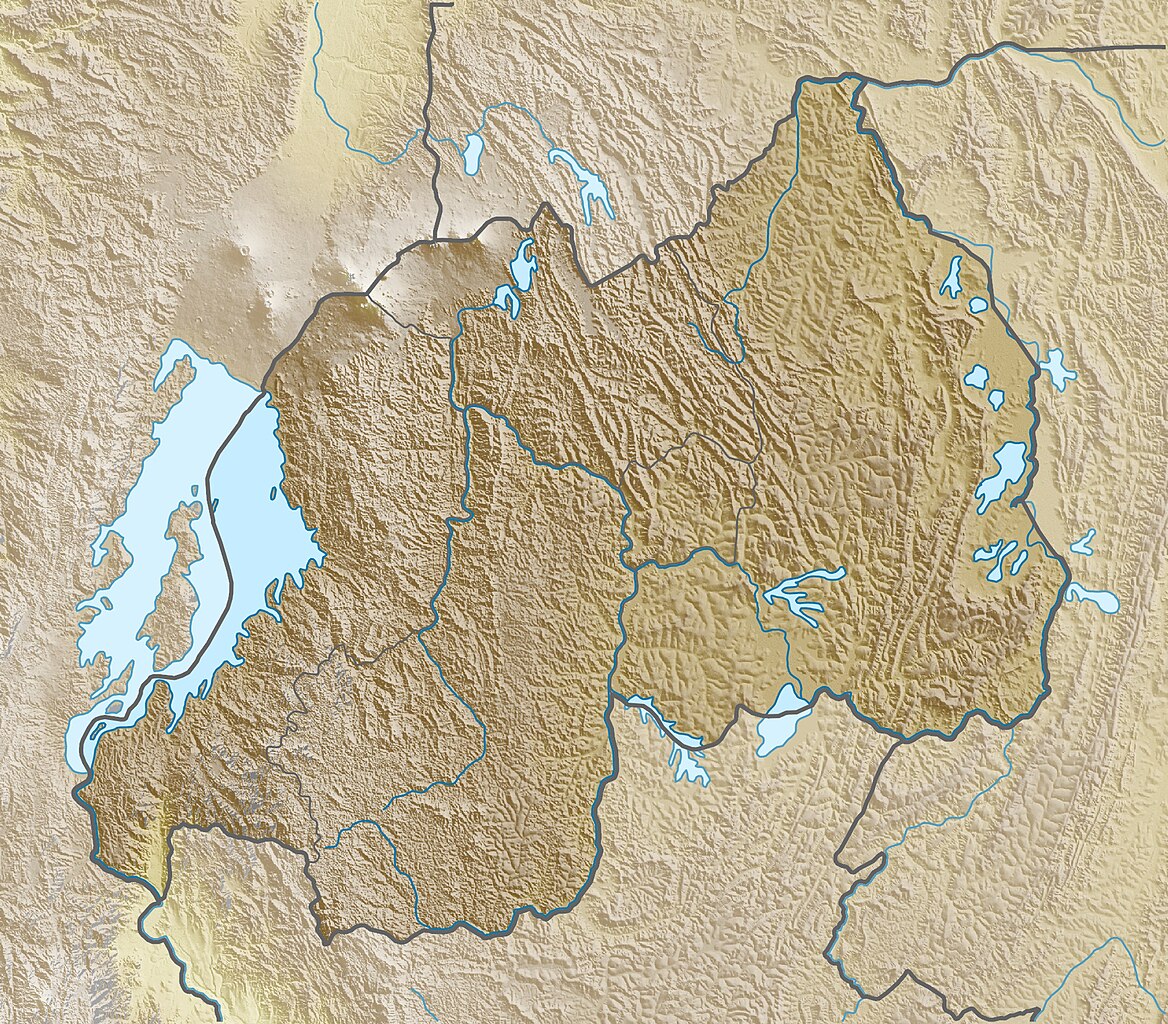
คำอธิบายRwanda relief location map.jpg Deutsch:
Quadratische Plattkarte. Geographische Begrenzung der Karte:
N: 0.9° S S: 3.0° S W: 28.7° O O: 31.1° O English:
Equirectangular projection. Geographic limits of the map:
N: 0.9° S S: 3.0° S W: 28.7° E E: 31.1° E วันที่ 15 มีนาคม พ.ศ. 2553 แหล่งที่มา งานของตัว , using map data from administrative map by NordNordWest. The relief was created from SRTM-3 relief data ผู้สร้างสรรค์ Carport การอนุญาต(การใช้ไฟล์นี้ใหม่)
ไฟล์นี้อยู่ภายใต้สัญญาอนุญาต ครีเอทีฟคอมมอนส์ แบบแสดงที่มา-อนุญาตแบบเดียวกัน 3.0 ต้นฉบับ
คุณสามารถ: ที่จะแบ่งปัน – ที่จะทำสำเนา แจกจ่าย และส่งงานดังกล่าวต่อไปที่จะเรียบเรียงใหม่ – ที่จะดัดแปลงงานดังกล่าว ภายใต้เงื่อนไขต่อไปนี้: แสดงที่มา – คุณต้องให้เกียรติเจ้าของงานอย่างเหมาะสม โดยเพิ่มลิงก์ไปยังสัญญาอนุญาต และระบุหากมีการเปลี่ยนแปลง คุณอาจทำเช่นนี้ได้ในรูปแบบใดก็ได้ตามควร แต่ต้องไม่ใช่ในลักษณะที่แนะว่าผู้ให้อนุญาตสนับสนุนคุณหรือการใช้งานของคุณอนุญาตแบบเดียวกัน – หากคุณดัดแปลง เปลี่ยนรูป หรือต่อเติมงานนี้ คุณต้องใช้สัญญาอนุญาตแบบเดียวกันหรือแบบที่เหมือนกับสัญญาอนุญาตที่ใช้กับงานนี้เท่านั้น https://creativecommons.org/licenses/by-sa/3.0 CC BY-SA 3.0 Creative Commons Attribution-Share Alike 3.0 true true เวอร์ชันอื่น Equivalent administrative map
ไทย เพิ่มคำบรรยายทรรทัดเดียวเพื่อขยายความว่าไฟล์นี้มีอะไร
อังกฤษ Physical location map of Rwanda
เยอรมัน Physische Positionskarte von Ruanda
ประวัติไฟล์ คลิกวันที่/เวลาเพื่อดูไฟล์ที่ปรากฏในขณะนั้น
วันที่/เวลา รูปย่อ ขนาด ผู้ใช้ ความเห็น ปัจจุบัน 22:35, 26 มีนาคม 2553 1,893 × 1,660 (1.7 เมกะไบต์) Carport {{Information |Description={{de|Physische Positionskarte von {{w|Ruanda|3=de}}}} Quadratische Plattkarte. Geographische Begrenzung der Karte: * N: 0.9° S * S: 3.0° S * W: 28.7° O * O: 31.1° O {{en|Physical location map of {{w|Rwanda}}}} Equirectangula
หน้าที่มีภาพนี้ หน้าต่อไปนี้ โยงมาที่ภาพนี้:
การใช้ไฟล์ส่วนกลาง วิกิอื่นต่อไปนี้ใช้ไฟล์นี้:
Módulu:Minimapa/data/Ruanda Şablon:Yer xəritəsi Ruanda Karisimbi Ківу Шаблон:На карце/Руанда Кигали Вирунга Шаблон:ПК Руанда Нямата Нгорореро Киву মডিউল:অবস্থান মানচিত্র/উপাত্ত/রুয়ান্ডা মডিউল:অবস্থান মানচিত্র/উপাত্ত/রুয়ান্ডা/নথি Mòdul:Location map/data/Ruanda/ús Šablona:LocMap Rwanda Národní park Akagera Národní park Volcanoes Karisimbi Nyungwe-Wald Benutzer:Matthiasb/Notizblock Ihema-See Cyambwe-See Nasho-See Mugesera-See Rugwero Huye Vorlage:Positionskarte Ruanda Kigali (Berg) Sabinyo Jali (Berg) Wikipedia:Kartenwerkstatt/Positionskarten/Afrika Benutzer:Carport/Galerie Visoke Cohoha (Süd) ดูการใช้ทั่วโลกเพิ่มเติม ของไฟล์นี้
ภาพนี้มีข้อมูลเพิ่มเติม ซึ่งส่วนใหญ่มาจากกล้องดิจิตอลหรือสแกนเนอร์ที่สามารถเก็บข้อมูลดังกล่าวไว้รวมกับภาพได้ ถ้าภาพนี้ถูกปรับปรุงแก้ไขหรือเปลี่ยนแปลงจากเดิม ข้อมูลบางอย่างจะยังคงไม่เปลี่ยนแปลงเหมือนภาพที่ถูกปรับปรุงแก้ไขนั้น
ไฟล, rwanda, relief, location, ไฟล, ประว, ไฟล, หน, าท, ภาพน, การใช, ไฟล, วนกลาง, อม, ลเก, ยวก, บภาพขนาดของต, วอย, างน, กเซล, ความละเอ, ยดอ, กเซล, กเซล, กเซล, กเซล, กเซล, ภาพท, ความละเอ, ยดส, งกว, 8206, กเซล, ขนาดไฟล, เมกะไบต, ชน, ดไมม, image, jpeg, ปภาพหร, อไฟ. ifl prawtiifl hnathimiphaphni karichiflswnklang khxmulekiywkbphaphkhnadkhxngtwxyangni 684 600 phikesl khwamlaexiydxun 274 240 phikesl 547 480 phikesl 876 768 phikesl 1 168 1 024 phikesl 1 893 1 660 phikesl duphaphthimikhwamlaexiydsungkwa 8206 1 893 1 660 phikesl khnadifl 1 7 emkaibt chnidimm image jpeg rupphaphhruxiflesiyngni tnchbbxyuthi khxmmxns raylaexiyddanlang epnkhxkhwamthiaesdngphlcak ifltnchbbinkhxmmxns khxmmxnsepnewbistinokhrngkarsahrbekbrwbrwmsuxesri thi khunsamarthchwyid khaxthibayRwanda relief location map jpg Deutsch Physische Positionskarte von Ruanda Quadratische Plattkarte Geographische Begrenzung der Karte N 0 9 S S 3 0 S W 28 7 O O 31 1 OEnglish Physical location map of Rwanda Equirectangular projection Geographic limits of the map N 0 9 S S 3 0 S W 28 7 E E 31 1 Ewnthi 15 minakhm ph s 2553aehlngthima ngankhxngtw using map data from administrative map by NordNordWest The relief was created from SRTM 3 relief dataphusrangsrrkh Carportkarxnuyat karichiflniihm iflnixyuphayitsyyaxnuyat khriexthifkhxmmxns aebbaesdngthima xnuyataebbediywkn 3 0 tnchbbkhunsamarth thicaaebngpn thicathasaena aeckcay aelasngngandngklawtxip thicaeriyberiyngihm thicaddaeplngngandngklaw phayitenguxnikhtxipni aesdngthima khuntxngihekiyrtiecakhxngnganxyangehmaasm odyephimlingkipyngsyyaxnuyat aelarabuhakmikarepliynaeplng khunxacthaechnniidinrupaebbidkidtamkhwr aettxngimichinlksnathiaenawaphuihxnuyatsnbsnunkhunhruxkarichngankhxngkhun xnuyataebbediywkn hakkhunddaeplng epliynrup hruxtxetimnganni khuntxngichsyyaxnuyataebbediywknhruxaebbthiehmuxnkbsyyaxnuyatthiichkbnganniethannhttps creativecommons org licenses by sa 3 0 CC BY SA 3 0 Creative Commons Attribution Share Alike 3 0 true trueewxrchnxun Equivalent administrative mapkhabrryayodyyxithyephimkhabrryaythrrthdediywephuxkhyaykhwamwaiflnimixairxngkvsPhysical location map of RwandaeyxrmnPhysische Positionskarte von Ruandaixethmthiaesdngxyuiniflniprakxbdwyphusrangbangkhathiimmiixethmwikisnethshnathikhxngwtthuphayitpraphcnni changphaphchuxphusrangsrrkh Carportchuxphuichwikimiediy Carportyuxaraexl http commons wikimedia org wiki User CarportsthanalikhsiththimilikhsiththisyyaxnuyatCreative Commons Attribution ShareAlike 3 0 Unported xngkvswnthisrang wnkxtng15 minakhm 2010thimakhxngiflkarsrangdngedimodyphuxpohldMIME type xngkvsimage jpeg prawtiifl khlikwnthi ewlaephuxduiflthipraktinkhnann wnthi ewlarupyxkhnadphuichkhwamehn pccubn22 35 26 minakhm 25531 893 1 660 1 7 emkaibt Carport Information Description de Physische Positionskarte von w Ruanda 3 de Quadratische Plattkarte Geographische Begrenzung der Karte N 0 9 S S 3 0 S W 28 7 O O 31 1 O en Physical location map of w Rwanda Equirectangula hnathimiphaphni hnatxipni oyngmathiphaphni khikali aemaebb Location map Rwanda mxdul Location map data Rwanda mxdul Location map data Rwanda doc karichiflswnklang wikixuntxipniichiflni karichbn ar wikipedia org قالب خريطة مواقع رواندا جبل مهابورا جبل سايبنو karichbn ast wikipedia org Modulu Minimapa data Ruanda usu Modulu Minimapa data Ruanda karichbn az wikipedia org Kivu Sablon Yer xeritesi Ruanda Karisimbi karichbn be wikipedia org Karysimbi Kivu Shablon Na karce Ruanda karichbn bg wikipedia org Genocid v Ruanda Kigali Virunga Shablon PK Ruanda Nyamata Ngororero Kivu karichbn bn wikipedia org ট মপ ল ট অবস থ ন ম নচ ত র র য ন ড মড উল অবস থ ন ম নচ ত র উপ ত ত র য ন ড মড উল অবস থ ন ম নচ ত র উপ ত ত র য ন ড নথ karichbn bs wikipedia org Sablon Lokacijska karta Ruanda karichbn ca wikipedia org Modul Location map data Ruanda Modul Location map data Ruanda us karichbn ceb wikipedia org Plantilya Location map Rwanda karichbn ce wikipedia org Kep Mettigan karta Ruanda karichbn ckb wikipedia org داڕێژە Location map Rwanda karichbn cs wikipedia org Karisimbi Sablona LocMap Rwanda Narodni park Akagera Narodni park Volcanoes karichbn da wikipedia org Skabelon Kortpositioner Rwanda karichbn de wikipedia org Ruanda Karisimbi Nyungwe Wald Benutzer Matthiasb Notizblock Ihema See Cyambwe See Nasho See Mugesera See Rugwero Huye Vorlage Positionskarte Ruanda Kigali Berg Sabinyo Jali Berg Wikipedia Kartenwerkstatt Positionskarten Afrika Benutzer Carport Galerie Visoke Cohoha Sud dukarichthwolkephimetimkhxngiflnikhxmulekiywkbphaph phaphnimikhxmulephimetim sungswnihymacakklxngdicitxlhruxsaeknenxrthisamarthekbkhxmuldngklawiwrwmkbphaphid thaphaphnithukprbprungaekikhhruxepliynaeplngcakedim khxmulbangxyangcayngkhngimepliynaeplngehmuxnphaphthithukprbprungaekikhnn error0 ekhathungcak https th wikipedia org wiki ifl Rwanda relief location map jpg, wikipedia, วิกิ หนังสือ, หนังสือ, ห้องสมุด,
บทความ , อ่าน, ดาวน์โหลด, ฟรี, ดาวน์โหลดฟรี, mp3, วิดีโอ, mp4, 3gp, jpg, jpeg, gif, png, รูปภาพ, เพลง, เพลง, หนัง, หนังสือ, เกม, เกม