azərbaycanca ∙ Deutsch (Sie-Form) ∙ čeština ∙ Deutsch ∙ sicilianu ∙ italiano ∙ русский ∙ română ∙ português ∙ English ∙ magyar ∙ Nederlands ∙ slovenščina ∙ polski ∙ latviešu ∙ македонски ∙ español ∙ فارسی ∙ français ∙ suomi ∙ עברית ∙ Plattdüütsch ∙ ქართული ∙ հայերեն ∙ বাংলা ∙ ไทย ∙ 日本語 ∙ 中文 ∙ 中文(简体) ∙ 中文(繁體) ∙ العربية ∙ +/−
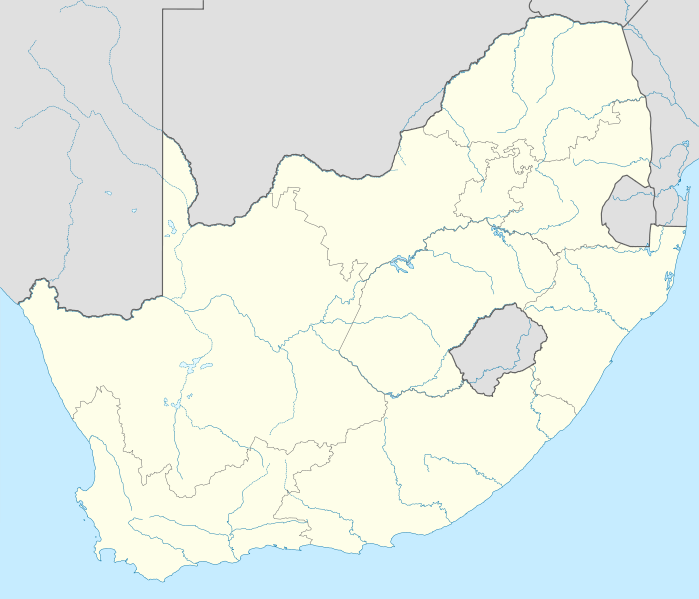
{{Information |Description= {{de|Positionskarte von Südafrika}} Quadratische Plattkarte, N-S-Streckung 110 %. Geographische Begrenzung der Karte: * N: 21.8° S * S: 35.2° S * W: 16.0° O * O: 33.2° O {{en|Location map of [[:en:South
ไฟล, south, africa, location, ไฟล, ประว, ไฟล, หน, าท, ภาพน, การใช, ไฟล, วนกลาง, อม, ลเก, ยวก, บภาพขนาดของต, วอย, าง, ของไฟล, กเซล, ความละเอ, ยดอ, กเซล, กเซล, กเซล, กเซล, กเซล, กเซล, ภาพท, ความละเอ, ยดส, งกว, 8206, ไฟล, กเซล, ขนาดไฟล, โลไบต, ปภาพหร, อไฟล, เส, ย. ifl prawtiifl hnathimiphaphni karichiflswnklang khxmulekiywkbphaphkhnadkhxngtwxyang PNG nikhxngifl SVG ni 699 599 phikesl khwamlaexiydxun 280 240 phikesl 560 480 phikesl 896 768 phikesl 1 195 1 024 phikesl 2 389 2 048 phikesl 2 031 1 741 phikesl duphaphthimikhwamlaexiydsungkwa 8206 ifl SVG 2 031 1 741 phikesl khnadifl 644 kiolibt rupphaphhruxiflesiyngni tnchbbxyuthi khxmmxns raylaexiyddanlang epnkhxkhwamthiaesdngphlcak ifltnchbbinkhxmmxns khxmmxnsepnewbistinokhrngkarsahrbekbrwbrwmsuxesri thi khunsamarthchwyid khwamyx khaxthibaySouth Africa location map svg Deutsch Positionskarte von Sudafrika Quadratische Plattkarte N S Streckung 110 Geographische Begrenzung der Karte N 21 8 S S 35 2 S W 16 0 O O 33 2 OEnglish Location map of South Africa Equirectangular projection N S stretching 110 Geographic limits of the map N 21 8 S S 35 2 S W 16 0 E E 33 2 Ewnthi 25 kumphaphnth ph s 2552aehlngthima own work using United States National Imagery and Mapping Agency data World Data Base II data South Africa Municipal Demarcation Boardphusrangsrrkh NordNordWestewxrchnxun Derivative work File South Africa relief location map svg aephnthinithuksranghruxphthnakhuncak Kartenwerkstatt hxngptibtikaraephnthi khxngwikiphiediyphasaeyxrmn sungkhunsamarthesnxaephnthiephuxphthnaidechnediywkn azerbaycanca Deutsch Sie Form cestina Deutsch sicilianu italiano russkij romană portugues English magyar Nederlands slovenscina polski latviesu makedonski espanol فارسی francais suomi עברית Plattduutsch ქართული հայերեն ব ল ithy 日本語 中文 中文 简体 中文 繁體 العربية karxnuyatichsiththi khapheca inthanaphuthuxlikhsiththikhxngphaphhruxsuxni xnuyatihichphaphhruxsuxniphayitenguxnikhtxipni xnuyatihkhdlxk aeckcayaela hruxddaeprexksarniphayitenguxnikhkhxngsyyaxnuyatexksaresrikhxngknu run 1 2 hruxrunid nbcaknithixxkodymulnithisxftaewresri odyimmiswnidhamaekikh immikhxkhwampkhnaaelapkhlng saenakhxngsyyaxnuyatrwmxyuinswnchux syyaxnuyatexksaresrikhxngknuhttp www gnu org copyleft fdl html GFDL GNU Free Documentation License true trueiflnixyuphayitsyyaxnuyatkhriexthifkhxmmxns run aesdngthima 3 0 tnchbbkhunsamarth thicaaebngpn thicathasaena aeckcay aelasngngandngklawtxip thicaeriyberiyngihm thicaddaeplngngandngklaw phayitenguxnikhtxipni aesdngthima khuntxngihekiyrtiecakhxngnganxyangehmaasm odyephimlingkipyngsyyaxnuyat aelarabuhakmikarepliynaeplng khunxacthaechnniidinrupaebbidkidtamkhwr aettxngimichinlksnathiaenawaphuihxnuyatsnbsnunkhunhruxkarichngankhxngkhunhttps creativecommons org licenses by 3 0 CC BY 3 0 Creative Commons Attribution 3 0 true truekhunsamartheluxksyyaxnuyatdngklawtamtxngkarkhabrryayodyyxithyephimkhabrryaythrrthdediywephuxkhyaykhwamwaiflnimixairixethmthiaesdngxyuiniflniprakxbdwyphusrangbangkhathiimmiixethmwikisnethsyuxaraexl https commons wikimedia org wiki user NordNordWestchuxphusrangsrrkh NordNordWestchuxphuichwikimiediy NordNordWeststhanalikhsiththimilikhsiththisyyaxnuyatGNU Free Documentation License version 1 2 or later xngkvsCreative Commons Attribution 3 0 Unported xngkvswnthisrang wnkxtng25 kumphaphnth 2009MIME type xngkvsimage svg xml prawtiifl khlikwnthi ewlaephuxduiflthipraktinkhnann wnthi ewlarupyxkhnadphuichkhwamehn pccubn23 18 28 kumphaphnth 25532 031 1 741 644 kiolibt NordNordWestupdate 03 39 26 kumphaphnth 25522 032 1 742 654 kiolibt NordNordWest Information Description de Positionskarte von Sudafrika Quadratische Plattkarte N S Streckung 110 Geographische Begrenzung der Karte N 21 8 S S 35 2 S W 16 0 O O 33 2 O en Location map of en South hnathimiphaphni hnatxipni oyngmathiphaphni aemnaekrtfich aemaebb Location map South Africa karichiflswnklang wikixuntxipniichiflni karichbn af wikipedia org Mapungubwe Oranjerivier Tafelberg Duiwelspiek Hartsrivier Kaapse floraryk Sjabloon Inligtingskas Berg Roggeveldberge Nasionale Vrouemonument Mont aux Sources Olifantsrivier Limpopo Toorberg berg Wieg van die Mensdom Sjabloon Inligtingskas Werelderfenisgebied Richtersveld Sterkfontein Sjabloon Liggingkaart Suid Afrika Grassridgedam Sondagsrivier Klein Visrivier Seweweekspoortpiek Kompasberg Thabana Ntlenyana Die Berg Kwaduma Ben Macdhui Sneeuberg Matroosberg Bloukranspas Moloporivier Modderrivier Kranskop koppie Kliprivier Vrystaat Mpumalanga grens Kliprivier Gauteng Kliprivier KwaZulu Natal Wilgerivier Vaal Majubaberg Groot Keirivier Keiskammarivier Leeukop Seinheuwel Soutkop Mokala Nasionale Park Rooinekpas Nonesisnek Oudebergpas Pitsengpas Potrivierpas Krokodilrivier Limpopo Krokodilrivier Mpumalanga dukarichthwolkephimetimkhxngiflnikhxmulekiywkbphaph phaphnimikhxmulephimetim sungswnihymacakklxngdicitxlhruxsaeknenxrthisamarthekbkhxmuldngklawiwrwmkbphaphid thaphaphnithukprbprungaekikhhruxepliynaeplngcakedim khxmulbangxyangcayngkhngimepliynaeplngehmuxnphaphthithukprbprungaekikhnnkhwamkwang2031 464khwamsung1740 957 ekhathungcak https th wikipedia org wiki ifl South Africa location map svg, wikipedia, วิกิ หนังสือ, หนังสือ, ห้องสมุด,