Quadratische Plattkarte, N-S-Streckung 102 %. Geographische Begrenzung der Karte:
N: 25.5° N
S: 0° N
W: 98.5° O
O: 122.5° O
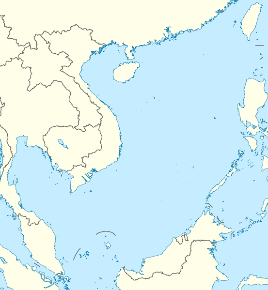
English: Location map of the South China Sea
Equirectangular projection, N/S stretching 102 %. Geographic limits of the map:
N: 25.5° N
S: 0° N
W: 98.5° E
E: 122.5° E
วันที่
แหล่งที่มา
own work, using World Data Base II data
ผู้สร้างสรรค์
NordNordWest
การอนุญาต (การใช้ไฟล์นี้ใหม่)
I have published this file as author NordNordWest under the "CC-BY-SA-3.0-DE" in Wikipedia. This means that free, commercial usage outside of Wikipedia is permitted under the following licence terms:
Online media:
The author "NordNordWest/Wikipedia" is named
A weblink to the original file is provided: //commons.wikimedia.org/wiki/File:South_China_Sea_location_map.svg
Please send me a specimen copy or the URL of the website where the file is used.
Please write an email to nnwest[at]web.de if you
need my postal address for sending a specimen copy
have further questions about the terms of the licence
PS: In case of refusal of the above terms the author reserves the right to take legal action.
This file has been released under a license which is incompatible with Facebook's licensing terms. It is not permitted to upload this file to Facebook.
azərbaycanca ∙ Deutsch (Sie-Form) ∙ čeština ∙ Deutsch ∙ sicilianu ∙ italiano ∙ русский ∙ română ∙ português ∙ English ∙ magyar ∙ Nederlands ∙ slovenščina ∙ polski ∙ latviešu ∙ македонски ∙ español ∙ فارسی ∙ français ∙ suomi ∙ עברית ∙ Plattdüütsch ∙ ქართული ∙ հայերեն ∙ বাংলা ∙ ไทย ∙ 日本語 ∙ 中文 ∙ 中文(简体) ∙ 中文(繁體) ∙ العربية ∙ +/−
ไฟล, south, china, location, ไฟล, ประว, ไฟล, หน, าท, ภาพน, การใช, ไฟล, วนกลางขนาดของต, วอย, าง, ของไฟล, กเซล, ความละเอ, ยดอ, กเซล, กเซล, กเซล, กเซล, กเซล, กเซล, ภาพท, ความละเอ, ยดส, งกว, 8206, ไฟล, กเซล, ขนาดไฟล, โลไบต, ปภาพหร, อไฟล, เส, ยงน, นฉบ, บอย, คอมมอนส. ifl prawtiifl hnathimiphaphni karichiflswnklangkhnadkhxngtwxyang PNG nikhxngifl SVG ni 553 599 phikesl khwamlaexiydxun 221 240 phikesl 443 480 phikesl 709 768 phikesl 945 1 024 phikesl 1 890 2 048 phikesl 1 134 1 229 phikesl duphaphthimikhwamlaexiydsungkwa 8206 ifl SVG 1 134 1 229 phikesl khnadifl 617 kiolibt rupphaphhruxiflesiyngni tnchbbxyuthi khxmmxns raylaexiyddanlang epnkhxkhwamthiaesdngphlcak ifltnchbbinkhxmmxns khxmmxnsepnewbistinokhrngkarsahrbekbrwbrwmsuxesri thi khunsamarthchwyid Quần đảo Hoang Sa khwamyx khaxthibaySouth China Sea location map svg Deutsch Positionskarte des Sudchinesischen Meers Quadratische Plattkarte N S Streckung 102 Geographische Begrenzung der Karte N 25 5 N S 0 N W 98 5 O O 122 5 OEnglish Location map of the South China Sea Equirectangular projection N S stretching 102 Geographic limits of the map N 25 5 N S 0 N W 98 5 E E 122 5 Ewnthi 17 singhakhm ph s 2554aehlngthima own work using World Data Base II dataphusrangsrrkh NordNordWestkarxnuyat karichiflniihm I have published this file as author NordNordWest under the CC BY SA 3 0 DE in Wikipedia This means that free commercial usage outside of Wikipedia is permitted under the following licence terms Online media The author NordNordWest Wikipedia is named A weblink to the original file is provided commons wikimedia org wiki File South China Sea location map svg A copy of or the Uniform Resource Identifier https creativecommons org licenses by sa 3 0 de legalcode for this licence with every copy Print media The author NordNordWest Wikipedia is named A copy of or the Uniform Resource Identifier https creativecommons org licenses by sa 3 0 de legalcode for this licence with every copyPlease send me a specimen copy or the URL of the website where the file is used Please write an email to nnwest at web de if you need my postal address for sending a specimen copy have further questions about the terms of the licencePS In case of refusal of the above terms the author reserves the right to take legal action This file has been released under a license which is incompatible with Facebook s licensing terms It is not permitted to upload this file to Facebook iflnixyuphayitsyyaxnuyat khriexthifkhxmmxns aebbaesdngthima xnuyataebbediywkn 3 0 khxngpraethseyxrmnikhunsamarth thicaaebngpn thicathasaena aeckcay aelasngngandngklawtxip thicaeriyberiyngihm thicaddaeplngngandngklaw phayitenguxnikhtxipni aesdngthima khuntxngihekiyrtiecakhxngnganxyangehmaasm odyephimlingkipyngsyyaxnuyat aelarabuhakmikarepliynaeplng khunxacthaechnniidinrupaebbidkidtamkhwr aettxngimichinlksnathiaenawaphuihxnuyatsnbsnunkhunhruxkarichngankhxngkhun xnuyataebbediywkn hakkhunddaeplng epliynrup hruxtxetimnganni khuntxngichsyyaxnuyataebbediywknhruxaebbthiehmuxnkbsyyaxnuyatthiichkbnganniethannhttps creativecommons org licenses by sa 3 0 de deed en CC BY SA 3 0 de Creative Commons Attribution Share Alike 3 0 de true true iflnixyuphayitsyyaxnuyat khriexthifkhxmmxns aebbaesdngthima xnuyataebbediywkn 3 0 tnchbbkhunsamarth thicaaebngpn thicathasaena aeckcay aelasngngandngklawtxip thicaeriyberiyngihm thicaddaeplngngandngklaw phayitenguxnikhtxipni aesdngthima khuntxngihekiyrtiecakhxngnganxyangehmaasm odyephimlingkipyngsyyaxnuyat aelarabuhakmikarepliynaeplng khunxacthaechnniidinrupaebbidkidtamkhwr aettxngimichinlksnathiaenawaphuihxnuyatsnbsnunkhunhruxkarichngankhxngkhun xnuyataebbediywkn hakkhunddaeplng epliynrup hruxtxetimnganni khuntxngichsyyaxnuyataebbediywknhruxaebbthiehmuxnkbsyyaxnuyatthiichkbnganniethannhttps creativecommons org licenses by sa 3 0 CC BY SA 3 0 Creative Commons Attribution Share Alike 3 0 true true aephnthinithuksranghruxphthnakhuncak Kartenwerkstatt hxngptibtikaraephnthi khxngwikiphiediyphasaeyxrmn sungkhunsamarthesnxaephnthiephuxphthnaidechnediywkn azerbaycanca Deutsch Sie Form cestina Deutsch sicilianu italiano russkij romană portugues English magyar Nederlands slovenscina polski latviesu makedonski espanol فارسی francais suomi עברית Plattduutsch ქართული հայերեն ব ল ithy 日本語 中文 中文 简体 中文 繁體 العربية khabrryayodyyxithyephimkhabrryaythrrthdediywephuxkhyaykhwamwaiflnimixairixethmthiaesdngxyuiniflniprakxbdwyphusrangbangkhathiimmiixethmwikisnethsyuxaraexl https commons wikimedia org wiki user NordNordWestchuxphuichwikimiediy NordNordWestchuxphusrangsrrkh NordNordWeststhanalikhsiththimilikhsiththisyyaxnuyatCreative Commons Attribution ShareAlike 3 0 Germany xngkvsCreative Commons Attribution ShareAlike 3 0 Unported xngkvswnthisrang wnkxtng17 singhakhm 2011 prawtiifl khlikwnthi ewlaephuxduiflthipraktinkhnann wnthi ewlarupyxkhnadphuichkhwamehn pccubn01 56 18 singhakhm 25541 134 1 229 617 kiolibt NordNordWest int filedesc Information Description de Positionskarte des Sudchinesischen Meers Quadratische Plattkarte N S Streckung 102 Geographische Begrenzung der Karte N 25 5 N S 0 N W 98 5 O O hnathimiphaphni hnatxipni oyngmathiphaphni sncha ekaaolsin mxdul Location map data South China Sea mxdul Location map data South China Sea doc karichiflswnklang wikixuntxipniichiflni karichbn an wikipedia org Plantilla Mapa de localizacion Mar de China meridional karichbn ar wikipedia org هاينان قالب Location map South China Sea جزر تشونغشا karichbn az wikipedia org Sablon Yer xeritesi Cenubi Cin denizi karichbn ban wikipedia org Mal Location map Segara Cina Kelod karichbn be wikipedia org Paraselskiya astravy Shablon Na karce Paydnyova Kitajskae mora karichbn bn wikipedia org মড উল অবস থ ন ম নচ ত র উপ ত ত দক ষ ণ চ ন স গর মড উল অবস থ ন ম নচ ত র উপ ত ত দক ষ ণ চ ন স গর নথ karichbn ceb wikipedia org Plantilya Location map South China Sea Kabupaten Natuna karichbn de wikipedia org Spratly Inseln Wikipedia Kartenwerkstatt Positionskarten Andere Vorlage Positionskarte Sudchinesisches Meer Wikipedia Kartenwerkstatt Archiv 2011 08 Liste der Flughafen in der Republik China karichbn en wikipedia org Kaohsiung Paracel Islands Spratly Islands Hainan Weizhou Island Pratas Island Natuna Regency Perhentian Islands Woody Island South China Sea Batam Third Taiwan Strait Crisis Anambas Islands Regency Taiping Island Redang Island Lang Tengah Island Scarborough Shoal Kapas Island Kalayaan Palawan Trường Sa township Tenggol Island Thitu Island Bidong Island List of airports in Taiwan Tree Island South China Sea Rocky Island South China Sea Triton Island Bombay Reef Natuna Besar Sansha 1967 USS Forrestal fire Spratly Island Johnson South Reef Subi Reef dukarichthwolkephimetimkhxngiflni ekhathungcak https th wikipedia org wiki ifl South China Sea location map svg, wikipedia, วิกิ หนังสือ, หนังสือ, ห้องสมุด,