ข้อมูลเพิ่มเติม This map is part of a series of location maps with unified standards: SVG as file format, standardised colours and name scheme. The boundaries on these maps always show the de facto situation and do not imply any endorsement or acceptance. In case of changes of the shown area the file is updated. The old version will be uploaded as a new file and thus is still available.
วันที่
แหล่งที่มา
Own work using:
United States National Imagery and Mapping Agency data
azərbaycanca ∙ Deutsch (Sie-Form) ∙ čeština ∙ Deutsch ∙ sicilianu ∙ italiano ∙ русский ∙ română ∙ português ∙ English ∙ magyar ∙ Nederlands ∙ slovenščina ∙ polski ∙ latviešu ∙ македонски ∙ español ∙ فارسی ∙ français ∙ suomi ∙ עברית ∙ Plattdüütsch ∙ ქართული ∙ հայերեն ∙ বাংলা ∙ ไทย ∙ 日本語 ∙ 中文 ∙ 中文(简体) ∙ 中文(繁體) ∙ العربية ∙ +/−
การอนุญาตใช้สิทธิ
Usage of this file with:
Map: NordNordWest, Licence: Creative Commons by-sa-3.0 de
explanatory notes: Legally binding is only the full legalcode. For a free usage I recommend to respect the following licence conditions: 1. Provide my name as given above: NordNordWest, 2. a copy of, or the URI for, the applicable license: https://creativecommons.org/licenses/by-sa/3.0/de/legalcode, 3. the title of the work, 4. in the case of an adaptation, a credit identifying the use of the work in the adaptation. This license and the rights granted hereunder will terminate automatically upon any breach by you of the terms of this license. Any of the above conditions can be waived if you get permission from the copyright holder. If you have questions or wish differing conditions, please contact me through nnwestt-online.de or my discussion page
This file has been released under a license which is incompatible with Facebook's licensing terms. It is not permitted to upload this file to Facebook.
Reverted to version as of 13:47, 25 February 2020 (UTC) South Sudan revert back to 10 States. https://www.aljazeera.com/news/2020/02/6-years-war-peace-finally-south-sudan-200223114919537.html
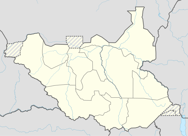
== {{int:filedesc}} == {{Information |Description= {{de|1=Positionskarte von Südsudan}} {{en|1=Location map of South Sudan}} {{Location map series N |stretching=101 |top=12.7 |bottom=3.2 |left=23.15 |right=36.4 }} |Source={{Own using}} * United States...
ไฟล, south, sudan, location, ไฟล, ประว, ไฟล, หน, าท, ภาพน, การใช, ไฟล, วนกลาง, อม, ลเก, ยวก, บภาพขนาดของต, วอย, าง, ของไฟล, กเซล, ความละเอ, ยดอ, กเซล, กเซล, กเซล, กเซล, กเซล, กเซล, ภาพท, ความละเอ, ยดส, งกว, 8206, ไฟล, กเซล, ขนาดไฟล, โลไบต, ปภาพหร, อไฟล, เส, ยง. ifl prawtiifl hnathimiphaphni karichiflswnklang khxmulekiywkbphaphkhnadkhxngtwxyang PNG nikhxngifl SVG ni 800 581 phikesl khwamlaexiydxun 320 232 phikesl 640 465 phikesl 1 024 743 phikesl 1 280 929 phikesl 2 560 1 858 phikesl 1 561 1 133 phikesl duphaphthimikhwamlaexiydsungkwa 8206 ifl SVG 1 561 1 133 phikesl khnadifl 201 kiolibt rupphaphhruxiflesiyngni tnchbbxyuthi khxmmxns raylaexiyddanlang epnkhxkhwamthiaesdngphlcak ifltnchbbinkhxmmxns khxmmxnsepnewbistinokhrngkarsahrbekbrwbrwmsuxesri thi khunsamarthchwyid khwamyx khaxthibaySouth Sudan adm location map svg Deutsch Positionskarte von Sudsudan English Location map of South Sudan Equirectangular projection vertical stretching 101 Border coordinates12 723 15 36 43 2 khxmulephimetim This map is part of a series of location maps with unified standards SVG as file format standardised colours and name scheme The boundaries on these maps always show the de facto situation and do not imply any endorsement or acceptance In case of changes of the shown area the file is updated The old version will be uploaded as a new file and thus is still available wnthi 12 phvscikayn ph s 2557aehlngthima Own work using United States National Imagery and Mapping Agency data World Data Base II data radiotamazuj orgphusrangsrrkh NordNordWestewxrchnxun 2011 2015 2015 2020 aephnthinithuksranghruxphthnakhuncak Kartenwerkstatt hxngptibtikaraephnthi khxngwikiphiediyphasaeyxrmn sungkhunsamarthesnxaephnthiephuxphthnaidechnediywkn azerbaycanca Deutsch Sie Form cestina Deutsch sicilianu italiano russkij romană portugues English magyar Nederlands slovenscina polski latviesu makedonski espanol فارسی francais suomi עברית Plattduutsch ქართული հայերեն ব ল ithy 日本語 中文 中文 简体 中文 繁體 العربية karxnuyatichsiththi Usage of this file with Map NordNordWest Licence Creative Commons by sa 3 0 de explanatory notes Legally binding is only the full legalcode For a free usage I recommend to respect the following licence conditions 1 Provide my name as given above NordNordWest 2 a copy of or the URI for the applicable license https creativecommons org licenses by sa 3 0 de legalcode 3 the title of the work 4 in the case of an adaptation a credit identifying the use of the work in the adaptation This license and the rights granted hereunder will terminate automatically upon any breach by you of the terms of this license Any of the above conditions can be waived if you get permission from the copyright holder If you have questions or wish differing conditions please contact me through span class nowrap nnwestt online de span or my discussion pageiflnixyuphayitsyyaxnuyat khriexthifkhxmmxns aebbaesdngthima xnuyataebbediywkn 3 0 khxngpraethseyxrmnikaraesdngthima Karte NordNordWest Lizenz Creative Commons by sa 3 0 dekhunsamarth thicaaebngpn thicathasaena aeckcay aelasngngandngklawtxip thicaeriyberiyngihm thicaddaeplngngandngklaw phayitenguxnikhtxipni aesdngthima khuntxngihekiyrtiecakhxngnganxyangehmaasm odyephimlingkipyngsyyaxnuyat aelarabuhakmikarepliynaeplng khunxacthaechnniidinrupaebbidkidtamkhwr aettxngimichinlksnathiaenawaphuihxnuyatsnbsnunkhunhruxkarichngankhxngkhun xnuyataebbediywkn hakkhunddaeplng epliynrup hruxtxetimnganni khuntxngichsyyaxnuyataebbediywknhruxaebbthiehmuxnkbsyyaxnuyatthiichkbnganniethannhttps creativecommons org licenses by sa 3 0 de deed en CC BY SA 3 0 de Creative Commons Attribution Share Alike 3 0 de true true This file has been released under a license which is incompatible with Facebook s licensing terms It is not permitted to upload this file to Facebook khabrryayodyyxithyephimkhabrryaythrrthdediywephuxkhyaykhwamwaiflnimixairrsesiyMestoraspolozhenie na karte Yuzhnogo SudanayuekhrnRoztashuvannya na mapi Pivdennogo SudanuixethmthiaesdngxyuiniflniprakxbdwysthanalikhsiththimilikhsiththisyyaxnuyatCreative Commons Attribution ShareAlike 3 0 Germany xngkvswnthisrang wnkxtng12 phvscikayn 2014 prawtiifl khlikwnthi ewlaephuxduiflthipraktinkhnann wnthi ewlarupyxkhnadphuichkhwamehn pccubn01 25 24 emsayn 25631 561 1 133 201 kiolibt LeviaveryAdded Pibor and Ruweng Administrative Areas 23 16 25 kumphaphnth 25631 561 1 133 199 kiolibt Myrabert01Reverted to version as of 13 47 25 February 2020 UTC South Sudan revert back to 10 States https www aljazeera com news 2020 02 6 years war peace finally south sudan 200223114919537 html 21 39 25 kumphaphnth 25631 561 1 133 213 kiolibt NordNordWestReverted to version as of 14 39 13 August 2016 UTC no reason for this revert 20 47 25 kumphaphnth 25631 561 1 133 199 kiolibt Myrabert01Reverted to version as of 18 18 12 November 2014 UTC South Sudan revert back to 10 States 21 39 13 singhakhm 25591 561 1 133 213 kiolibt NordNordWestcorr 19 31 12 singhakhm 25591 561 1 133 214 kiolibt NordNordWestupd new states 01 18 13 phvscikayn 25571 561 1 133 199 kiolibt NordNordWest int filedesc Information Description de 1 Positionskarte von Sudsudan en 1 Location map of South Sudan Location map series N stretching 101 top 12 7 bottom 3 2 left 23 15 right 36 4 Source Own using United States hnathimiphaphni hnatxipni oyngmathiphaphni cuba malakal mxdul Location map data South Sudan mxdul Location map data South Sudan doc karichiflswnklang wikixuntxipniichiflni karichbn af wikipedia org Joeba Rokon Yei Wau Ramciel karichbn an wikipedia org Plantilla Mapa de localizacion Sudan d o Sud Juba karichbn ast wikipedia org Juba Plantia Minimapa Sudan del Sur Universida de Juba Sudd Aeropuertu de Wau karichbn av wikipedia org Shablon BakIKarta Bakdaseb Sudan karichbn azb wikipedia org جوبا یامبیو اکوبو گونئی سودان کوایوک قوقریال بنتیو اداک karichbn az wikipedia org Cuba Ramsel Sablon Yer xeritesi Cenubi Sudan karichbn be wikipedia org Dzhuba Shablon Na karce Paydnyovy Sudan karichbn bg wikipedia org Dzhuba Boma nacionalen park Uau Uarab grad Malakal Sobat Bahr al Gazal reka Bandingilo Yuzhen nacionalen park Nimule nacionalen park Rumbek Shablon PK Yuzhen Sudan karichbn bn wikipedia org ট মপ ল ট অবস থ ন ম নচ ত র দক ষ ণ স দ ন জ ব মড উল অবস থ ন ম নচ ত র উপ ত ত দক ষ ণ স দ ন মড উল অবস থ ন ম নচ ত র উপ ত ত দক ষ ণ স দ ন নথ karichbn bs wikipedia org Sablon Lokacijska karta Juzni Sudan karichbn ceb wikipedia org Plantilya Location map South Sudan Lau Kobo Keni Rongu Raja pagklaro Lokuta Kalli dukarichthwolkephimetimkhxngiflnikhxmulekiywkbphaph phaphnimikhxmulephimetim sungswnihymacakklxngdicitxlhruxsaeknenxrthisamarthekbkhxmuldngklawiwrwmkbphaphid thaphaphnithukprbprungaekikhhruxepliynaeplngcakedim khxmulbangxyangcayngkhngimepliynaeplngehmuxnphaphthithukprbprungaekikhnnkhwamkwang1561 41khwamsung1133 275 ekhathungcak https th wikipedia org wiki ifl South Sudan adm location map svg, wikipedia, วิกิ หนังสือ, หนังสือ, ห้องสมุด,