This is one of the images forming part of the Valued image set: Locator maps of the Ceremonial counties of England on Wikimedia Commons. The image set has been assessed under the valued image set criteria and is considered the most valued set on Commons within the scope:
Locator maps of the Ceremonial counties of England
You can see its nomination at Commons:Valued image candidates/Locator maps of English ceremonial counties.
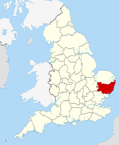
== Summary == {{Information |Description=Location of the ceremonial county of Suffolk within England. |Source=Ordnance Survey [https://www.ordnancesurvey.co.uk/opendatadownload/products.html OpenData]: *County boundarie
ไฟล, suffolk, locator, 2010, ไฟล, ประว, ไฟล, หน, าท, ภาพน, การใช, ไฟล, วนกลางขนาดของต, วอย, าง, ของไฟล, กเซล, ความละเอ, ยดอ, กเซล, กเซล, กเซล, กเซล, กเซล, กเซล, ภาพท, ความละเอ, ยดส, งกว, 8206, ไฟล, กเซล, ขนาดไฟล, โลไบต, ปภาพหร, อไฟล, เส, ยงน, นฉบ, บอย, คอมมอนส. ifl prawtiifl hnathimiphaphni karichiflswnklangkhnadkhxngtwxyang PNG nikhxngifl SVG ni 494 600 phikesl khwamlaexiydxun 198 240 phikesl 395 480 phikesl 633 768 phikesl 843 1 024 phikesl 1 687 2 048 phikesl 1 108 1 345 phikesl duphaphthimikhwamlaexiydsungkwa 8206 ifl SVG 1 108 1 345 phikesl khnadifl 302 kiolibt rupphaphhruxiflesiyngni tnchbbxyuthi khxmmxns raylaexiyddanlang epnkhxkhwamthiaesdngphlcak ifltnchbbinkhxmmxns khxmmxnsepnewbistinokhrngkarsahrbekbrwbrwmsuxesri thi khunsamarthchwyid khwamyx khaxthibaySuffolk UK locator map 2010 svg Location of the ceremonial county of Suffolk within England wnthi 23 phvscikayn ph s 2553 aehlngthima Ordnance Survey OpenData County boundaries and GB coastline National Geospatial Intelligence Agency Irish French and Isle of Man coastlines Lough Neagh and Irish border phusrangsrrkh Nilfanion karxnuyatichsiththi khapheca inthanaphuthuxlikhsiththikhxngphaphhruxsuxni xnuyatihichphaphhruxsuxniphayitenguxnikhtxipniiflnixyuphayitsyyaxnuyat khriexthifkhxmmxns aebbaesdngthima xnuyataebbediywkn 3 0 tnchbbkhunsamarth thicaaebngpn thicathasaena aeckcay aelasngngandngklawtxip thicaeriyberiyngihm thicaddaeplngngandngklaw phayitenguxnikhtxipni aesdngthima khuntxngihekiyrtiecakhxngnganxyangehmaasm odyephimlingkipyngsyyaxnuyat aelarabuhakmikarepliynaeplng khunxacthaechnniidinrupaebbidkidtamkhwr aettxngimichinlksnathiaenawaphuihxnuyatsnbsnunkhunhruxkarichngankhxngkhun xnuyataebbediywkn hakkhunddaeplng epliynrup hruxtxetimnganni khuntxngichsyyaxnuyataebbediywknhruxaebbthiehmuxnkbsyyaxnuyatthiichkbnganniethannhttps creativecommons org licenses by sa 3 0 CC BY SA 3 0 Creative Commons Attribution Share Alike 3 0 true true xnuyatihkhdlxk aeckcayaela hruxddaeprexksarniphayitenguxnikhkhxngsyyaxnuyatexksaresrikhxngknu run 1 2 hruxrunid nbcaknithixxkodymulnithisxftaewresri odyimmiswnidhamaekikh immikhxkhwampkhnaaelapkhlng saenakhxngsyyaxnuyatrwmxyuinswnchux syyaxnuyatexksaresrikhxngknuhttp www gnu org copyleft fdl html GFDL GNU Free Documentation License true truekhunsamartheluxksyyaxnuyatdngklawtamtxngkar This is one of the images forming part of the Valued image set Locator maps of the Ceremonial counties of England on Wikimedia Commons The image set has been assessed under the valued image set criteria and is considered the most valued set on Commons within the scope Locator maps of the Ceremonial counties of England You can see its nomination at Commons Valued image candidates Locator maps of English ceremonial counties khabrryayodyyxithyephimkhabrryaythrrthdediywephuxkhyaykhwamwaiflnimixairixethmthiaesdngxyuiniflniprakxbdwyphusrangbangkhathiimmiixethmwikisnethschuxphuichwikimiediy Nilfanionyuxaraexl https commons wikimedia org wiki user Nilfanionchuxphusrangsrrkh NilfanionsthanalikhsiththimilikhsiththisyyaxnuyatGNU Free Documentation License version 1 2 or later nbsp xngkvsCreative Commons Attribution ShareAlike 3 0 Unported nbsp xngkvswnthisrang wnkxtng23 phvscikayn 2010 prawtiifl khlikwnthi ewlaephuxduiflthipraktinkhnann wnthi ewlarupyxkhnadphuichkhwamehn pccubn05 45 24 phvscikayn 25531 108 1 345 302 kiolibt Nilfanion Summary Information Description Location of the ceremonial county of Suffolk within England Source Ordnance Survey https www ordnancesurvey co uk opendatadownload products html OpenData County boundarie hnathimiphaphni hnatxipni oyngmathiphaphni sffxlk karichiflswnklang wikixuntxipniichiflni karichbn af wikipedia org Suffolk karichbn an wikipedia org Suffolk karichbn ar wikipedia org سوفولك karichbn arz wikipedia org سوفولك karichbn ast wikipedia org Suffolk karichbn be tarask wikipedia org Safalk karichbn bg wikipedia org Sfolk Kategoriya Sfolk karichbn ca wikipedia org Suffolk Llista de comtats cerimonials d Anglaterra karichbn ceb wikipedia org Suffolk kondado karichbn ckb wikipedia org سافک karichbn cs wikipedia org Suffolk karichbn en wikipedia org Suffolk Benacre Broad Suffolk Coast and Heaths Gipping East Suffolk county Needham Market Hintlesham Metfield Bramford Moulton Suffolk River Yox Mellis Rushmere St Andrew Great Bricett Claydon Suffolk Newmarket Ridge Bawdsey Stowupland Mendlesham Great Wood Hill Ingham Suffolk Troston Melton Suffolk Westerfield Rickinghall Badley Mickley Green Whepstead Yaxley Suffolk Syleham Rickinghall Superior Template Suffolk geo stub Wenhaston The Saints Suffolk Ampton Ashbocking Ashfield cum Thorpe dukarichthwolkephimetimkhxngiflni ekhathungcak https th wikipedia org wiki ifl Suffolk UK locator map 2010 svg, wikipedia, วิกิ หนังสือ, หนังสือ, ห้องสมุด,