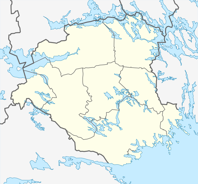
{{Information |Description={{en|1=Location map of Södermanland county in Sweden Equirectangular projection, N/S stretching 195 %. Geographic limits of the map: * N: 59.60° N * S: 58.50° N * W: 15.50° E * E: 17.80° E}} {{de|1=Positionskarte von Söd
ไฟล, sweden, södermanland, location, ไฟล, ประว, ไฟล, หน, าท, ภาพน, การใช, ไฟล, วนกลางขนาดของต, วอย, าง, ของไฟล, กเซล, ความละเอ, ยดอ, กเซล, กเซล, กเซล, กเซล, กเซล, กเซล, ภาพท, ความละเอ, ยดส, งกว, 8206, ไฟล, กเซล, ขนาดไฟล, โลไบต, ปภาพหร, อไฟล, เส, ยงน, นฉบ, บอย,. ifl prawtiifl hnathimiphaphni karichiflswnklangkhnadkhxngtwxyang PNG nikhxngifl SVG ni 644 599 phikesl khwamlaexiydxun 258 240 phikesl 516 480 phikesl 825 768 phikesl 1 100 1 024 phikesl 2 200 2 048 phikesl 839 781 phikesl duphaphthimikhwamlaexiydsungkwa 8206 ifl SVG 839 781 phikesl khnadifl 218 kiolibt rupphaphhruxiflesiyngni tnchbbxyuthi khxmmxns raylaexiyddanlang epnkhxkhwamthiaesdngphlcak ifltnchbbinkhxmmxns khxmmxnsepnewbistinokhrngkarsahrbekbrwbrwmsuxesri thi khunsamarthchwyid khwamyx khaxthibaySweden Sodermanland location map svg English Location map of Sodermanland county in Sweden Equirectangular projection N S stretching 195 Geographic limits of the map N 59 60 N S 58 50 N W 15 50 E E 17 80 E Deutsch Positionskarte von Sodermanland lan in Schweden Quadratische Plattkarte N S Streckung 195 Geographische Begrenzung der Karte N 59 60 N S 58 50 N W 15 50 O O 17 80 Ownthi 29 mkrakhm ph s 2552aehlngthima ngankhxngtwphusrangsrrkh Erik Frohne karxnuyatichsiththi khapheca inthanaphuthuxlikhsiththikhxngphaphhruxsuxni xnuyatihichphaphhruxsuxniphayitenguxnikhtxipni xnuyatihkhdlxk aeckcayaela hruxddaeprexksarniphayitenguxnikhkhxngsyyaxnuyatexksaresrikhxngknu run 1 2 hruxrunid nbcaknithixxkodymulnithisxftaewresri odyimmiswnidhamaekikh immikhxkhwampkhnaaelapkhlng saenakhxngsyyaxnuyatrwmxyuinswnchux syyaxnuyatexksaresrikhxngknuhttp www gnu org copyleft fdl html GFDL GNU Free Documentation License true trueiflnixyuphayitsyyaxnuyatkhriexthifkhxmmxns run aesdngthima 3 0 tnchbbkhunsamarth thicaaebngpn thicathasaena aeckcay aelasngngandngklawtxip thicaeriyberiyngihm thicaddaeplngngandngklaw phayitenguxnikhtxipni aesdngthima khuntxngihekiyrtiecakhxngnganxyangehmaasm odyephimlingkipyngsyyaxnuyat aelarabuhakmikarepliynaeplng khunxacthaechnniidinrupaebbidkidtamkhwr aettxngimichinlksnathiaenawaphuihxnuyatsnbsnunkhunhruxkarichngankhxngkhunhttps creativecommons org licenses by 3 0 CC BY 3 0 Creative Commons Attribution 3 0 true truekhunsamartheluxksyyaxnuyatdngklawtamtxngkarkhabrryayodyyxithyephimkhabrryaythrrthdediywephuxkhyaykhwamwaiflnimixairixethmthiaesdngxyuiniflniprakxbdwyphusrangbangkhathiimmiixethmwikisnethschuxphusrangsrrkh Erik Frohnechuxphuichwikimiediy Erik Frohneyuxaraexl http commons wikimedia org wiki User Erik FrohnesthanalikhsiththimilikhsiththisyyaxnuyatGNU Free Documentation License version 1 2 or later xngkvsCreative Commons Attribution 3 0 Unported xngkvswnthisrang wnkxtng29 mkrakhm 2009thimakhxngiflkarsrangdngedimodyphuxpohldMIME type xngkvsimage svg xml prawtiifl khlikwnthi ewlaephuxduiflthipraktinkhnann wnthi ewlarupyxkhnadphuichkhwamehn pccubn21 11 29 mkrakhm 2552839 781 218 kiolibt Erik Frohne Information Description en 1 Location map of Sodermanland county in Sweden Equirectangular projection N S stretching 195 Geographic limits of the map N 59 60 N S 58 50 N W 15 50 E E 17 80 E de 1 Positionskarte von Sod hnathimiphaphni hnatxipni oyngmathiphaphni exskilsthuxna karichiflswnklang wikixuntxipniichiflni karichbn ar wikipedia org قالب Location map Sweden Sodermanland karichbn bar wikipedia org Flen Vorlog Positionskarte Schweden Sodermanland karichbn bg wikipedia org Mariefred Eskilstyuna Torshhela Flen Malmshoping Gnesta Katrineholm Nyushoping Okselosund Strengnes Trusa Vagnherad Vingoker Shablon PK Shveciya Sodermanland karichbn ceb wikipedia org Plantilya Location map Sweden Sodermanland Fogdon karichbn da wikipedia org Katrineholm Skabelon Kortpositioner Sverige Sodermanland Halleforsnas Alberga Sverige Aspa Nykopings kommun Hedlandet og Asgard Abborrberget karichbn de wikipedia org Mariefred Eskilstuna Nykoping Strangnas Katrineholm Vingaker Trosa Gnesta Torshalla Tunavallen Flen Akers styckebruk Oxelosund Baven Tvaren Wikipedia Kartenwerkstatt Positionskarten Europa Vorlage Positionskarte Schweden Sodermanland Bie Scaniarinken Vagnharad Fjallskafte Halleforsnas Skogsbyas Yngaren dukarichthwolkephimetimkhxngiflni ekhathungcak https th wikipedia org wiki ifl Sweden Sodermanland location map svg, wikipedia, วิกิ หนังสือ, หนังสือ, ห้องสมุด,