Deutsch: Positionskarte von Feuerland und Umgebung
Quadratische Plattkarte, N-S-Streckung 160 %. Geographische Begrenzung der Karte:
N: 48.4° S
S: 56.6° S
W: 76.4° W
O: 63.4° W
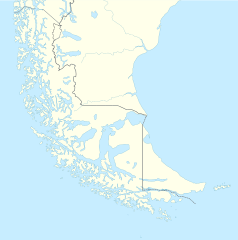
English: Location map of Tierra del Fuego and surroundings
Equirectangular projection, N/S stretching 160 %. Geographic limits of the map:
N: 48.4° S
S: 56.6° S
W: 76.4° W
E: 63.4° W
Español: Ubicación de Tierra del Fuego y alrededores
Proyección equirectangular, N/S 160% de estiramiento. Límites geográficos del mapa:
N: 48.4° S
S: 56.6° S
W: 76.4° W
E: 63.4° W
วันที่
แหล่งที่มา
งานของตัว, using
United States National Imagery and Mapping Agency data
World Data Base II data
ผู้สร้างสรรค์
NordNordWest
การอนุญาต (การใช้ไฟล์นี้ใหม่)
I have published this file as author NordNordWest under the "CC-BY-SA-3.0-DE" in Wikipedia. This means that free, commercial usage outside of Wikipedia is permitted under the following licence terms:
Online media:
The author "NordNordWest/Wikipedia" is named
A weblink to the original file is provided: //commons.wikimedia.org/wiki/File:Tierra_del_Fuego_location_map.svg
Please send me a specimen copy or the URL of the website where the file is used.
Please write an email to nnwest[at]web.de if you
need my postal address for sending a specimen copy
have further questions about the terms of the licence
PS: In case of refusal of the above terms the author reserves the right to take legal action.
This file has been released under a license which is incompatible with Facebook's licensing terms. It is not permitted to upload this file to Facebook.
azərbaycanca ∙ Deutsch (Sie-Form) ∙ čeština ∙ Deutsch ∙ sicilianu ∙ italiano ∙ русский ∙ română ∙ português ∙ English ∙ magyar ∙ Nederlands ∙ slovenščina ∙ polski ∙ latviešu ∙ македонски ∙ español ∙ فارسی ∙ français ∙ suomi ∙ עברית ∙ Plattdüütsch ∙ ქართული ∙ հայերեն ∙ বাংলা ∙ ไทย ∙ 日本語 ∙ 中文 ∙ 中文(简体) ∙ 中文(繁體) ∙ العربية ∙ +/−
Added Southern Patagonian Ice Field (Campo de hielo Patagónico Sur) undefined limits part, since 1998 For more information read: https://en.wikipedia.org/wiki/Southern_Patagonian_Ice_Field#Borderline Now with full resolution.
ไฟล, tierra, fuego, location, ไฟล, ประว, ไฟล, หน, าท, ภาพน, การใช, ไฟล, วนกลาง, อม, ลเก, ยวก, บภาพขนาดของต, วอย, าง, ของไฟล, กเซล, ความละเอ, ยดอ, กเซล, กเซล, กเซล, กเซล, กเซล, กเซล, ภาพท, ความละเอ, ยดส, งกว, 8206, ไฟล, กเซล, ขนาดไฟล, โลไบต, ปภาพหร, อไฟล, เส, ย. ifl prawtiifl hnathimiphaphni karichiflswnklang khxmulekiywkbphaphkhnadkhxngtwxyang PNG nikhxngifl SVG ni 594 600 phikesl khwamlaexiydxun 238 240 phikesl 475 480 phikesl 761 768 phikesl 1 014 1 024 phikesl 2 028 2 048 phikesl 1 535 1 550 phikesl duphaphthimikhwamlaexiydsungkwa 8206 ifl SVG 1 535 1 550 phikesl khnadifl 588 kiolibt rupphaphhruxiflesiyngni tnchbbxyuthi khxmmxns raylaexiyddanlang epnkhxkhwamthiaesdngphlcak ifltnchbbinkhxmmxns khxmmxnsepnewbistinokhrngkarsahrbekbrwbrwmsuxesri thi khunsamarthchwyid khwamyx khaxthibayTierra del Fuego location map svg Deutsch Positionskarte von Feuerland und Umgebung Quadratische Plattkarte N S Streckung 160 Geographische Begrenzung der Karte N 48 4 S S 56 6 S W 76 4 W O 63 4 WEnglish Location map of Tierra del Fuego and surroundings Equirectangular projection N S stretching 160 Geographic limits of the map N 48 4 S S 56 6 S W 76 4 W E 63 4 WEspanol Ubicacion de Tierra del Fuego y alrededores Proyeccion equirectangular N S 160 de estiramiento Limites geograficos del mapa N 48 4 S S 56 6 S W 76 4 W E 63 4 Wwnthi 3 thnwakhm ph s 2552aehlngthima ngankhxngtw using United States National Imagery and Mapping Agency data World Data Base II dataphusrangsrrkh NordNordWestkarxnuyat karichiflniihm I have published this file as author NordNordWest under the CC BY SA 3 0 DE in Wikipedia This means that free commercial usage outside of Wikipedia is permitted under the following licence terms Online media The author NordNordWest Wikipedia is named A weblink to the original file is provided commons wikimedia org wiki File Tierra del Fuego location map svg A copy of or the Uniform Resource Identifier https creativecommons org licenses by sa 3 0 de legalcode for this licence with every copy Print media The author NordNordWest Wikipedia is named A copy of or the Uniform Resource Identifier https creativecommons org licenses by sa 3 0 de legalcode for this licence with every copyPlease send me a specimen copy or the URL of the website where the file is used Please write an email to nnwest at web de if you need my postal address for sending a specimen copy have further questions about the terms of the licencePS In case of refusal of the above terms the author reserves the right to take legal action This file has been released under a license which is incompatible with Facebook s licensing terms It is not permitted to upload this file to Facebook iflnixyuphayitsyyaxnuyat khriexthifkhxmmxns aebbaesdngthima xnuyataebbediywkn 3 0 khxngpraethseyxrmnikhunsamarth thicaaebngpn thicathasaena aeckcay aelasngngandngklawtxip thicaeriyberiyngihm thicaddaeplngngandngklaw phayitenguxnikhtxipni aesdngthima khuntxngihekiyrtiecakhxngnganxyangehmaasm odyephimlingkipyngsyyaxnuyat aelarabuhakmikarepliynaeplng khunxacthaechnniidinrupaebbidkidtamkhwr aettxngimichinlksnathiaenawaphuihxnuyatsnbsnunkhunhruxkarichngankhxngkhun xnuyataebbediywkn hakkhunddaeplng epliynrup hruxtxetimnganni khuntxngichsyyaxnuyataebbediywknhruxaebbthiehmuxnkbsyyaxnuyatthiichkbnganniethannhttps creativecommons org licenses by sa 3 0 de deed en CC BY SA 3 0 de Creative Commons Attribution Share Alike 3 0 de true true iflnixyuphayitsyyaxnuyat khriexthifkhxmmxns aebbaesdngthima xnuyataebbediywkn 3 0 khxngpraethseyxrmnikhunsamarth thicaaebngpn thicathasaena aeckcay aelasngngandngklawtxip thicaeriyberiyngihm thicaddaeplngngandngklaw phayitenguxnikhtxipni aesdngthima khuntxngihekiyrtiecakhxngnganxyangehmaasm odyephimlingkipyngsyyaxnuyat aelarabuhakmikarepliynaeplng khunxacthaechnniidinrupaebbidkidtamkhwr aettxngimichinlksnathiaenawaphuihxnuyatsnbsnunkhunhruxkarichngankhxngkhun xnuyataebbediywkn hakkhunddaeplng epliynrup hruxtxetimnganni khuntxngichsyyaxnuyataebbediywknhruxaebbthiehmuxnkbsyyaxnuyatthiichkbnganniethannhttps creativecommons org licenses by sa 3 0 de deed en CC BY SA 3 0 de Creative Commons Attribution Share Alike 3 0 de true trueewxrchnxun iflxunthiichiflni Argentina Santa Cruz location map svg Argentina Tierra del Fuego and Staten Island location map svg Tierra del Fuego location of Ushuaia jpg Magallanes y Antartica Chilena location map South American part svg aephnthinithuksranghruxphthnakhuncak Kartenwerkstatt hxngptibtikaraephnthi khxngwikiphiediyphasaeyxrmn sungkhunsamarthesnxaephnthiephuxphthnaidechnediywkn azerbaycanca Deutsch Sie Form cestina Deutsch sicilianu italiano russkij romană portugues English magyar Nederlands slovenscina polski latviesu makedonski espanol فارسی francais suomi עברית Plattduutsch ქართული հայերեն ব ল ithy 日本語 中文 中文 简体 中文 繁體 العربية khabrryayodyyxithyephimkhabrryaythrrthdediywephuxkhyaykhwamwaiflnimixairixethmthiaesdngxyuiniflniprakxbdwysthanalikhsiththimilikhsiththisyyaxnuyatCreative Commons Attribution ShareAlike 3 0 Germany xngkvswnthisrang wnkxtng3 thnwakhm 2009MIME type xngkvsimage svg xml prawtiifl khlikwnthi ewlaephuxduiflthipraktinkhnann lasud ekasud du ihmkwa 10 ekakwa 10 10 20 50 100 250 500 wnthi ewlarupyxkhnadphuichkhwamehn pccubn08 23 29 thnwakhm 25651 535 1 550 588 kiolibt JanitoalevicImproved borders 02 41 4 phvsphakhm 25631 535 1 550 566 kiolibt JanitoalevicImproved Isla de los Estados 01 47 4 phvsphakhm 25631 535 1 550 558 kiolibt JanitoalevicImproved 06 23 30 singhakhm 25601 535 1 550 441 kiolibt JanitoalevicFixed size 18 23 29 singhakhm 25601 535 1 550 510 kiolibt NordNordWestReverted to version as of 20 59 15 March 2016 UTC change of size is catastrophic to some templates 05 18 29 singhakhm 25601 638 1 653 442 kiolibt JanitoalevicMore precise borders and lakes 03 59 16 minakhm 25591 535 1 550 510 kiolibt JanitoalevicFixed limits following Google Earth maps limits 05 12 3 minakhm 25591 535 1 550 510 kiolibt JanitoalevicUpdated 03 34 12 knyayn 25581 535 1 550 508 kiolibt JanitoalevicAdded Southern Patagonian Ice Field Campo de hielo Patagonico Sur undefined limits part since 1998 For more information read https en wikipedia org wiki Southern Patagonian Ice Field Borderline Now with full resolution 23 49 21 mithunayn 25581 535 1 550 503 kiolibt YannReverted to version as of 16 52 3 December 2009 lasud ekasud du ihmkwa 10 ekakwa 10 10 20 50 100 250 500 hnathimiphaphni hnatxipni oyngmathiphaphni xuswya esrortxrer aemaebb Location map Tierra del Fuego karichiflswnklang wikixuntxipniichiflni karichbn als wikipedia org Vorlage Positionskarte Feuerland Le Maire Strasse Kap Hoorn karichbn ar wikipedia org ريو غراندي تييرا ديل فويغو مدينة قالب Location map Tierra del Fuego karichbn az wikipedia org Sablon Yer xeritesi Cili Odlu Torpaq karichbn ba wikipedia org Ҡalyp PozKarta Utly Er Utly Er karichbn bn wikipedia org ফ টস রয মড উল অবস থ ন ম নচ ত র উপ ত ত ত য র র দ ল ফ য গ মড উল অবস থ ন ম নচ ত র উপ ত ত ত য র র দ ল ফ য গ নথ karichbn ceb wikipedia org Plantilya Location map Tierra del Fuego Cerro Fitzroy karichbn cs wikipedia org Cerro Chalten Ushuaia Nejjiznejsi mesto Sablona LocMap Ohnova zeme Navarino Rio Grande Argentina karichbn da wikipedia org Skabelon Kortpositioner Ildlandet karichbn de wikipedia org Wikipedia Kartenwerkstatt Positionskarten Sudamerika Wikipedia Kartenwerkstatt Archiv 2009 12 karichbn en wikipedia org Tierra del Fuego Ushuaia Malvinas Argentinas International Airport Isla Grande de Tierra del Fuego Puerto Williams Rio Grande Tierra del Fuego Diego Ramirez Islands Riesco Island Hoste Island Cerro Torre Picton Lennox and Nueva Fitz Roy Viedma Lake Gallegos River Mount Darwin Andes Puerto Toro Dawson Island Ildefonso Islands Hermite Islands Southern Patagonian Ice Field Navarino Island Cordillera Darwin Cordillera Sarmiento Londonderry Island Hornos Island Grey Lake Desolacion Island Clarence Island Chile Gordon Island Juan Guillermos Island dukarichthwolkephimetimkhxngiflnikhxmulekiywkbphaph phaphnimikhxmulephimetim sungswnihymacakklxngdicitxlhruxsaeknenxrthisamarthekbkhxmuldngklawiwrwmkbphaphid thaphaphnithukprbprungaekikhhruxepliynaeplngcakedim khxmulbangxyangcayngkhngimepliynaeplngehmuxnphaphthithukprbprungaekikhnnkhwamkwang1535 4365khwamsung1550 0398 ekhathungcak https th wikipedia org wiki ifl Tierra del Fuego location map svg, wikipedia, วิกิ หนังสือ, หนังสือ, ห้องสมุด,