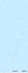
English: Blank administrative map of Tonga, for geo-location purposes.
Français : Carte administrative vierge de la Tonga, destinée à la géolocalisation.
Scale: 1:3,720,000 (precision: 930 m) Equirectangular projection, WGS84 datum
Central meridian: 174° 57' W
Standard parallel: 18° 57' S
Geographic limits of the map:
Top: 15° 24' S
Bottom: 22° 30' S
Left: 176° 24' W
Right: 173° 30' W
วันที่
แหล่งที่มา
งานของตัว
Sources of data:
NGDC World Data Bank II (public domain);
NGDC GSHHS (public domain).
ผู้สร้างสรรค์
Eric Gaba (Sting - fr:Sting)
การอนุญาต (การใช้ไฟล์นี้ใหม่)
Attribution and Share-Alike required
Any use of this map can be made as long as you credit me (Eric Gaba – Wikimedia Commons user: Sting) as the author and distribute the copies and derivative works under the same license(s) that the one(s) stated below. A message with a reply address would also be greatly appreciated.
ไฟล, tonga, location, ไฟล, ประว, ไฟล, หน, าท, ภาพน, การใช, ไฟล, วนกลาง, อม, ลเก, ยวก, บภาพขนาดของต, วอย, าง, ของไฟล, กเซล, ความละเอ, ยดอ, กเซล, กเซล, กเซล, กเซล, กเซล, กเซล, ภาพท, ความละเอ, ยดส, งกว, 8206, ไฟล, กเซล, ขนาดไฟล, โลไบต, ปภาพหร, อไฟล, เส, ยงน, นฉบ,. ifl prawtiifl hnathimiphaphni karichiflswnklang khxmulekiywkbphaphkhnadkhxngtwxyang PNG nikhxngifl SVG ni 231 598 phikesl khwamlaexiydxun 92 240 phikesl 185 480 phikesl 296 768 phikesl 395 1 024 phikesl 791 2 048 phikesl 677 1 753 phikesl duphaphthimikhwamlaexiydsungkwa 8206 ifl SVG 677 1 753 phikesl khnadifl 77 kiolibt rupphaphhruxiflesiyngni tnchbbxyuthi khxmmxns raylaexiyddanlang epnkhxkhwamthiaesdngphlcak ifltnchbbinkhxmmxns khxmmxnsepnewbistinokhrngkarsahrbekbrwbrwmsuxesri thi khunsamarthchwyid khwamyx taaehnngthitngklxng18 57 00 it 174 57 00 tawntk phaphniaelaphaphxun n sthanthiediywknthi OpenStreetMap 18 950000 174 950000 khaxthibayTonga location map svg English Blank administrative map of Tonga for geo location purposes Francais Carte administrative vierge de la Tonga destinee a la geolocalisation Scale 1 3 720 000 precision 930 m Equirectangular projection WGS84 datum Central meridian 174 57 W Standard parallel 18 57 SGeographic limits of the map Top 15 24 S Bottom 22 30 S Left 176 24 W Right 173 30 Wwnthi thnwakhm ph s 2552aehlngthima ngankhxngtw Sources of data NGDC World Data Bank II public domain NGDC GSHHS public domain phusrangsrrkh Eric Gaba Sting fr Sting karxnuyat karichiflniihm Attribution and Share Alike requiredAny use of this map can be made as long as you credit me Eric Gaba Wikimedia Commons user Sting as the author and distribute the copies and derivative works under the same license s that the one s stated below A message with a reply address would also be greatly appreciated ewxrchnxun Equivalent physical map karxnuyatichsiththi khapheca inthanaphuthuxlikhsiththikhxngphaphhruxsuxni xnuyatihichphaphhruxsuxniphayitenguxnikhtxipniiflnixyuphayitsyyaxnuyat khriexthifkhxmmxns aebbaesdngthima xnuyataebbediywkn 3 0 tnchbbkhunsamarth thicaaebngpn thicathasaena aeckcay aelasngngandngklawtxip thicaeriyberiyngihm thicaddaeplngngandngklaw phayitenguxnikhtxipni aesdngthima khuntxngihekiyrtiecakhxngnganxyangehmaasm odyephimlingkipyngsyyaxnuyat aelarabuhakmikarepliynaeplng khunxacthaechnniidinrupaebbidkidtamkhwr aettxngimichinlksnathiaenawaphuihxnuyatsnbsnunkhunhruxkarichngankhxngkhun xnuyataebbediywkn hakkhunddaeplng epliynrup hruxtxetimnganni khuntxngichsyyaxnuyataebbediywknhruxaebbthiehmuxnkbsyyaxnuyatthiichkbnganniethannhttps creativecommons org licenses by sa 3 0 CC BY SA 3 0 Creative Commons Attribution Share Alike 3 0 true true xnuyatihkhdlxk aeckcayaela hruxddaeprexksarniphayitenguxnikhkhxngsyyaxnuyatexksaresrikhxngknu run 1 2 hruxrunid nbcaknithixxkodymulnithisxftaewresri odyimmiswnidhamaekikh immikhxkhwampkhnaaelapkhlng saenakhxngsyyaxnuyatrwmxyuinswnchux syyaxnuyatexksaresrikhxngknuhttp www gnu org copyleft fdl html GFDL GNU Free Documentation License true truekhunsamartheluxksyyaxnuyatdngklawtamtxngkarkhabrryayodyyxithyephimkhabrryaythrrthdediywephuxkhyaykhwamwaiflnimixairixethmthiaesdngxyuiniflniprakxbdwyphusrangbangkhathiimmiixethmwikisnethschuxphusrangsrrkh Stingchuxphuichwikimiediy Stingyuxaraexl http commons wikimedia org wiki User StingsthanalikhsiththimilikhsiththisyyaxnuyatGNU Free Documentation License version 1 2 or later xngkvsCreative Commons Attribution ShareAlike 3 0 Unported xngkvswnthisrang wnkxtngthnwakhm 2009thimakhxngiflkarsrangdngedimodyphuxpohldcoordinates of the point of view xngkvs18 57 0 000 S 174 57 0 000 W prawtiifl khlikwnthi ewlaephuxduiflthipraktinkhnann wnthi ewlarupyxkhnadphuichkhwamehn pccubn02 16 2 thnwakhm 2552677 1 753 77 kiolibt Sting int filedesc Location 18 57 00 S 174 57 00 W scale 5000000 lt br gt Information Description en Blank administrative map of Tonga for geo location purposes fr Carte administrative vierge de la Tonga destin hnathimiphaphni hnatxipni oyngmathiphaphni mxdul Location map data Tonga mxdul Location map data Tonga doc karichiflswnklang wikixuntxipniichiflni karichbn af wikipedia org Sjabloon Liggingkaart Tonga karichbn als wikipedia org Vorlage Positionskarte Tonga karichbn an wikipedia org Plantilla Mapa de localizacion Tonga karichbn ar wikipedia org قالب خريطة مواقع تونغا karichbn ast wikipedia org Nuku Alofa Palaciu real de Tonga Ilesia Llibre de Tonga Modulu Minimapa data Tonga Modulu Minimapa data Tonga usu Fuesa de Tonga karichbn az wikipedia org Sablon Yer xeritesi Tonqa karichbn be tarask wikipedia org Nukualofa Shablyon Lyakalizacyjnaya mapa Tonga karichbn be wikipedia org Nukualofa Shablon Na karce Tonga karichbn bg wikipedia org Shablon PK Tonga karichbn bn wikipedia org মড উল অবস থ ন ম নচ ত র উপ ত ত ট ঙ গ মড উল অবস থ ন ম নচ ত র উপ ত ত ট ঙ গ নথ karichbn bs wikipedia org Sablon Lokacijska karta Tonga Kvalifikacije za Svjetsko prvenstvo u nogometu 2018 OFC 1 krug karichbn ca wikipedia org Ohonua karichbn ceb wikipedia org Plantilya Location map Tonga The Narrows Fata Sandy Point East Point Mango pagklaro Puhi Lolo pagklaro Fua Uia Lima pagklaro Ward Rock Barrier Reef Eastern Passage Mango Island Buhi Amsterdam Island Middelburg Tafuna Ofu Island Mount Zion North Passage Herald Bight Big Lake Bickerton Island Home Reef Falcon Island Alexander Reef Ava dukarichthwolkephimetimkhxngiflnikhxmulekiywkbphaph phaphnimikhxmulephimetim sungswnihymacakklxngdicitxlhruxsaeknenxrthisamarthekbkhxmuldngklawiwrwmkbphaphid thaphaphnithukprbprungaekikhhruxepliynaeplngcakedim khxmulbangxyangcayngkhngimepliynaeplngehmuxnphaphthithukprbprungaekikhnnchuxeruxngsnBlank map of Tonga for geo location purposes ekhathungcak https th wikipedia org wiki ifl Tonga location map svg, wikipedia, วิกิ หนังสือ, หนังสือ, ห้องสมุด,