azərbaycanca ∙ Deutsch (Sie-Form) ∙ čeština ∙ Deutsch ∙ sicilianu ∙ italiano ∙ русский ∙ română ∙ português ∙ English ∙ magyar ∙ Nederlands ∙ slovenščina ∙ polski ∙ latviešu ∙ македонски ∙ español ∙ فارسی ∙ français ∙ suomi ∙ עברית ∙ Plattdüütsch ∙ ქართული ∙ հայերեն ∙ বাংলা ∙ ไทย ∙ 日本語 ∙ 中文 ∙ 中文(简体) ∙ 中文(繁體) ∙ العربية ∙ +/−
การอนุญาตใช้สิทธิ
Usage of this file with:
Map: NordNordWest, Licence: Creative Commons by-sa-3.0 de
explanatory notes: Legally binding is only the full legalcode. For a free usage I recommend to respect the following licence conditions: 1. Provide my name as given above: NordNordWest, 2. a copy of, or the URI for, the applicable license: https://creativecommons.org/licenses/by-sa/3.0/de/legalcode, 3. the title of the work, 4. in the case of an adaptation, a credit identifying the use of the work in the adaptation. This license and the rights granted hereunder will terminate automatically upon any breach by you of the terms of this license. Any of the above conditions can be waived if you get permission from the copyright holder. If you have questions or wish differing conditions, please contact me through nnwestt-online.de or my discussion page
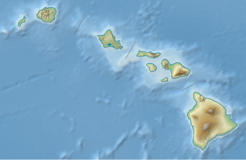
ไฟล, hawaii, relief, location, ไฟล, ประว, ไฟล, หน, าท, ภาพน, การใช, ไฟล, วนกลาง, อม, ลเก, ยวก, บภาพขนาดของต, วอย, าง, ของไฟล, กเซล, ความละเอ, ยดอ, กเซล, กเซล, กเซล, กเซล, กเซล, กเซล, ภาพท, ความละเอ, ยดส, งกว, 8206, ไฟล, กเซล, ขนาดไฟล, โลไบต, ปภาพหร, อไฟล, เส, . ifl prawtiifl hnathimiphaphni karichiflswnklang khxmulekiywkbphaphkhnadkhxngtwxyang PNG nikhxngifl SVG ni 800 519 phikesl khwamlaexiydxun 320 208 phikesl 640 415 phikesl 1 024 664 phikesl 1 280 831 phikesl 2 560 1 661 phikesl 1 441 935 phikesl duphaphthimikhwamlaexiydsungkwa 8206 ifl SVG 1 441 935 phikesl khnadifl 317 kiolibt rupphaphhruxiflesiyngni tnchbbxyuthi khxmmxns raylaexiyddanlang epnkhxkhwamthiaesdngphlcak ifltnchbbinkhxmmxns khxmmxnsepnewbistinokhrngkarsahrbekbrwbrwmsuxesri thi khunsamarthchwyid khwamyx khaxthibayUSA Hawaii relief location map svg Deutsch Positionskarte von Hawaii USA Quadratische Plattkarte N S Streckung 107 nbsp Geographische Begrenzung der Karte N 22 4 N S 18 7 N W 160 7 W O 154 6 W English Location map of Hawaii USA Equirectangular projection N S stretching 107 nbsp Geographic limits of the map N 22 4 N S 18 7 N W 160 7 W E 154 6 W wnthi 3 singhakhm ph s 2556 aehlngthima own work using United States National Imagery and Mapping Agency data U S Geological Survey USGS data SRTM30 v 2 data NGDC ETOPO2v2 data phusrangsrrkh NordNordWest ewxrchnxun administrative version aephnthinithuksranghruxphthnakhuncak Kartenwerkstatt hxngptibtikaraephnthi khxngwikiphiediyphasaeyxrmn sungkhunsamarthesnxaephnthiephuxphthnaidechnediywkn azerbaycanca nbsp Deutsch Sie Form nbsp cestina nbsp Deutsch nbsp sicilianu nbsp italiano nbsp russkij nbsp romană nbsp portugues nbsp English nbsp magyar nbsp Nederlands nbsp slovenscina nbsp polski nbsp latviesu nbsp makedonski nbsp espanol nbsp فارسی nbsp francais nbsp suomi nbsp עברית nbsp Plattduutsch nbsp ქართული nbsp հայերեն nbsp ব ল nbsp ithy nbsp 日本語 nbsp 中文 nbsp 中文 简体 nbsp 中文 繁體 nbsp العربية nbsp karxnuyatichsiththi Usage of this file with Map NordNordWest Licence Creative Commons by sa 3 0 de explanatory notes Legally binding is only the full legalcode For a free usage I recommend to respect the following licence conditions 1 Provide my name as given above NordNordWest 2 a copy of or the URI for the applicable license https creativecommons org licenses by sa 3 0 de legalcode 3 the title of the work 4 in the case of an adaptation a credit identifying the use of the work in the adaptation This license and the rights granted hereunder will terminate automatically upon any breach by you of the terms of this license Any of the above conditions can be waived if you get permission from the copyright holder If you have questions or wish differing conditions please contact me through span class nowrap nnwest span typeof mw File span title span span t online de span or my discussion pageiflnixyuphayitsyyaxnuyat khriexthifkhxmmxns aebbaesdngthima xnuyataebbediywkn 3 0 khxngpraethseyxrmnikaraesdngthima Karte NordNordWest Lizenz Creative Commons by sa 3 0 dekhunsamarth thicaaebngpn thicathasaena aeckcay aelasngngandngklawtxip thicaeriyberiyngihm thicaddaeplngngandngklaw phayitenguxnikhtxipni aesdngthima khuntxngihekiyrtiecakhxngnganxyangehmaasm odyephimlingkipyngsyyaxnuyat aelarabuhakmikarepliynaeplng khunxacthaechnniidinrupaebbidkidtamkhwr aettxngimichinlksnathiaenawaphuihxnuyatsnbsnunkhunhruxkarichngankhxngkhun xnuyataebbediywkn hakkhunddaeplng epliynrup hruxtxetimnganni khuntxngichsyyaxnuyataebbediywknhruxaebbthiehmuxnkbsyyaxnuyatthiichkbnganniethannhttps creativecommons org licenses by sa 3 0 de deed en CC BY SA 3 0 de Creative Commons Attribution Share Alike 3 0 de true truekhabrryayodyyxithyephimkhabrryaythrrthdediywephuxkhyaykhwamwaiflnimixairixethmthiaesdngxyuiniflniprakxbdwysthanalikhsiththimilikhsiththisyyaxnuyatCreative Commons Attribution ShareAlike 3 0 Germany nbsp xngkvswnthisrang wnkxtng3 singhakhm 2013MIME type nbsp xngkvsimage svg xml prawtiifl khlikwnthi ewlaephuxduiflthipraktinkhnann wnthi ewlarupyxkhnadphuichkhwamehn pccubn02 22 4 singhakhm 25561 441 935 317 kiolibt NordNordWestbrighter 02 10 4 singhakhm 25561 441 935 331 kiolibt NordNordWest Information Description de Positionskarte von Hawaii USA Quadratische Plattkarte N S Streckung 107 Geographische Begrenzung der Karte N 22 4 N S 18 7 N W 160 7 W O 154 6 W en Location map o hnathimiphaphni hnatxipni oyngmathiphaphni phuekhaifkhielaewxa phuekhaifemanaolxa aephndinihwinekaahaway ph s 2561 mxdul Location map data Hawaii mxdul Location map data USA Hawaii mxdul Location map data USA Hawaii doc karichiflswnklang wikixuntxipniichiflni karichbn ar wikipedia org قالب خريطة مواقع الولايات المتحدة هاواي زلزال هاواي 2018 كاو كريتر karichbn ast wikipedia org Modulu Minimapa data Ḥawai Modulu Minimapa data Ḥawai usu karichbn azb wikipedia org پیو یووی هاوایی karichbn az wikipedia org Havay adalari Sablon Yer xeritesi Amerika Birlesmis Statlari Havay Kau sehrasi karichbn bg wikipedia org Honolulu Hilo Makauao Prl Siti Havai Shablon PK SASh Havai Vulkani na Havai nacionalen park Haleakala nacionalen park karichbn bn wikipedia org মড উল অবস থ ন ম নচ ত র উপ ত ত হ ওয ই মড উল অবস থ ন ম নচ ত র উপ ত ত হ ওয ই নথ মড উল অবস থ ন ম নচ ত র উপ ত ত ম র ক ন য ক তর ষ ট র হ ওয ই মড উল অবস থ ন ম নচ ত র উপ ত ত ম র ক ন য ক তর ষ ট র হ ওয ই নথ karichbn ca wikipedia org Modul Location map data USA Hawaii Modul Location map data USA Hawaii us karichbn ceb wikipedia org Plantilya Location map USA Hawaii karichbn ce wikipedia org Kep Mettigan karta ACSh Gavajsh Kilba malhbalen gӀajrenash karichbn ckb wikipedia org ڕوانگەی جێمینی karichbn cs wikipedia org Mauna Loa Mauna Kea Kilauea Sablona LocMap Havaj Hualalai Diamond Head Haleakala Narodni park Haleakala Narodni park Havajske vulkany Kaʻala karichbn de wikipedia org Mauna Loa Mauna Kea Kama ehuakanaloa Kohala Kilauea Hawaiʻi Volcanoes Nationalpark Haleakala Nationalpark Diamond Head Hawaii Haleakala Hualalai Mauna Kamakou Punchbowl Crater Molokini Marinefunkstelle Lualualei Puʻu ʻŌʻō dukarichthwolkephimetimkhxngiflnikhxmulekiywkbphaph phaphnimikhxmulephimetim sungswnihymacakklxngdicitxlhruxsaeknenxrthisamarthekbkhxmuldngklawiwrwmkbphaphid thaphaphnithukprbprungaekikhhruxepliynaeplngcakedim khxmulbangxyangcayngkhngimepliynaeplngehmuxnphaphthithukprbprungaekikhnnkhwamkwang1440 954pxkhwamsung935 188px ekhathungcak https th wikipedia org wiki ifl USA Hawaii relief location map svg, wikipedia, วิกิ หนังสือ, หนังสือ, ห้องสมุด,