azərbaycanca ∙ Deutsch (Sie-Form) ∙ čeština ∙ Deutsch ∙ sicilianu ∙ italiano ∙ русский ∙ română ∙ português ∙ English ∙ magyar ∙ Nederlands ∙ slovenščina ∙ polski ∙ latviešu ∙ македонски ∙ español ∙ فارسی ∙ français ∙ suomi ∙ עברית ∙ Plattdüütsch ∙ ქართული ∙ հայերեն ∙ বাংলা ∙ ไทย ∙ 日本語 ∙ 中文 ∙ 中文(简体) ∙ 中文(繁體) ∙ العربية ∙ +/−
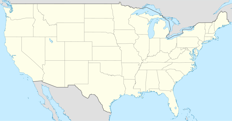
{{Information |Description= {{de|Positionskarte der Vereinigten Staaten}} Quadratische Plattkarte, N-S-Streckung 120 %. Geographische Begrenzung der Karte: * N: 49.8° N * S: 24.2° N * W: 125.5° W * O: 66.5° W {{en|Location m
ไฟล, location, ไฟล, ประว, ไฟล, หน, าท, ภาพน, การใช, ไฟล, วนกลาง, อม, ลเก, ยวก, บภาพขนาดของต, วอย, าง, ของไฟล, กเซล, ความละเอ, ยดอ, กเซล, กเซล, กเซล, กเซล, กเซล, กเซล, ภาพท, ความละเอ, ยดส, งกว, 8206, ไฟล, กเซล, ขนาดไฟล, โลไบต, ปภาพหร, อไฟล, เส, ยงน, นฉบ, บอย, ค. ifl prawtiifl hnathimiphaphni karichiflswnklang khxmulekiywkbphaphkhnadkhxngtwxyang PNG nikhxngifl SVG ni 800 417 phikesl khwamlaexiydxun 320 167 phikesl 640 333 phikesl 1 024 533 phikesl 1 280 667 phikesl 2 560 1 333 phikesl 1 859 968 phikesl duphaphthimikhwamlaexiydsungkwa 8206 ifl SVG 1 859 968 phikesl khnadifl 721 kiolibt rupphaphhruxiflesiyngni tnchbbxyuthi khxmmxns raylaexiyddanlang epnkhxkhwamthiaesdngphlcak ifltnchbbinkhxmmxns khxmmxnsepnewbistinokhrngkarsahrbekbrwbrwmsuxesri thi khunsamarthchwyid khwamyx khaxthibayUSA location map svg Deutsch Positionskarte der Vereinigten Staaten lower 48 Quadratische Plattkarte N S Streckung 120 Geographische Begrenzung der Karte N 49 8 N S 24 2 N W 125 5 W O 66 5 WEnglish Location map of the United States lower 48 Equirectangular projection N S stretching 120 Geographic limits of the map N 49 8 N S 24 2 N W 125 5 W E 66 5 WItaliano Mappa di localizzazione degli Stati Uniti d America lower 48 Proiezione equirettangolare stiramento N S 120 Limiti geografici della mappa N 49 8 N S 24 2 N O 125 5 O E 66 5 Ownthi 29 krkdakhm ph s 2551aehlngthima own work using United States National Imagery and Mapping Agency data World Data Base II dataphusrangsrrkh NordNordWestewxrchnxun File USA location map counties no water svg File USA location map counties svgiflxunthiichiflni Bank of America footprint png CRW flight map svg FirstCitizensBancShares footprint png MSY flight map svg North Country Trail Locator Map US svg RAP flight map svg SDF flight map svg aephnthinithuksranghruxphthnakhuncak Kartenwerkstatt hxngptibtikaraephnthi khxngwikiphiediyphasaeyxrmn sungkhunsamarthesnxaephnthiephuxphthnaidechnediywkn azerbaycanca Deutsch Sie Form cestina Deutsch sicilianu italiano russkij romană portugues English magyar Nederlands slovenscina polski latviesu makedonski espanol فارسی francais suomi עברית Plattduutsch ქართული հայերեն ব ল ithy 日本語 中文 中文 简体 中文 繁體 العربية karxnuyatichsiththi khapheca inthanaphuthuxlikhsiththikhxngphaphhruxsuxni xnuyatihichphaphhruxsuxniphayitenguxnikhtxipni xnuyatihkhdlxk aeckcayaela hruxddaeprexksarniphayitenguxnikhkhxngsyyaxnuyatexksaresrikhxngknu run 1 2 hruxrunid nbcaknithixxkodymulnithisxftaewresri odyimmiswnidhamaekikh immikhxkhwampkhnaaelapkhlng saenakhxngsyyaxnuyatrwmxyuinswnchux syyaxnuyatexksaresrikhxngknuhttp www gnu org copyleft fdl html GFDL GNU Free Documentation License true trueiflnixyuphayitsyyaxnuyat khriexthifkhxmmxns aebbaesdngthima xnuyataebbediywkn 3 0 tnchbbkhunsamarth thicaaebngpn thicathasaena aeckcay aelasngngandngklawtxip thicaeriyberiyngihm thicaddaeplngngandngklaw phayitenguxnikhtxipni aesdngthima khuntxngihekiyrtiecakhxngnganxyangehmaasm odyephimlingkipyngsyyaxnuyat aelarabuhakmikarepliynaeplng khunxacthaechnniidinrupaebbidkidtamkhwr aettxngimichinlksnathiaenawaphuihxnuyatsnbsnunkhunhruxkarichngankhxngkhun xnuyataebbediywkn hakkhunddaeplng epliynrup hruxtxetimnganni khuntxngichsyyaxnuyataebbediywknhruxaebbthiehmuxnkbsyyaxnuyatthiichkbnganniethannhttps creativecommons org licenses by sa 3 0 CC BY SA 3 0 Creative Commons Attribution Share Alike 3 0 true truekhunsamartheluxksyyaxnuyatdngklawtamtxngkarkhabrryayodyyxithyephimkhabrryaythrrthdediywephuxkhyaykhwamwaiflnimixairxngkvsLocation map of the United StateseyxrmnPositionskarte der Vereinigten StaatenxitaliMappa di localizzazione degli Stati Uniti d Americaixethmthiaesdngxyuiniflniprakxbdwyshrthxemrikaaephnthiphusrangbangkhathiimmiixethmwikisnethschuxphuichwikimiediy NordNordWestchuxphusrangsrrkh NordNordWestyuxaraexl https commons wikimedia org wiki user NordNordWeststhanalikhsiththimilikhsiththisyyaxnuyatGNU Free Documentation License version 1 2 or later xngkvsCreative Commons Attribution ShareAlike 3 0 Unported xngkvswnthisrang wnkxtng29 krkdakhm 2008 prawtiifl khlikwnthi ewlaephuxduiflthipraktinkhnann wnthi ewlarupyxkhnadphuichkhwamehn pccubn03 04 30 krkdakhm 25511 859 968 721 kiolibt NordNordWest Information Description de Positionskarte der Vereinigten Staaten Quadratische Plattkarte N S Streckung 120 Geographische Begrenzung der Karte N 49 8 N S 24 2 N W 125 5 W O 66 5 W en Location m hnathimiphaphni hnatxipni oyngmathiphaphni phasaxngkvsaebbxemrikn aemaebb Map of American English karichiflswnklang wikixuntxipniichiflni karichbn af wikipedia org Vryheidstandbeeld Sjabloon Liggingkaart Verenigde State Grand Canyon Yosemite Nasionale Park Yellowstone Nasionale Park Nasionale Sequoia park Strawberryberg Cahokia karichbn am wikipedia org ሺካጎ መለጠፊያ Location map አሜሪካ ምልዎኪ karichbn ar wikipedia org متنزه يلوستون الوطني رايت باترسون قالب خريطة مواقع الولايات المتحدة قالب صندوق معلومات منطقة محمية شرح قالب صندوق معلومات منطقة محمية قاعدة لاكلاند الجوية قالب ص م موقع جغرافي متعدد قالب ص م موقع جغرافي متعدد شرح الدرومي الكامبري الكاتي كأس الكونكاكاف الذهبية 2015 قالب صندوق معلومات تقسيم إداري شرح قالب صندوق معلومات منطقة محمية ملعب karichbn arz wikipedia org قالب Location map USA قالب خريطة مواقع قالب خريطة مواقع شرح قالب Location map شرح قالب صندوق معلومات منطقة محمية قالب صندوق معلومات منطقة محمية شرح karichbn as wikipedia org স চ Infobox protected area স চ Infobox protected area doc karichbn azb wikipedia org شابلون Location map USA شابلون Location map United States karichbn be tarask wikipedia org Nyu York Vashyngton akruga Kalyumbiya Chykaga Los Andzheles Las Vegas Filadelfiya Sietl G yustan Dalas Finiks Aryzona San Antoniyo San Dyega Detrojt San Hase Kaliforniya Indyyanapalis Dzheksanvil dukarichthwolkephimetimkhxngiflnikhxmulekiywkbphaph phaphnimikhxmulephimetim sungswnihymacakklxngdicitxlhruxsaeknenxrthisamarthekbkhxmuldngklawiwrwmkbphaphid thaphaphnithukprbprungaekikhhruxepliynaeplngcakedim khxmulbangxyangcayngkhngimepliynaeplngehmuxnphaphthithukprbprungaekikhnnkhwamkwang1858 62183khwamsung968 37671 ekhathungcak https th wikipedia org wiki ifl USA location map svg, wikipedia, วิกิ หนังสือ, หนังสือ, ห้องสมุด,