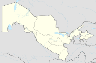
ข้อมูลเพิ่มเติม This map is part of a series of location maps with unified standards: SVG as file format, standardised colours and name scheme. The boundaries on these maps always show the de facto situation and do not imply any endorsement or acceptance. In case of changes of the shown area the file is updated. The old version will be uploaded as a new file and thus is still available.
วันที่
แหล่งที่มา
Own work using:
United States National Imagery and Mapping Agency data
azərbaycanca ∙ Deutsch (Sie-Form) ∙ čeština ∙ Deutsch ∙ sicilianu ∙ italiano ∙ русский ∙ română ∙ português ∙ English ∙ magyar ∙ Nederlands ∙ slovenščina ∙ polski ∙ latviešu ∙ македонски ∙ español ∙ فارسی ∙ français ∙ suomi ∙ עברית ∙ Plattdüütsch ∙ ქართული ∙ հայերեն ∙ বাংলা ∙ ไทย ∙ 日本語 ∙ 中文 ∙ 中文(简体) ∙ 中文(繁體) ∙ العربية ∙ +/−
การอนุญาตใช้สิทธิ
Usage of this file with:
Map: NordNordWest, Licence: Creative Commons by-sa-3.0 de
explanatory notes: Legally binding is only the full legalcode. For a free usage I recommend to respect the following licence conditions: 1. Provide my name as given above: NordNordWest, 2. a copy of, or the URI for, the applicable license: https://creativecommons.org/licenses/by-sa/3.0/de/legalcode, 3. the title of the work, 4. in the case of an adaptation, a credit identifying the use of the work in the adaptation. This license and the rights granted hereunder will terminate automatically upon any breach by you of the terms of this license. Any of the above conditions can be waived if you get permission from the copyright holder. If you have questions or wish differing conditions, please contact me through nnwestt-online.de or my discussion page
This file has been released under a license which is incompatible with Facebook's licensing terms. It is not permitted to upload this file to Facebook.
ไฟล, uzbekistan, location, ไฟล, ประว, ไฟล, หน, าท, ภาพน, การใช, ไฟล, วนกลาง, อม, ลเก, ยวก, บภาพขนาดของต, วอย, าง, ของไฟล, กเซล, ความละเอ, ยดอ, กเซล, กเซล, กเซล, กเซล, กเซล, กเซล, ภาพท, ความละเอ, ยดส, งกว, 8206, ไฟล, กเซล, ขนาดไฟล, โลไบต, ปภาพหร, อไฟล, เส, ยงน,. ifl prawtiifl hnathimiphaphni karichiflswnklang khxmulekiywkbphaphkhnadkhxngtwxyang PNG nikhxngifl SVG ni 800 529 phikesl khwamlaexiydxun 320 211 phikesl 640 423 phikesl 1 024 677 phikesl 1 280 846 phikesl 2 560 1 692 phikesl 2 114 1 397 phikesl duphaphthimikhwamlaexiydsungkwa 8206 ifl SVG 2 114 1 397 phikesl khnadifl 285 kiolibt rupphaphhruxiflesiyngni tnchbbxyuthi khxmmxns raylaexiyddanlang epnkhxkhwamthiaesdngphlcak ifltnchbbinkhxmmxns khxmmxnsepnewbistinokhrngkarsahrbekbrwbrwmsuxesri thi khunsamarthchwyid khwamyx khaxthibayUzbekistan adm location map svg Deutsch Positionskarte von Usbekistan English Location map of Uzbekistan Equirectangular projection vertical stretching 130 Border coordinates45 955 6 73 536 8 khxmulephimetim This map is part of a series of location maps with unified standards SVG as file format standardised colours and name scheme The boundaries on these maps always show the de facto situation and do not imply any endorsement or acceptance In case of changes of the shown area the file is updated The old version will be uploaded as a new file and thus is still available wnthi 25 knyayn ph s 2557aehlngthima Own work using United States National Imagery and Mapping Agency data World Data Base II dataphusrangsrrkh NordNordWest aephnthinithuksranghruxphthnakhuncak Kartenwerkstatt hxngptibtikaraephnthi khxngwikiphiediyphasaeyxrmn sungkhunsamarthesnxaephnthiephuxphthnaidechnediywkn azerbaycanca Deutsch Sie Form cestina Deutsch sicilianu italiano russkij romană portugues English magyar Nederlands slovenscina polski latviesu makedonski espanol فارسی francais suomi עברית Plattduutsch ქართული հայերեն ব ল ithy 日本語 中文 中文 简体 中文 繁體 العربية karxnuyatichsiththi Usage of this file with Map NordNordWest Licence Creative Commons by sa 3 0 de explanatory notes Legally binding is only the full legalcode For a free usage I recommend to respect the following licence conditions 1 Provide my name as given above NordNordWest 2 a copy of or the URI for the applicable license https creativecommons org licenses by sa 3 0 de legalcode 3 the title of the work 4 in the case of an adaptation a credit identifying the use of the work in the adaptation This license and the rights granted hereunder will terminate automatically upon any breach by you of the terms of this license Any of the above conditions can be waived if you get permission from the copyright holder If you have questions or wish differing conditions please contact me through span class nowrap nnwestt online de span or my discussion pageiflnixyuphayitsyyaxnuyat khriexthifkhxmmxns aebbaesdngthima xnuyataebbediywkn 3 0 khxngpraethseyxrmnikaraesdngthima Karte NordNordWest Lizenz Creative Commons by sa 3 0 dekhunsamarth thicaaebngpn thicathasaena aeckcay aelasngngandngklawtxip thicaeriyberiyngihm thicaddaeplngngandngklaw phayitenguxnikhtxipni aesdngthima khuntxngihekiyrtiecakhxngnganxyangehmaasm odyephimlingkipyngsyyaxnuyat aelarabuhakmikarepliynaeplng khunxacthaechnniidinrupaebbidkidtamkhwr aettxngimichinlksnathiaenawaphuihxnuyatsnbsnunkhunhruxkarichngankhxngkhun xnuyataebbediywkn hakkhunddaeplng epliynrup hruxtxetimnganni khuntxngichsyyaxnuyataebbediywknhruxaebbthiehmuxnkbsyyaxnuyatthiichkbnganniethannhttps creativecommons org licenses by sa 3 0 de deed en CC BY SA 3 0 de Creative Commons Attribution Share Alike 3 0 de true true This file has been released under a license which is incompatible with Facebook s licensing terms It is not permitted to upload this file to Facebook khabrryayodyyxithyephimkhabrryaythrrthdediywephuxkhyaykhwamwaiflnimixairxngkvsA map of Uzbekistan epxresiyنقشه ازبکستانrsesiyKosonsoyewiydnamBản đồ vị tri của UzbekistanixethmthiaesdngxyuiniflniprakxbdwyKosonsoy xngkvssthanalikhsiththimilikhsiththisyyaxnuyatCreative Commons Attribution ShareAlike 3 0 Germany xngkvswnthisrang wnkxtng25 knyayn 2014 prawtiifl khlikwnthi ewlaephuxduiflthipraktinkhnann wnthi ewlarupyxkhnadphuichkhwamehn pccubn00 44 26 knyayn 25572 114 1 397 285 kiolibt NordNordWest int filedesc Information Description de 1 Positionskarte von Usbekistan en 1 Location map of Uzbekistan Location map series N stretching 130 top 45 9 bottom 36 8 left 55 6 right 73 5 Source Own using United States hnathimiphaphni hnatxipni oyngmathiphaphni khiwa chahruxsps samarknt thachekhnt thaxakasyannanachatithachekhnt namngaekn bukhxrx pxyiaeklxn phiphithphnthprawtisastretmuxraehngrth futbxlexechiyeyawchnxayuimekin 23 pi 2022 mxynk minxraxiaeklxn xusebkisthansuepxrlik enxkus okkxn mxdul Location map data Uzbekistan mxdul Location map data Uzbekistan doc karichiflswnklang wikixuntxipniichiflni karichbn af wikipedia org Sjabloon Liggingkaart Oesbekistan Nukus karichbn ast wikipedia org Aeropuertu Internacional de Bukhara Taxkent Samarcanda Registan Depresion del Turan Bukhara Navoi Torre de Taxkent Modulu Minimapa data Uzbequistan Modulu Minimapa data Uzbequistan usu Aeropuertu Internacional de Taxkent karichbn av wikipedia org Halip BakӀKarta Halip Bak1Karta doc Buhara Halip BakӀKarta doc Halip BakӀKarta gӀuzh Halip BakӀKarta karta Halip BakӀKarta Uzbekistan karichbn azb wikipedia org تاشکند خیوه اورگنج انقار بالیقچی بندخان بیرونی شهر بئش آریق بئشکند بئش رباط باغوت بوکه بولونغور چیمبای چیناز چیرچیق چیراقچی چارتاق چوست دئناو دوستلیک دوست آباد فیرغانا قاقارین شهر قلعه آسیا غله آرال غزل کند غوزار گولیستان شهر گول آباد اؤزبکیستان dukarichthwolkephimetimkhxngiflnikhxmulekiywkbphaph phaphnimikhxmulephimetim sungswnihymacakklxngdicitxlhruxsaeknenxrthisamarthekbkhxmuldngklawiwrwmkbphaphid thaphaphnithukprbprungaekikhhruxepliynaeplngcakedim khxmulbangxyangcayngkhngimepliynaeplngehmuxnphaphthithukprbprungaekikhnnkhwamkwang2114 177pxkhwamsung1397 293px ekhathungcak https th wikipedia org wiki ifl Uzbekistan adm location map svg, wikipedia, วิกิ หนังสือ, หนังสือ, ห้องสมุด,