ไฟล์อื่นที่ใช้ไฟล์นี้: Europe Jewish % change 1945 2010.png
English: This map is part of a series of historical political maps of Europe. All maps by Alphathon and based upon Blank map of Europe.svg unless otherwise stated.
Deutsch: Diese Karte ist Teil einer Serie historischer politischer Europakarten. Solange nicht anders angegeben, wurden alle Karten durch Alphathon auf Basis von Blank map of Europe.svg erstellt, sofern nicht anders angegeben.
Français : Cette carte fait partie d'une série de cartes historiques et politiques d'Europe. Toutes les cartes ont été créées par Alphathon et basées sur Blank map of Europe.svg sauf indication contraire.
Evolution of specific states
Greece/Byzantine Empire
Byzantine Empire: ca. 330 – 1204; 1261 – 1453
Byzantine Empire – 814
Byzantine Empire – 1190
1453 – 1832 Between 1453 and 1832 there was no independent Greek state. During this period the region was ruled by the Byzantine Empire's Turkish successor: the Ottoman Empire.
Greece: 1832 – Today
Kingdom of Greece – 1890
Kingdom of Greece – 1914
Second Hellenic Republic – 1935
Hellenic State – 1942
Kingdom of Greece – 1973
France
Frankish Empire – 814
West Francia – 843
Kingdom of France – 1000
Kingdom of France – 1097
Kingdom of France – 1190
Kingdom of France – 1789
First French Empire – 1812
Kingdom of France – 1815
Kingdom of France – 1839
French Third Republic – 1914
French Third Republic – 1939
French State(Vichy France) – 1942
Provisional Government of the French Republic – 1945-1949
French Fourth Republic – 1946-1957
ดูเพิ่ม:French State (incl. occupation zone) – 1942, Military Administration in France – 1942, Military Administration inBelgium and Northern France – 1942
Germany/Holy Roman Empire
Frankish Empire – 814
East Francia – 843
Holy Roman Empire – 1000
Holy Roman Empire – 1004
Holy Roman Empire – 1097
Holy Roman Empire – 1190
Holy Roman Empire – 1789
ดูเพิ่ม:Kingdom of Germany – 1000
ดูเพิ่ม:Kingdom of Germany – 1004
1806
Confederation of the Rhine – 1812
German Confederation – 1815
North German Confederation – 1870
A confederation of German client-states of the First French Empire
An attempted partial resurrection of the Holy Roman Empire after the Napoleonic wars
A Prussian-dominated successor to the German Confederation following the 1866 Austro-Prussian War
This image is a derivative work of the following images:
File:Blank_map_of_Europe_1956-1990.svg licensed with Cc-by-sa-3.0
2011-10-30T04:43:42Z Alphathon 450x456 (485146 Bytes) == {{int:filedesc}} == {{Information |Description={{en|Blank map of Europe showing national borders as they stood from 1956-1990.}} |Source=*[[:File:Blank_map_of_Europe.svg|]] |Date=2011-10-30 04:42 (UTC) |Author=*[[:File:Bla
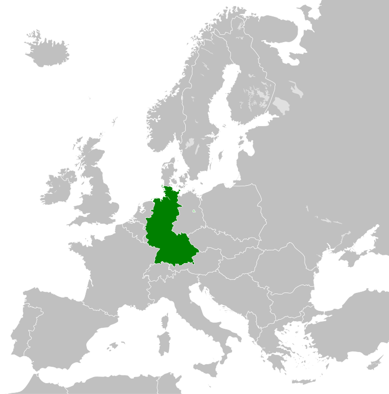
== {{int:filedesc}} == {{Information |Description={{en|Map of West Germany (Federal Republic of Germany) as it was from 1949-1990. Surrounding countries accurate from 1956-1990.}} |Source=*[[:File:Blank_map_of_Europe_1956-1990.svg|Bla
A blank Map of Europe. Every country has an id which is its ISO-3166-1-ALPHA2 code in lower case.
Members of the EU have a class="eu", countries in europe (which I found turkey to be but russia not) have a class="europe". Certain countries are further subdivided the United Kingdom has gb-gbn for Great Britain and gb-nir for Northern Ireland. Russia is divided into ru-kgd for the Kaliningrad Oblast and ru-main for the Main body of Russia. There is the additional grouping #xb for the "British Islands" (the UK with its Crown Dependencies - Jersey, Guernsey and the Isle of Man) Contributors. Original Image: (http://commons.wikimedia.org/wiki/Image:Europe_countries.svg) Júlio Reis (http://commons.wikimedia.org/wiki/User:Tintazul). Recolouring and tagging with country codes: Marian "maix" Sigler (http://commons.wikimedia.org/wiki/User:Maix) Improved geographical features: http://commons.wikimedia.org/wiki/User:W!B: Updated to reflect dissolution of Serbia & Montenegro: http://commons.wikimedia.org/wiki/User:Zirland Updated to include British Crown Dependencies as seperate entities and regroup them as "British Islands", with some simplifications to the XML and CSS: James Hardy (http://commons.wikimedia.org/wiki/User:MrWeeble)
ไฟล, west, germany, 1956, 1990, ไฟล, ประว, ไฟล, หน, าท, ภาพน, การใช, ไฟล, วนกลาง, อม, ลเก, ยวก, บภาพขนาดของต, วอย, าง, ของไฟล, กเซล, ความละเอ, ยดอ, กเซล, กเซล, กเซล, กเซล, กเซล, ภาพท, ความละเอ, ยดส, งกว, 8206, ไฟล, กเซล, ขนาดไฟล, โลไบต, ปภาพหร, อไฟล, เส, ยงน, . ifl prawtiifl hnathimiphaphni karichiflswnklang khxmulekiywkbphaphkhnadkhxngtwxyang PNG nikhxngifl SVG ni 450 456 phikesl khwamlaexiydxun 237 240 phikesl 474 480 phikesl 758 768 phikesl 1 011 1 024 phikesl 2 021 2 048 phikesl duphaphthimikhwamlaexiydsungkwa 8206 ifl SVG 450 456 phikesl khnadifl 471 kiolibt rupphaphhruxiflesiyngni tnchbbxyuthi khxmmxns raylaexiyddanlang epnkhxkhwamthiaesdngphlcak ifltnchbbinkhxmmxns khxmmxnsepnewbistinokhrngkarsahrbekbrwbrwmsuxesri thi khunsamarthchwyid khwamyx khaxthibayWest Germany 1956 1990 svg English Map of West Germany Federal Republic of Germany as it was from 1949 1990 Surrounding countries accurate from 1956 1990 wnthi 26 phvscikayn ph s 2554 00 14 UTC aehlngthima Blank map of Europe 1956 1990 svg phusrangsrrkh Blank map of Europe 1956 1990 svg Blank map of Europe svg maix derivative work Alphathon nbsp aeɫfe 8ɒn nbsp talk derivative work StalwartUK talk ewxrchnxun iflxunthiichiflni nbsp Europe Jewish nbsp change 1945 2010 png English This map is part of a series of historical political maps of Europe All maps by Alphathon and based upon Blank map of Europe svg unless otherwise stated Deutsch Diese Karte ist Teil einer Serie historischer politischer Europakarten Solange nicht anders angegeben wurden alle Karten durch Alphathon auf Basis von Blank map of Europe svg erstellt sofern nicht anders angegeben Francais nbsp Cette carte fait partie d une serie de cartes historiques et politiques d Europe Toutes les cartes ont ete creees par Alphathon et basees sur Blank map of Europe svg sauf indication contraire Evolution of specific states Greece Byzantine Empire Byzantine Empire ca 330 nbsp 1204 1261 nbsp 1453 Byzantine Empire 814 Byzantine Empire 1190 1453 nbsp 1832Between 1453 and 1832 there was no independent Greek state During this period the region was ruled by the Byzantine Empire s Turkish successor the Ottoman Empire Greece 1832 nbsp Today Kingdom of Greece 1890 Kingdom of Greece 1914 Second Hellenic Republic 1935 Hellenic State 1942 Kingdom of Greece 1973 France Frankish Empire 814 West Francia 843 Kingdom of France 1000 Kingdom of France 1097 Kingdom of France 1190Kingdom of France 1789 First French Empire 1812 Kingdom of France 1815 Kingdom of France 1839 French Third Republic 1914French Third Republic 1939 French State Vichy France 1942 Provisional Government of the French Republic 1945 1949 French Fourth Republic 1946 1957duephim French State incl occupation zone 1942 Military Administration in France 1942 Military Administration in Belgium and Northern France 1942 Germany Holy Roman Empire Frankish Empire 814 East Francia 843 Holy Roman Empire 1000 Holy Roman Empire 1004 Holy Roman Empire 1097 Holy Roman Empire 1190 Holy Roman Empire 1789duephim Kingdom of Germany 1000 duephim Kingdom of Germany 1004 1806 Confederation of the Rhine 1812 German nbsp Confederation 1815 North German Confederation 1870 A confederation of German client states of the First French Empire An attempted partial resurrection of the Holy Roman Empire after the Napoleonic wars A Prussian dominated successor to the German Confederation following the 1866 Austro Prussian War 1871 German nbsp Empire 1914 Weimar nbsp Republic 1930 German nbsp Reich November 1938 March 1939 German nbsp Reich Mar Sep 1939 Greater German Reich 1942 Federal Republic of Germany West Germany 1956 90 German Democratic Republic East Germany 1956 90 Austria Habsburg nbsp Monarchy 1714 Habsburg nbsp Monarchy 1789 Austrian Empire 1812 Austrian Empire 1815 Austria Hungary 1914 Federal State of Austria 1938See also Austrian Empire excluding Lombardy Venetia 1815 Kingdom of Lombardy Venetia 1815 Hungary Approx territory of the Mayars in 814 Kingdom of Hungary 1000 Kingdom of Hungary 1097 Kingdom of Hungary 1190 Habsburg Monarchy 1714 Habsburg Monarchy 1789Austrian Empire 1812 Austrian Empire 1815 Austria Hungary 1914 Kingdom of Hungary 1929 1938 Kingdom of Hungary 1942 Second Hungarian Republic 1945 1949duephim Austrian Empire excluding Lombardy Venetia 1815 Kingdom of Lombardy Venetia 1815Hungarian People s Republic 1956 1990 Italy Northern Italy 774 nbsp 1176 1805 Frankish nbsp Empire 814 Middle nbsp Francia 843 Kingdom of Italy Holy Roman Empire 1000 1805 nbsp 1814 Kingdom of Italy Napoleonic 1812 Southern Italy 774 nbsp 1860 Norman possessions in southern Italy 1097 Norman Kingdom of Sicily 1190 Kingdom of the Two Sicilies 1839 Risorgimento 1860 nbsp 20xx Kingdom of Sardinia 1860 Kingdom of Italy 1861 Kingdom of Italy 1870 Kingdom of Italy 1914 Kingdom of Italy 1936 Kingdom of Italy 1943 Italian Social Republic 1943 Poland Duchy of Poland 1000 Kingdom of Poland 1097 Kingdom of Poland 1190 Polish Lithuanian Commonwealth 1714 Polish Lithuanian Commonwealth 1789Duchy of Warsaw 1812 Congress nbsp Poland 1815 Second Polish Republic 1930 General Government 1942 Polish People s Republic 1956 90See also Free City of Danzig 1812 See also Free City of Danzig 1930 Brandenburg the Teutonic Order and Prussia Kingdom of Prussia 1714 Kingdom of Prussia 1789 Kingdom of Prussia 1797 Kingdom of Prussia 1812 Kingdom of Prussia 1815 Kingdom of Prussia 1870 9th Century 814 Blank map of Europe 814 svg Francia Frankish Empire Carolingian Empire Byzantine East Roman Empire First Bulgarian Empire Kingdom of Asturias Approx territory of the Magyars 843 Blank map of Europe 843 svg West Francia Middle Francia East Francia 11th Century 1000 Blank map of Europe 1000 svg Holy Roman Empire Kingdom of Germany Kingdom of Italy Kingdom of Arles Arelat Burgundy Kingdom of France Kingdom of Hungary Duchy of Poland Duchy of Bohemia 1004 Blank map of Europe 1004 svg Holy Roman Empire Kingdom of Germany 1097 Blank map of Europe 1097 svg Holy Roman Empire Kingdom of France Kingdom of Hungary Kingdoms of Castile and Leon Norman possessions in Southern Italy 12th Century 1190 Blank map of Europe 1190 svg Holy Roman Empire Byzantine East Roman Empire Angevin Empire England Kingdom of France Kingdom of Hungary Kingdom of Poland Norman Kingdom of Sicily Kingdom of Aragon Kingdoms of Castile and Leon Kingdom of Portugal 18th Century 1714 Blank map of Europe 1714 svg Kingdom of Prussia Habsburg Monarchy Polish Lithuanian Commonwealth Swiss Confederacy 1789 Europe 1789 svg Holy Roman Empire nbsp Alternative version excluding extra imperial Prussian and Habsburg territory derivative work by TRAJAN 117 nbsp Habsburg Monarchy nbsp alternative file Habsburg Hereditary Lands derivative work by TRAJAN 117 nbsp Austrian Netherlands Duchy of Milan Kingdom of Prussia Electorate of Brunswick Luneburg Electorate of Bavaria Electorate of Saxony Duchy of Wurttemberg Duchy of Mecklenburg Schwerin Duchy of Holstein Landgraviate of Hesse Kassel Ecclesiastical lands of the Holy Roman Empire Republic of Venice nbsp Duchy of Parma and Piacenza derivative work by Facquis nbsp Papal States Grand Duchy of Tuscany Kingdom of Sardinia Republic of Genoa Polish Lithuanian Commonwealth Kingdom of Sweden Kingdom of Great Britain nbsp Kingdom of Ireland derivative work by Elevatorrailfan nbsp nbsp Kingdom of France derivative work by TRAJAN 117 nbsp nbsp Cropped version derivative work by Dbachmann nbsp nbsp Dutch Republic derivative work by TRAJAN 117 nbsp nbsp Kingdom of Spain derivative work by TRAJAN 117 nbsp nbsp Voivodeship of Wallachia derivative work by TRAJAN 117 nbsp nbsp Voivodeship of Moldavia derivative work by TRAJAN 117 nbsp 1797 Europe 1797 svg derivative work by Facquis Batavian Republic Cisalpine Republic Kingdom of Prussia 19th Century 1812 Europe at the height of Napoleon s power Blank map of Europe 1812 svg First French Empire and its satellite states nbsp French Empire derivative work by TRAJAN 117 nbsp nbsp Confederation of the Rhine derivative work by TRAJAN 117 nbsp nbsp Austrian Empire derivative work by TRAJAN 117 nbsp Kingdom of Bavaria Kingdom of Westphalia Kingdom of Saxony nbsp Principality of Erfurt derivative work by OwenBlacker nbsp nbsp Free City of Danzig derivative work by TRAJAN 117 nbsp nbsp Duchy of Warsaw derivative work by TRAJAN 117 nbsp nbsp Prince Bishopric of Montenegro derivative work by TRAJAN 117 nbsp nbsp Territory of the First Serbian Uprising derivative work by TRAJAN 117 nbsp nbsp Voivodeship of Wallachia derivative work by TRAJAN 117 nbsp nbsp Voivodeship of Moldavia derivative work by TRAJAN 117 nbsp nbsp Kingdom of Italy derivative work by TRAJAN 117 nbsp nbsp Kingdom of Spain derivative work by TRAJAN 117 nbsp 1815 Europe following the Congress of Vienna which restored much of the old order following the Napoleonic wars Blank map of Europe 1815 svg German Confederation nbsp German Confederation alt colour scheme derivative work by TRAJAN 117 nbsp Austrian Empire nbsp Austrian Empire incl Lombardy Venetia derivative work by TRAJAN 117 nbsp Kingdom of Lombardy Venetia Kingdom of Prussia Kingdom of Bavaria Kingdom of Hanover Kingdom of Wurttemberg Kingdom of Saxony Grand Duchy of Baden United Kingdom of the Netherlands Grand Duchy of Luxembourg Kingdom of Sardinia Free Independent and Strictly Neutral City of Krakow Congress Poland nbsp Kingdom of France derivative work by TRAJAN 117 nbsp 1839 Blank map of Europe 1839 svgderivative work by ArnoldPlaton nbsp Kingdom of France derivative work by Elevatorrailfan nbsp nbsp Kingdom of the Two Sicilies derivative work by Elevatorrailfan nbsp 1860 Blank map of Europe 1860 svg Kingdom of Sardinia 1861 Blank map of Europe 1861 svg Kingdom of Italy 1870 Blank map of Europe 1870 svg North German Confederation Kingdom of Prussia Kingdom of Italy 1890 Blank map of Europe 1890 svg nbsp Principality of Bulgaria derivative work by TRAJAN 117 nbsp nbsp Kingdom of Greece derivative work by TRAJAN 117 nbsp nbsp Principality of Montenegro derivative work by TRAJAN 117 nbsp nbsp Kingdom of Portugal derivative work by TRAJAN 117 nbsp nbsp Kingdom of Romania derivative work by TRAJAN 117 nbsp 20th Century 1914 Blank map of Europe 1914 svg German Empire Province of Pomerania nbsp Austria Hungary derivative work by TRAJAN 117 nbsp nbsp French Third Republic derivative work by Semhur nbsp nbsp Grand Duchy Principality of Finland derivative work by TRAJAN 117 nbsp nbsp Kingdom of Italy derivative work by WindEwriX nbsp nbsp Kingdom of Bulgaria derivative work by TRAJAN 117 nbsp nbsp Kingdom of Greece derivative work by TRAJAN 117 nbsp nbsp Kingdom of Serbia derivative work by TRAJAN 117 nbsp nbsp Kingdom of Montenegro derivative work by TRAJAN 117 nbsp nbsp Kingdom of Romania derivative work by TRAJAN 117 nbsp 1929 1938 Blank map of Europe 1929 1938 svg The Weimar Republic nbsp Czechoslovakia Czechoslovak Republic derivative work by TRAJAN 117 nbsp Free City of Danzig nbsp Albanian Kingdom derivative work by TRAJAN 117 nbsp Second Polish Republic nbsp Second Hellenic Republic Greece derivative work by TRAJAN 117 nbsp nbsp Second Spanish Republic derivative work by TRAJAN 117 nbsp nbsp Kingdom of Yugoslavia derivative work by TRAJAN 117 nbsp nbsp Kingdom of Italy derivative work by TRAJAN 117 nbsp nbsp Spanish Morocco derivative work by TRAJAN 117 nbsp nbsp The Little Entente derivative work by Tschechoslowakei nbsp nbsp Irish Free State derivative work by Elevatorrailfan nbsp nbsp Federal State of Austria derivative work by TRAJAN 117 nbsp Kingdom of Hungary October 1938 March 1939 Blank map of Europe October 1938 March 1939 svg nbsp German Reich Nazi Germany derivative work by TRAJAN 117 nbsp nbsp First Czechoslovak Republic Czechoslovakia derivative work by TRAJAN 117 nbsp nbsp Kingdom of Romania derivative work by TRAJAN 117 nbsp nbsp Albanian Kingdom derivative work by TRAJAN 117 nbsp March September 1939 Blank map of Europe March September 1939 svgderivative work by Goran tek en nbsp German Reich Nazi Germany derivative work by DIREKTOR nbsp nbsp French Third Republic derivative work by DIREKTOR nbsp 1942 Europe 1942 svg nbsp Europe in 1942 coloured with legend and labels derivative work by Goran tek en nbsp nbsp Europe in 1942 coloured with key derivative work by Goran tek en nbsp nbsp Europe in 1942 coloured no key derivative work by Goran tek en nbsp nbsp Axis Occupation of Europe 1942 derivative work by TRAJAN 117 nbsp nbsp German Reich occupations derivative work by DIREKTOR nbsp nbsp 11 19 November derivative work by DIREKTOR nbsp nbsp Greater German Reich Nazi Germany derivative work by TRAJAN 117 nbsp nbsp Alternative file derivative work by DIREKTOR nbsp nbsp General Government Poland derivative work by TRAJAN 117 nbsp nbsp Protectorate of Bohemia and Moravia derivative work by TRAJAN 117 nbsp nbsp French State incl occupation zone derivative work by TRAJAN 117 nbsp nbsp French State excl occupation zone derivative work by DIREKTOR nbsp nbsp Militarverwaltung in Frankreich derivative work by TRAJAN 117 nbsp nbsp Militarverwaltung in Belgien und Nordfrankreich derivative work by TRAJAN 117 nbsp nbsp Reichskommissariat Niederlande derivative work by TRAJAN 117 nbsp nbsp Reichskommissariat Norwegen derivative work by TRAJAN 117 nbsp nbsp Reichskommissariat Ostland derivative work by TRAJAN 117 nbsp nbsp Reichskommissariat Ukraine derivative work by TRAJAN 117 nbsp nbsp General District of Crimea derivative work by TRAJAN 117 nbsp nbsp Republic of Finland derivative work by TRAJAN 117 nbsp nbsp Kingdom of Hungary derivative work by TRAJAN 117 nbsp nbsp Kingdom of Romania derivative work by TRAJAN 117 nbsp nbsp Kingdom of Bulgaria derivative work by TRAJAN 117 nbsp nbsp Albanian Kingdom derivative work by TRAJAN 117 nbsp nbsp Kingdom of Iceland derivative work by TRAJAN 117 nbsp nbsp Hellenic State Greece derivative work by TRAJAN 117 nbsp Territory of the Military Commander in Serbia Occupied Serbia nbsp Independent State of Croatia derivative work by TRAJAN 117 nbsp nbsp Slovak State First Slovak Republic derivative work by TRAJAN 117 nbsp nbsp Italian Governorate or Kingdom of Montenegro derivative work by TRAJAN 117 nbsp nbsp Italian Social Republic derivative work by Elevatorrailfan nbsp nbsp Italian Social Republic in 1943 derivative work by Elevatorrailfan nbsp nbsp Ireland derivative work by Elevatorrailfan nbsp 1956 1990 Blank map of Europe 1956 1990 svg nbsp People s Socialist Republic of Albania derivative work by StalwartUK nbsp nbsp People s Republic of Bulgaria derivative work by StalwartUK nbsp Czechoslovakia nbsp East Germany German Democratic Republic derivative work by StalwartUK nbsp nbsp West Germany Federal Republic of Germany derivative work by StalwartUK nbsp nbsp Kingdom of Greece derivative work by TRAJAN 117 nbsp nbsp People s Republic of Hungary derivative work by StalwartUK nbsp nbsp Polish People s Republic derivative work by StalwartUK nbsp nbsp People s Socialist Republic of Romania derivative work by StalwartUK nbsp nbsp Socialist Federal Republic of Yugoslavia derivative work by StalwartUK nbsp nbsp Francoist Spain derivative work by TRAJAN 117 nbsp NATO and the Warsaw Pact circa 1973 phaphni idrbkarprbaetngphaph sunghmaykhwamwacaidrbkarepliynaeplngphaphtangcaktnchbb tnchbbsamarthduidthini Blank map of Europe 1956 1990 svg nbsp karxnuyatichsiththi khapheca inthanaphuthuxlikhsiththikhxngphaphhruxsuxni xnuyatihichphaphhruxsuxniphayitenguxnikhtxipniiflnixyuphayitsyyaxnuyat khriexthifkhxmmxns aebbaesdngthima xnuyataebbediywkn 3 0 tnchbbkhunsamarth thicaaebngpn thicathasaena aeckcay aelasngngandngklawtxip thicaeriyberiyngihm thicaddaeplngngandngklaw phayitenguxnikhtxipni aesdngthima khuntxngihekiyrtiecakhxngnganxyangehmaasm odyephimlingkipyngsyyaxnuyat aelarabuhakmikarepliynaeplng khunxacthaechnniidinrupaebbidkidtamkhwr aettxngimichinlksnathiaenawaphuihxnuyatsnbsnunkhunhruxkarichngankhxngkhun xnuyataebbediywkn hakkhunddaeplng epliynrup hruxtxetimnganni khuntxngichsyyaxnuyataebbediywknhruxaebbthiehmuxnkbsyyaxnuyatthiichkbnganniethannhttps creativecommons org licenses by sa 3 0 CC BY SA 3 0 Creative Commons Attribution Share Alike 3 0 true true bnthukkarxphohld This image is a derivative work of the following images File Blank map of Europe 1956 1990 svg licensed with Cc by sa 3 0 2011 10 30T04 43 42Z Alphathon 450x456 485146 Bytes int filedesc Information Description en Blank map of Europe showing national borders as they stood from 1956 1990 Source File Blank map of Europe svg Date 2011 10 30 04 42 UTC Author File BlakhabrryayodyyxithyephimkhabrryaythrrthdediywephuxkhyaykhwamwaiflnimixairyuekhrnKarta FRN u 1949 1990 rokah Kordoni inshih krayin zobrazheni na chas vid 1956 do 1990 rokuixethmthiaesdngxyuiniflniprakxbdwysthanalikhsiththimilikhsiththisyyaxnuyatCreative Commons Attribution ShareAlike 3 0 Unported nbsp xngkvswnthisrang wnkxtng26 phvscikayn 2011 prawtiifl khlikwnthi ewlaephuxduiflthipraktinkhnann wnthi ewlarupyxkhnadphuichkhwamehn pccubn08 31 28 knyayn 2561450 456 471 kiolibt FelipeRevSe incluye Berlin Oeste pero con un color diferente para marcar que pertenecia a su espacio economico 11 04 15 krkdakhm 2558450 456 476 kiolibt ElevatorrailfanBreaking apart West Germany and West Berlin paths 08 43 10 thnwakhm 2557450 456 476 kiolibt ElevatorrailfanWest Berlin was not part of West Germany 07 39 26 phvscikayn 2554450 456 474 kiolibt StalwartUK int filedesc Information Description en Map of West Germany Federal Republic of Germany as it was from 1949 1990 Surrounding countries accurate from 1956 1990 Source File Blank map of Europe 1956 1990 svg Bla hnathimiphaphni hnatxipni oyngmathiphaphni praethseyxrmnitawntk karichiflswnklang wikixuntxipniichiflni karichbn af wikipedia org Wes Duitsland karichbn ar wikipedia org ألمانيا الغربية نظام التصنيف في الشطرنج karichbn ast wikipedia org Republica Federal d Alemana 1949 1990 karichbn be wikipedia org Federatyynaya Respublika Germanii 1949 1990 karichbn bg wikipedia org Zapadna Germaniya karichbn bn wikipedia org পশ চ ম জ র ম ন karichbn bs wikipedia org Historija Njemacke 1945 1990 karichbn ca wikipedia org Alemanya Occidental karichbn cs wikipedia org Zapadni Nemecko karichbn da wikipedia org Vesttyskland karichbn el wikipedia org Dytikh Germania karichbn en wikipedia org German nationality law Germany European Parliament constituency User Sigehelmus sandbox User Falcaorib Germany Yugoslavia relations User Acbeaton4 sandbox Germany European Parliament constituency karichbn eo wikipedia org Okcidenta Germanio karichbn es wikipedia org Alemania Occidental karichbn eu wikipedia org Mendebaldeko Alemania karichbn fi wikipedia org Lansi Saksa karichbn fr wikipedia org Allemagne de l Ouest Frontieres de l Allemagne karichbn fr wiktionary org Allemagne de l Ouest karichbn gl wikipedia org Republica Federal Alema 1949 1990 karichbn gv wikipedia org Yn Ghermaan Heear karichbn ha wikipedia org Yammacin Jamus karichbn he wikipedia org גרמניה המערבית karichbn hi wikipedia org पश च म जर मन karichbn hr wikipedia org Zapadna Njemacka karichbn ia wikipedia org Germania Occidental karichbn id wikipedia org Jerman Barat karichbn io wikipedia org West Germania karichbn it wikipedia org Germania Ovest karichbn ja wikipedia org 西ドイツ karichbn ka wikipedia org გერმანიის ფედერაციული რესპუბლიკა 1990 წლამდე karichbn ko wikipedia org 서독 틀 서독 표 karichbn ku wikipedia org Almanyaya Rojava karichbn lij wikipedia org Repubbrica Federa de Germania karichbn lld wikipedia org Germania dl Vest karichbn lmo wikipedia org Germania Ovest karichbn lt wikipedia org Vakaru Vokietija karichbn lv wikipedia org Rietumvacija karichbn mk wikipedia org Zapadna Germaniјa karichbn ml wikipedia org പശ ച മ ജർമ മന karichbn mr wikipedia org पश च म जर मन karichbn ms wikipedia org Jerman Barat karichbn nl wikipedia org Bondsrepubliek Duitsland 1949 1990 dukarichthwolkephimetimkhxngiflnikhxmulekiywkbphaph phaphnimikhxmulephimetim sungswnihymacakklxngdicitxlhruxsaeknenxrthisamarthekbkhxmuldngklawiwrwmkbphaphid thaphaphnithukprbprungaekikhhruxepliynaeplngcakedim khxmulbangxyangcayngkhngimepliynaeplngehmuxnphaphthithukprbprungaekikhnnchuxeruxngsnCountries of EuropechuxphaphA blank Map of Europe Every country has an id which is its ISO 3166 1 ALPHA2 code in lower case Members of the EU have a class eu countries in europe which I found turkey to be but russia not have a class europe Certain countries are further subdivided the United Kingdom has gb gbn for Great Britain and gb nir for Northern Ireland Russia is divided into ru kgd for the Kaliningrad Oblast and ru main for the Main body of Russia There is the additional grouping xb for the British Islands the UK with its Crown Dependencies Jersey Guernsey and the Isle of Man Contributors Original Image http commons wikimedia org wiki Image Europe countries svg Julio Reis http commons wikimedia org wiki User Tintazul Recolouring and tagging with country codes Marian maix Sigler http commons wikimedia org wiki User Maix Improved geographical features http commons wikimedia org wiki User W B Updated to reflect dissolution of Serbia amp Montenegro http commons wikimedia org wiki User Zirland Updated to include British Crown Dependencies as seperate entities and regroup them as British Islands with some simplifications to the XML and CSS James Hardy http commons wikimedia org wiki User MrWeeble Released under CreativeCommons Attribution ShareAlike http creativecommons org licenses by sa 2 5 khwamkwang450khwamsung456 ekhathungcak https th wikipedia org wiki ifl West Germany 1956 1990 svg, wikipedia, วิกิ หนังสือ, หนังสือ, ห้องสมุด,