This image is a derivative work of the following images:
File:East_Germany_1956-1990.svg licensed with Cc-by-sa-3.0
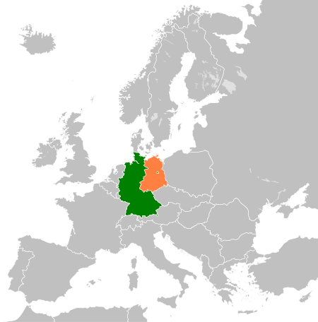
2011-11-26T00:33:57Z StalwartUK 450x456 (485146 Bytes) == {{int:filedesc}} == {{Information |Description={{en|Map of the [[:en:East Germany|East Germany]] (German Democratic Republic) as it was from 1949-1990. Surrounding countries accurate from 1956-1990.}} |Source=*[[:File:Blan
ไฟล, west, east, germany, locator, ไฟล, ประว, ไฟล, หน, าท, ภาพน, การใช, ไฟล, วนกลาง, อม, ลเก, ยวก, บภาพขนาดของต, วอย, าง, ของไฟล, กเซล, ความละเอ, ยดอ, กเซล, กเซล, กเซล, กเซล, กเซล, ภาพท, ความละเอ, ยดส, งกว, 8206, ไฟล, กเซล, ขนาดไฟล, โลไบต, ปภาพหร, อไฟล, เส, ยง. ifl prawtiifl hnathimiphaphni karichiflswnklang khxmulekiywkbphaphkhnadkhxngtwxyang PNG nikhxngifl SVG ni 450 456 phikesl khwamlaexiydxun 237 240 phikesl 474 480 phikesl 758 768 phikesl 1 011 1 024 phikesl 2 021 2 048 phikesl duphaphthimikhwamlaexiydsungkwa 8206 ifl SVG 450 456 phikesl khnadifl 354 kiolibt rupphaphhruxiflesiyngni tnchbbxyuthi khxmmxns raylaexiyddanlang epnkhxkhwamthiaesdngphlcak ifltnchbbinkhxmmxns khxmmxnsepnewbistinokhrngkarsahrbekbrwbrwmsuxesri thi khunsamarthchwyid khwamyx khaxthibayWest and East Germany locator svg English West and East Germany locator map wnthi 13 kumphaphnth ph s 2556 aehlngthima This file was derived from East Germany 1956 1990 svg phusrangsrrkh East Germany 1956 1990 svg Blank map of Europe 1956 1990 svg Blank map of Europe svg maix derivative work Alphathon nbsp aeɫfe 8ɒn nbsp talk derivative work StalwartUK talk derivative work NordNordWest karxnuyatichsiththi khapheca inthanaphuthuxlikhsiththikhxngphaphhruxsuxni xnuyatihichphaphhruxsuxniphayitenguxnikhtxipniiflnixyuphayitsyyaxnuyat khriexthifkhxmmxns aebbaesdngthima xnuyataebbediywkn 3 0 tnchbbkhunsamarth thicaaebngpn thicathasaena aeckcay aelasngngandngklawtxip thicaeriyberiyngihm thicaddaeplngngandngklaw phayitenguxnikhtxipni aesdngthima khuntxngihekiyrtiecakhxngnganxyangehmaasm odyephimlingkipyngsyyaxnuyat aelarabuhakmikarepliynaeplng khunxacthaechnniidinrupaebbidkidtamkhwr aettxngimichinlksnathiaenawaphuihxnuyatsnbsnunkhunhruxkarichngankhxngkhun xnuyataebbediywkn hakkhunddaeplng epliynrup hruxtxetimnganni khuntxngichsyyaxnuyataebbediywknhruxaebbthiehmuxnkbsyyaxnuyatthiichkbnganniethannhttps creativecommons org licenses by sa 3 0 CC BY SA 3 0 Creative Commons Attribution Share Alike 3 0 true true bnthukkarxphohld This image is a derivative work of the following images File East Germany 1956 1990 svg licensed with Cc by sa 3 0 2011 11 26T00 33 57Z StalwartUK 450x456 485146 Bytes int filedesc Information Description en Map of the en East Germany East Germany German Democratic Republic as it was from 1949 1990 Surrounding countries accurate from 1956 1990 Source File BlankhabrryayodyyxithyephimkhabrryaythrrthdediywephuxkhyaykhwamwaiflnimixairixethmthiaesdngxyuiniflniprakxbdwysthanalikhsiththimilikhsiththisyyaxnuyatCreative Commons Attribution ShareAlike 3 0 Unported nbsp xngkvswnthisrang wnkxtng13 kumphaphnth 2013 prawtiifl khlikwnthi ewlaephuxduiflthipraktinkhnann wnthi ewlarupyxkhnadphuichkhwamehn pccubn04 01 14 kumphaphnth 2556450 456 354 kiolibt NordNordWest int filedesc Information Description en West and East Germany locator map Source Derived from East Germany 1956 1990 svg Date 2013 02 13 Author File East Germany 1956 1990 svg File Blank map of Europe 1956 1990 svg B hnathimiphaphni hnatxipni oyngmathiphaphni prawtisastreyxrmni kh s 1945 1990 karichiflswnklang wikixuntxipniichiflni karichbn de wikipedia org Aussenpolitik der Bundesrepublik Deutschland Wikipedia Kartenwerkstatt Archiv 2017 02 karichbn fr wikipedia org Allemagne de l Est region karichbn he wikipedia org גרמניה לאחר מלחמת העולם השנייה karichbn hu wikipedia org A Nemet Demokratikus Koztarsasag es a Nemetorszagi Szovetsegi Koztarsasag kozotti kapcsolatok karichbn sv wikipedia org Relationer mellan Vasttyskland och Osttysklandkhxmulekiywkbphaph phaphnimikhxmulephimetim sungswnihymacakklxngdicitxlhruxsaeknenxrthisamarthekbkhxmuldngklawiwrwmkbphaphid thaphaphnithukprbprungaekikhhruxepliynaeplngcakedim khxmulbangxyangcayngkhngimepliynaeplngehmuxnphaphthithukprbprungaekikhnnkhwamkwang450pxkhwamsung456px ekhathungcak https th wikipedia org wiki ifl West and East Germany locator svg, wikipedia, วิกิ หนังสือ, หนังสือ, ห้องสมุด,