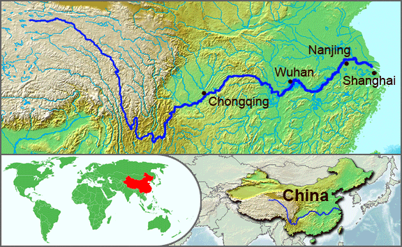
English: The underlying topographic maps used in this image come from the Demis Web Map Server, and are in the public domain. The world locator map is derived from :Image:BlankMap-World.png. I added the feature layers myself. —Papayoung ☯ 20:57, 1 October 2005 (UTC)
วันที่
1 ตุลาคม พ.ศ. 2548 (original upload date)
แหล่งที่มา
นำเข้าจาก en.wikipedia มายังคอมมอนส์ โดย Common Good โดยใช้ CommonsHelper
ผู้สร้างสรรค์
The original uploader was Papayoung ที่ วิกิพีเดียภาษาอังกฤษ.
The original description page was here. All following user names refer to en.wikipedia.
2005-10-01 20:51 Papayoung 576×355× (125604 bytes) The underlying topographic maps used in this image come from the [http://www2.demis.nl/mapserver/mapper.asp Demis Web Map Server], and are in the public domain. The world locator map is derived from [[Commons:Image:BlankMap-World.png|BlankMap-World.png]].
2005-09-25 22:57 Papayoung 936×363× (221574 bytes) The underlying topographic maps used in this image come from the [http://www2.demis.nl/mapserver/mapper.asp Demis Web Map Server], and are in the public domain. I added the feature layers myself. —~~~~
{{BotMoveToCommons|en.wikipedia|year={{subst:CURRENTYEAR}}|month={{subst:CURRENTMONTHNAME}}|day={{subst:CURRENTDAY}}}} {{Information |Description={{en|The underlying topographic maps used in this image come from the [http://www2.demis.nl/mapserver/mapper
ไฟล, yangtze, river, ไฟล, ประว, ไฟล, หน, าท, ภาพน, การใช, ไฟล, วนกลางไม, ภาพท, รายละเอ, ยดส, งกว, าน, yangtze, river, 8206, กเซล, ขนาดไฟล, โลไบต, ชน, ดไมม, image, ปภาพหร, อไฟล, เส, ยงน, นฉบ, บอย, คอมมอนส, รายละเอ, ยดด, านล, าง, เป, นข, อความท, แสดงผลจาก, ไฟล, . ifl prawtiifl hnathimiphaphni karichiflswnklangimmiphaphthimiraylaexiydsungkwani Yangtze River Map png 8206 576 355 phikesl khnadifl 123 kiolibt chnidimm image png rupphaphhruxiflesiyngni tnchbbxyuthi khxmmxns raylaexiyddanlang epnkhxkhwamthiaesdngphlcak ifltnchbbinkhxmmxns khxmmxnsepnewbistinokhrngkarsahrbekbrwbrwmsuxesri thi khunsamarthchwyid khwamyx khaxthibayYangtze River Map png English The underlying topographic maps used in this image come from the Demis Web Map Server and are in the public domain The world locator map is derived from Image BlankMap World png I added the feature layers myself Papayoung 20 57 1 October 2005 UTC wnthi 1 tulakhm ph s 2548 original upload date aehlngthima naekhacak en wikipedia mayngkhxmmxns ody Common Good odyich CommonsHelper phusrangsrrkh The original uploader was Papayoung thi wikiphiediyphasaxngkvs ewxrchnxun iflxunthiichiflni Yangtze River el JPG Yangtze River Hanzi jpg karxnuyatichsiththi iflnixyuphayitsyyaxnuyat khriexthifkhxmmxns aebbaesdngthima xnuyataebbediywkn 3 0 tnchbb thngni epniptamkhxptiesthkhwamrbphidchxb khunsamarth thicaaebngpn thicathasaena aeckcay aelasngngandngklawtxip thicaeriyberiyngihm thicaddaeplngngandngklaw phayitenguxnikhtxipni aesdngthima khuntxngihekiyrtiecakhxngnganxyangehmaasm odyephimlingkipyngsyyaxnuyat aelarabuhakmikarepliynaeplng khunxacthaechnniidinrupaebbidkidtamkhwr aettxngimichinlksnathiaenawaphuihxnuyatsnbsnunkhunhruxkarichngankhxngkhun xnuyataebbediywkn hakkhunddaeplng epliynrup hruxtxetimnganni khuntxngichsyyaxnuyataebbediywknhruxaebbthiehmuxnkbsyyaxnuyatthiichkbnganniethann payaesdngsthanalikhsiththinithukephimephuxihepniptamkarepliynaeplngsyyaxnuyatkhxngmulnithiwikimiediy cak GFDL ipyng GFDL khwbkhukb CC BY SA 3 0 http creativecommons org licenses by sa 3 0 CC BY SA 3 0 Creative Commons Attribution Share Alike 3 0 true true xnuyatihkhdlxk aeckcayaela hruxddaeprexksarniphayitenguxnikhkhxngsyyaxnuyatexksaresrikhxngknu run 1 2 hruxrunid nbcaknithixxkodymulnithisxftaewresri odyimmiswnidhamaekikh immikhxkhwampkhnaaelapkhlng saenakhxngsyyaxnuyatrwmxyuinswnchux syyaxnuyatexksaresrikhxngknu thngni epniptamkhxptiesthkhwamrbphidchxbhttp www gnu org copyleft fdl html GFDL GNU Free Documentation License true true bnthukkarxphohld The original description page was here All following user names refer to en wikipedia 2005 10 01 20 51 Papayoung 576 355 125604 bytes The underlying topographic maps used in this image come from the http www2 demis nl mapserver mapper asp Demis Web Map Server and are in the public domain The world locator map is derived from Commons Image BlankMap World png BlankMap World png 2005 09 25 22 57 Papayoung 936 363 221574 bytes The underlying topographic maps used in this image come from the http www2 demis nl mapserver mapper asp Demis Web Map Server and are in the public domain I added the feature layers myself khabrryayodyyxithyephimkhabrryaythrrthdediywephuxkhyaykhwamwaiflnimixairixethmthiaesdngxyuiniflniprakxbdwysthanalikhsiththimilikhsiththisyyaxnuyatGNU Free Documentation License version 1 2 or later nbsp xngkvsCreative Commons Attribution ShareAlike 3 0 Unported nbsp xngkvswnthisrang wnkxtng1 tulakhm 2005 prawtiifl khlikwnthi ewlaephuxduiflthipraktinkhnann wnthi ewlarupyxkhnadphuichkhwamehn pccubn03 30 8 phvsphakhm 2552576 355 123 kiolibt File Upload Bot Magnus Manske BotMoveToCommons en wikipedia year subst CURRENTYEAR month subst CURRENTMONTHNAME day subst CURRENTDAY Information Description en The underlying topographic maps used in this image come from the http www2 demis nl mapserver mapper hnathimiphaphni hnatxipni oyngmathiphaphni aemnaaeyngsi karichiflswnklang wikixuntxipniichiflni karichbn af wikipedia org Yangtze karichbn als wikipedia org Jangtsekiang karichbn am wikipedia org ያንግ ጸ ወንዝ karichbn ary wikipedia org يانݣ تسي karichbn ast wikipedia org Wuhan karichbn as wikipedia org য জ নদ karichbn azb wikipedia org یانقتسه چایی karichbn bar wikipedia org Jangtsekiang karichbn be tarask wikipedia org Yanczy karichbn bh wikipedia org य ग त स नद karichbn bn wikipedia org ছ চ য নদ karichbn bo wikipedia org འབ ཆ karichbn br wikipedia org Yangtze karichbn cs wikipedia org Jang c tiang karichbn de wikipedia org Jangtsekiang Lied vom Chang Jiang karichbn en wikipedia org Yangtze Patrol User Poker95 sandbox 1935 Yangtze flood karichbn en wikinews org Massive flooding in China over 550 thousand evacuated karichbn es wikipedia org Yangtse Chongqing karichbn et wikipedia org Jangtse Xianting karichbn eu wikipedia org Txikipedia Ibai Urdina karichbn fi wikipedia org Jangtse karichbn fo wikipedia org Yangtze karichbn frr wikipedia org Jangtsekiang karichbn fr wikipedia org Yangtse Patrouille du Yangtse karichbn fr wikivoyage org Yangzi Jiang karichbn fr wiktionary org Yangtse karichbn fy wikipedia org Jangtse karichbn hi wikipedia org य ग त स क य ग karichbn hu wikipedia org Jangce karichbn hy wikipedia org Յանցզի karichbn hyw wikipedia org Չինաստան karichbn id wikipedia org Sungai Panjang karichbn ilo wikipedia org Karayan Yangtze karichbn incubator wikimedia org Wp kjh Yanczy Wp mnc golmin ula karichbn io wikipedia org Yangcekiang karichbn it wikipedia org Fiume Azzurro Incidente del Fiume Azzurro karichbn ja wikipedia org 長江 karichbn ka wikipedia org იანძი karichbn ko wikipedia org 장강 karichbn ku wikipedia org Yangtse karichbn la wikipedia org Flumen Caeruleum karichbn lfn wikipedia org Rio Yangzi dukarichthwolkephimetimkhxngiflni ekhathungcak https th wikipedia org wiki ifl Yangtze River Map png, wikipedia, วิกิ หนังสือ, หนังสือ, ห้องสมุด,