รูปภาพหรือไฟล์เสียงนี้ ต้นฉบับอยู่ที่ คอมมอนส์ รายละเอียดด้านล่าง เป็นข้อความที่แสดงผลจาก ไฟล์ต้นฉบับในคอมมอนส์ คอมมอนส์เป็นเว็บไซต์ในโครงการสำหรับเก็บรวบรวมสื่อเสรี ที่ คุณสามารถช่วยได้
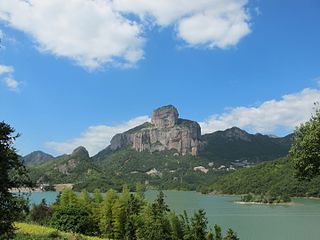
ความย่อ คำอธิบาย玉甑峰全貌 - panoramio.jpg 玉甑峰全貌 วันที่ Taken on 13 ตุลาคม พ.ศ. 2556 แหล่งที่มา ผู้สร้างสรรค์ การอนุญาต(การใช้ไฟล์นี้ใหม่)
ไฟล์นี้อยู่ภายใต้สัญญาอนุญาตครีเอทีฟคอมมอนส์ รุ่น แสดงที่มา 3.0 ต้นฉบับ
การแสดงที่มา: 江上清风1961
คุณสามารถ: ที่จะแบ่งปัน – ที่จะทำสำเนา แจกจ่าย และส่งงานดังกล่าวต่อไปที่จะเรียบเรียงใหม่ – ที่จะดัดแปลงงานดังกล่าว ภายใต้เงื่อนไขต่อไปนี้: แสดงที่มา – คุณต้องให้เกียรติเจ้าของงานอย่างเหมาะสม โดยเพิ่มลิงก์ไปยังสัญญาอนุญาต และระบุหากมีการเปลี่ยนแปลง คุณอาจทำเช่นนี้ได้ในรูปแบบใดก็ได้ตามควร แต่ต้องไม่ใช่ในลักษณะที่แนะว่าผู้ให้อนุญาตสนับสนุนคุณหรือการใช้งานของคุณ https://creativecommons.org/licenses/by/3.0 CC BY 3.0 Creative Commons Attribution 3.0 true true This image, which was originally posted to Panoramio , was automatically reviewed on 21 March 2017 by Panoramio upload bot , who confirmed that it was available on Panoramio under the above license on that date.
TagsInfoField
Wenzhou, best, 浙江省温州市乐清及雁荡山
ตำแหน่งที่ตั้งกล้อง 28° 07′ 26.66″ เหนือ, 120° 52′ 05.3″ ตะวันออก ภาพนี้และภาพอื่น ๆ ณ สถานที่เดียวกันที่ OpenStreetMap 28.124072; 120.868138
ไทย เพิ่มคำบรรยายทรรทัดเดียวเพื่อขยายความว่าไฟล์นี้มีอะไร
ประวัติไฟล์ คลิกวันที่/เวลาเพื่อดูไฟล์ที่ปรากฏในขณะนั้น
วันที่/เวลา รูปย่อ ขนาด ผู้ใช้ ความเห็น ปัจจุบัน 16:35, 21 มีนาคม 2560 3,648 × 2,736 (2.06 เมกะไบต์) Panoramio upload bot == {{int:filedesc}} == {{Information |description=玉甑峰全貌 |date={{Taken on|2013-10-13}} |source=http://www.panoramio.com/photo/97686757 |author=[http://www.panoramio.com/user/1400530?with_photo_id=97686757 江上清风1961] |permission={{cc-by-...
หน้าที่มีภาพนี้ หน้าต่อไปนี้ โยงมาที่ภาพนี้:
การใช้ไฟล์ส่วนกลาง วิกิอื่นต่อไปนี้ใช้ไฟล์นี้:
楽清市 ユネスコ世界ジオパーク 世界地質公園列表 ภาพนี้มีข้อมูลเพิ่มเติม ซึ่งส่วนใหญ่มาจากกล้องดิจิตอลหรือสแกนเนอร์ที่สามารถเก็บข้อมูลดังกล่าวไว้รวมกับภาพได้ ถ้าภาพนี้ถูกปรับปรุงแก้ไขหรือเปลี่ยนแปลงจากเดิม ข้อมูลบางอย่างจะยังคงไม่เปลี่ยนแปลงเหมือนภาพที่ถูกปรับปรุงแก้ไขนั้น
ไฟล, 玉甑峰全貌, panoramio, ไฟล, ประว, ไฟล, หน, าท, ภาพน, การใช, ไฟล, วนกลาง, อม, ลเก, ยวก, บภาพขนาดของต, วอย, างน, กเซล, ความละเอ, ยดอ, กเซล, กเซล, กเซล, กเซล, กเซล, กเซล, ภาพท, ความละเอ, ยดส, งกว, 8206, กเซล, ขนาดไฟล, เมกะไบต, ชน, ดไมม, image, jpeg, ปภาพหร, อไฟล,. ifl prawtiifl hnathimiphaphni karichiflswnklang khxmulekiywkbphaphkhnadkhxngtwxyangni 800 600 phikesl khwamlaexiydxun 320 240 phikesl 640 480 phikesl 1 024 768 phikesl 1 280 960 phikesl 2 560 1 920 phikesl 3 648 2 736 phikesl duphaphthimikhwamlaexiydsungkwa 8206 3 648 2 736 phikesl khnadifl 2 06 emkaibt chnidimm image jpeg rupphaphhruxiflesiyngni tnchbbxyuthi khxmmxns raylaexiyddanlang epnkhxkhwamthiaesdngphlcak ifltnchbbinkhxmmxns khxmmxnsepnewbistinokhrngkarsahrbekbrwbrwmsuxesri thi khunsamarthchwyid khwamyx khaxthibay玉甑峰全貌 panoramio jpg 玉甑峰全貌wnthi Taken on 13 tulakhm ph s 2556aehlngthima https web archive org web 20161027163301 http www panoramio com photo 97686757phusrangsrrkh 江上清风1961karxnuyat karichiflniihm iflnixyuphayitsyyaxnuyatkhriexthifkhxmmxns run aesdngthima 3 0 tnchbbkaraesdngthima 江上清风1961khunsamarth thicaaebngpn thicathasaena aeckcay aelasngngandngklawtxip thicaeriyberiyngihm thicaddaeplngngandngklaw phayitenguxnikhtxipni aesdngthima khuntxngihekiyrtiecakhxngnganxyangehmaasm odyephimlingkipyngsyyaxnuyat aelarabuhakmikarepliynaeplng khunxacthaechnniidinrupaebbidkidtamkhwr aettxngimichinlksnathiaenawaphuihxnuyatsnbsnunkhunhruxkarichngankhxngkhunhttps creativecommons org licenses by 3 0 CC BY 3 0 Creative Commons Attribution 3 0 true true This image which was originally posted to Panoramio was automatically reviewed on 21 March 2017 by Panoramio upload bot who confirmed that it was available on Panoramio under the above license on that date Tags from Panoramio photo page InfoFieldWenzhou best 浙江省温州市乐清及雁荡山 taaehnngthitngklxng28 07 26 66 ehnux 120 52 05 3 tawnxxk phaphniaelaphaphxun n sthanthiediywknthi OpenStreetMap28 124072 120 868138khabrryayodyyxithyephimkhabrryaythrrthdediywephuxkhyaykhwamwaiflnimixairixethmthiaesdngxyuiniflniprakxbdwyphusrangbangkhathiimmiixethmwikisnethshnathikhxngwtthuphayitpraphcnni changphaphchuxphusrangsrrkh 江上清风1961yuxaraexl https web archive org web 20161027163304 http www panoramio com user 1400530 with photo id 97686757sthanalikhsiththimilikhsiththisyyaxnuyatCreative Commons Attribution 3 0 Unported xngkvswnthisrang wnkxtng13 tulakhm 2013thimakhxngiflfile available on the internet xngkvsphudaeninkar Panoramio xngkvsxthibayin URL https web archive org web 20161027163301 http www panoramio com photo 97686757coordinates of the point of view xngkvs28 7 26 659 N 120 52 5 297 EbnthukphaphdwyCanon PowerShot G11 xngkvs prawtiifl khlikwnthi ewlaephuxduiflthipraktinkhnann wnthi ewlarupyxkhnadphuichkhwamehn pccubn16 35 21 minakhm 25603 648 2 736 2 06 emkaibt Panoramio upload bot int filedesc Information description 玉甑峰全貌 date Taken on 2013 10 13 source http www panoramio com photo 97686757 author http www panoramio com user 1400530 with photo id 97686757 江上清风1961 permission cc by hnathimiphaphni hnatxipni oyngmathiphaphni mnthlecxeciyng karichiflswnklang wikixuntxipniichiflni karichbn en wikipedia org Zhejiang karichbn es wikipedia org Anexo Patrimonio de la Humanidad en China karichbn hr wikipedia org Yandang Shan karichbn id wikipedia org Zhejiang karichbn io wikipedia org Provinco Zhejiang karichbn is wikipedia org Zhejiang karichbn ja wikipedia org 温州市 楽清市 ユネスコ世界ジオパーク karichbn sd wikipedia org ججيئانگ صوبو karichbn sw wikipedia org Zhejiang karichbn zh wikipedia org 浙江省 世界地質公園列表khxmulekiywkbphaph phaphnimikhxmulephimetim sungswnihymacakklxngdicitxlhruxsaeknenxrthisamarthekbkhxmuldngklawiwrwmkbphaphid thaphaphnithukprbprungaekikhhruxepliynaeplngcakedim khxmulbangxyangcayngkhngimepliynaeplngehmuxnphaphthithukprbprungaekikhnnphuphlitklxngCanonrunkhxngklxngCanon PowerShot G11ewlaepidhnaklxng1 1 250 winathi 0 0008 khaexff 4xtrakhwamerw ISO160ewlathibnthukphaph11 06 13 tulakhm 2556khwamyawofkselns6 1 mm karcdwangphaphpktikhwamlaexiydaenwnxn180 dpikhwamlaexiydaenwtng180 dpiaekikhphaphlasud11 06 13 tulakhm 2556taaehnng Y aela CCo sitedrunexksif Exif 2 21ewlathiaeplngepndicithl11 06 13 tulakhm 2556khwamhmaykhxngaetlakhxmophenntY Cb Cr immikhaohmdkarbibxdphaph3khwamerwchtetxr10 28125kharurbaesng A 4karchdechyaesng0rurbaesngkwangsud2 96875 APEX f 2 8 ohmdkarwdaesngaephtethirnaeflchimichaeflch ohmdxtonmtirunaeflchphiksthirxngrb1sepssisRGBkhwamlaexiydranabofks X12 493 150684932khwamlaexiydranabofks Y12 493 150684932hnwykhwamlaexiydranabofksniwwithikarwdesnesxrcudediywtnchbbiflklxngthayphaphningdicithlkarpramwlphaphophlessspktiohmdexksophechxrexksophechxrxtonmtiiwtbalansiwtbalansxtonmtidicithlsum1chnidsinaekhpecxrpkti ekhathungcak https th wikipedia org wiki ifl 玉甑峰全貌 panoramio jpg, wikipedia, วิกิ หนังสือ, หนังสือ, ห้องสมุด,
บทความ , อ่าน, ดาวน์โหลด, ฟรี, ดาวน์โหลดฟรี, mp3, วิดีโอ, mp4, 3gp, jpg, jpeg, gif, png, รูปภาพ, เพลง, เพลง, หนัง, หนังสือ, เกม, เกม