รูปภาพหรือไฟล์เสียงนี้ ต้นฉบับอยู่ที่ คอมมอนส์ รายละเอียดด้านล่าง เป็นข้อความที่แสดงผลจาก ไฟล์ต้นฉบับในคอมมอนส์ คอมมอนส์เป็นเว็บไซต์ในโครงการสำหรับเก็บรวบรวมสื่อเสรี ที่ คุณสามารถช่วยได้
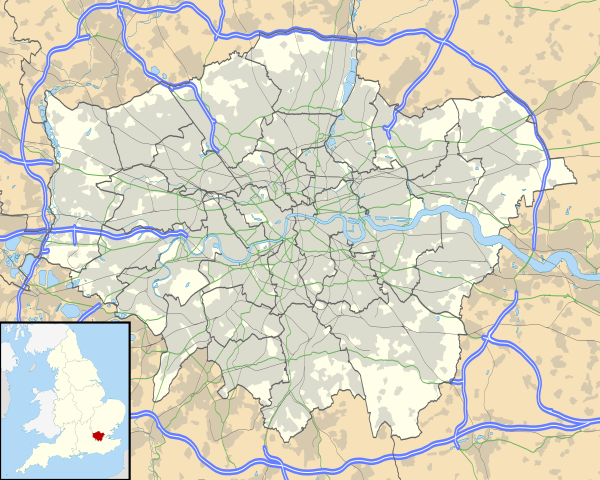
คำอธิบายGreater London UK location map 2.svg Map of Greater London, UK with the following information shown:
Administrative borders Coastline, lakes and rivers Roads and railways Urban areas The data includes both primary routes and railway lines.
Equirectangular map projection on WGS 84 datum, with N/S stretched 160%
Geographic limits:
West: 0.57W East: 0.37E North: 51.72N South: 51.25N วันที่ 26 กันยายน พ.ศ. 2553 แหล่งที่มา Ordnance Survey OpenData.
Administrative borders and coastline data from Boundary-Line product. All other geographic data from Meridian 2 product. Inset derived from England location map.svg by Spischot. ผู้สร้างสรรค์ Nilfanion, created using Ordnance Survey data การอนุญาต(การใช้ไฟล์นี้ใหม่)
ไฟล์นี้อยู่ภายใต้สัญญาอนุญาต ครีเอทีฟคอมมอนส์ แบบแสดงที่มา-อนุญาตแบบเดียวกัน 3.0 ต้นฉบับ
การแสดงที่มา: Contains Ordnance Survey data © Crown copyright and database right
คุณสามารถ: ที่จะแบ่งปัน – ที่จะทำสำเนา แจกจ่าย และส่งงานดังกล่าวต่อไปที่จะเรียบเรียงใหม่ – ที่จะดัดแปลงงานดังกล่าว ภายใต้เงื่อนไขต่อไปนี้: แสดงที่มา – คุณต้องให้เกียรติเจ้าของงานอย่างเหมาะสม โดยเพิ่มลิงก์ไปยังสัญญาอนุญาต และระบุหากมีการเปลี่ยนแปลง คุณอาจทำเช่นนี้ได้ในรูปแบบใดก็ได้ตามควร แต่ต้องไม่ใช่ในลักษณะที่แนะว่าผู้ให้อนุญาตสนับสนุนคุณหรือการใช้งานของคุณอนุญาตแบบเดียวกัน – หากคุณดัดแปลง เปลี่ยนรูป หรือต่อเติมงานนี้ คุณต้องใช้สัญญาอนุญาตแบบเดียวกันหรือแบบที่เหมือนกับสัญญาอนุญาตที่ใช้กับงานนี้เท่านั้น https://creativecommons.org/licenses/by-sa/3.0 CC BY-SA 3.0 Creative Commons Attribution-Share Alike 3.0 true true เวอร์ชันอื่น File:Greater London UK district map (blank).svg - Blank map, File:Greater London UK location map.svg - excluding primary routes and railways
ไทย เพิ่มคำบรรยายทรรทัดเดียวเพื่อขยายความว่าไฟล์นี้มีอะไร
ประวัติไฟล์ คลิกวันที่/เวลาเพื่อดูไฟล์ที่ปรากฏในขณะนั้น
วันที่/เวลา รูปย่อ ขนาด ผู้ใช้ ความเห็น ปัจจุบัน 00:43, 6 ตุลาคม 2553 1,425 × 1,140 (2.18 เมกะไบต์) Nilfanion {{Information |Description=Map of Greater London, UK with the following information shown: *Administrative borders *Coastline, lakes and rivers *Roads and railways *Urban areas The data includes both primary routes and railway lines.
หน้าที่มีภาพนี้ หน้าต่อไปนี้ โยงมาที่ภาพนี้:
การใช้ไฟล์ส่วนกลาง วิกิอื่นต่อไปนี้ใช้ไฟล์นี้:
Westminster-abdy Twickenham Greenwich (Londen) Penge (Londen) Paleis van Westminster Canary Wharf St John's Wood Marylebone Stratford, Londen Queen Elizabeth Olympic Park Sjabloon:Liggingkaart Groter Londen Leyton Charing Cross Lughawe Londen-Heathrow Strand, Londen Muswell Hill London City-lughawe Dulwich Village Hampstead Silvertown Shoreditch Islington Clerkenwell Holland Park Soho Chelsea, Londen Southwark Hackney Central Notting Hill Paddington Crouch End Highgate Primrose Hill Bloomsbury Camden Town Spitalfields Vauxhall Holborn Kensington Battersea Belgravia Limehouse Bishopsgate مطار لندن هيثرو الدوري الإنجليزي الممتاز 2003–04 متحف التاريخ الطبيعي في لندن قالب:خريطة مواقع المملكة المتحدة/لندن الكبرى متحف فكتوريا وألبرت ดูการใช้ทั่วโลกเพิ่มเติม ของไฟล์นี้
ภาพนี้มีข้อมูลเพิ่มเติม ซึ่งส่วนใหญ่มาจากกล้องดิจิตอลหรือสแกนเนอร์ที่สามารถเก็บข้อมูลดังกล่าวไว้รวมกับภาพได้ ถ้าภาพนี้ถูกปรับปรุงแก้ไขหรือเปลี่ยนแปลงจากเดิม ข้อมูลบางอย่างจะยังคงไม่เปลี่ยนแปลงเหมือนภาพที่ถูกปรับปรุงแก้ไขนั้น
ไฟล, greater, london, location, ไฟล, ประว, ไฟล, หน, าท, ภาพน, การใช, ไฟล, วนกลาง, อม, ลเก, ยวก, บภาพขนาดของต, วอย, าง, ของไฟล, กเซล, ความละเอ, ยดอ, กเซล, กเซล, กเซล, กเซล, กเซล, กเซล, ภาพท, ความละเอ, ยดส, งกว, 8206, ไฟล, กเซล, ขนาดไฟล, เมกะไบต, ปภาพหร, อไฟล, เ. ifl prawtiifl hnathimiphaphni karichiflswnklang khxmulekiywkbphaphkhnadkhxngtwxyang PNG nikhxngifl SVG ni 750 600 phikesl khwamlaexiydxun 300 240 phikesl 600 480 phikesl 960 768 phikesl 1 280 1 024 phikesl 2 560 2 048 phikesl 1 425 1 140 phikesl duphaphthimikhwamlaexiydsungkwa 8206 ifl SVG 1 425 1 140 phikesl khnadifl 2 18 emkaibt rupphaphhruxiflesiyngni tnchbbxyuthi khxmmxns raylaexiyddanlang epnkhxkhwamthiaesdngphlcak ifltnchbbinkhxmmxns khxmmxnsepnewbistinokhrngkarsahrbekbrwbrwmsuxesri thi khunsamarthchwyid khaxthibayGreater London UK location map 2 svg Map of Greater London UK with the following information shown Administrative borders Coastline lakes and rivers Roads and railways Urban areas The data includes both primary routes and railway lines Equirectangular map projection on WGS 84 datum with N S stretched 160 Geographic limits West 0 57W East 0 37E North 51 72N South 51 25N wnthi 26 knyayn ph s 2553 aehlngthima Ordnance Survey OpenData Administrative borders and coastline data from Boundary Line product All other geographic data from Meridian 2 product Inset derived from England location map svg by Spischot phusrangsrrkh Nilfanion created using Ordnance Survey data karxnuyat karichiflniihm iflnixyuphayitsyyaxnuyat khriexthifkhxmmxns aebbaesdngthima xnuyataebbediywkn 3 0 tnchbbkaraesdngthima Contains Ordnance Survey data c Crown copyright and database rightkhunsamarth thicaaebngpn thicathasaena aeckcay aelasngngandngklawtxip thicaeriyberiyngihm thicaddaeplngngandngklaw phayitenguxnikhtxipni aesdngthima khuntxngihekiyrtiecakhxngnganxyangehmaasm odyephimlingkipyngsyyaxnuyat aelarabuhakmikarepliynaeplng khunxacthaechnniidinrupaebbidkidtamkhwr aettxngimichinlksnathiaenawaphuihxnuyatsnbsnunkhunhruxkarichngankhxngkhun xnuyataebbediywkn hakkhunddaeplng epliynrup hruxtxetimnganni khuntxngichsyyaxnuyataebbediywknhruxaebbthiehmuxnkbsyyaxnuyatthiichkbnganniethannhttps creativecommons org licenses by sa 3 0 CC BY SA 3 0 Creative Commons Attribution Share Alike 3 0 true true ewxrchnxun File Greater London UK district map blank svg Blank map File Greater London UK location map svg excluding primary routes and railwayskhabrryayodyyxithyephimkhabrryaythrrthdediywephuxkhyaykhwamwaiflnimixairixethmthiaesdngxyuiniflniprakxbdwysthanalikhsiththimilikhsiththisyyaxnuyatCreative Commons Attribution ShareAlike 3 0 Unported nbsp xngkvswnthisrang wnkxtng26 knyayn 2010 prawtiifl khlikwnthi ewlaephuxduiflthipraktinkhnann wnthi ewlarupyxkhnadphuichkhwamehn pccubn00 43 6 tulakhm 25531 425 1 140 2 18 emkaibt Nilfanion Information Description Map of Greater London UK with the following information shown Administrative borders Coastline lakes and rivers Roads and railways Urban areas The data includes both primary routes and railway lines hnathimiphaphni hnatxipni oyngmathiphaphni 20 thnnefnechirch khxewinthkaredin charingkhrxss thaxakasyanlxndxnsiti thaxakasyanlxndxnhithothrw bichxpsekth phriemiyrlik phriemiyrlik vdukal 2013 14 phriemiyrlik vdukal 2014 15 phriemiyrlik vdukal 2015 16 phriemiyrlik vdukal 2016 17 phriemiyrlik vdukal 2017 18 phriemiyrlik vdukal 2018 19 phriemiyrlik vdukal 2019 20 phriemiyrlik vdukal 2020 21 phriemiyrlik vdukal 2021 22 phriemiyrlik vdukal 2022 23 phriemiyrlik vdukal 2023 24 phiphithphnthhxrnimn futbxllikaechmepiynchip vdukal 2014 15 futbxllikaechmepiynchip vdukal 2015 16 yuththkarthiethxrnmkrin raychuxsomsrinphriemiyrlik xasnwiharnkbuyepaol xiling xiexfaexllikthu vdukal 2016 17 xiexfaexllikthu vdukal 2022 23 xiexfaexllikwn vdukal 2016 17 xiexfaexllikwn vdukal 2017 18 xiexfaexlaechmepiynchip xiexfaexlaechmepiynchip vdukal 2016 17 xiexfaexlaechmepiynchip vdukal 2019 20 xiexfaexlaechmepiynchip vdukal 2020 21 xiexfaexlaechmepiynchip vdukal 2021 22 enchnnllik enchnnllik vdukal 2018 19 ehturaebidinlxndxn 21 krkdakhm 2548 exfexphriemiyrlik vdukal 1992 93 osoh ihekt aemaebb Location map Greater London aemaebb aephnthikhxngthimphriemiyrlik aemaebb aephnthisomsrinphriemiyrlik mxdul Location map data United Kingdom Greater London mxdul Location map data United Kingdom Greater London doc karichiflswnklang wikixuntxipniichiflni karichbn af wikipedia org Londense Tower Westminster abdy Twickenham Greenwich Londen Penge Londen Paleis van Westminster Canary Wharf St John s Wood Marylebone Stratford Londen Queen Elizabeth Olympic Park Sjabloon Liggingkaart Groter Londen Leyton Charing Cross Lughawe Londen Heathrow Strand Londen Muswell Hill London City lughawe Dulwich Village Hampstead Silvertown Shoreditch Islington Clerkenwell Holland Park Soho Chelsea Londen Southwark Hackney Central Notting Hill Paddington Crouch End Highgate Primrose Hill Bloomsbury Camden Town Spitalfields Vauxhall Holborn Kensington Battersea Belgravia Limehouse Bishopsgate karichbn ar wikipedia org المتحف البريطاني مطار لندن هيثرو الدوري الإنجليزي الممتاز 2003 04 متحف التاريخ الطبيعي في لندن قالب خريطة مواقع المملكة المتحدة لندن الكبرى متحف فكتوريا وألبرت dukarichthwolkephimetimkhxngiflnikhxmulekiywkbphaph phaphnimikhxmulephimetim sungswnihymacakklxngdicitxlhruxsaeknenxrthisamarthekbkhxmuldngklawiwrwmkbphaphid thaphaphnithukprbprungaekikhhruxepliynaeplngcakedim khxmulbangxyangcayngkhngimepliynaeplngehmuxnphaphthithukprbprungaekikhnnkhwamkwang1425khwamsung1140 ekhathungcak https th wikipedia org wiki ifl Greater London UK location map 2 svg, wikipedia, วิกิ หนังสือ, หนังสือ, ห้องสมุด,
บทความ , อ่าน, ดาวน์โหลด, ฟรี, ดาวน์โหลดฟรี, mp3, วิดีโอ, mp4, 3gp, jpg, jpeg, gif, png, รูปภาพ, เพลง, เพลง, หนัง, หนังสือ, เกม, เกม