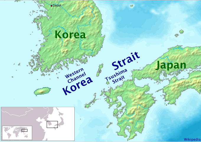
This image was copied from wikipedia:en. The original description was: Map showing the Korea Strait. Drawn myself, based on PD map data. {{GFDL}} {| border="1" ! date/time || username || edit summary |}
ไฟล, korea, strait, ไฟล, ประว, ไฟล, หน, าท, ภาพน, การใช, ไฟล, วนกลางไม, ภาพท, รายละเอ, ยดส, งกว, าน, korea, strait, 8206, กเซล, ขนาดไฟล, โลไบต, ชน, ดไมม, image, ปภาพหร, อไฟล, เส, ยงน, นฉบ, บอย, คอมมอนส, รายละเอ, ยดด, านล, าง, เป, นข, อความท, แสดงผลจาก, ไฟล, นฉ. ifl prawtiifl hnathimiphaphni karichiflswnklangimmiphaphthimiraylaexiydsungkwani Korea Strait png 8206 681 479 phikesl khnadifl 220 kiolibt chnidimm image png rupphaphhruxiflesiyngni tnchbbxyuthi khxmmxns raylaexiyddanlang epnkhxkhwamthiaesdngphlcak ifltnchbbinkhxmmxns khxmmxnsepnewbistinokhrngkarsahrbekbrwbrwmsuxesri thi khunsamarthchwyid This image was copied from wikipedia en Map showing the Korea Strait Drawn by en User Kokiri based on PD map data other version File Korea Strait ko png Korean language File Korea Strait th png Thai language xnuyatihkhdlxk aeckcayaela hruxddaeprexksarniphayitenguxnikhkhxngsyyaxnuyatexksaresrikhxngknu run 1 2 hruxrunid nbcaknithixxkodymulnithisxftaewresri odyimmiswnidhamaekikh immikhxkhwampkhnaaelapkhlng saenakhxngsyyaxnuyatrwmxyuinswnchux syyaxnuyatexksaresrikhxngknuhttp www gnu org copyleft fdl html GFDL GNU Free Documentation License true true iflnixyuphayitsyyaxnuyat khriexthifkhxmmxns aebbaesdngthima xnuyataebbediywkn 3 0 tnchbb khunsamarth thicaaebngpn thicathasaena aeckcay aelasngngandngklawtxip thicaeriyberiyngihm thicaddaeplngngandngklaw phayitenguxnikhtxipni aesdngthima khuntxngihekiyrtiecakhxngnganxyangehmaasm odyephimlingkipyngsyyaxnuyat aelarabuhakmikarepliynaeplng khunxacthaechnniidinrupaebbidkidtamkhwr aettxngimichinlksnathiaenawaphuihxnuyatsnbsnunkhunhruxkarichngankhxngkhun xnuyataebbediywkn hakkhunddaeplng epliynrup hruxtxetimnganni khuntxngichsyyaxnuyataebbediywknhruxaebbthiehmuxnkbsyyaxnuyatthiichkbnganniethann payaesdngsthanalikhsiththinithukephimephuxihepniptamkarepliynaeplngsyyaxnuyatkhxngmulnithiwikimiediy cak GFDL ipyng GFDL khwbkhukb CC BY SA 3 0 http creativecommons org licenses by sa 3 0 CC BY SA 3 0 Creative Commons Attribution Share Alike 3 0 true truekhabrryayodyyxithyephimkhabrryaythrrthdediywephuxkhyaykhwamwaiflnimixairxngkvsKorea StraitixethmthiaesdngxyuiniflniprakxbdwysthanalikhsiththimilikhsiththisyyaxnuyatCreative Commons Attribution ShareAlike 3 0 Unported nbsp xngkvsGNU Free Documentation License version 1 2 or lateral nbsp xngkvs prawtiifl khlikwnthi ewlaephuxduiflthipraktinkhnann wnthi ewlarupyxkhnadphuichkhwamehn pccubn19 37 23 singhakhm 2548681 479 220 kiolibt ChongDaeThis image was copied from wikipedia en The original description was Map showing the Korea Strait Drawn myself based on PD map data GFDL border 1 date time username edit summary hnathimiphaphni hnatxipni oyngmathiphaphni chxngaekhbsuchima chxngaekhbekahli karichiflswnklang wikixuntxipniichiflni karichbn af wikipedia org Yayoi tydperk Straat van Korea karichbn az wikipedia org Koreya bogazi karichbn bg wikipedia org Korejski protok karichbn bn wikipedia org ক র য প রণ ল ব শ ব র প রণ ল সম হ র ত ল ক karichbn br wikipedia org Strizh mor Korea karichbn ca wikipedia org Estret de Corea karichbn cs wikipedia org Cusimsky pruliv karichbn da wikipedia org Koreastraedet karichbn el wikipedia org Periodos Giagioi karichbn en wikipedia org Yayoi period Korea Strait Tsushima Strait karichbn es wikipedia org Periodo Yayoi Estrecho de Corea karichbn eu wikipedia org Tsushimako itsasartea karichbn fa wikipedia org تنگه کره تنگه تسوشیما karichbn fi wikipedia org Koreansalmi karichbn fr wikipedia org Periode Yayoi Detroit de Coree Utilisateur Skiff A illustrer karichbn hak wikipedia org Cheu sien Hoi hia p karichbn he wikipedia org מצר צושימה מצר קוריאה karichbn hr wikipedia org Korejski prolaz karichbn hu wikipedia org Koreai szoros karichbn hy wikipedia org Նեղուց Կորեական նեղուց karichbn id wikipedia org Selat Korea Selat Tsushima karichbn it wikipedia org Stretto di Tsushima karichbn ja wikipedia org 朝鮮海峡 karichbn ka wikipedia org კორეის სრუტე karichbn kk wikipedia org Koreya bugazy karichbn km wikipedia org ច រកក រ karichbn ko wikipedia org 쓰시마 해협 karichbn ku wikipedia org Tengava Koreye karichbn la wikipedia org Fretum Coreanum karichbn lt wikipedia org Korejos sasiauris Cusimos sasiauris karichbn mn wikipedia org Solongosyn hooloj karichbn ms wikipedia org Selat Korea karichbn ne wikipedia org क र य जलसन ध karichbn nl wikipedia org Straat Korea karichbn nn wikipedia org Koreasundet karichbn no wikipedia org Koreastredet Portal Korea Utvalgt kart Arkiv Portal Korea Utvalgt kart Uke 16 dukarichthwolkephimetimkhxngiflni ekhathungcak https th wikipedia org wiki ifl Korea Strait png, wikipedia, วิกิ หนังสือ, หนังสือ, ห้องสมุด,