| | รูปภาพหรือไฟล์เสียงนี้ ต้นฉบับอยู่ที่ คอมมอนส์ รายละเอียดด้านล่าง เป็นข้อความที่แสดงผลจาก ไฟล์ต้นฉบับในคอมมอนส์ คอมมอนส์เป็นเว็บไซต์ในโครงการสำหรับเก็บรวบรวมสื่อเสรี ที่ คุณสามารถช่วยได้ |
ความย่อ
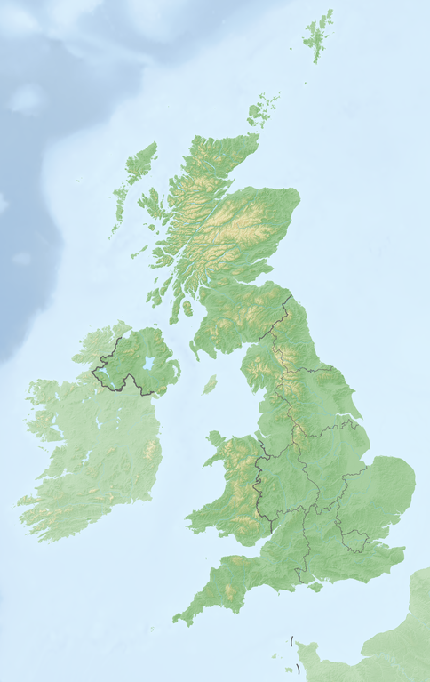
| คำอธิบายReliefkarte Vereinigtes Königreich.png | Deutsch: Reliefkarte Vereinigtes_Königreich Topographischer Hintergrund: NASA Shuttle Radar Topography Mission (public domain). SRTM3 v.2.
Grenzen: United Kingdom NUTS location map.svg |
| วันที่ | |
| แหล่งที่มา | งานของตัว |
| ผู้สร้างสรรค์ | Tschubby |
การอนุญาต
(การใช้ไฟล์นี้ใหม่) | ข้าพเจ้า ในฐานะผู้ถือลิขสิทธิ์ของภาพหรือสื่อนี้ อนุญาตให้ใช้ภาพหรือสื่อนี้ภายใต้เงื่อนไขต่อไปนี้ | | อนุญาตให้คัดลอก แจกจ่ายและ/หรือดัดแปรเอกสารนี้ภายใต้เงื่อนไขของสัญญาอนุญาตเอกสารเสรีของกนู รุ่น 1.2 หรือรุ่นใด ๆ นับจากนี้ที่ออกโดยมูลนิธิซอฟต์แวร์เสรี โดยไม่มีส่วนใดห้ามแก้ไข ไม่มีข้อความปกหน้าและปกหลัง สำเนาของสัญญาอนุญาตรวมอยู่ในส่วนชื่อ สัญญาอนุญาตเอกสารเสรีของกนูhttp://www.gnu.org/copyleft/fdl.htmlGFDLGNU Free Documentation Licensetruetrue |
| ไฟล์นี้อยู่ภายใต้สัญญาอนุญาต ครีเอทีฟคอมมอนส์ แบบแสดงที่มา-อนุญาตแบบเดียวกัน 3.0 ต้นฉบับ | | | | - คุณสามารถ:
- ที่จะแบ่งปัน – ที่จะทำสำเนา แจกจ่าย และส่งงานดังกล่าวต่อไป
- ที่จะเรียบเรียงใหม่ – ที่จะดัดแปลงงานดังกล่าว
- ภายใต้เงื่อนไขต่อไปนี้:
- แสดงที่มา – คุณต้องให้เกียรติเจ้าของงานอย่างเหมาะสม โดยเพิ่มลิงก์ไปยังสัญญาอนุญาต และระบุหากมีการเปลี่ยนแปลง คุณอาจทำเช่นนี้ได้ในรูปแบบใดก็ได้ตามควร แต่ต้องไม่ใช่ในลักษณะที่แนะว่าผู้ให้อนุญาตสนับสนุนคุณหรือการใช้งานของคุณ
- อนุญาตแบบเดียวกัน – หากคุณดัดแปลง เปลี่ยนรูป หรือต่อเติมงานนี้ คุณต้องใช้สัญญาอนุญาตแบบเดียวกันหรือแบบที่เหมือนกับสัญญาอนุญาตที่ใช้กับงานนี้เท่านั้น
| | ป้ายแสดงสถานะลิขสิทธิ์นี้ถูกเพิ่มเพื่อให้เป็นไปตามการเปลี่ยนแปลงสัญญาอนุญาตของมูลนิธิวิกิมีเดีย จาก GFDL ไปยัง GFDL ควบคู่กับ CC-BY-SA 3.0http://creativecommons.org/licenses/by-sa/3.0/CC BY-SA 3.0Creative Commons Attribution-Share Alike 3.0truetrue |
ไฟล์นี้อยู่ภายใต้สัญญาอนุญาตครีเอทีฟคอมมอนส์ รุ่นแสดงที่มา-อนุญาตแบบเดียวกัน 2.5 ทั่วไป, 2.0 ทั่วไป และ 1.0 ทั่วไป - คุณสามารถ:
- ที่จะแบ่งปัน – ที่จะทำสำเนา แจกจ่าย และส่งงานดังกล่าวต่อไป
- ที่จะเรียบเรียงใหม่ – ที่จะดัดแปลงงานดังกล่าว
- ภายใต้เงื่อนไขต่อไปนี้:
- แสดงที่มา – คุณต้องให้เกียรติเจ้าของงานอย่างเหมาะสม โดยเพิ่มลิงก์ไปยังสัญญาอนุญาต และระบุหากมีการเปลี่ยนแปลง คุณอาจทำเช่นนี้ได้ในรูปแบบใดก็ได้ตามควร แต่ต้องไม่ใช่ในลักษณะที่แนะว่าผู้ให้อนุญาตสนับสนุนคุณหรือการใช้งานของคุณ
- อนุญาตแบบเดียวกัน – หากคุณดัดแปลง เปลี่ยนรูป หรือต่อเติมงานนี้ คุณต้องใช้สัญญาอนุญาตแบบเดียวกันหรือแบบที่เหมือนกับสัญญาอนุญาตที่ใช้กับงานนี้เท่านั้น
https://creativecommons.org/licenses/by-sa/2.5CC BY-SA 2.5 Creative Commons Attribution-Share Alike 2.5 truetrueคุณสามารถเลือกสัญญาอนุญาตดังกล่าวตามต้องการ |
เพิ่มคำบรรยายทรรทัดเดียวเพื่อขยายความว่าไฟล์นี้มีอะไร
ประวัติไฟล์
คลิกวันที่/เวลาเพื่อดูไฟล์ที่ปรากฏในขณะนั้น
| วันที่/เวลา | รูปย่อ | ขนาด | ผู้ใช้ | ความเห็น |
|---|
| ปัจจุบัน | 17:36, 21 พฤษภาคม 2561 | | 2,825 × 4,478 (7.79 เมกะไบต์) | Tschubby | {{Information |description= |source= |date= |author= |permission= |other versions= }} |
| 17:19, 21 พฤษภาคม 2561 | | 2,826 × 4,479 (7.79 เมกะไบต์) | Tschubby | == {{int:filedesc}} == {{Information |Description= {{de| Reliefkarte Vereinigtes_Königreich}} Topographischer Hintergrund: [http://www2.jpl.nasa.gov/srtm NASA Shuttle Radar Topography Mission] (public domain). SRTM3 v.2.<br /> Grenzen: Spain location map.svg |Source={{own}} |Date= 2018-05-21 |Author= Tschubby |Permission= {{self|GFDL|Cc-by-sa-3.0-migrated|Cc-by-sa-2.5,2.0,1.0}} |other_versions= }} [[Category:Location maps of the United K... |
หน้าที่มีภาพนี้
ไม่มีหน้าใดโยงมาที่ภาพนี้
การใช้ไฟล์ส่วนกลาง
วิกิอื่นต่อไปนี้ใช้ไฟล์นี้:
- Шаблон:ПК Великобритания
- Тинтагил
- Каледонски планини
- Грампиански планини
- Ландс Енд (нос)
- Хебридски острови
- Хебридско море
- Гринуичка обсерватория
- Северошотландска планинска земя
- Чевиот Хилс
- Камбрийски планини
- Сейнт Килда
- Бийчи Хед
Vereinigtes Königreich Kanalinseln Irische See Blackpool Tower MSF (Zeitzeichensender) GBZ (Rufzeichen) Fernsehturm Emley Moor Sender Lisnagarvey Nordkanal (Meerenge) Bristolkanal New Brighton Tower Vorlage:Positionskarte Vereinigtes Königreich Vorlage:Positionskarte Schottland Benutzer:Wiki surfer bcr/Baustellen Vorlage:Infobox Burg Shepperton St.-Georgs-Kanal Vorlage:Infobox Burg/Doku Vorlage:Positionskarte Nordirland Vorlage:Positionskarte England Liste der Kernreaktoren im Vereinigten Königreich Kategorie:Rennstrecke im Vereinigten Königreich Wikipedia:Kartenwerkstatt/Positionskarten/Europa Vorlage:Positionskarte Isle of Man Vorlage:Positionskarte Wales Vorlage:Positionskarte Kanalinseln St Donat’s Castle Portishead Radio Vorlage:Infobox Wasserfall Vorlage:Infobox Wasserfall/Doku Diskussion:Box Tunnel Benutzer:Haigst-Mann/Geschichte DT SW Sender Orfordness Vorlage:Positionskarte Kernkraftwerke im Vereinigten Königreich Vorlage:Positionskarte Städte im Vereinigten Königreich ดูการใช้ทั่วโลกเพิ่มเติมของไฟล์นี้
ภาพนี้มีข้อมูลเพิ่มเติม ซึ่งส่วนใหญ่มาจากกล้องดิจิตอลหรือสแกนเนอร์ที่สามารถเก็บข้อมูลดังกล่าวไว้รวมกับภาพได้ ถ้าภาพนี้ถูกปรับปรุงแก้ไขหรือเปลี่ยนแปลงจากเดิม ข้อมูลบางอย่างจะยังคงไม่เปลี่ยนแปลงเหมือนภาพที่ถูกปรับปรุงแก้ไขนั้น
ไฟล, reliefkarte, vereinigtes, königreich, ไฟล, ประว, ไฟล, หน, าท, ภาพน, การใช, ไฟล, วนกลาง, อม, ลเก, ยวก, บภาพขนาดของต, วอย, างน, กเซล, ความละเอ, ยดอ, กเซล, กเซล, กเซล, กเซล, กเซล, กเซล, ภาพท, ความละเอ, ยดส, งกว, 8206, กเซล, ขนาดไฟล, เมกะไบต, ชน, ดไมม, image,. ifl prawtiifl hnathimiphaphni karichiflswnklang khxmulekiywkbphaphkhnadkhxngtwxyangni 378 599 phikesl khwamlaexiydxun 151 240 phikesl 303 480 phikesl 484 768 phikesl 646 1 024 phikesl 1 292 2 048 phikesl 2 825 4 478 phikesl duphaphthimikhwamlaexiydsungkwa 8206 2 825 4 478 phikesl khnadifl 7 79 emkaibt chnidimm image png rupphaphhruxiflesiyngni tnchbbxyuthi khxmmxns raylaexiyddanlang epnkhxkhwamthiaesdngphlcak ifltnchbbinkhxmmxns khxmmxnsepnewbistinokhrngkarsahrbekbrwbrwmsuxesri thi khunsamarthchwyid khwamyx khaxthibayReliefkarte Vereinigtes Konigreich png Deutsch Reliefkarte Vereinigtes Konigreich Topographischer Hintergrund NASA Shuttle Radar Topography Mission public domain SRTM3 v 2 Grenzen United Kingdom NUTS location map svg wnthi 21 phvsphakhm ph s 2561 aehlngthima ngankhxngtw phusrangsrrkh Tschubby karxnuyat karichiflniihm khapheca inthanaphuthuxlikhsiththikhxngphaphhruxsuxni xnuyatihichphaphhruxsuxniphayitenguxnikhtxipni xnuyatihkhdlxk aeckcayaela hruxddaeprexksarniphayitenguxnikhkhxngsyyaxnuyatexksaresrikhxngknu run 1 2 hruxrunid nbcaknithixxkodymulnithisxftaewresri odyimmiswnidhamaekikh immikhxkhwampkhnaaelapkhlng saenakhxngsyyaxnuyatrwmxyuinswnchux syyaxnuyatexksaresrikhxngknuhttp www gnu org copyleft fdl html GFDL GNU Free Documentation License true true iflnixyuphayitsyyaxnuyat khriexthifkhxmmxns aebbaesdngthima xnuyataebbediywkn 3 0 tnchbb khunsamarth thicaaebngpn thicathasaena aeckcay aelasngngandngklawtxip thicaeriyberiyngihm thicaddaeplngngandngklaw phayitenguxnikhtxipni aesdngthima khuntxngihekiyrtiecakhxngnganxyangehmaasm odyephimlingkipyngsyyaxnuyat aelarabuhakmikarepliynaeplng khunxacthaechnniidinrupaebbidkidtamkhwr aettxngimichinlksnathiaenawaphuihxnuyatsnbsnunkhunhruxkarichngankhxngkhun xnuyataebbediywkn hakkhunddaeplng epliynrup hruxtxetimnganni khuntxngichsyyaxnuyataebbediywknhruxaebbthiehmuxnkbsyyaxnuyatthiichkbnganniethann payaesdngsthanalikhsiththinithukephimephuxihepniptamkarepliynaeplngsyyaxnuyatkhxngmulnithiwikimiediy cak GFDL ipyng GFDL khwbkhukb CC BY SA 3 0 http creativecommons org licenses by sa 3 0 CC BY SA 3 0 Creative Commons Attribution Share Alike 3 0 true trueiflnixyuphayitsyyaxnuyatkhriexthifkhxmmxns runaesdngthima xnuyataebbediywkn 2 5 thwip 2 0 thwip aela 1 0 thwipkhunsamarth thicaaebngpn thicathasaena aeckcay aelasngngandngklawtxip thicaeriyberiyngihm thicaddaeplngngandngklaw phayitenguxnikhtxipni aesdngthima khuntxngihekiyrtiecakhxngnganxyangehmaasm odyephimlingkipyngsyyaxnuyat aelarabuhakmikarepliynaeplng khunxacthaechnniidinrupaebbidkidtamkhwr aettxngimichinlksnathiaenawaphuihxnuyatsnbsnunkhunhruxkarichngankhxngkhun xnuyataebbediywkn hakkhunddaeplng epliynrup hruxtxetimnganni khuntxngichsyyaxnuyataebbediywknhruxaebbthiehmuxnkbsyyaxnuyatthiichkbnganniethannhttps creativecommons org licenses by sa 2 5 CC BY SA 2 5 Creative Commons Attribution Share Alike 2 5 true truekhunsamartheluxksyyaxnuyatdngklawtamtxngkarkhabrryayodyyxithyephimkhabrryaythrrthdediywephuxkhyaykhwamwaiflnimixairixethmthiaesdngxyuiniflniprakxbdwysthanalikhsiththimilikhsiththisyyaxnuyatGNU Free Documentation License version 1 2 or lateral nbsp xngkvsCreative Commons Attribution ShareAlike 1 0 Generic nbsp xngkvsCreative Commons Attribution ShareAlike 2 0 Generic nbsp xngkvsCreative Commons Attribution ShareAlike 2 5 Generic nbsp xngkvsCreative Commons Attribution ShareAlike 3 0 Unported nbsp xngkvswnthisrang wnkxtng21 phvsphakhm 2018thimakhxngiflkarsrangdngedimodyphuxpohldMIME type nbsp xngkvsimage png prawtiifl khlikwnthi ewlaephuxduiflthipraktinkhnann wnthi ewlarupyxkhnadphuichkhwamehn pccubn17 36 21 phvsphakhm 25612 825 4 478 7 79 emkaibt Tschubby Information description source date author permission other versions 17 19 21 phvsphakhm 25612 826 4 479 7 79 emkaibt Tschubby int filedesc Information Description de Reliefkarte Vereinigtes Konigreich Topographischer Hintergrund http www2 jpl nasa gov srtm NASA Shuttle Radar Topography Mission public domain SRTM3 v 2 lt br gt Grenzen Spain location map svg Source own Date 2018 05 21 Author Tschubby Permission self GFDL Cc by sa 3 0 migrated Cc by sa 2 5 2 0 1 0 other versions Category Location maps of the United K hnathimiphaphni immihnaidoyngmathiphaphnikarichiflswnklang wikixuntxipniichiflni karichbn bg wikipedia org Sevrn Shablon PK Velikobritaniya Tintagil Kaledonski planini Grampianski planini Lands End nos Hebridski ostrovi Hebridsko more Grinuichka observatoriya Severoshotlandska planinska zemya Cheviot Hils Kambrijski planini Sejnt Kilda Bijchi Hed karichbn de wikipedia org Grossbritannien Insel Vereinigtes Konigreich Kanalinseln Irische See Blackpool Tower MSF Zeitzeichensender GBZ Rufzeichen Fernsehturm Emley Moor Sender Lisnagarvey Nordkanal Meerenge Bristolkanal New Brighton Tower Vorlage Positionskarte Vereinigtes Konigreich Vorlage Positionskarte Schottland Benutzer Wiki surfer bcr Baustellen Vorlage Infobox Burg Shepperton St Georgs Kanal Vorlage Infobox Burg Doku Vorlage Positionskarte Nordirland Vorlage Positionskarte England Liste der Kernreaktoren im Vereinigten Konigreich Kategorie Rennstrecke im Vereinigten Konigreich Wikipedia Kartenwerkstatt Positionskarten Europa Vorlage Positionskarte Isle of Man Vorlage Positionskarte Wales Vorlage Positionskarte Kanalinseln St Donat s Castle Portishead Radio Vorlage Infobox Wasserfall Vorlage Infobox Wasserfall Doku Diskussion Box Tunnel Benutzer Haigst Mann Geschichte DT SW Sender Orfordness Vorlage Positionskarte Kernkraftwerke im Vereinigten Konigreich Vorlage Positionskarte Stadte im Vereinigten Konigreich dukarichthwolkephimetimkhxngiflnikhxmulekiywkbphaph phaphnimikhxmulephimetim sungswnihymacakklxngdicitxlhruxsaeknenxrthisamarthekbkhxmuldngklawiwrwmkbphaphid thaphaphnithukprbprungaekikhhruxepliynaeplngcakedim khxmulbangxyangcayngkhngimepliynaeplngehmuxnphaphthithukprbprungaekikhnnkhwamlaexiydaenwnxn118 11 dpckhwamlaexiydaenwtng118 11 dpc ekhathungcak https th wikipedia org wiki ifl Reliefkarte Vereinigtes Konigreich png, wikipedia, วิกิ หนังสือ, หนังสือ, ห้องสมุด,
บทความ
, อ่าน, ดาวน์โหลด, ฟรี, ดาวน์โหลดฟรี, mp3, วิดีโอ, mp4, 3gp, jpg, jpeg, gif, png, รูปภาพ, เพลง, เพลง, หนัง, หนังสือ, เกม, เกม