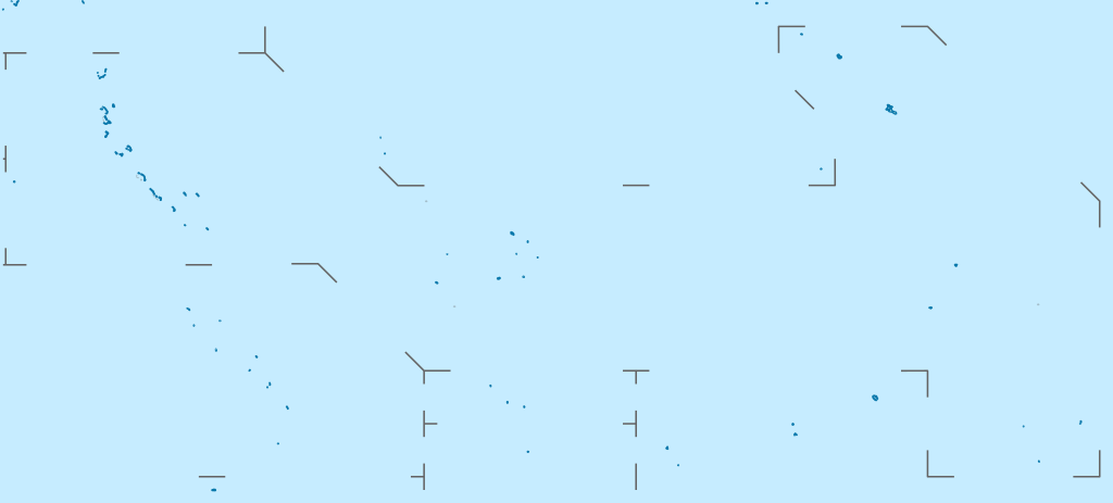
Quadratische Plattkarte. Geographische Begrenzung der Karte:
N: 6° N
S: 13° S
W: 169° O
O: 149° W
English: Location map of Kiribati
Equirectangular projection. Geographic limits of the map:
N: 6° N
S: 13° S
W: 169° E
E: 149° W
วันที่
แหล่งที่มา
งานของตัว, using
United States National Imagery and Mapping Agency data
ผู้สร้างสรรค์
NordNordWest
การอนุญาต (การใช้ไฟล์นี้ใหม่)
I have published this file as author NordNordWest under the "CC-BY-SA-3.0-DE" in Wikipedia. This means that free, commercial usage outside of Wikipedia is permitted under the following licence terms:
Online media:
The author "NordNordWest/Wikipedia" is named
A weblink to the original file is provided: //commons.wikimedia.org/wiki/File:Kiribati_location_map.svg
Please send me a specimen copy or the URL of the website where the file is used.
Please write an email to nnwest[at]web.de if you
need my postal address for sending a specimen copy
have further questions about the terms of the licence
PS: In case of refusal of the above terms the author reserves the right to take legal action.
This file has been released under a license which is incompatible with Facebook's licensing terms. It is not permitted to upload this file to Facebook.
azərbaycanca ∙ Deutsch (Sie-Form) ∙ čeština ∙ Deutsch ∙ sicilianu ∙ italiano ∙ русский ∙ română ∙ português ∙ English ∙ magyar ∙ Nederlands ∙ slovenščina ∙ polski ∙ latviešu ∙ македонски ∙ español ∙ فارسی ∙ français ∙ suomi ∙ עברית ∙ Plattdüütsch ∙ ქართული ∙ հայերեն ∙ বাংলা ∙ ไทย ∙ 日本語 ∙ 中文 ∙ 中文(简体) ∙ 中文(繁體) ∙ العربية ∙ +/−
== {{int:filedesc}} == {{Information |Description= {{de|Positionskarte von Kiribati}} Quadratische Plattkarte. Geographische Begrenzung der Karte: * N: 6° N * S: 13° S * W: 169° O * O: 149° W {{en|Location map of [[:en:Kiribati|Kiriba
ไฟล, kiribati, location, ไฟล, ประว, ไฟล, หน, าท, ภาพน, การใช, ไฟล, วนกลาง, อม, ลเก, ยวก, บภาพขนาดของต, วอย, าง, ของไฟล, กเซล, ความละเอ, ยดอ, กเซล, กเซล, กเซล, กเซล, กเซล, กเซล, ภาพท, ความละเอ, ยดส, งกว, 8206, ไฟล, กเซล, ขนาดไฟล, โลไบต, ปภาพหร, อไฟล, เส, ยงน, น. ifl prawtiifl hnathimiphaphni karichiflswnklang khxmulekiywkbphaphkhnadkhxngtwxyang PNG nikhxngifl SVG ni 800 362 phikesl khwamlaexiydxun 320 145 phikesl 640 289 phikesl 1 024 463 phikesl 1 280 579 phikesl 2 560 1 158 phikesl 1 488 673 phikesl duphaphthimikhwamlaexiydsungkwa 8206 ifl SVG 1 488 673 phikesl khnadifl 68 kiolibt rupphaphhruxiflesiyngni tnchbbxyuthi khxmmxns raylaexiyddanlang epnkhxkhwamthiaesdngphlcak ifltnchbbinkhxmmxns khxmmxnsepnewbistinokhrngkarsahrbekbrwbrwmsuxesri thi khunsamarthchwyid khwamyx khaxthibayKiribati location map svg Deutsch Positionskarte von Kiribati Quadratische Plattkarte Geographische Begrenzung der Karte N 6 N S 13 S W 169 O O 149 WEnglish Location map of Kiribati Equirectangular projection Geographic limits of the map N 6 N S 13 S W 169 E E 149 Wwnthi 5 minakhm ph s 2553aehlngthima ngankhxngtw using United States National Imagery and Mapping Agency dataphusrangsrrkh NordNordWestkarxnuyat karichiflniihm I have published this file as author NordNordWest under the CC BY SA 3 0 DE in Wikipedia This means that free commercial usage outside of Wikipedia is permitted under the following licence terms Online media The author NordNordWest Wikipedia is named A weblink to the original file is provided commons wikimedia org wiki File Kiribati location map svg A copy of or the Uniform Resource Identifier https creativecommons org licenses by sa 3 0 de legalcode for this licence with every copy Print media The author NordNordWest Wikipedia is named A copy of or the Uniform Resource Identifier https creativecommons org licenses by sa 3 0 de legalcode for this licence with every copyPlease send me a specimen copy or the URL of the website where the file is used Please write an email to nnwest at web de if you need my postal address for sending a specimen copy have further questions about the terms of the licencePS In case of refusal of the above terms the author reserves the right to take legal action This file has been released under a license which is incompatible with Facebook s licensing terms It is not permitted to upload this file to Facebook iflnixyuphayitsyyaxnuyat khriexthifkhxmmxns aebbaesdngthima xnuyataebbediywkn 3 0 khxngpraethseyxrmnikhunsamarth thicaaebngpn thicathasaena aeckcay aelasngngandngklawtxip thicaeriyberiyngihm thicaddaeplngngandngklaw phayitenguxnikhtxipni aesdngthima khuntxngihekiyrtiecakhxngnganxyangehmaasm odyephimlingkipyngsyyaxnuyat aelarabuhakmikarepliynaeplng khunxacthaechnniidinrupaebbidkidtamkhwr aettxngimichinlksnathiaenawaphuihxnuyatsnbsnunkhunhruxkarichngankhxngkhun xnuyataebbediywkn hakkhunddaeplng epliynrup hruxtxetimnganni khuntxngichsyyaxnuyataebbediywknhruxaebbthiehmuxnkbsyyaxnuyatthiichkbnganniethannhttps creativecommons org licenses by sa 3 0 de deed en CC BY SA 3 0 de Creative Commons Attribution Share Alike 3 0 de true true iflnixyuphayitsyyaxnuyat khriexthifkhxmmxns aebbaesdngthima xnuyataebbediywkn 3 0 khxngpraethseyxrmnikhunsamarth thicaaebngpn thicathasaena aeckcay aelasngngandngklawtxip thicaeriyberiyngihm thicaddaeplngngandngklaw phayitenguxnikhtxipni aesdngthima khuntxngihekiyrtiecakhxngnganxyangehmaasm odyephimlingkipyngsyyaxnuyat aelarabuhakmikarepliynaeplng khunxacthaechnniidinrupaebbidkidtamkhwr aettxngimichinlksnathiaenawaphuihxnuyatsnbsnunkhunhruxkarichngankhxngkhun xnuyataebbediywkn hakkhunddaeplng epliynrup hruxtxetimnganni khuntxngichsyyaxnuyataebbediywknhruxaebbthiehmuxnkbsyyaxnuyatthiichkbnganniethannhttps creativecommons org licenses by sa 3 0 de deed en CC BY SA 3 0 de Creative Commons Attribution Share Alike 3 0 de true trueewxrchnxun Equivalent physical map aephnthinithuksranghruxphthnakhuncak Kartenwerkstatt hxngptibtikaraephnthi khxngwikiphiediyphasaeyxrmn sungkhunsamarthesnxaephnthiephuxphthnaidechnediywkn azerbaycanca Deutsch Sie Form cestina Deutsch sicilianu italiano russkij romană portugues English magyar Nederlands slovenscina polski latviesu makedonski espanol فارسی francais suomi עברית Plattduutsch ქართული հայերեն ব ল ithy 日本語 中文 中文 简体 中文 繁體 العربية khabrryayodyyxithyephimkhabrryaythrrthdediywephuxkhyaykhwamwaiflnimixairixethmthiaesdngxyuiniflniprakxbdwyphusrangbangkhathiimmiixethmwikisnethschuxphusrangsrrkh NordNordWestchuxphuichwikimiediy NordNordWestyuxaraexl http commons wikimedia org wiki User NordNordWeststhanalikhsiththimilikhsiththisyyaxnuyatCreative Commons Attribution ShareAlike 3 0 Germany xngkvswnthisrang wnkxtng5 minakhm 2010thimakhxngiflkarsrangdngedimodyphuxpohldMIME type xngkvsimage svg xml prawtiifl khlikwnthi ewlaephuxduiflthipraktinkhnann wnthi ewlarupyxkhnadphuichkhwamehn pccubn22 52 23 kumphaphnth 25641 488 673 68 kiolibt NordNordWestReverted to version as of 09 54 1 April 2010 UTC sorry but this is not location map style 20 08 23 kumphaphnth 25641 488 673 137 kiolibt Amitchell125borders made visible with minor corrections 16 54 1 emsayn 25531 488 673 68 kiolibt NordNordWestc 03 04 6 minakhm 25531 488 673 84 kiolibt NordNordWest int filedesc Information Description de Positionskarte von Kiribati Quadratische Plattkarte Geographische Begrenzung der Karte N 6 N S 13 S W 169 O O 149 W en Location map of en Kiribati Kiriba hnathimiphaphni hnatxipni oyngmathiphaphni khirismas tarawa esathtarawa aemaebb Location map Kiribati mxdul Location map data Kiribati mxdul Location map data Kiribati doc karichiflswnklang wikixuntxipniichiflni karichbn af wikipedia org Sjabloon Liggingkaart Kiribati karichbn als wikipedia org Vorlage Positionskarte Kiribati karichbn an wikipedia org Plantilla Mapa de localizacion Kiribati karichbn ar wikipedia org قالب خريطة مواقع كيريباتي karichbn ast wikipedia org Tarawa Modulu Minimapa data Kiribati Aeropuertu Internacional Bonriki Aeropuertu de la Islla Canton Modulu Minimapa data Kiribati usu karichbn az wikipedia org Cenubi Tarava Sablon Yer xeritesi Kiribati karichbn ba wikipedia org Ҡalyp PozKarta Kiribati karichbn be tarask wikipedia org Paydnyovaya Tarava Shablyon Lyakalizacyjnaya mapa Kirybaci karichbn be wikipedia org Paydnyovaya Tarava Shablon Na karce Kirybaci Bairyki Bikenibeu karichbn bg wikipedia org Shablon PK Kiribati karichbn bh wikipedia org Module Location map data Kiribati doc Module Location map data Kiribati karichbn bn wikipedia org ত র ওয মড উল অবস থ ন ম নচ ত র উপ ত ত ক র ব স মড উল অবস থ ন ম নচ ত র উপ ত ত ক র ব স নথ মড উল অবস থ ন ম নচ ত র উপ ত ত ক র ব ত মড উল অবস থ ন ম নচ ত র উপ ত ত ক র ব ত নথ karichbn bs wikipedia org Sablon Lokacijska karta Kiribati karichbn ceb wikipedia org Plantilya Location map Kiribati South Channel Long Island Bird Islet Nabari Napari North Channel Uma pagklaro South Passage South West Point Maria pagklaro South Spit Vostok Caroline Clark Island Cook Island Entrance Island Francis Island Gardner Island Gilbert Hope Island Hurd Matthews dukarichthwolkephimetimkhxngiflnikhxmulekiywkbphaph phaphnimikhxmulephimetim sungswnihymacakklxngdicitxlhruxsaeknenxrthisamarthekbkhxmuldngklawiwrwmkbphaphid thaphaphnithukprbprungaekikhhruxepliynaeplngcakedim khxmulbangxyangcayngkhngimepliynaeplngehmuxnphaphthithukprbprungaekikhnnkhwamkwang1488 19pxkhwamsung673 227px ekhathungcak https th wikipedia org wiki ifl Kiribati location map svg, wikipedia, วิกิ หนังสือ, หนังสือ, ห้องสมุด,