azərbaycanca ∙ Deutsch (Sie-Form) ∙ čeština ∙ Deutsch ∙ sicilianu ∙ italiano ∙ русский ∙ română ∙ português ∙ English ∙ magyar ∙ Nederlands ∙ slovenščina ∙ polski ∙ latviešu ∙ македонски ∙ español ∙ فارسی ∙ français ∙ suomi ∙ עברית ∙ Plattdüütsch ∙ ქართული ∙ հայերեն ∙ বাংলা ∙ ไทย ∙ 日本語 ∙ 中文 ∙ 中文(简体) ∙ 中文(繁體) ∙ العربية ∙ +/−
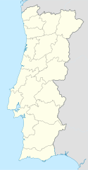
{{Information |Description= {{de|Positionskarte von Portugal}} Quadratische Plattkarte, N-S-Streckung 130 %. Geographische Begrenzung der Karte: * N: 42.3° N * S: 36.7° N * W: 9.8° W * O: 6.0° W {{en|Location map of [[:en:Portugal|Por
ไฟล, portugal, location, ไฟล, ประว, ไฟล, หน, าท, ภาพน, การใช, ไฟล, วนกลาง, อม, ลเก, ยวก, บภาพขนาดของต, วอย, าง, ของไฟล, กเซล, ความละเอ, ยดอ, กเซล, กเซล, กเซล, กเซล, กเซล, กเซล, ภาพท, ความละเอ, ยดส, งกว, 8206, ไฟล, กเซล, ขนาดไฟล, โลไบต, ปภาพหร, อไฟล, เส, ยงน, น. ifl prawtiifl hnathimiphaphni karichiflswnklang khxmulekiywkbphaphkhnadkhxngtwxyang PNG nikhxngifl SVG ni 313 600 phikesl khwamlaexiydxun 125 240 phikesl 250 480 phikesl 400 768 phikesl 534 1 024 phikesl 1 068 2 048 phikesl 612 1 173 phikesl duphaphthimikhwamlaexiydsungkwa 8206 ifl SVG 612 1 173 phikesl khnadifl 211 kiolibt rupphaphhruxiflesiyngni tnchbbxyuthi khxmmxns raylaexiyddanlang epnkhxkhwamthiaesdngphlcak ifltnchbbinkhxmmxns khxmmxnsepnewbistinokhrngkarsahrbekbrwbrwmsuxesri thi khunsamarthchwyid Oi a cidade de Vizeu khwamyx khaxthibayPortugal location map svg Deutsch Positionskarte von Portugal Quadratische Plattkarte N S Streckung 130 Geographische Begrenzung der Karte N 42 3 N S 36 7 N W 9 8 W O 6 0 WEnglish Location map of Portugal Equirectangular projection N S stretching 130 Geographic limits of the map N 42 3 N S 36 7 N W 9 8 W E 6 0 WEspanol Mapa de Portugal con los 18 distritos delimitados Proyeccion cilindrica equidistante N S alargamiento 130 Limites geograficos del mapa N 42 3 N S 36 7 N W 9 8 W E 6 0 W Portugues Mapa de Portugal com os 18 distritos delimitados para uso em localizacoes geograficas Projeccao cilindrica equidistante N S alongamento 130 Limites geograficos do mapa N 42 3 N S 36 7 N W 9 8 W E 6 0 Wwnthi 03 07 2008aehlngthima own work using United States National Imagery and Mapping Agency dataphusrangsrrkh NordNordWestewxrchnxun iflxunthiichiflni Portugal Leiria district map svg Portugal blank map svg aephnthinithuksranghruxphthnakhuncak Kartenwerkstatt hxngptibtikaraephnthi khxngwikiphiediyphasaeyxrmn sungkhunsamarthesnxaephnthiephuxphthnaidechnediywkn azerbaycanca Deutsch Sie Form cestina Deutsch sicilianu italiano russkij romană portugues English magyar Nederlands slovenscina polski latviesu makedonski espanol فارسی francais suomi עברית Plattduutsch ქართული հայերեն ব ল ithy 日本語 中文 中文 简体 中文 繁體 العربية karxnuyatichsiththi khapheca inthanaphuthuxlikhsiththikhxngphaphhruxsuxni xnuyatihichphaphhruxsuxniphayitenguxnikhtxipni xnuyatihkhdlxk aeckcayaela hruxddaeprexksarniphayitenguxnikhkhxngsyyaxnuyatexksaresrikhxngknu run 1 2 hruxrunid nbcaknithixxkodymulnithisxftaewresri odyimmiswnidhamaekikh immikhxkhwampkhnaaelapkhlng saenakhxngsyyaxnuyatrwmxyuinswnchux syyaxnuyatexksaresrikhxngknuhttp www gnu org copyleft fdl html GFDL GNU Free Documentation License true trueiflnixyuphayitsyyaxnuyat khriexthifkhxmmxns aebbaesdngthima xnuyataebbediywkn 3 0 tnchbbkhunsamarth thicaaebngpn thicathasaena aeckcay aelasngngandngklawtxip thicaeriyberiyngihm thicaddaeplngngandngklaw phayitenguxnikhtxipni aesdngthima khuntxngihekiyrtiecakhxngnganxyangehmaasm odyephimlingkipyngsyyaxnuyat aelarabuhakmikarepliynaeplng khunxacthaechnniidinrupaebbidkidtamkhwr aettxngimichinlksnathiaenawaphuihxnuyatsnbsnunkhunhruxkarichngankhxngkhun xnuyataebbediywkn hakkhunddaeplng epliynrup hruxtxetimnganni khuntxngichsyyaxnuyataebbediywknhruxaebbthiehmuxnkbsyyaxnuyatthiichkbnganniethannhttps creativecommons org licenses by sa 3 0 CC BY SA 3 0 Creative Commons Attribution Share Alike 3 0 true truekhunsamartheluxksyyaxnuyatdngklawtamtxngkarkhabrryayodyyxithyephimkhabrryaythrrthdediywephuxkhyaykhwamwaiflnimixairxngkvsPortugal map with delimicted disctries 18 uses for locationoprtueksMapa de Portugal com os 18 distritos delimitados para uso em localizacoes geograficasrsesiyKarta Portugaliiixethmthiaesdngxyuiniflniprakxbdwypraethsoprtueksphusrangbangkhathiimmiixethmwikisnethsyuxaraexl https commons wikimedia org wiki user NordNordWestchuxphuichwikimiediy NordNordWestchuxphusrangsrrkh NordNordWeststhanalikhsiththimilikhsiththisyyaxnuyatCreative Commons Attribution ShareAlike 3 0 Unported xngkvsGNU Free Documentation License version 1 2 or later xngkvsMIME type xngkvsimage svg xml prawtiifl khlikwnthi ewlaephuxduiflthipraktinkhnann wnthi ewlarupyxkhnadphuichkhwamehn pccubn15 27 29 singhakhm 2551612 1 173 211 kiolibt NordNordWest 01 29 12 singhakhm 2551306 586 207 kiolibt NordNordWest 05 01 3 krkdakhm 2551306 586 236 kiolibt NordNordWest Information Description de Positionskarte von Portugal Quadratische Plattkarte N S Streckung 130 Geographische Begrenzung der Karte N 42 3 N S 36 7 N W 9 8 W O 6 0 W en Location map of en Portugal Por hnathimiphaphni hnatxipni oyngmathiphaphni kimairch braka priimralika faru futbxlchingaechmpaehngchatiyuorp 2004 wiyanadukchaetlu aemaebb Location map Portugal mxdul Location map data Portugal mxdul Location map data Portugal doc karichiflswnklang wikixuntxipniichiflni karichbn af wikipedia org Amadora Sjabloon Liggingkaart Portugal karichbn als wikipedia org Lissabon Vorlage Positionskarte Portugal Fussball Europameisterschaft 2004 karichbn am wikipedia org ሴቱባል መለጠፊያ Location map ፖርቱጋል ፖርቱ karichbn an wikipedia org Sacavem Lisbona Ericeira Mafra Sintra Braga Coimbra Evora Aveiro Guarda Portugal Leiria Setubal Almada Portugal Miranda de l Douro Bumioso Sines Porto Estadio do Dragao Seu de Porto Cascais Guimaraes Lousa Miranda do Corvo Pampilhosa da Serra Vila Nova de Gaia Pavilhao Joao Rocha Elvas Ponte de Sor Portalegre Plantilla Mapa de localizacion Portugal karichbn ar wikipedia org قالب خريطة مواقع البرتغال فالنغو دو فوغا فالفرد اغوير دا بيرا قائمة مواقع التراث العالمي في البرتغال karichbn az wikipedia org Lissabon Portu Sablon Yer xeritesi Portuqaliya Koimbra Braqa seher Fayl Portuqaliya Vizey Fatima seher dukarichthwolkephimetimkhxngiflnikhxmulekiywkbphaph phaphnimikhxmulephimetim sungswnihymacakklxngdicitxlhruxsaeknenxrthisamarthekbkhxmuldngklawiwrwmkbphaphid thaphaphnithukprbprungaekikhhruxepliynaeplngcakedim khxmulbangxyangcayngkhngimepliynaeplngehmuxnphaphthithukprbprungaekikhnnkhwamkwang611 82129khwamsung1172 6089 ekhathungcak https th wikipedia org wiki ifl Portugal location map svg, wikipedia, วิกิ หนังสือ, หนังสือ, ห้องสมุด,